Lansford, Pennsylvania facts for kids
Quick facts for kids
Lansford, Pennsylvania
|
|
|---|---|
|
Borough
|
|

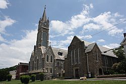
St. Katharine Drexel Church in the Lansford Historic District in July 2013
|
|

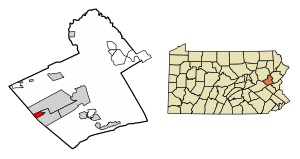
Location of Lansford in Carbon County, Pennsylvania
|
|
| Country | United States |
| State | Pennsylvania |
| County | Carbon |
| Borough (Pennsylvania) | c. 1827 along with Coaldale, Pennsylvania |
| Area | |
| • Total | 1.54 sq mi (3.98 km2) |
| • Land | 1.54 sq mi (3.98 km2) |
| • Water | 0.00 sq mi (0.00 km2) |
| Elevation | 1,145 ft (349 m) |
| Population
(2020)
|
|
| • Total | 4,141 |
| • Density | 2,695.96/sq mi (1,040.68/km2) |
| Time zone | UTC-5 (EST) |
| • Summer (DST) | UTC-4 (EDT) |
| ZIP Code |
18232
|
| Area codes | 570 |
| FIPS code | 42-41464 |
Lansford is a small town, also called a borough, located in Carbon County, Pennsylvania, United States. It is part of a larger area known as Northeastern Pennsylvania. Lansford is about 37 miles (60 km) northwest of Allentown. It is also 19 miles (31 km) south of Hazleton. The town is nestled in the Panther Creek Valley. It is very close to Coaldale, a nearby town in Schuylkill County.
The land where Lansford now stands was once owned by the Lehigh Coal & Navigation Company. This company was very important in the area's history. They likely built some of the first buildings around 1827. Lansford grew because of the anthracite coal mines nearby. The town was named after Asa Lansford Foster. He believed that the small mining towns in the area should join together.
In 2020, about 4,141 people lived in Lansford. This number is much lower than its highest population of 9,632 in 1930. Many mining towns in Northeastern Pennsylvania saw similar drops in population.
Contents
Lansford's Past: A Look Back
Lansford has a rich history, especially tied to coal mining. The town's first school opened in 1847 on Abbott Street. The first church, the Welsh Congregational Church, was built in 1850. It is still standing today on West Abbott Street.
Mining History and the No. 9 Mine
The old No. 9 Mine and Museum is a famous spot in Lansford. This deep mine operated from 1855 to 1972. Today, it is a tourist attraction. Visitors can take tours inside the mine. They can also learn a lot about the history of local mining. The museum is in the building that used to be the mine's Wash Shanty. It has a large collection of old mining tools and items.
During the 1870s, there were many conflicts related to labor unions. A group called the Molly Maguires was involved in some of these events. One local mine boss, John P. Jones, was killed in Lansford during this time.
First Cable TV System
Lansford is also famous for something else. It was home to the first commercial Cable Television system in the United States. This was a big step in how people watched TV!
Historic Places in Lansford
The Lansford Historic District is an important area in town. It was added to the National Register of Historic Places in 2012. This means it is recognized for its historical importance.
Lansford's Location and Surroundings
Lansford is a small town covering about 1.6 square miles (3.98 square kilometers) of land. It shares a border with Coaldale, a nearby community. Coaldale is often seen as a suburban neighborhood of Lansford.
Nearby Towns and Elevation
Lansford is located 1 mile (1.6 km) north of Summit Hill. It is also 10 miles (16 km) west of Lehighton. Tamaqua is 6 miles (9.7 km) northeast of Lansford. The town sits at an elevation of 1,145 feet (349 meters) above sea level. Lansford is on the edge of the Lehigh Valley. It is also at the southern end of the Coal Region and the Poconos.
Mountains and Waterways
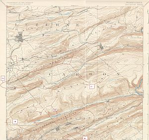
Lansford is on the northern side of Pisgah Mountain. It is also along the south bank of the Panther Creek. This creek flows into the Little Schuylkill River. Nesquehoning Mountain is on the north side of Panther Creek. The coal from the valley's mines was shipped through the 3,800-foot (1,158-meter) long Hauto Tunnel. This tunnel helped transport coal to cities like New York City and Philadelphia.
Getting Around Lansford
Roads and Highways
In 2007, Lansford had about 15.45 miles (24.86 km) of public roads. Most of these roads, about 13.30 miles (21.40 km), were maintained by the borough itself. The Pennsylvania Department of Transportation (PennDOT) maintained the rest.
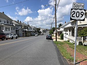
U.S. Route 209 is the main highway that goes through Lansford. It runs along Patterson Street, from southwest to northeast, right through the middle of town. Pennsylvania Route 902 also starts at US 209. It heads southeast along Spring Garden Street.
Lansford's Population Over Time
| Historical population | |||
|---|---|---|---|
| Census | Pop. | %± | |
| 1880 | 2,206 | — | |
| 1890 | 4,004 | 81.5% | |
| 1900 | 4,888 | 22.1% | |
| 1910 | 8,321 | 70.2% | |
| 1920 | 9,625 | 15.7% | |
| 1930 | 9,632 | 0.1% | |
| 1940 | 8,710 | −9.6% | |
| 1950 | 7,486 | −14.1% | |
| 1960 | 5,958 | −20.4% | |
| 1970 | 5,168 | −13.3% | |
| 1980 | 4,466 | −13.6% | |
| 1990 | 4,583 | 2.6% | |
| 2000 | 4,230 | −7.7% | |
| 2010 | 3,941 | −6.8% | |
| 2020 | 4,141 | 5.1% | |
| Sources: | |||
Lansford's population has changed a lot over the years. In 1880, about 2,206 people lived there. The population grew steadily, reaching its highest point in 1930 with 9,632 residents. After that, the population started to decrease. By 2010, it was 3,941 people. However, the population increased slightly to 4,141 people by 2020.
Local Media
Lansford has its own local radio station called WLSH. It broadcasts at 1410 on the AM radio dial. The station started on December 24, 1952. The letters "WLSH" stand for Lansford and its neighboring town, Summit Hill.
See also
 In Spanish: Lansford (Pensilvania) para niños
 | Delilah Pierce |
 | Gordon Parks |
 | Augusta Savage |
 | Charles Ethan Porter |


