
Pocono Mountains facts for kids
Quick facts for kids The Poconos |
|
|---|---|

View from Mount Pocono Knob Lookout
|
|
| Highest point | |
| Peak | Kistler Ledge |
| Elevation | 2,215 ft (675 m) |
| Naming | |
| Etymology | Lenape term for "stream between two mountains". |

Map of Pennsylvania showing the Glaciated Pocono Plateau Section, also known as the Poconos.
|
|
The Pocono Mountains, often called the Poconos, is a special area in Northeastern Pennsylvania, United States. It's known for its unique geography, geology, and culture. The Poconos are part of a bigger area called the Allegheny Plateau.
These mountains create a 2,400-square-mile (6,200 km2) steep slope that looks over the Delaware River and Delaware Water Gap to the east. To the north, you'll find Lake Wallenpaupack. To the west are the Wyoming Valley and the Coal Region. The Lehigh Valley borders the Poconos to the south. The name "Poconos" comes from the Munsee word Pokawachne. This word means "Creek Between Two Hills."
Many people from the Greater New York-Newark area live near or visit the Poconos. Its forests and valleys have been a popular place for fun for a long time. Millions of people can reach it within a two-hour drive. Many communities here have hotels with activities like fishing, hunting, skiing, and other sports.
Contents
People Living in the Poconos
The Pocono Mountains are a popular spot for both local people and visitors. While it has always been a tourist place, many towns have seen more people move in. This is especially true in Coolbaugh Township and other areas in Monroe County.
About 340,300 people live in the region. This number is growing fast. Many vacationers from New York and New Jersey are turning their holiday homes into permanent ones. The Poconos doesn't have one very large city. However, towns like Stroudsburg, East Stroudsburg, and Mount Pocono are important. These towns and their surrounding areas are all in Monroe County. About half of the Poconos' total population lives there.
The Poconos now also serves as a place where people live and travel to work in bigger cities. Many residents travel to New York City and northern New Jersey. This daily trip can often take up to two hours each way because of traffic.
Towns and Communities in the Poconos
The Pocono Mountains in northeastern Pennsylvania are split into six main areas. These are the Mountain Region, Lake Region, Delaware River Region, Upper Delaware River Region, Wyoming Valley, and Lehigh River Gorge Region.
Mountain Region Communities

This area is found in Monroe, Luzerne, southern Lackawanna, and northern Carbon Counties.
- Albrightsville
- Barrett Township
- Bartonsville
- Bear Creek
- Blakeslee
- Canadensis
- Chestnuthill Township
- Drifton
- Delaware Water Gap
- East Side
- East Stroudsburg
- Foster Township
- Freeland
- Gouldsboro
- Henryville
- Jackson Township
- Jim Thorpe
- Monroe County
- Kidder Township
- Lake Harmony
- Lausanne Township
- Long Pond
- Marshalls Creek
- Middle Smithfield
- Mount Pocono
- Mountainhome
- Packer Township
- Paradise Township
- Penn Forest Township
- Penn Lake Park
- Pocono Lake
- Pocono Pines
- Pocono Summit
- Pocono Township
- Price Township
- Reeders
- Smithfield Township
- Scotrun
- Stroudsburg
- Stroud Township
- Thornhurst
- Weatherly
- White Haven
- Swiftwater
- Tannersville
- Tobyhanna
- Saylorsburg
Lake Region Communities

This region is located in Pike and Wayne counties.
Delaware River Region Communities

This area is in Monroe and Pike counties.
Upper Delaware River Region Communities
This region is located in Pike and Wayne counties.
- Greeley
- Lackawaxen
- Shohola
Wyoming Valley Communities
This area is found in Luzerne county.
- Mountaintop
- Dennison Township
- Ashley
- Kingston
- Forty Fort
- Nanticoke
- Wilkes-Barre Township
- Laurel Run
- Sugar Notch
- Dorrance
- Greater Pittston
- Wilkes-Barre
- Nanticoke
- Hanover
- Fairview Township
Outlying Areas Near the Poconos
The exact borders of the Poconos can sometimes be a bit fuzzy. These towns are on the edge of the region. They are in Lehigh Valley, Carbon County, Schuylkill County, and Greater Hazleton (Luzerne County).
- Coaldale (Schuylkill County)
- Pen Argyl (Northampton County)
- Bangor (Northampton County)
- Walnutport (Northampton County)
- Slatington (Lehigh County)
- Drums (Luzerne County)
- Hazleton (Luzerne County)
- West Hazleton (Luzerne County)
- Aquashicola (Carbon County)
- Andreas (Carbon and Schuylkill Counties)
- Beaver Meadows (Carbon County)
- Ashfield (Carbon County)
- Bowmanstown (Carbon County)
- Forest Inn (Carbon County)
- Lansford (Carbon County)
- Lehighton (Carbon County)
- Nesquehoning (Carbon County)
- Palmerton (Carbon County)
- Parryville (Carbon County)
- Portland (Northampton County)
- Summit Hill (Carbon County)
- Tamaqua (Schuylkill County)
- Weissport (Carbon County)
Getting Around the Poconos
Roads for Travel

Many state highways serve the Poconos Region. The most used ones include Pennsylvania Route 115, Pennsylvania Route 715, and Pennsylvania Route 903. Route 903 is sometimes called the "Highway to Adventure" because of the many fun places along it. Other important routes are Pennsylvania Route 33, Pennsylvania Route 940, and Pennsylvania Route 611.
Two U.S. Highways are in the Pocono Mountains. U.S. Route 209 runs from New York to Pennsylvania. Its middle point is in the Poconos, north of Stroudsburg. U.S. Route 6 is a very long highway that crosses the country. It is known as a scenic route in Pennsylvania.
The main east-west highway is Interstate 80. From I-80, Interstate 380 branches off, connecting the Poconos to Scranton. Other Interstate Highways in the region include Interstate 476, which is part of the Pennsylvania Turnpike. Interstate 81 is another option for travelers going between places like Toronto and Washington, D.C. Interstate 84 goes from Scranton to New England. Interstate 78 also serves the area.
Future Passenger Train Service
NJ Transit is working to rebuild train tracks from Scranton through the Poconos to Hoboken, New Jersey. This project is called the Lackawanna Cut-Off Restoration Project. There is no exact date yet for when the train service will be ready. Once finished, there will be nine trains each day in both directions. Before 1970, trains used to run through the Poconos to Buffalo and Chicago in the west, and Hoboken in the east.
Air Travel Options
Two airports are located just outside the Poconos region. These are Wilkes-Barre/Scranton International Airport and Lehigh Valley International Airport.
Poconos Geography

The Pocono Mountains cover parts of Carbon, Monroe, Pike, and southern Wayne counties in Pennsylvania. In total, the Poconos covers over 2,500 square miles (6,500 km2). Some people also include parts of Lackawanna, Luzerne, eastern Schuylkill, and Susquehanna counties in the Poconos.
Geologically, the Poconos are part of the Allegheny Plateau. This is similar to the nearby Catskills. The highest point in the Poconos is Kistler Ledge in Monroe County. It reaches over 2215 feet (675 m) high. The lowest point is 350 feet (107 m) in Pike County.
The Delaware River flows through the Pocono Mountains. The region's name comes from a Native American term. It roughly means "stream between two mountains." The Lehigh and Lackawaxen Rivers also flow through the area. Together, these waterways stretch about 170 miles (270 km).
Poconos Climate
The Poconos has a climate with warm summers and cold winters. It gets rain and snow throughout the year.
Northern and Eastern Poconos Climate
In the northern and eastern parts of the Poconos, summers are warm. Most summer days are comfortably humid. However, it can sometimes get very hot and humid. The highest temperature recorded since 1981 was 94.1 °F (34.5 °C) on August 6, 2001. July usually has the most thunderstorms and is the warmest month. The wettest day since 1981 had 5.83 inches (148 mm) of rain.
Winters are cold. The average lowest temperature each year is about −13.1 °F (−25.1 °C). The coldest temperature recorded since 1981 was −27.9 °F (−33.3 °C) on January 21, 1994. It can get very windy and cold, with wind chill values below −26 °F (−32 °C). January is usually the snowiest month. Big snowstorms with over 12 inches (30 cm) of snow happen almost every year. These often occur during "nor'easters" from December to March.
| Climate data for Lake Wallenpaupack, Elevation 1,188 ft (362 m), 1981-2010 normals, extremes 1981-2018 | |||||||||||||
|---|---|---|---|---|---|---|---|---|---|---|---|---|---|
| Month | Jan | Feb | Mar | Apr | May | Jun | Jul | Aug | Sep | Oct | Nov | Dec | Year |
| Record high °F (°C) | 63.2 (17.3) |
72.2 (22.3) |
82.5 (28.1) |
87.8 (31.0) |
91.0 (32.8) |
90.7 (32.6) |
93.9 (34.4) |
94.1 (34.5) |
91.0 (32.8) |
83.1 (28.4) |
79.0 (26.1) |
67.5 (19.7) |
94.1 (34.5) |
| Mean daily maximum °F (°C) | 32.2 (0.1) |
35.3 (1.8) |
43.6 (6.4) |
56.0 (13.3) |
67.1 (19.5) |
75.1 (23.9) |
78.7 (25.9) |
78.1 (25.6) |
71.0 (21.7) |
59.8 (15.4) |
48.2 (9.0) |
36.4 (2.4) |
56.9 (13.8) |
| Daily mean °F (°C) | 22.5 (−5.3) |
25.0 (−3.9) |
32.9 (0.5) |
44.6 (7.0) |
55.2 (12.9) |
64.0 (17.8) |
67.9 (19.9) |
66.9 (19.4) |
59.4 (15.2) |
48.0 (8.9) |
38.6 (3.7) |
27.7 (−2.4) |
46.2 (7.9) |
| Mean daily minimum °F (°C) | 12.9 (−10.6) |
14.8 (−9.6) |
22.1 (−5.5) |
33.2 (0.7) |
43.4 (6.3) |
53.0 (11.7) |
57.1 (13.9) |
55.7 (13.2) |
47.7 (8.7) |
36.3 (2.4) |
29.0 (−1.7) |
18.9 (−7.3) |
35.4 (1.9) |
| Record low °F (°C) | −27.9 (−33.3) |
−17.3 (−27.4) |
−10.0 (−23.3) |
9.9 (−12.3) |
25.1 (−3.8) |
31.4 (−0.3) |
40.4 (4.7) |
35.9 (2.2) |
26.6 (−3.0) |
16.3 (−8.7) |
−1.9 (−18.8) |
−17.2 (−27.3) |
−27.9 (−33.3) |
| Average precipitation inches (mm) | 2.82 (72) |
2.55 (65) |
3.18 (81) |
3.62 (92) |
3.99 (101) |
4.46 (113) |
3.89 (99) |
3.77 (96) |
4.21 (107) |
4.18 (106) |
3.37 (86) |
3.32 (84) |
43.36 (1,101) |
| Average snowfall inches (cm) | 15.7 (40) |
11.2 (28) |
11.7 (30) |
2.8 (7.1) |
0.0 (0.0) |
0.0 (0.0) |
0.0 (0.0) |
0.0 (0.0) |
0.0 (0.0) |
0.1 (0.25) |
3.0 (7.6) |
9.4 (24) |
53.8 (137) |
| Average relative humidity (%) | 73.5 | 68.8 | 63.6 | 60.3 | 62.9 | 72.5 | 72.7 | 74.4 | 75.1 | 71.4 | 71.3 | 73.7 | 70.0 |
| Average dew point °F (°C) | 15.3 (−9.3) |
16.2 (−8.8) |
21.9 (−5.6) |
31.7 (−0.2) |
42.8 (6.0) |
55.0 (12.8) |
58.8 (14.9) |
58.5 (14.7) |
51.5 (10.8) |
39.2 (4.0) |
30.1 (−1.1) |
20.4 (−6.4) |
36.9 (2.7) |
| Source: PRISM | |||||||||||||
Central and Western Poconos Climate
The central and western Poconos also have warm summers and cold winters. It rains all year. Summers are usually humid. But sometimes, it can get very hot and humid. The highest temperature recorded since 1981 was 94.0 °F (34.4 °C) on July 22, 2011. July is the warmest month and has the most thunderstorms. The wettest day since 1981 had 6.81 inches (173 mm) of rain.
Winters are cold. The average lowest temperature each year is about −10.1 °F (−23.4 °C). The coldest temperature recorded since 1981 was −21.6 °F (−29.8 °C) on January 21, 1994. It can get very cold and windy, with wind chill values below −22 °F (−30 °C). January is the snowiest month. Large snowstorms with over 12 inches (30 cm) of snow happen almost every year. These often occur during "nor'easters" from December to March.
| Climate data for Mount Pocono, Elevation 1,808 ft (551 m), 1981-2010 normals, extremes 1981-2018 | |||||||||||||
|---|---|---|---|---|---|---|---|---|---|---|---|---|---|
| Month | Jan | Feb | Mar | Apr | May | Jun | Jul | Aug | Sep | Oct | Nov | Dec | Year |
| Record high °F (°C) | 61.7 (16.5) |
72.1 (22.3) |
81.2 (27.3) |
87.3 (30.7) |
89.6 (32.0) |
89.9 (32.2) |
94.0 (34.4) |
92.2 (33.4) |
90.3 (32.4) |
82.3 (27.9) |
74.7 (23.7) |
66.1 (18.9) |
94.0 (34.4) |
| Mean daily maximum °F (°C) | 31.1 (−0.5) |
34.4 (1.3) |
42.6 (5.9) |
55.4 (13.0) |
66.4 (19.1) |
74.1 (23.4) |
78.3 (25.7) |
76.8 (24.9) |
69.8 (21.0) |
58.2 (14.6) |
47.0 (8.3) |
35.2 (1.8) |
55.9 (13.3) |
| Daily mean °F (°C) | 23.0 (−5.0) |
25.7 (−3.5) |
33.3 (0.7) |
44.8 (7.1) |
55.3 (12.9) |
63.6 (17.6) |
68.0 (20.0) |
66.7 (19.3) |
59.7 (15.4) |
48.4 (9.1) |
38.8 (3.8) |
27.7 (−2.4) |
46.3 (7.9) |
| Mean daily minimum °F (°C) | 15.0 (−9.4) |
16.9 (−8.4) |
24.0 (−4.4) |
34.3 (1.3) |
44.3 (6.8) |
53.2 (11.8) |
57.7 (14.3) |
56.7 (13.7) |
49.6 (9.8) |
38.5 (3.6) |
30.5 (−0.8) |
20.2 (−6.6) |
36.8 (2.7) |
| Record low °F (°C) | −21.6 (−29.8) |
−13.6 (−25.3) |
−6.6 (−21.4) |
10.6 (−11.9) |
27.0 (−2.8) |
32.9 (0.5) |
37.6 (3.1) |
33.8 (1.0) |
27.8 (−2.3) |
17.2 (−8.2) |
−0.7 (−18.2) |
−14.8 (−26.0) |
−21.6 (−29.8) |
| Average precipitation inches (mm) | 3.73 (95) |
3.37 (86) |
4.54 (115) |
4.55 (116) |
4.71 (120) |
4.86 (123) |
4.71 (120) |
4.43 (113) |
5.21 (132) |
5.79 (147) |
4.45 (113) |
4.49 (114) |
54.84 (1,393) |
| Average snowfall inches (cm) | 19.3 (49) |
13.8 (35) |
14.3 (36) |
3.4 (8.6) |
0.0 (0.0) |
0.0 (0.0) |
0.0 (0.0) |
0.0 (0.0) |
0.0 (0.0) |
0.1 (0.25) |
3.6 (9.1) |
11.6 (29) |
66.2 (168) |
| Average relative humidity (%) | 75.5 | 69.2 | 66.4 | 61.6 | 63.4 | 73.8 | 72.9 | 76.3 | 77.1 | 73.4 | 72.7 | 76.9 | 71.6 |
| Average dew point °F (°C) | 16.4 (−8.7) |
17.0 (−8.3) |
23.3 (−4.8) |
32.4 (0.2) |
43.1 (6.2) |
55.1 (12.8) |
59.0 (15.0) |
59.0 (15.0) |
52.5 (11.4) |
40.3 (4.6) |
30.8 (−0.7) |
21.4 (−5.9) |
37.6 (3.1) |
| Source: PRISM | |||||||||||||
Southern Poconos Climate
The southern Poconos, in the Ridge and Valley area, have hot summers and cold winters. It rains all year. Summers are usually a bit humid. But sometimes, it can get very hot and humid. The highest temperature recorded since 1981 was 100.3 °F (37.9 °C) on July 22, 2011. July is the warmest month and has the most thunderstorms.
September is usually the wettest month. This is because of tropical storm remnants during hurricane season. The wettest day since 1981 had 6.36 inches (162 mm) of rain. Winters are cold. The average lowest temperature each year is about −5.4 °F (−20.8 °C). The coldest temperature recorded since 1981 was −18.0 °F (−27.8 °C) on January 21, 1994. It can get very cold and windy, with wind chill values below −17 °F (−27 °C). January is the snowiest month. Big snowstorms with over 12 inches (30 cm) of snow happen every couple of years. These often occur during "nor'easters" from December to March.
| Climate data for East Stroudsburg, Elevation 531 ft (162 m), 1981-2010 normals, extremes 1981-2018 | |||||||||||||
|---|---|---|---|---|---|---|---|---|---|---|---|---|---|
| Month | Jan | Feb | Mar | Apr | May | Jun | Jul | Aug | Sep | Oct | Nov | Dec | Year |
| Record high °F (°C) | 68.6 (20.3) |
77.0 (25.0) |
86.3 (30.2) |
94.4 (34.7) |
94.5 (34.7) |
95.3 (35.2) |
100.3 (37.9) |
98.7 (37.1) |
96.3 (35.7) |
87.9 (31.1) |
79.5 (26.4) |
71.1 (21.7) |
100.3 (37.9) |
| Mean daily maximum °F (°C) | 36.1 (2.3) |
39.8 (4.3) |
48.8 (9.3) |
61.6 (16.4) |
71.9 (22.2) |
79.9 (26.6) |
83.9 (28.8) |
82.3 (27.9) |
75.1 (23.9) |
63.6 (17.6) |
52.3 (11.3) |
40.4 (4.7) |
61.4 (16.3) |
| Daily mean °F (°C) | 27.0 (−2.8) |
29.9 (−1.2) |
37.9 (3.3) |
49.2 (9.6) |
59.3 (15.2) |
68.0 (20.0) |
72.4 (22.4) |
70.9 (21.6) |
63.5 (17.5) |
51.9 (11.1) |
42.3 (5.7) |
31.9 (−0.1) |
50.4 (10.2) |
| Mean daily minimum °F (°C) | 17.9 (−7.8) |
20.1 (−6.6) |
27.0 (−2.8) |
36.9 (2.7) |
46.7 (8.2) |
56.1 (13.4) |
60.9 (16.1) |
59.5 (15.3) |
51.9 (11.1) |
40.3 (4.6) |
32.3 (0.2) |
23.4 (−4.8) |
39.5 (4.2) |
| Record low °F (°C) | −18.0 (−27.8) |
−8.6 (−22.6) |
−0.5 (−18.1) |
14.3 (−9.8) |
27.1 (−2.7) |
36.4 (2.4) |
42.6 (5.9) |
38.0 (3.3) |
29.8 (−1.2) |
19.8 (−6.8) |
6.1 (−14.4) |
−7.1 (−21.7) |
−18.0 (−27.8) |
| Average precipitation inches (mm) | 3.40 (86) |
2.97 (75) |
3.64 (92) |
4.11 (104) |
4.43 (113) |
4.48 (114) |
4.52 (115) |
4.41 (112) |
4.97 (126) |
4.77 (121) |
4.02 (102) |
4.09 (104) |
49.81 (1,265) |
| Average snowfall inches (cm) | 11.8 (30) |
8.5 (22) |
8.8 (22) |
2.1 (5.3) |
0.0 (0.0) |
0.0 (0.0) |
0.0 (0.0) |
0.0 (0.0) |
0.0 (0.0) |
0.1 (0.25) |
2.2 (5.6) |
7.1 (18) |
40.6 (103) |
| Average relative humidity (%) | 69.1 | 64.3 | 59.6 | 57.4 | 61.8 | 68.9 | 68.9 | 71.7 | 72.8 | 71.0 | 69.4 | 70.5 | 67.1 |
| Average dew point °F (°C) | 18.2 (−7.7) |
19.3 (−7.1) |
25.1 (−3.8) |
34.8 (1.6) |
46.2 (7.9) |
57.4 (14.1) |
61.6 (16.4) |
61.3 (16.3) |
54.6 (12.6) |
42.8 (6.0) |
33.0 (0.6) |
23.4 (−4.8) |
39.9 (4.4) |
| Source: PRISM | |||||||||||||
Poconos Ecology: Plants and Animals
The Poconos is home to different types of forests.
Northern and Eastern Poconos Forests
In the northern and eastern Poconos, the main type of forest is called Northern Hardwood. These forests have trees like maple, birch, and beech. Spring flowers usually bloom in early May. The leaves change to beautiful fall colors in early October. The average lowest temperature each year is about −13.1 °F (−25.1 °C).
Central and Western Poconos Forests
The central and western Poconos also have Northern Hardwood forests. These forests are full of strong, leafy trees. Spring flowers typically appear in early May. The peak of fall colors is usually in early October. The average lowest temperature each year is about −10.1 °F (−23.4 °C).
Southern Poconos Forests
In the southern Poconos, in the Ridge and Valley region, the main forest type is Appalachian Oak. These forests are filled with different kinds of oak trees. Spring flowers usually bloom in late April. The best time to see fall colors is in mid-October. The average lowest temperature each year is about −5.4 °F (−20.8 °C).
History: Sullivan March
During the Revolutionary War in 1779, General John Sullivan led his soldiers through the Pocono Mountains. This march was part of their mission to fight the Iroquois tribe in New York State. One soldier, Sergeant Moses Fellows, wrote that the area was "very poor & Barren." He thought it would "never Be Settled."
Fun and Recreation in the Poconos
The Poconos is a famous place for outdoor fun. Many visitors come from New York City and Philadelphia. The region includes the Delaware State Forest, which has six special natural areas. There are also seven state parks and seventeen state game lands. The Delaware Water Gap National Recreation Area is on the eastern side of the Poconos. It has 70,000 acres of wild land.
Poconos Resorts


Some of the first resorts in the Poconos were started by Quaker groups. These were the Inn at Buck Hill Falls (1901) and Pocono Manor (1902). These early resorts were quiet places. They did not allow alcohol or dancing. Over time, these religious retreats became fancy mountain resorts. Buck Hill closed in 1990. The Inn at Pocono Manor was mostly destroyed by fire in 2019.
Skytop Lodge, built in 1928, looks like a Dutch Colonial-style manor house. It was different from the Quaker resorts. It had a dance floor and served drinks. Skytop has thirty miles of hiking trails. The main building is surrounded by 5,000 acres of woods, bogs, and waterfalls.
The Buckwood Inn opened in 1911. It had the first golf course designed by famous architect A. W. Tillinghast. In 1943, bandleader Fred Waring bought the resort. He renamed it the Shawnee Inn. He even broadcast his radio shows from there. The Shawnee Inn has a unique Spanish colonial revival style. It was the only resort right on the Delaware River in the 1990s.
Tamiment was a popular resort for young Jewish people. It was seen as a more modern version of the Borscht Belt resorts. It opened in 1921 to help fund a Socialist school in New York. The Tamiment Playhouse put on new shows every Saturday night in the summer. Many famous Broadway and TV stars got their start there. The shows stopped in 1960, and the resort closed in 2005.
Unity House was a large Pocono retreat that offered affordable vacations for factory workers. The International Ladies' Garment Workers' Union owned it for seventy years. It was a place for union activities. Eleanor Roosevelt visited Unity House many times. She wrote that it was a wonderful place for children. The resort closed in 1990.
In 1945, Rudolf Van Hoevenberg started the first honeymoon resort in the Poconos. It was called Farm on the Hill. At first, couples had to help with chores. By 1960, the Poconos was as popular as Niagara Falls for honeymoons. It attracted 100,000 couples each year. Morris Wilkins, who owned Cove Haven, invented the heart-shaped bathtub in 1963. This tub became a symbol of the Poconos' couples resorts.
Mount Airy Lodge grew from a small inn into the biggest Pocono resort. It was very popular in the 1960s and 1970s. It closed in 2001.
In the 1950s, the Kiesendahl family bought a small boarding house. It became the Woodloch Resort. By 2014, it covered 1,000 acres and could host 900 guests. The Lodge at Woodloch (opened 2006) was named one of the top spas in the world.
As of July 2015, four Pocono resorts had indoor water parks. These were Great Wolf Lodge, H20ooohh! at Split Rock Resort, Aquatopia at Camelback Resort, and Kalahari Resort. The Poconos has changed its image. It is now known as a great place for families, outdoor adventures, and water parks.
Gambling Fun
In November 2006, the Pocono Downs complex opened the first slot machine area in Pennsylvania. It had almost 1,100 machines. The Mount Airy Casino Resort opened in October 2007. It was built on the site of the old Mount Airy Lodge. It had about 2,500 slot machines.
Camping Adventures
The Poconos has several Scout camps. Camp Minsi is owned by the Boy Scouts. It is in Pocono Summit and covers 1,200 acres (490 ha). Camp Mosey Wood is owned by the Girl Scouts. It is in White Haven and covers 425 acres (170 ha). Other Scout camps include Goose Pond Scout Reservation and Resica Falls Scout Reservation.
The Poconos also has several Jewish summer camps. These include Camp Massad, Camp Ramah, and Pinemere Camp. Other summer camps for all kids include Camp Lohikan, Camp Watonka, and Pocono Springs Camp.
Racing Excitement

Pocono Raceway is a major car race track. It hosts an IndyCar race, the Pocono 500. It also has two NASCAR Cup Series races: the Pocono 400 and the Pennsylvania 400. The track is also used for racing schools and motorcycle events. The NASCAR weekends bring a lot of tourism money to the area. Pocono Raceway is the closest major race track to Philadelphia, New York, and New Jersey.
Skiing Fun
Skiing was a very important industry in the Poconos. In 1987, it made up a quarter of the region's tourist business. John Guresh, who worked at Big Boulder Ski Resort, helped bring skiing to the Poconos. In 1956–57, he invented a machine that made artificial snow. Before his invention, skiing was a small sport in the Poconos. Resorts could not rely on natural snow. There were times when conditions were right for skiing only two weeks a year. Guresh is seen as one of the "pioneers" of the U.S. ski industry.

Here are some of the ski resorts in the Poconos:
- Alpine Mountain - This resort is now closed.
- Blue Mountain Ski Area — This is one of the most popular ski resorts in Pennsylvania. It has 39 trails and 13 lifts. The elevation gain is 1,082 feet (330 m).
- Camelback Ski Area — This resort has the second-highest number of ski runs in the Poconos. It is very popular and peaks over 2,133 feet (650 m).
- Jack Frost Mountain and Big Boulder — Both resorts are owned by the same company. Jack Frost is for traditional family skiing. Big Boulder focuses on terrain park skiing and snowboarding.
- Shawnee Mountain Ski Area — This resort is closest to New York City. It is great for families and beginners.
- Ski Big Bear
- Montage Mountain Ski Resort — This resort was formerly known as "Snö Mountain."
- Tanglwood — This resort is now closed.
Famous People from the Poconos
Many notable people have lived in or are from the Poconos.
- Fethullah Gülen, a cleric from Turkey
- Robert E. Kintner, former President of both ABC and NBC
- S. S. Kresge, who started KMart stores
- Byron Lichtenberg, an American engineer and fighter pilot who flew on NASA Space Shuttle missions
- Kelly Monaco, an actress and winner of Dancing with the Stars
- James Mungro, a former NFL running back and Super Bowl Champion
- Paul Sorvino, an actor and opera singer
- Morris Wilkins, who invented the heart-shaped bathtub
Poconos Media
Newspapers and Publications
The Pocono Record is the main newspaper for the Poconos. It covers Stroudsburg and East Stroudsburg. It also covers parts of Monroe, Pike, Lackawanna, Luzerne, Wayne, and Carbon counties. Some areas of western New Jersey are also covered.
The Times News, from Lehighton, covers Carbon, Schuylkill, and Monroe counties. It also covers parts of northern Lehigh and Northampton counties.
West End Happenings reports on events in the West End of Monroe County.
The Morning Call, from Allentown, is given out in a large part of the region. This is especially true in southern Carbon, southern Monroe, and southeastern Schuylkill counties. Its main focus is the nearby Lehigh Valley. A similar situation happens with The Times-Tribune from the Scranton/Wilkes-Barre area. It covers northern Monroe, northern Carbon, and Luzerne counties.
The Standard-Speaker, from Hazleton, covers parts of Luzerne, Carbon, Monroe, and Schuylkill counties.
Blue Mountain Moments is a monthly magazine. It covers the Route 903 area from Blakeslee to Jim Thorpe.
Radio Stations
- WABT "Pocono 96.7" is licensed to Lehman Township in Pike County.
- WESS (90.3 FM) broadcasts from East Stroudsburg. It is a service of East Stroudsburg University. Students and teachers often provide programs. When live DJs are not available, the station plays BBC World Service.
- WSBG (93.5 FM) is a radio station that plays adult contemporary music. It is licensed to Stroudsburg. The station serves the Pocono area with the slogan "The Poconos' Best Variety."
- WKRZ (98.5 FM/107.9 FM) is a radio station that plays contemporary hits. The station's call letters are WKRF-FM. It is licensed to Tobyhanna and also broadcasts WKRZ-FM (98.5 FM from Wilkes Barre) on 107.9 FM.
Images for kids
-
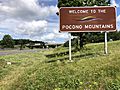
Sign on I-80 eastbound welcoming motorists to the Pocono Mountains

