Monroe County, Pennsylvania facts for kids
Quick facts for kids
Monroe County
|
||
|---|---|---|
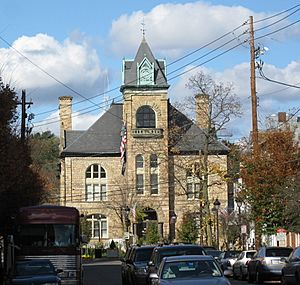
Monroe County Courthouse in Stroudsburg in November 2009
|
||
|
||
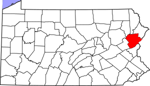
Location within the U.S. state of Pennsylvania
|
||
 Pennsylvania's location within the U.S. |
||
| Country | ||
| State | ||
| Founded | April 1, 1836 | |
| Named for | James Monroe 270 | |
| Seat | Stroudsburg | |
| Largest township | Coolbaugh Township | |
| Area | ||
| • Total | 617 sq mi (1,600 km2) | |
| • Land | 608 sq mi (1,570 km2) | |
| • Water | 9.0 sq mi (23 km2) 1.5%% | |
| Population
(2020)
|
||
| • Total | 168,327 |
|
| • Density | 270/sq mi (100/km2) | |
| Time zone | UTC−5 (Eastern) | |
| • Summer (DST) | UTC−4 (EDT) | |
| Congressional districts | 7th, 8th | |
| Website | http://www.monroecountypa.gov | |
Monroe County is a county in the state of Pennsylvania. In 2020, about 168,327 people lived here. Its main town, called the county seat, is Stroudsburg. This county is part of the Northeast Pennsylvania area.
Monroe County was created on April 1, 1836. It was made from parts of Northampton and Pike counties. The county was named after James Monroe, who was the fifth president of the United States.
The county is next to Northampton County to the south. To the north are Pike and Wayne counties. To the west, you'll find Carbon and Luzerne counties. To the east is the Delaware River and Warren County, New Jersey.
In recent years, Monroe County has grown a lot. Many people moved here from New York City and its surrounding areas. They liked the lower cost of living and that it was still close enough to commute to the city. Tourism, especially around the Pocono Mountains, also helped the county grow.
The county is home to East Stroudsburg University. The Lehigh River, which is about 109 miles (175 km) long, flows through Monroe County. It eventually joins the Delaware River.
Contents
Geography
Monroe County covers a total area of about 617 square miles (1,598 square kilometers). Most of this, 608 square miles (1,575 square kilometers), is land. The rest, 9.0 square miles (23 square kilometers), is water.
Neighboring Counties
Monroe County shares borders with these counties:
- Wayne County (north)
- Pike County (northeast)
- Sussex County, New Jersey (northeast)
- Warren County, New Jersey (east)
- Northampton County (south)
- Carbon County (west)
- Luzerne County (northwest)
- Lackawanna County (northwest)
Protected Natural Areas
Parts of these national protected areas are in Monroe County:
Population Facts
| Historical population | |||
|---|---|---|---|
| Census | Pop. | %± | |
| 1840 | 9,879 | — | |
| 1850 | 13,270 | 34.3% | |
| 1860 | 16,758 | 26.3% | |
| 1870 | 18,362 | 9.6% | |
| 1880 | 20,175 | 9.9% | |
| 1890 | 20,111 | −0.3% | |
| 1900 | 21,161 | 5.2% | |
| 1910 | 22,941 | 8.4% | |
| 1920 | 24,295 | 5.9% | |
| 1930 | 28,286 | 16.4% | |
| 1940 | 29,802 | 5.4% | |
| 1950 | 33,773 | 13.3% | |
| 1960 | 39,567 | 17.2% | |
| 1970 | 45,422 | 14.8% | |
| 1980 | 69,409 | 52.8% | |
| 1990 | 95,709 | 37.9% | |
| 2000 | 138,687 | 44.9% | |
| 2010 | 169,842 | 22.5% | |
| 2020 | 168,327 | −0.9% | |
| U.S. Decennial Census 1790–1960 1900–1990 1990–2000 2010–2019 |
|||
In 2010, there were 169,842 people living in Monroe County. The population density was about 228 people per square mile. Most people were White (70.5%), followed by Black or African American (13.2%). About 13.1% of the population was Hispanic or Latino.
The median age in the county was 37 years old. This means half the people were older than 37 and half were younger. About 26.8% of the population was under 18 years old.
By the end of 2021, the average value of homes in Monroe County was $210,972. This was a 13% increase from the year before.
Statistical Areas
The U.S. Office of Management and Budget has named Monroe County the East Stroudsburg, PA Micropolitan Statistical Area. Before 2023, it was called a metropolitan area. In 2010, this area had a population of 169,842 people. It is the 12th most populated area in Pennsylvania.
Monroe County is also part of a larger area called the Allentown-Bethlehem-East Stroudsburg, PA-NJ Combined Statistical Area. In 2020, this larger area had over 1 million people. It is the third most populated Combined Statistical Area in Pennsylvania.
Getting Around
Public Transportation
The Monroe County Transit Authority (MCTA), also known as the "Pocono Pony," offers public transportation. They have a bus system with set routes. They also offer a special service for people who need door-to-door rides.
There are plans to bring back train service from Hoboken to Scranton. This train would go through the Poconos. This would be the first time since the 1970s that daily trains run through this area.
Main Roads
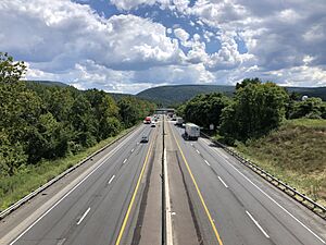
Major highways in Monroe County include:
 I-80
I-80 I-380
I-380 US 209


 US 209 Bus.
 PA 33
PA 33 PA 115
 PA 191
 PA 196
 PA 314
 PA 390
 PA 402
 PA 423
 PA 435
 PA 447
 PA 507
 PA 534
 PA 611
 PA 715
 PA 903
 PA 940
Education
Colleges and Universities
- East Stroudsburg University of Pennsylvania (in East Stroudsburg)
- Northampton Community College Monroe Campus (in Tannersville)
Public School Districts
The public school districts in Monroe County are:
- East Stroudsburg Area School District
- Pleasant Valley School District
- Pocono Mountain School District
- Stroudsburg Area School District
Other Schools
- Evergreen Community Charter School, Cresco (a charter school)
- Monroe Career and Technical Institute, Bartonsville (a technology school)
Private Schools
- Art Learning Center, East Stroudsburg
- Character Builders Christian Academy, Pocono Pines
- Monsignor McHugh School, Cresco (closed in 2020)
- Notre Dame Elementary School, East Stroudsburg
- Notre Dame High School, East Stroudsburg
- St Pauls Lutheran Pre-School, East Stroudsburg
- Stroudsburg 7th Day Adventists School, Stroudsburg
- Triumphant & Excellence Academy 1, East Stroudsburg
- Triumphant & Excellence Academy 2 TEA Institute, Tobyhanna
- Triumphant Living Heritage, Marshalls Creek
- Victory Baptist Christian School, Brodheadsville
- The Growing Concern Elementary School, Stroudsburg
Industry
The Tobyhanna Army Depot is located in Monroe County. It is the largest center for repairing and making electronic systems for the U.S. Department of Defense. In 2004, it was the biggest employer in northeastern Pennsylvania.
Parks and Trails
The Delaware Water Gap National Recreation Area is partly in Monroe County. This area has almost 70,000 acres (283 square kilometers) of mountains, valleys, and floodplains.
Monroe County also has several state parks, including:
The Appalachian Trail goes through Monroe County. This long footpath, stretching from Georgia to Maine, has a very beautiful but tough section along Monroe County's southern border. Hiking has always been a big part of Monroe County's history.
During the Revolutionary War in 1779, General John Sullivan led his troops through Monroe County. They were on an expedition to fight the Iroquois tribe in New York State. Many historical markers show where the "Sullivan Trail" was.
Other places with trails for public access include:
- Long Pond Conservation Easement: Over 10,000 acres (40 square kilometers) with many trails.
- Dixon Miller State Forest: An extensive trail system in Long Pond.
- Jonas Mountain Nature Preserve: Over 300 acres (121 hectares) with trails, an old mountain ridge, and Jonas Creek.
- Cherry Valley National Wildlife Refuge: Has detailed trail systems.
- Mount Wismer: A scenic hiking spot.
- Nothstein Preserve: A wooded trail system in the Poconos.
- Chestnut Mountain Nature Preserve: A large preserve on top of a plateau.
Resorts
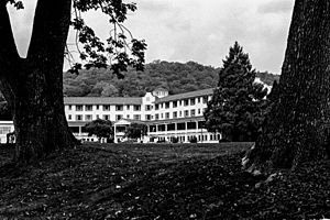
Monroe County is famous for its resorts. Two of the earliest Pocono resorts were Inn at Buck Hill Falls (opened 1901) and Pocono Manor (opened 1902). These started as quiet retreats but later became fancy mountain resorts. The Inn at Pocono Manor was mostly destroyed by fire in 2019.
Skytop Lodge, built in 1928, is a large manor house. It has 30 miles (48 km) of hiking trails and is surrounded by 5,000 acres (20 square kilometers) of woods and waterfalls.
The Buckwood Inn opened in 1911 and had the first golf course designed by famous architect A. W. Tillinghast. In 1943, bandleader Fred Waring bought it and renamed it Shawnee Inn. He even broadcast his radio shows from there.
Mount Airy Lodge was once the biggest Pocono resort. It was famous for its catchy jingle in New York. Big stars like Bob Hope performed there. It closed in 2001, and the Mount Airy Casino Resort opened on the same spot in 2007.
As of 2015, Monroe County had three resorts with indoor water parks:
- Great Wolf Lodge
- Aquatopia at Camelback Resort
- Kalahari Resort
Communities
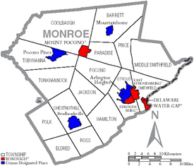
In Pennsylvania, there are different types of towns and areas. Here are the main ones in Monroe County:
Boroughs
- Delaware Water Gap
- East Stroudsburg
- Mount Pocono
- Stroudsburg (the county seat)
Townships
- Barrett
- Chestnuthill
- Coolbaugh
- Eldred
- Hamilton
- Jackson
- Middle Smithfield
- Paradise
- Pocono
- Polk
- Price
- Ross
- Smithfield
- Stroud
- Tobyhanna
- Tunkhannock
Census-Designated Places (CDPs)
CDPs are areas the U.S. Census Bureau uses to collect data. They are not official towns or cities.
- Arlington Heights
- Brodheadsville
- Effort
- Emerald Lakes
- Gouldsboro
- Indian Mountain Lake (partially in Carbon County)
- Mountainhome
- Penn Estates
- Pocono Pines
- Saw Creek (mostly in Pike County)
- Saylorsburg
- Sierra View
- Sun Valley
Unincorporated Communities
These are smaller places that are not officially part of a city, borough, or township.
- Analomink
- Appenzell
- Bartonsville
- Blakeslee
- Bossardsville
- Canadensis
- Cherry Valley
- Cresco
- Gilbert
- Gravel Place
- Hamilton Square
- Henryville
- Jonas
- Kellersville
- Kemmertown
- Kresgeville
- Kunkletown
- Long Pond
- Marshalls Creek
- McIlhaney
- McMichaels
- Meistertown
- Neola
- Paradise Valley
- Pocono Manor
- Pocono Summit
- Reeders
- Sciota
- Scotrun
- Shawnee on Delaware
- Skytop
- Snydersvillle
- South Stroudsburg
- Swiftwater
- Tannersville
- Tobyhanna
Population Ranking
This table shows the population of the biggest communities in Monroe County, based on the 2010 census.
† county seat
| Rank | City/Town/etc. | Municipal type | Population (2010 Census) |
|---|---|---|---|
| 1 | East Stroudsburg | Borough | 9,840 |
| 2 | Arlington Heights | CDP | 6,333 |
| 3 | † Stroudsburg | Borough | 5,567 |
| 4 | Sierra View | CDP | 4,813 |
| 5 | Penn Estates | CDP | 4,493 |
| 6 | Indian Mountain Lake (partially in Carbon County) | CDP | 4,372 |
| 7 | Saw Creek (mostly in Pike County) | CDP | 4,016 |
| 8 | Mount Pocono | Borough | 3,170 |
| 9 | Emerald Lakes | CDP | 2,886 |
| 10 | Sun Valley | CDP | 2,399 |
| 11 | Effort | CDP | 2,269 |
| 12 | Brodheadsville | CDP | 1,800 |
| 13 | Pocono Pines | CDP | 1,409 |
| 14 | Mountainhome | CDP | 1,182 |
| 15 | Saylorsburg | CDP | 1,126 |
| 16 | Gouldsboro (mostly in Wayne County) | CDP | 890 |
| 17 | Delaware Water Gap | Borough | 746 |
Water Systems
Monroe County has three main watersheds, which are areas of land where all the water drains into a common river or lake. All of these watersheds are part of the larger Delaware River Watershed.
The three main watersheds are:
- The Brodhead Watershed
- The Aquashicola Pohopoco Watershed
- The Tobyhanna Tunkhannock Watershed
Climate
Monroe County has two main climate regions: the higher Pocono Plateau and the lower Ridge and Valley section.
Pocono Plateau Region Climate
This higher area has a temperate continental climate. It has warm summers and cold winters. It rains or snows throughout the year.
- The highest temperature recorded since 1981 was 93.0°F (33.9°C) on July 15, 1995.
- The lowest temperature recorded since 1981 was -22.9°F (-30.5°C) on January 21, 1994.
- January is usually the snowiest month. Big snowstorms with 12 inches (30 cm) or more of snow happen almost every year.
| Climate data for 4 NE Tobyhanna, Elevation 2,087 ft (636 m), 1981–2010 normals, extremes 1981–2018 | |||||||||||||
|---|---|---|---|---|---|---|---|---|---|---|---|---|---|
| Month | Jan | Feb | Mar | Apr | May | Jun | Jul | Aug | Sep | Oct | Nov | Dec | Year |
| Record high °F (°C) | 60.9 (16.1) |
71.1 (21.7) |
80.3 (26.8) |
86.4 (30.2) |
88.9 (31.6) |
88.5 (31.4) |
93.0 (33.9) |
91.5 (33.1) |
89.1 (31.7) |
81.4 (27.4) |
74.8 (23.8) |
65.2 (18.4) |
93.0 (33.9) |
| Mean daily maximum °F (°C) | 29.9 (−1.2) |
33.3 (0.7) |
41.6 (5.3) |
54.3 (12.4) |
65.4 (18.6) |
73.2 (22.9) |
77.5 (25.3) |
76.0 (24.4) |
68.9 (20.5) |
57.3 (14.1) |
46.1 (7.8) |
34.3 (1.3) |
54.9 (12.7) |
| Daily mean °F (°C) | 21.9 (−5.6) |
25.0 (−3.9) |
32.3 (0.2) |
44.6 (7.0) |
55.2 (12.9) |
63.5 (17.5) |
68.1 (20.1) |
66.8 (19.3) |
59.8 (15.4) |
48.4 (9.1) |
38.5 (3.6) |
27.3 (−2.6) |
46.0 (7.8) |
| Mean daily minimum °F (°C) | 13.9 (−10.1) |
16.6 (−8.6) |
23.0 (−5.0) |
34.8 (1.6) |
45.0 (7.2) |
53.8 (12.1) |
58.7 (14.8) |
57.6 (14.2) |
50.7 (10.4) |
39.5 (4.2) |
30.9 (−0.6) |
20.3 (−6.5) |
37.2 (2.9) |
| Record low °F (°C) | −22.9 (−30.5) |
−14.1 (−25.6) |
−9.0 (−22.8) |
10.7 (−11.8) |
27.5 (−2.5) |
33.2 (0.7) |
38.1 (3.4) |
34.3 (1.3) |
28.2 (−2.1) |
17.9 (−7.8) |
−0.7 (−18.2) |
−16.2 (−26.8) |
−22.9 (−30.5) |
| Average precipitation inches (mm) | 3.66 (93) |
3.31 (84) |
4.27 (108) |
4.54 (115) |
4.67 (119) |
5.13 (130) |
4.78 (121) |
4.32 (110) |
5.14 (131) |
5.31 (135) |
4.44 (113) |
4.25 (108) |
53.82 (1,367) |
| Average snowfall inches (cm) | 20.9 (53) |
15.0 (38) |
15.6 (40) |
3.7 (9.4) |
0.0 (0.0) |
0.0 (0.0) |
0.0 (0.0) |
0.0 (0.0) |
0.0 (0.0) |
0.1 (0.25) |
3.9 (9.9) |
12.5 (32) |
71.7 (182) |
| Average relative humidity (%) | 76.0 | 70.3 | 66.5 | 62.3 | 64.9 | 74.1 | 74.0 | 77.1 | 78.5 | 75.2 | 74.2 | 77.8 | 72.6 |
| Average dew point °F (°C) | 15.5 (−9.2) |
16.7 (−8.5) |
22.4 (−5.3) |
32.5 (0.3) |
43.6 (6.4) |
55.1 (12.8) |
59.5 (15.3) |
59.4 (15.2) |
53.1 (11.7) |
40.9 (4.9) |
31.0 (−0.6) |
21.3 (−5.9) |
37.7 (3.2) |
| Source: PRISM | |||||||||||||
Ridge and Valley Region Climate
This lower area also has a temperate continental climate, but with hotter summers. It also has cold winters and year-round precipitation.
- The highest temperature recorded since 1981 was 100.3°F (37.9°C) on July 22, 2011.
- The lowest temperature recorded since 1981 was -18.0°F (-27.8°C) on January 21, 1994.
- July is usually the month with the most thunderstorms.
- January is usually the snowiest month.
| Climate data for East Stroudsburg, Elevation 531 ft (162 m), 1981–2010 normals, extremes 1981–2018 | |||||||||||||
|---|---|---|---|---|---|---|---|---|---|---|---|---|---|
| Month | Jan | Feb | Mar | Apr | May | Jun | Jul | Aug | Sep | Oct | Nov | Dec | Year |
| Record high °F (°C) | 68.6 (20.3) |
77.0 (25.0) |
86.3 (30.2) |
94.4 (34.7) |
94.5 (34.7) |
95.3 (35.2) |
100.3 (37.9) |
98.7 (37.1) |
96.3 (35.7) |
87.9 (31.1) |
79.5 (26.4) |
71.1 (21.7) |
100.3 (37.9) |
| Mean daily maximum °F (°C) | 36.1 (2.3) |
39.8 (4.3) |
48.8 (9.3) |
61.6 (16.4) |
71.9 (22.2) |
79.9 (26.6) |
83.9 (28.8) |
82.3 (27.9) |
75.1 (23.9) |
63.6 (17.6) |
52.3 (11.3) |
40.4 (4.7) |
61.4 (16.3) |
| Daily mean °F (°C) | 27.0 (−2.8) |
29.9 (−1.2) |
37.9 (3.3) |
49.2 (9.6) |
59.3 (15.2) |
68.0 (20.0) |
72.4 (22.4) |
70.9 (21.6) |
63.5 (17.5) |
51.9 (11.1) |
42.3 (5.7) |
31.9 (−0.1) |
50.4 (10.2) |
| Mean daily minimum °F (°C) | 17.9 (−7.8) |
20.1 (−6.6) |
27.0 (−2.8) |
36.9 (2.7) |
46.7 (8.2) |
56.1 (13.4) |
60.9 (16.1) |
59.5 (15.3) |
51.9 (11.1) |
40.3 (4.6) |
32.3 (0.2) |
23.4 (−4.8) |
39.5 (4.2) |
| Record low °F (°C) | −18.0 (−27.8) |
−8.6 (−22.6) |
−0.5 (−18.1) |
14.3 (−9.8) |
27.1 (−2.7) |
36.4 (2.4) |
42.6 (5.9) |
38.0 (3.3) |
29.8 (−1.2) |
19.8 (−6.8) |
6.1 (−14.4) |
−7.1 (−21.7) |
−18.0 (−27.8) |
| Average precipitation inches (mm) | 3.40 (86) |
2.97 (75) |
3.64 (92) |
4.11 (104) |
4.43 (113) |
4.48 (114) |
4.52 (115) |
4.41 (112) |
4.97 (126) |
4.77 (121) |
4.02 (102) |
4.09 (104) |
49.81 (1,265) |
| Average snowfall inches (cm) | 11.8 (30) |
8.5 (22) |
8.8 (22) |
2.1 (5.3) |
0.0 (0.0) |
0.0 (0.0) |
0.0 (0.0) |
0.0 (0.0) |
0.0 (0.0) |
0.1 (0.25) |
2.2 (5.6) |
7.1 (18) |
40.6 (103) |
| Average relative humidity (%) | 69.1 | 64.3 | 59.6 | 57.4 | 61.8 | 68.9 | 68.9 | 71.7 | 72.8 | 71.0 | 69.4 | 70.5 | 67.1 |
| Average dew point °F (°C) | 18.2 (−7.7) |
19.3 (−7.1) |
25.1 (−3.8) |
34.8 (1.6) |
46.2 (7.9) |
57.4 (14.1) |
61.6 (16.4) |
61.3 (16.3) |
54.6 (12.6) |
42.8 (6.0) |
33.0 (0.6) |
23.4 (−4.8) |
39.9 (4.4) |
| Source: PRISM | |||||||||||||
Nature and Environment
Long Pond Wetlands
Long Pond is an important freshwater wetland area. The Nature Conservancy's Hauser Nature Center is a great place for hiking and learning about nature in Long Pond.
Pocono Plateau Region Plants
The higher Pocono Plateau area mainly has Northern Hardwood forests. The trees usually bloom in early May, and their leaves change color in early October.
Ridge and Valley Region Plants
The lower Ridge and Valley section of Monroe County mainly has Appalachian Oak forests. Trees here typically bloom in late April, and fall colors appear in mid-October.
Glacial Till Barrens
These unique areas are found near Big Pocono State Park, Blakeslee, and Long Pond. The Long Pond Conservation Easement is a good example, with public trails. Glacial Till Barrens are also in Dixon Miller State Forest. These areas are moist but have plants that usually grow in much colder, northern climates. They are one of the only ecosystems of their kind in Pennsylvania.
See also
 In Spanish: Condado de Monroe (Pensilvania) para niños
 | Aurelia Browder |
 | Nannie Helen Burroughs |
 | Michelle Alexander |


