
East Stroudsburg, Pennsylvania facts for kids
Quick facts for kids
East Stroudsburg, Pennsylvania
|
||
|---|---|---|
|
Borough
|
||

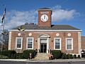
East Stroudsburg's borough hall
|
||
|
||

Location of East Stroudsburg in Monroe County, Pennsylvania
|
||

East Stroudsburg, Pennsylvania
Location in Pennsylvania

East Stroudsburg, Pennsylvania
Location in the United States
|
||
| Country | United States | |
| State | Pennsylvania | |
| County | Monroe | |
| Founded | 1738 | |
| Area | ||
| • Borough | 2.86 sq mi (7.41 km2) | |
| • Land | 2.84 sq mi (7.37 km2) | |
| • Water | 0.02 sq mi (0.04 km2) | |
| Elevation | 466 ft (142 m) | |
| Population
(2020)
|
||
| • Borough | 9,669 | |
| • Density | 3,399.79/sq mi (1,312.58/km2) | |
| • Metro | 176,567 μSA | |
| Time zone | UTC-5 (EST) | |
| • Summer (DST) | UTC-4 (EDT) | |
| ZIP Codes |
18301-18302
|
|
| Area code(s) | 570 | |
| FIPS code | 42-21872 | |

East Stroudsburg is a town, called a borough, in Monroe County, Pennsylvania. It's part of the beautiful Pocono Mountains region. The town was first known as Dansbury. It got its new name, East Stroudsburg, when the Delaware, Lackawanna, and Western Railroad opened a train station there. Even though it's named after its neighbor, Stroudsburg, East Stroudsburg has almost twice as many people.
It is the largest town in Monroe County. In 2020, about 9,847 people lived in East Stroudsburg. The town is located about 42 miles (68 km) northeast of Allentown. It's also about 102 miles (164 km) north of Philadelphia and 75 miles (121 km) west of New York City.
Contents
History of East Stroudsburg
How East Stroudsburg Was Founded
In 1737, a judge named Daniel Brodhead from Marbletown, New York, settled in what is now East Stroudsburg. He bought a large piece of land, about 1,000 acres. This land was near where the Lehigh Valley Hospital–Pocono Hospital is today. It was then part of Bucks County, but now it's in Monroe County. The land was along the east side of Brodhead Creek. Daniel Brodhead called his property Dansbury Manor.
Early Challenges and Growth
On December 11, 1755, about six months after Daniel Brodhead passed away, Dansbury Manor was attacked. Around 200 Native Americans were involved. Brodhead's five sons and daughter fought back. They were able to save their lives, but Dansbury Manor was destroyed.
In 1856, the Delaware, Lackawanna and Western Railroad built a railway through East Stroudsburg. This helped the town grow a lot. More people moved there, and businesses became stronger. By the late 1800s and early 1900s, East Stroudsburg became an important center for making goods and trading in eastern Pennsylvania.
Important Historical Buildings
Two buildings in East Stroudsburg are very important historically. They are the East Stroudsburg Armory and the East Stroudsburg station. Both are listed on the National Register of Historic Places. This means they are recognized for their special history.
Geography of East Stroudsburg
East Stroudsburg is located at 41.001442 degrees north latitude and -75.180111 degrees west longitude. The U.S. Census Bureau says the town covers about 2.9 square miles (7.5 square kilometers) of land. When you travel west on Interstate 80, East Stroudsburg is the second town you reach after crossing the border from New Jersey into Pennsylvania. You can take Exit 308 to get there.
Population and People
| Historical population | |||
|---|---|---|---|
| Census | Pop. | %± | |
| 1880 | 1,162 | — | |
| 1890 | 1,819 | 56.5% | |
| 1900 | 2,648 | 45.6% | |
| 1910 | 3,330 | 25.8% | |
| 1920 | 4,855 | 45.8% | |
| 1930 | 6,099 | 25.6% | |
| 1940 | 6,404 | 5.0% | |
| 1950 | 7,274 | 13.6% | |
| 1960 | 7,674 | 5.5% | |
| 1970 | 7,894 | 2.9% | |
| 1980 | 8,039 | 1.8% | |
| 1990 | 8,781 | 9.2% | |
| 2000 | 9,888 | 12.6% | |
| 2010 | 11,922 | 20.6% | |
| 2020 | 9,847 | −17.4% | |
| 2021 (est.) | 9,913 | −16.9% | |
| Sources: | |||
In 2010, there were 11,922 people living in East Stroudsburg. There were 3,145 households, which are groups of people living together. The population density was about 3,445.6 people per square mile (1,330.4 people per square kilometer).
The people living in East Stroudsburg come from many different backgrounds. In 2009, about 64.35% of the people were White. About 21.26% were Black or African American. Other groups included people of two or more races, Asian, Native American, and Native Hawaiian or Pacific Islander.
The average age of people in East Stroudsburg in 2010 was 26 years old. About 18.0% of the population was under 18. Many young adults, about 30.3%, were between 18 and 24 years old.
Education in East Stroudsburg
East Stroudsburg has several schools and a university.
Public Schools
The East Stroudsburg Area School District serves the area. It includes:
- East Stroudsburg High School North
- East Stroudsburg High School South
Private Schools
- Notre Dame High School is a private school option.
Colleges and Universities
- East Stroudsburg University of Pennsylvania is a university located in the town.
Sports in East Stroudsburg
East Stroudsburg is home to the Pocono Snow, an American soccer team. They started in 2008 and play in the National Premier Soccer League. Their home games are at Eiler-Martin Stadium at East Stroudsburg University. The team's colors are orange, blue, and white.
East Stroudsburg University also has its own sports teams, called the East Stroudsburg Warriors. They have 22 different sports teams. These teams compete in NCAA Division II, which is a level of college sports.
Transportation
Roads and Highways
_from_the_overpass_for_Prospect_Street_in_East_Stroudsburg,_Monroe_County,_Pennsylvania.jpg)
East Stroudsburg has many public roads. In 2017, there were about 30.37 miles (48.88 km) of roads. The Pennsylvania Department of Transportation (PennDOT) takes care of some roads. The borough itself maintains the rest.
The main highways in East Stroudsburg are Interstate 80 and U.S. Route 209. They run together through the southern part of the town. U.S. Route 209 Business goes through the center of town. Pennsylvania Route 447 crosses the northern part of the borough.
Airport
The Stroudsburg-Pocono Airport is located near East Stroudsburg. It serves the town and Monroe County. The airport has a paved runway that is 3087 feet (941 meters) long. You can find activities there like the Sky's the Limit Skydiving Center.
Bus Service
The Monroe County Transit Authority, also known as the Pocono Pony, provides bus service in Monroe County. Two of its bus routes, the Red and Yellow routes, serve East Stroudsburg. The Red route connects the town center with Stroudsburg and the Pocono Medical Center. The Yellow Route serves the northern and eastern parts of the borough. It also connects to the Stroud Mall.
Train Service

The East Stroudsburg station used to have passenger train service. The last passenger train, the Lake Cities, stopped there in 1970. There are plans to bring back train service to this station. New Jersey Transit hopes to run trains from Scranton to Hoboken, New Jersey. This would include a stop in East Stroudsburg. However, most of this project still needs funding.
The train tracks going east from East Stroudsburg are still used. The Delaware-Lackawanna Railroad uses them for freight three times a week. The tracks going west from East Stroudsburg to Scranton also have a usable track. The Delaware Lackawanna Railroad uses this for local freight. Passenger trips from Steamtown, USA in Scranton also run to East Stroudsburg a few times a year.
Future Train Plans
There is a big effort to bring back passenger train service between Scranton and Hoboken. This project is called the Lackawanna Cut-Off Restoration Project. The first work on this project began in 2011. Money has been set aside to fix bridges. This will help trains run again.
Media
Newspapers
The Pocono Record is the local newspaper for Monroe County. It covers news in Stroudsburg and East Stroudsburg. It also reports on nearby communities and parts of other counties.
Radio Stations
Several radio stations broadcast in or near East Stroudsburg:
- WESS (90.3 FM) broadcasts from East Stroudsburg University. Students and teachers often host shows. When live DJs are not on air, it plays BBC World Service.
- WSBG (93.5 FM) plays soft adult contemporary music. It is based in Stroudsburg.
- WRTI (91.1 FM) from Jackson Township plays news, Jazz, and NPR.
- WXPJ (91.9 FM) from Hackettstown, New Jersey, offers independent programs and music, including NPR.
- WHCY (106.3 FM) plays Contemporary Hit Radio music.
- WKRF (107.9 FM) also plays Contemporary Hit Radio music.
Notable People
Many interesting people have connections to East Stroudsburg:
- Hugh Brannum: A singer who later became Mr. Green Jeans on the Captain Kangaroo kids' show.
- Charlie Brenneman: A professional UFC MMA fighter.
- Keir Dillon: A professional snowboarder.
- Bob Dorough: A jazz pianist and composer of many famous Schoolhouse Rock! songs.
- Francis Dunnery: A musician, singer-songwriter, and record producer.
- James Geoffrey Franklin: The head coach for Penn State Nittany Lions football.
- Lenny Kaye: A guitarist and member of the Patti Smith Group.
- Nellie McKay: A singer-songwriter, actor, and former stand-up comedian.
- James Mungro: A retired NFL player for the Indianapolis Colts.
- Phil Woods: A jazz musician and composer. He helped start the annual Celebration of the Arts Festival.
- Brian Xanders: An executive with the NFL's Los Angeles Rams and Denver Broncos.
Historical Sites
East Stroudsburg has several places listed on the National Register of Historic Places:
- East Stroudsburg Railroad Station: This restored train station was built in 1864. It was known as the Dansbury Depot. Today, it holds historical information and is used as a community center.
- East Stroudsburg Armory: This building is located on Washington Street. It was listed as a historic site in 1991.
- Zion Lutheran Church: This historic church was built in 1851. It was listed as a historic site in 1972.
Climate
East Stroudsburg has a climate with hot summers and cold winters. It rains or snows throughout the year. Even though most summer days are a bit humid, it can get very hot and sticky. The highest temperature ever recorded was 106°F (41°C) in September.
In winter, the coldest temperature ever recorded was -35°F (-37°C) in January. Snowstorms with 12 inches (30 cm) or more of snow happen every few years. These often occur during big winter storms called "nor'easters."
| Climate data for East Stroudsburg, Pennsylvania (1991–2020 normals, extremes 1911–present) | |||||||||||||
|---|---|---|---|---|---|---|---|---|---|---|---|---|---|
| Month | Jan | Feb | Mar | Apr | May | Jun | Jul | Aug | Sep | Oct | Nov | Dec | Year |
| Record high °F (°C) | 72 (22) |
75 (24) |
87 (31) |
96 (36) |
97 (36) |
100 (38) |
104 (40) |
103 (39) |
106 (41) |
95 (35) |
86 (30) |
72 (22) |
106 (41) |
| Mean daily maximum °F (°C) | 35.8 (2.1) |
39.3 (4.1) |
48.2 (9.0) |
61.9 (16.6) |
72.1 (22.3) |
79.6 (26.4) |
84.3 (29.1) |
82.3 (27.9) |
74.9 (23.8) |
63.0 (17.2) |
51.0 (10.6) |
40.4 (4.7) |
61.1 (16.2) |
| Daily mean °F (°C) | 27.5 (−2.5) |
30.0 (−1.1) |
38.0 (3.3) |
49.5 (9.7) |
59.8 (15.4) |
67.8 (19.9) |
72.7 (22.6) |
70.7 (21.5) |
63.6 (17.6) |
51.7 (10.9) |
41.2 (5.1) |
32.5 (0.3) |
50.4 (10.2) |
| Mean daily minimum °F (°C) | 19.3 (−7.1) |
20.6 (−6.3) |
27.9 (−2.3) |
37.2 (2.9) |
47.4 (8.6) |
56.1 (13.4) |
61.0 (16.1) |
59.2 (15.1) |
52.3 (11.3) |
40.4 (4.7) |
31.5 (−0.3) |
24.5 (−4.2) |
39.8 (4.3) |
| Record low °F (°C) | −35 (−37) |
−21 (−29) |
−11 (−24) |
10 (−12) |
24 (−4) |
32 (0) |
36 (2) |
32 (0) |
20 (−7) |
14 (−10) |
2 (−17) |
−14 (−26) |
−35 (−37) |
| Average precipitation inches (mm) | 3.78 (96) |
3.12 (79) |
4.04 (103) |
4.31 (109) |
4.41 (112) |
5.50 (140) |
4.71 (120) |
4.83 (123) |
5.30 (135) |
5.24 (133) |
3.89 (99) |
4.42 (112) |
53.55 (1,360) |
| Average snowfall inches (cm) | 11.3 (29) |
10.3 (26) |
9.5 (24) |
0.9 (2.3) |
0.0 (0.0) |
0.0 (0.0) |
0.0 (0.0) |
0.0 (0.0) |
0.0 (0.0) |
0.1 (0.25) |
1.5 (3.8) |
8.0 (20) |
41.6 (106) |
| Average precipitation days (≥ 0.01 in) | 12.7 | 11.2 | 11.4 | 12.4 | 13.9 | 12.0 | 12.3 | 11.7 | 9.5 | 12.0 | 10.9 | 12.3 | 142.3 |
| Average snowy days (≥ 0.1 in) | 7.4 | 6.1 | 4.3 | 0.7 | 0.0 | 0.0 | 0.0 | 0.0 | 0.0 | 0.1 | 1.0 | 4.9 | 24.5 |
| Source: NOAA | |||||||||||||
Ecology
East Stroudsburg's natural plant life would mostly be Appalachian Oak forests. The trees in this area are mostly Hardwood trees. Spring flowers usually bloom in late April. The leaves change to beautiful fall colors in mid-October. The area's coldest winter temperature is usually around -5.4°F (-20.8°C).
Images for kids
-
East Stroudsburg's borough hall
-

Seal of East Stroudsburg
-

Location of East Stroudsburg in Monroe County, Pennsylvania
See also
 In Spanish: East Stroudsburg para niños
