
Hackettstown, New Jersey facts for kids
Quick facts for kids
Hackettstown, New Jersey
|
||
|---|---|---|
|
Town
|
||

Centenary University, Warren County’s only four year post secondary institution
|
||
|
||

Hackettstown, New Jersey
Location in Warren County, New Jersey

Hackettstown, New Jersey
Location in New Jersey

Hackettstown, New Jersey
Location in the United States
|
||
| Country | ||
| State | ||
| County | Warren | |
| Incorporated | March 9, 1853 | |
| Named for | Samuel Hackett | |
| Government | ||
| • Type | Special charter | |
| • Body | Town Council | |
| Area | ||
| • Total | 3.71 sq mi (9.61 km2) | |
| • Land | 3.61 sq mi (9.35 km2) | |
| • Water | 0.10 sq mi (0.26 km2) 2.67% | |
| Area rank | 307th of 565 in state 18th of 22 in county |
|
| Elevation | 554 ft (169 m) | |
| Population
(2020)
|
||
| • Total | 10,248 | |
| • Estimate
(2023)
|
10,125 | |
| • Rank | 239th of 565 in state 2nd of 22 in county |
|
| • Density | 2,837.2/sq mi (1,095.4/km2) | |
| • Density rank | 230th of 565 in state 3rd of 22 in county |
|
| Time zone | UTC−05:00 (Eastern (EST)) | |
| • Summer (DST) | UTC−04:00 (Eastern (EDT)) | |
| ZIP Code |
07840
|
|
| Area code(s) | 908 | |
| FIPS code | 3404128710 | |
| GNIS feature ID | 0885237 | |

Hackettstown is a town in Warren County, New Jersey, in the United States. It's famous for being the home of the US headquarters of Mars, Inc., the company that makes many popular candies.
In 2020, about 10,248 people lived in Hackettstown. The town was officially created on March 9, 1853. It was formed from parts of Independence Township.
Contents
History of Hackettstown
How Hackettstown Started
Hackettstown was named after Samuel Hackett. He was an early settler and owned a lot of land. People say he gave money for drinks at a new hotel. This helped make sure the town was named after him. Before that, it was called Helms' Mills or Musconetcong.
William Johnson and his brother George helped a lot in making Hackettstown an official town in 1853. They were successful shop owners. Both brothers were very active in the community. They helped start the Union Cemetery, for example.
Important Events in the 20th Century
The Hackettstown State Fish Hatchery was built in 1912. It became a popular place for visitors.
In 1925, a serious train accident happened near town. About 50 people died and 50 more were hurt. This happened because a storm washed debris onto the tracks. It was the deadliest event in Warren County's history.
A new hospital, Hackettstown Community Hospital, opened in 1973. It had 106 beds. Many local groups and businesses helped raise money for it.
In 1994, a charity picnic was held at the Elk's Lodge. A fight broke out between rival motorcycle clubs. Two people died and three others were injured.
Hackettstown in the 21st Century
In 2005, Money Magazine named Hackettstown one of the top 100 towns in the U.S. for living and working.
In 2011, Hackettstown became a "sister city" with Hacketstown, Ireland. This means they share a special friendly connection.
Geography and Location
Hackettstown covers about 3.71 square miles (9.61 square kilometers). Most of this is land, with a small amount of water. The town is in a valley next to the Musconetcong River.
Hackettstown is surrounded by several other towns. These include Washington Township (Morris County) to the southeast and Mansfield Township to the southwest. It is also near Allamuchy, Mount Olive, and Independence.
The town is about 49.6 miles northeast of Allentown. It is also about 55.3 miles northwest of New York City.
Climate in Hackettstown
| Climate data for Hackettstown, New Jersey, 40°51′13″N 74°49′30″W / 40.8537°N 74.8249°W, Elevation: 554 ft (169 m) | |||||||||||||
|---|---|---|---|---|---|---|---|---|---|---|---|---|---|
| Month | Jan | Feb | Mar | Apr | May | Jun | Jul | Aug | Sep | Oct | Nov | Dec | Year |
| Mean daily maximum °F (°C) | 36.4 (2.4) |
39.3 (4.1) |
47.6 (8.7) |
60.4 (15.8) |
70.4 (21.3) |
78.2 (25.7) |
82.9 (28.3) |
81.1 (27.3) |
74.9 (23.8) |
63.3 (17.4) |
51.9 (11.1) |
41.5 (5.3) |
60.7 (15.9) |
| Daily mean °F (°C) | 27.6 (−2.4) |
29.6 (−1.3) |
37.5 (3.1) |
49.1 (9.5) |
59.3 (15.2) |
67.7 (19.8) |
72.4 (22.4) |
70.7 (21.5) |
63.9 (17.7) |
52.3 (11.3) |
41.9 (5.5) |
33.1 (0.6) |
50.4 (10.2) |
| Mean daily minimum °F (°C) | 18.7 (−7.4) |
19.8 (−6.8) |
27.5 (−2.5) |
37.8 (3.2) |
48.2 (9.0) |
57.2 (14.0) |
62.0 (16.7) |
60.3 (15.7) |
52.8 (11.6) |
41.4 (5.2) |
31.8 (−0.1) |
24.7 (−4.1) |
40.2 (4.5) |
| Average precipitation inches (mm) | 3.68 (93) |
2.94 (75) |
4.13 (105) |
4.02 (102) |
4.17 (106) |
4.84 (123) |
4.76 (121) |
4.79 (122) |
4.70 (119) |
4.79 (122) |
3.54 (90) |
4.52 (115) |
50.88 (1,293) |
| Source: PRISM (spatially interpolated, 1991-2020 normals) | |||||||||||||
Population and People
| Historical population | |||
|---|---|---|---|
| Census | Pop. | %± | |
| 1860 | 1,322 | — | |
| 1870 | 2,202 | 66.6% | |
| 1880 | 2,502 | 13.6% | |
| 1890 | 2,417 | −3.4% | |
| 1900 | 2,474 | 2.4% | |
| 1910 | 2,715 | 9.7% | |
| 1920 | 2,936 | 8.1% | |
| 1930 | 3,038 | 3.5% | |
| 1940 | 3,289 | 8.3% | |
| 1950 | 3,894 | 18.4% | |
| 1960 | 5,276 | 35.5% | |
| 1970 | 9,472 | 79.5% | |
| 1980 | 8,850 | −6.6% | |
| 1990 | 8,120 | −8.2% | |
| 2000 | 10,403 | 28.1% | |
| 2010 | 9,724 | −6.5% | |
| 2020 | 10,248 | 5.4% | |
| 2023 (est.) | 10,125 | 4.1% | |
| Population sources: 1860–1920 1860–1870 1870 1880–1890 1890–1910 1910–1930 1940–2000 2000 2010 2020 |
|||
Population in 2010
In 2010, the town had 9,724 people living in 3,575 households. About 85% of the people were White. Other groups included Black or African American (2.5%), Asian (5%), and Native American (0.2%). About 15% of the population was Hispanic or Latino.
About 29% of households had children under 18. The average household had 2.48 people. The average family had 3.09 people.
About 20% of the population was under 18 years old. About 14% were 65 or older. The average age in Hackettstown was 37.3 years.
Economy and Jobs

Hackettstown is home to the US headquarters of Mars Wrigley Confectionery. This is a part of Mars, Incorporated. They make many famous candies like Milky Way, Mars, M&M's, Twix, and Snickers.
Arts and Culture
The The Semonski Sisters are a musical group from Hackettstown. This family act appeared on The Lawrence Welk Show from 1975 to 1977.
Sports and Teams
- The Skyland Rollergirls were a roller derby team. They started in 2008 and played in Hackettstown.
- The Jersey Express basketball team moved to Hackettstown in 2012. They played at Centenary College.
- Hackettstown High School sports teams are called the Tigers. They play in the Northwest Jersey Athletic Conference.
- The sports teams at Centenary University are known as the Cyclones.
- The Hackettstown Harleys ice hockey team was formed in 2008.
Education and Schools

The Hackettstown School District serves students from pre-kindergarten through 12th grade. There are four schools in the district:
- Hatchery Hill School (PreK-1)
- Willow Grove School (grades 2–4)
- Hackettstown Middle School (grades 5-8)
- Hackettstown High School (grades 9–12)
In the 2021–22 school year, the district had over 2,000 students. Students from Allamuchy, Independence, and Liberty also attend Hackettstown High School.
Hackettstown Middle School received a special award in 2001–2002. It was given the National Blue Ribbon Award of Excellence. This is a very high honor for American schools.
Students in Warren County can also attend other schools. These include Ridge and Valley Charter School for younger students. Older students can go to Warren County Technical School for vocational training.
Centenary University is a private college in Hackettstown. It started in 1867 and offers master's degrees.
Media and News
- WRNJ is a radio station licensed to Hackettstown. It broadcasts on 1510 AM and also on FM.
- WXPJ is another radio station at 91.9 FM. It used to be Centenary University's station.
- Two digital news publications cover the town: The Star-Ledger and The Express-Times.
Transportation and Travel
_just_east_of_New_Jersey_State_Route_182_and_Warren_County_Route_517_(Mountain_Avenue)_in_Hackettstown,_Warren_County,_New_Jersey.jpg)
Hackettstown has many roads, including U.S. Route 46, Route 57, and County Route 517. Interstate 80 is just north of the town.
Public Transport Options

The Hackettstown station is the last stop for some NJ Transit train lines. These trains can take you to Hoboken Terminal. From there, you can connect to Pennsylvania Station in Midtown Manhattan.
Warren County also has a shuttle bus service. It runs along Route 57 on weekdays.
Airports Near Hackettstown
Hackettstown is about 49.3 miles from Newark Liberty International Airport. This airport is in Newark and Elizabeth. Lehigh Valley International Airport is about 39.0 miles away.
There is also a small airport called Hackettstown Airport nearby. It is in Mansfield Township.
Places to Visit
- Union Cemetery, Mountain Avenue
- Mars Wrigley US Headquarters
-
Historical Society Museum
-

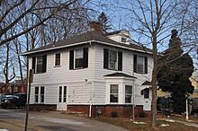
Jacob C. Allen House, listed on the National Register of Historic Places
-
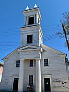
First Presbyterian Church
-
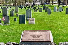
Old Presbyterian Burial Ground
-
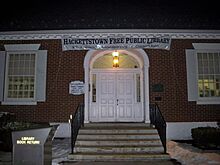
Hackettstown Free Public Library
-
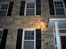
Hackettstown Community Center
-
400 West Moore Street
-
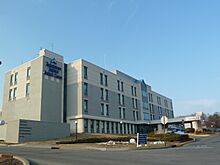
Hackettstown Medical Center


Famous People From Hackettstown


Many interesting people have lived in or are connected to Hackettstown, including:
- John D. Bulkeley (1911–1996) – A Vice Admiral in the U.S. Navy and a Medal of Honor winner.
- Bette Cooper (1920–2017) – She was crowned Miss America in 1937.
- Jim Courter (born 1941) – A former member of the U.S. Congress.
- Jonathan Townley Crane (1819–1880) – A clergyman and author, and the father of famous author Stephen Crane.
- Christina Desiderio (born 2000) – An artistic gymnast.
- John DiMaio (born 1955) – A member of the New Jersey General Assembly and a former mayor of Hackettstown.
- Brian Fallon (born 1980) – The lead singer for the band The Gaslight Anthem.
- Izetta Jewel (1883–1978) – An actress and activist for women's rights.
- Cole Kimball (born 1985) – A pitcher who played for the Washington Nationals baseball team.
- Kristen Maloney (born 1981) – A former Olympic gymnast.
- Jimmi Simpson (born 1975) – An Emmy-nominated actor in movies and TV shows.
- Anthony Veneziano (born 1997) – A Major League Baseball pitcher for the Kansas City Royals.
- George Theodore Werts (1846–1910) – A former Governor of New Jersey.
See also
 In Spanish: Hackettstown para niños
