
Hoboken, New Jersey facts for kids
Quick facts for kids
Hoboken, New Jersey
|
|||||
|---|---|---|---|---|---|
|
City
|
|||||
|
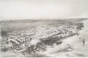
Aerial view of Hoboken
Stevens Institute of Technology
Hoboken City Hall
Pier A Park
|
|||||
|
|||||
| Nickname(s):
The Mile Square City
|
|||||

Hoboken, New Jersey
Location in Hudson County, New Jersey

Hoboken, New Jersey
Location in New Jersey

Hoboken, New Jersey
Location in the United States
|
|||||
| Country | |||||
| State | |||||
| County | Hudson | ||||
| Incorporated | April 9, 1849 | ||||
| Government | |||||
| • Type | Faulkner Act (mayor–council) | ||||
| • Body | City Council | ||||
| Area | |||||
| • Total | 1.97 sq mi (5.10 km2) | ||||
| • Land | 1.25 sq mi (3.24 km2) | ||||
| • Water | 0.72 sq mi (1.87 km2) 37.50% | ||||
| Area rank | 413th of 565 in state 6th of 12 in county |
||||
| Elevation | 23 ft (7 m) | ||||
| Population
(2020)
|
|||||
| • Total | 60,419 | ||||
| • Estimate
(2023)
|
57,010 | ||||
| • Rank | 708th in country (as of 2023) 5th of 12 in county |
||||
| • Density | 48,335.2/sq mi (18,662.3/km2) | ||||
| • Density rank | 4th of 565 in state 4th of 12 in county |
||||
| Demonym(s) | Hobokenite | ||||
| Time zone | UTC−05:00 (Eastern (EST)) | ||||
| • Summer (DST) | UTC−04:00 (Eastern (EDT)) | ||||
| ZIP Code |
07030
|
||||
| Area code(s) | 201 | ||||
| FIPS code | 3401732250 | ||||
| GNIS feature ID | 0885257 | ||||


Hoboken is a city in Hudson County, New Jersey. It is part of the larger New York metropolitan area. Hoboken is famous for Hoboken Terminal, a big place where many types of transportation meet. In 2020, about 60,419 people lived there. The city is known for being very densely populated, meaning many people live close together.
Hoboken was first settled by Europeans in the 1600s. In the early 1800s, Colonel John Stevens helped develop the city. It started as a resort and later became a place where people lived. Hoboken became a separate town in 1849 and a city in 1855. It is also known as the place where the first recorded game of baseball happened. The Stevens Institute of Technology, one of the oldest technology universities in the U.S., is also in Hoboken. Plus, it's the hometown of the famous singer Frank Sinatra. Many streets and parks in the city are named after him.
Located along the Hudson Waterfront, Hoboken was once a very important part of the Port of New York and New Jersey. It had many big factories for most of the 1900s. Over time, the city changed from an industrial area with factories like Maxwell House coffee and Wonder Bread to a place with trendy shops and modern apartments. It has been ranked as one of the best places to live in Hudson County.
Contents
Exploring Hoboken's Past
How Hoboken Got Its Name
The name Hoboken was chosen by Colonel John Stevens when he bought land here. Native Americans, called the Lenape, used to call the area "land of the tobacco pipe." This was because they found soapstone there to carve pipes. Their phrase sounded like "Hopoghan Hackingh."
An old Dutch word, Hoebuck, meant "high bluff." This likely referred to Castle Point, the highest part of the city. Over time, the name changed to Hoboken. This was influenced by people from Flanders, a region in Belgium, and it sounds like the city of Hoboken in Antwerp.
Hoboken is often called the "Mile Square City." However, it is actually a bit larger, covering about 1.25 square miles of land.
Early European Settlers

Hoboken was originally like an island. It had the Hudson River to the east and wet, marshy lands to the west. The Hackensack tribe, part of the Lenape people, used this area as a seasonal camp. They used the unique rock found there to carve pipes.
The first European to claim this land was Henry Hudson in 1609. He was sailing for the Dutch. Soon after, the area became part of a Dutch colony called New Netherland. In 1630, a Dutch mayor named Michael Reyniersz Pauw bought the land from the Lenape. He planned to start a colony, but it didn't work out.
Later, in 1643, a farmer named Aert Van Putten built a house and North America's first brewery here. Sadly, he was killed, and his buildings were destroyed during conflicts between Native Americans and the Dutch.
In 1664, the English took control of New Amsterdam, which included Hoboken. The area remained mostly farmland with few people. In 1784, after the American Revolutionary War, Colonel John Stevens bought the land.
Hoboken in the 1800s
_Hoboken_in_1854(NYPL_Hades-1090707-psnypl_prn_1006)_(cropped).jpg)
.png)
In the early 1800s, Colonel John Stevens turned the waterfront into a fun resort for people from Manhattan. In 1811, his ship, the Juliana, became the world's first commercial steam ferry, carrying people between Manhattan and Hoboken. Stevens also built a steam locomotive in 1825.
A natural spring in a cave called Sybil's Cave opened in 1832. Visitors could pay a penny for a glass of water, which some believed had healing powers. The famous writer Edgar Allan Poe even wrote a story about an event that supposedly happened there. The cave was closed for many years but reopened in 2008.
Before he passed away in 1838, Stevens started the Hoboken Land and Improvement Company. This company planned out the city's streets, built houses, and created places for factories. Many of these old brick houses and the street layout can still be seen today.
Hoboken officially became a city on March 29, 1855. As the city grew, shipping companies started using Hoboken as a major port. A large railroad terminal was built at the waterfront in 1907. By the late 1800s, many German immigrants lived in Hoboken, making it feel like "Little Bremen."
Birthplace of Baseball


Hoboken is famous as the place where the first officially recorded game of baseball took place. This happened in 1846 at Elysian Fields. The game was played between the Knickerbocker Club and the New York Nine.
The Knickerbocker Club, started by Alexander Cartwright, began using Elysian Fields because there weren't good fields in Manhattan. Famous early baseball figures like Harry Wright and Henry Chadwick played there. Chadwick, a journalist, even came up with the phrase "America's Pastime" for baseball.
In the 1850s, many New York baseball teams used Elysian Fields as their home. In 1865, a big championship game between the Mutual Club of New York City and the Atlantic Club of Brooklyn drew about 20,000 fans. This game was even captured in a famous picture called "The American National Game of Base Ball."
As new baseball parks were built in Brooklyn where people could pay to watch, Elysian Fields became less important for professional games.
Hoboken in the 1900s
.jpg.jpeg)

When the U.S. entered World War I, the piers in Hoboken were taken over by the government. Hoboken became a main point for soldiers to leave the country. More than three million soldiers, called "doughboys," passed through the city. General Pershing's famous saying was, "Heaven, Hell or Hoboken... by Christmas."
After the war, many Italian and Irish immigrants moved to Hoboken. Even during the Great Depression, jobs were still available in the shipyards and factories. The Port Authority of New York and New Jersey helped build the Holland Tunnel (finished in 1927) and the Lincoln Tunnel (in 1937). These tunnels made it easier to travel between New Jersey and New York City by car.
After World War II
World War II helped Hoboken's economy grow because its factories were important for the war. Many women were hired in factories. After the war, many people stayed in Hoboken. In the 1950s, big companies like Todd Shipyards, Maxwell House, and Lipton Tea still had a strong presence.

In the 1960s, things started to change. Old buildings became run down, and it was cheaper to build ships and make goods overseas. Many factories moved away, and port operations shifted to larger areas. Many Hoboken residents moved to the suburbs, and property values went down. Hoboken went from a busy port town to a more rundown place.
However, Hoboken was never completely empty. New immigrants, especially from Puerto Rico, helped keep small businesses open. Washington Street, the main street, always had shops. The close-knit neighborhoods remained home to many proud residents. Stevens Institute of Technology stayed a top school, and Maxwell House continued to operate.

In 1975, part of the old Keuffel and Esser Manufacturing Complex was turned into apartments. This building was once a factory for architectural and engineering tools.
The Waterfront's New Look
The Hudson Waterfront was key to Hoboken's economy for many years. It was full of factories and shipyards. By the 1970s, these docks were mostly abandoned. A large part of River Street, known for its taverns, was torn down to make way for new projects.

In the 1980s and 1990s, plans were made to rebuild the waterfront. New homes, businesses, and public spaces were created. Many old factories were torn down for new apartment buildings. Some buildings, like the old Lipton Tea factory, were renovated for new uses.
Today, Frank Sinatra Park and Sinatra Drive honor the city's most famous son. Uptown, the name Maxwell reminds people of the coffee factory. The promenade along the river is part of the Hudson River Waterfront Walkway. This walkway connects many towns along the Hudson River, offering great views of the New York City skyline.
Hoboken Today
In the late 1970s and 1980s, many people from New York City moved to Hoboken. They bought old brownstone houses and apartments. Hoboken became popular with artists, musicians, and people who worked in New York City but wanted more affordable rents.
Empty lots were built on, and old apartments became luxury homes. Hoboken was greatly affected by the events of September 11, 2001, as many new residents worked at the World Trade Center. The city has changed from a working-class town to one with gourmet shops and luxury apartments.
In October 2012, Hurricane Sandy caused a lot of flooding in Hoboken. The city was without electricity for days. The storm caused over $100 million in damage. In 2014, the U.S. government gave Hoboken $230 million to build new defenses against flooding. This included levees, parks, and special systems to store rainwater.
By September 2023, these improvements were very successful. When a big storm hit, Hoboken had very little flooding compared to New York City. This has made Hoboken a "climate change success story."
Hoboken's Location and Layout

Hoboken covers about 2 square miles. It has 1.25 square miles of land and 0.75 square miles of water.
The city is on the west bank of the Hudson River. To the north are Weehawken and Union City. To the south and west is Jersey City. Across the Hudson River, you can see the Manhattan, New York City neighborhoods of West Village and Chelsea.
Hoboken is laid out in a grid pattern. Streets running north-south are named after presidents, like Washington, Adams, and Jefferson. Streets running east-west are numbered, starting with First Street. The city's ZIP Code is 07030.
Weather in Hoboken
Hoboken has a humid subtropical climate, similar to nearby New York City. In winter, temperatures go up and down, but there isn't one coldest time. The coldest temperatures usually happen in late December and early to mid-February.
| Climate data for Hoboken | |||||||||||||
|---|---|---|---|---|---|---|---|---|---|---|---|---|---|
| Month | Jan | Feb | Mar | Apr | May | Jun | Jul | Aug | Sep | Oct | Nov | Dec | Year |
| Record high °F (°C) | 72 (22) |
75 (24) |
86 (30) |
96 (36) |
99 (37) |
101 (38) |
106 (41) |
104 (40) |
102 (39) |
94 (34) |
84 (29) |
75 (24) |
106 (41) |
| Mean daily maximum °F (°C) | 38 (3) |
42 (6) |
50 (10) |
61 (16) |
71 (22) |
79 (26) |
84 (29) |
83 (28) |
75 (24) |
64 (18) |
54 (12) |
43 (6) |
62 (17) |
| Mean daily minimum °F (°C) | 27 (−3) |
29 (−2) |
35 (2) |
45 (7) |
54 (12) |
64 (18) |
69 (21) |
68 (20) |
61 (16) |
50 (10) |
42 (6) |
32 (0) |
48 (9) |
| Record low °F (°C) | −6 (−21) |
−15 (−26) |
3 (−16) |
12 (−11) |
28 (−2) |
44 (7) |
52 (11) |
50 (10) |
39 (4) |
28 (−2) |
7 (−14) |
−13 (−25) |
−15 (−26) |
| Average precipitation inches (mm) | 3.65 (93) |
3.21 (82) |
4.36 (111) |
4.50 (114) |
4.19 (106) |
4.41 (112) |
4.60 (117) |
4.44 (113) |
4.28 (109) |
4.40 (112) |
4.02 (102) |
4.00 (102) |
50.06 (1,273) |
| Average snowfall inches (cm) | 7.5 (19) |
6.8 (17) |
3.0 (7.6) |
0.5 (1.3) |
0.0 (0.0) |
0.0 (0.0) |
0.0 (0.0) |
0.0 (0.0) |
0.0 (0.0) |
0.0 (0.0) |
0.4 (1.0) |
3.9 (9.9) |
22.1 (55.8) |
| Average precipitation days (≥ 0.01 in) | 6.0 | 5.6 | 6.8 | 7.3 | 7.3 | 7.1 | 7.1 | 6.4 | 6.2 | 5.5 | 6.0 | 6.3 | 77.6 |
| Average snowy days (≥ 0.1 in) | 8.0 | 6.5 | 2.3 | 0.4 | 0.0 | 0.0 | 0.0 | 0.0 | 0.0 | 0.0 | 0.2 | 3.0 | 20.4 |
People and Community
Hoboken has a diverse population. In 2020, about 70% of residents were white, 10% Asian, and 4% Black. About 14% of the population was Hispanic or Latino. Many people in Hoboken have college degrees. In 2019, it was ranked as the most educated city in New Jersey for places with over 10,000 people.
Most people who live in Hoboken and work commute to New York City. In 2000, about 53% of working residents traveled to one of New York City's five boroughs for their jobs.
Economy and Jobs
Hoboken is home to the publisher John Wiley & Sons, which moved from Manhattan in 2002. The first Blimpie restaurant opened in Hoboken in 1964.
Stevens Institute of Technology plays a big part in Hoboken's economy. In 2014, the university added $117 million to the city's economy. This included salaries for its staff and money spent by students and visitors. The university supports over 1,200 full-time jobs.
Parks and Fun Places


Hoboken has many parks for people to enjoy. Some of the older parks include Church Square Park, Columbus Park, and Elysian Park.
Newer parks have also been built. Pier C is a rebuilt pier with a curving walkway. 1600 Park, a sports field, opened in 2013. Southwest Park was finished in 2017. In 2019, the 7th and Jackson Resiliency Park opened. It has a playground, a lawn, a gym, and systems to collect rainwater to help with flooding.
The Northwest Resiliency Park, a large new park, opened in June 2023. It has a big lawn, a stage, a fountain that can become an ice skating rink, playgrounds, and sports fields. It also has a huge underground system that can store 2 million gallons of water to prevent flooding.
The Hudson River Waterfront Walkway runs along the river. This path is part of a plan to connect all the towns along the Hudson River. It gives people easy access to the water's edge and offers amazing views of the New York City skyline.
Arts and Culture
Since 1992, the Hudson Shakespeare Company has performed free Shakespeare plays in Hoboken during the summer. They often perform "Shakespeare Mondays" at Frank Sinatra Park. Hoboken also has art galleries and the Hoboken Historical Museum.
Yearly Events
Hoboken hosts many fun events each year. These include the Frank Sinatra Idol Contest, Hoboken Comedy Festival, Hoboken House Tour, and the Hoboken Arts and Music Festival. The Hoboken Farmer's Market is held every Tuesday from June to October. There are also many festivals, like the Saint Patrick's Day Parade and the Saint Ann's Feast.
From the 1960s until 2011, the Macy's Parade Studio was in Hoboken. This is where many of the floats for the Macy's Thanksgiving Day Parade were kept and prepared.
City Government and Services
Local Government

Hoboken is run by a Mayor and a nine-member City Council. The Mayor and three council members are elected by the whole city. The other six council members represent different parts of the city called wards. All are elected for four-year terms.
As of 2025, the Mayor of Hoboken is Ravinder Bhalla. He was first elected in 2017, becoming the first Sikh mayor in New Jersey's history. He was re-elected in November 2021.
Fire Department
| Agency overview | |
|---|---|
| Established | 1891 |
| Annual calls | ~3,500 |
| Employees | 132 |
| Staffing | Career |
| Fire chief | Brian Crimmins |
| EMS level | First Responder BLS |
| Facilities and equipment | |
| Battalions | 1 |
| Stations | 4 |
| Engines | 4 |
| Trucks | 2 |
| Rescues | 1 |
| HAZMAT | 1 |
| USAR | 1 |
| Fireboats | 1 |

The city's fire department, the Hoboken Fire Department (HFD), has 132 paid firefighters. It was started in 1891. In 2010, the HFD responded to over 3,300 emergency calls. The department is highly rated for its quick response times and effectiveness. Hoboken's firehouses, including its fire museum, are listed on the National Register of Historic Places.
Fire Station Locations
| Engine company | Ladder company | Special unit | Chief unit | Address | Neighborhood |
|---|---|---|---|---|---|
| Engine 1 | Ladder 1 | Fire Boat 1 (docked in Shipyard Marina), Spare Ladder 3 | 1313 Washington Street | Uptown | |
| Engine 2 | Ladder 2 | Spare Engine 5 | 43 Madison Street | Downtown | |
| Engine 3 | Rescue 1 (which is also part of the Metro USAR Collapse Rescue Strike Team) | 801 Clinton Street | Uptown | ||
| Engine 4 | Haz-Mat 1, Spare Rescue 2, Spare Engine 6 | Car 155 (Deputy Chief/Tour Commander) | 201 Jefferson Street | Midtown |
The Fire Museum is located at 213 Bloomfield Street.
Emergency Medical Services
Medical emergencies in Hoboken are mainly handled by the Hoboken Volunteer Ambulance Corps (HVAC). This group was started in 1971 and does not charge for its services. HVAC has seven emergency vehicles and bicycles for events.
Hoboken University Medical Center, founded in 1863, is a historic hospital and the oldest continuously operating hospital in New Jersey.
Getting Around Hoboken


Hoboken has the highest use of public transportation in the United States. About 56% of working residents use public transit every day. Hoboken Terminal, built in 1907, is a very important transportation hub. It's a National Historic Landmark.
Hudson Bike Share, a bicycle sharing system, started in October 2015. In May 2021, Hoboken switched to Citi Bike, connecting its bike sharing network with Jersey City and New York City.
Safe Streets for Everyone
In recent years, Hoboken has made many changes to make its streets safer for people walking and biking. These changes include giving pedestrians a head start at traffic lights and adding posts to prevent cars from parking too close to intersections. By 2022, the city had not had a traffic death in four years, showing how successful these safety efforts have been.
Trains and Light Rail
Several NJ Transit train lines end at Hoboken Terminal, connecting the city to many parts of New Jersey. The Hudson-Bergen Light Rail also has three stations in Hoboken.
PATH is a 24-hour subway system that runs from Hoboken Terminal to Manhattan and other parts of New Jersey.
Ferries and Buses
NY Waterway ferry service takes people across the Hudson River from Hoboken Terminal and 14th Street to different spots in Manhattan.
NJ Transit buses also stop at Hoboken Terminal, connecting the city to nearby areas.
Roads and Highways
_between_Hudson_County_Route_683_(South_Wing_Viaduct)_and_Willow_Avenue_in_Hoboken,_Hudson_County,_New_Jersey.jpg)
Hoboken has about 31.79 miles of roads. The 14th Street Viaduct connects Hoboken to Jersey City Heights. Two major tunnels, the Lincoln Tunnel and the Holland Tunnel, are close to Hoboken and connect New Jersey to New York City.
Airports
Hoboken does not have its own airport. The closest airports are Newark Liberty International Airport, LaGuardia Airport, and John F. Kennedy Airport, all operated by the Port Authority of New York and New Jersey.
Education in Hoboken
Hoboken has a very educated population. In 2019, it was ranked first in New Jersey for cities with over 10,000 people, with more than 50% of residents having a bachelor's degree or higher.
Public Schools

The Hoboken Public Schools district serves students from pre-kindergarten through high school. The district has five schools:
- Joseph F. Brandt Elementary School (grades K–5)
- Thomas G. Connors Elementary School (grades K–5)
- Wallace Elementary School (grades PreK–5)
- Hoboken Middle School (grades 6–8)
- Hoboken High School (grades 9–12)
Hoboken also has three charter schools: Elysian Charter School (K–8), Hoboken Charter School (K–12), and Hoboken Dual Language Charter School (K–8). The Dual Language charter was named a "Model Program" in New Jersey in 2018.
Private Schools
Private schools in Hoboken include The Hudson School, All Saint's Episcopal Day School, and Stevens Cooperative School. Hoboken Catholic Academy, a K-8 Catholic school, was recognized as an "Exemplary High Performing School" in 2017.
Higher Education

Stevens Institute of Technology, founded in 1870, is located in Hoboken. It is a university with over 8,800 undergraduate and graduate students. Stevens is known for its research in areas like healthcare, energy, and finance. It also owns most of Castle Point, the highest point in Hoboken.
Media and Entertainment

Hoboken is part of the New York media market. Local news is covered by The Jersey Journal and the blog Hoboken Now. The Hoboken Reporter used to be a local weekly paper.
Many movies and TV shows have been filmed in Hoboken. The Academy Award-winning 1954 film On the Waterfront was shot here. A wedding scene in the 1997 film Picture Perfect was filmed at the Elks Club. The 1998 film Restaurant is set in Hoboken. The children's book The Hoboken Chicken Emergency also takes place in the city.
The city is home to Carlo's Bake Shop, which was featured in the reality TV show Cake Boss from 2009 to 2020. The show's popularity brought many tourists to Hoboken.
The TV series Dream Street (1989) was set and filmed in Hoboken. Bands from Hoboken include The Bongos and Yo La Tengo.
Famous People from Hoboken
Many notable people have come from Hoboken, including the famous singer Frank Sinatra.
See also
 In Spanish: Hoboken (Nueva Jersey) para niños
- Bergen, New Netherland
- Gateway Region
- Hudson Street
