Hudson River Waterfront Walkway facts for kids
The Hudson River Waterfront Walkway, also known as the Hudson River Walkway, is a special path being built along the western side of the Hudson River in New Jersey. This project aims to create a long, connected park right by the water. It will stretch from the Bayonne Bridge all the way to the George Washington Bridge. The idea is to give everyone easy access to the beautiful waterfront.
There isn't a set date for when the whole walkway will be finished. However, many parts have already been built. The southern end in Bayonne might eventually connect to the Hackensack RiverWalk. This would create a "Harbor Ring" around the whole harbor! The northern end connects to Palisades Interstate Park. From there, you can keep walking along the river and mountain paths into New York State and even further.
By 2007, about 11 miles (18 km) of the walkway were complete. Another 5 miles (8 km) in Bayonne were also part of the plan. This walkway is also a section of the East Coast Greenway. This is a huge path nearly 3,000 miles (4,828 km) long. It connects major cities along the Atlantic coast. In 2013, some parts of the walkway needed repairs. This was due to age and damage from storms like Hurricane Sandy.
Contents
Exploring the Hudson River Walkway
The Hudson River Waterfront Walkway is about 18.5 miles (30 km) long if you measure in a straight line. But it's much longer when you follow all the curves of the shoreline! As you walk, you'll pass through many different areas. These include neighborhoods, redeveloped piers, and natural wetlands. You'll also see industrial areas and transportation hubs. There are many public and private marinas and parks along the way.
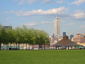
From most of the walkway, you can enjoy amazing views of the water and the New York City skyline. The path goes through several towns in New Jersey. These towns have a combined population of about 550,000 people.
Here are some of the towns you will pass through:
- Bayonne
- Jersey City: Here, the walkway runs through areas like Port Liberte and Liberty State Park. Another part goes from Exchange Place to Hoboken.
- Hoboken
- Weehawken
- West New York
- Guttenberg
- North Bergen
- Edgewater
- Fort Lee
History of the Walkway Project
The idea for a walkway along the New Jersey waterfront started in the late 1970s. In 1988, the New Jersey Department of Environmental Protection made rules for building along the coast. These rules say that anyone building within 100 feet (30 m) of the water must create a public space at least 30 feet (9 m) wide along the shore. Developers pay for this construction.
By the end of 2019, most of the walkway was complete. Only seven small "gaps" were left to build. These gaps are mainly from Liberty State Park in Jersey City to the George Washington Bridge. Some larger sections in industrial Bayonne are also still unbuilt.
Benefits and Challenges of the Walkway
The land where the walkway is built, or will be built, is owned by both private companies and the public. If private land is not being redeveloped, it doesn't have to have a walkway yet. However, it must still be open to the public. Sometimes, in private communities, access to the water is not always clear.
The land along the route is very varied. There are canals and coves that go far inland. This means the walkway sometimes has to go around them or cross them with bridges. Also, there are transportation and shipping areas along the path. Much of the land used to be for shipping or factories. These areas are now old or unused.
Most builders of homes and businesses see the walkway as a good thing. It adds value to their properties by offering access to the water. Some parts of the walkway are easy to reach by public transportation. You can use the Hudson-Bergen Light Rail, NY Waterway ferries, and New Jersey Transit buses. The walkway connects public parks in each town. It has become a very important place for people to enjoy outdoor activities.
Cool Places and Parks Along the Way
Here are some of the interesting places and parks you can find along the Hudson River Waterfront Walkway:
- Bergen Point
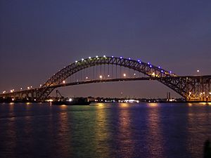
- Bayonne Bridge: One of the world's longest steel arch bridges.
- Kill van Kull Park
- Robbins Reef Light: A historic lighthouse.
- Bayonne Golf Course: Built on land that used to be polluted, now cleaned up.
- The Peninsula at Bayonne Harbor: This used to be a military shipping terminal.
- Tear of Grief: A gift from Russia to remember September 11, 2001.
- Cape Liberty Cruise Port: Where cruise ships depart.
- Port Jersey
- Waterfront Observation Tower and a bird sanctuary for special birds.
- Liberty National Golf Course
- Liberty State Park
- Black Tom: Site of a big explosion during World War I.
- Central Railroad of New Jersey Terminal: A historic train station.
- Liberty Science Center: A fun science museum.
- Paulus Hook
- Colgate Clock: Said to be one of the world's largest clocks.
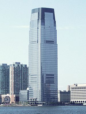
- Goldman Sachs Tower: The tallest building in New Jersey.
- Exchange Place: A busy downtown area in Jersey City.
- Katyń Memorial: A monument.
- Pavonia
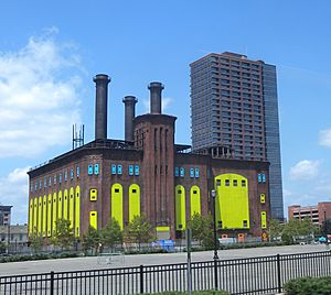
- Hudson and Manhattan Railroad Powerhouse: An old power station.
- Pavonia/Newport: Used to be a major train station.
- Holland Tunnel Ventilation Tower: Helps air flow in the tunnel.
- Hoboken
- Hoboken Terminal: A historic train station and major transportation hub.
- Pier A: A popular park on a pier.
- Stevens Institute of Technology: A famous university.
- Sybil's Cave: An old spring that inspired a famous writer.
- Elysian Park
- Weehawken
- Weehawken Cove: Where Henry Hudson's ship, the Half Moon, anchored in 1609.
- King's Bluff: Where the famous Burr-Hamilton duel took place in 1804.
- Lincoln Tunnel Ventilation Towers: Helps air flow in the tunnel.
- Weehawken Port Imperial: A ferry terminal.
- Guttenberg
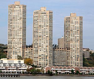
- Galaxy Towers: Three tall, unique buildings.
- Edgewater
- Edgewater Harbor
- Edgewater Cemetery: With graves from the 1800s and 1900s.
- Mitsuwa Marketplace: A large Japanese supermarket.
- Veterans Park: Site of a plaque remembering Vriessendael, the first European settlement in this area.
- Palisades Interstate Park
- Fort Lee Historic Park: A historic site from the Revolutionary War.
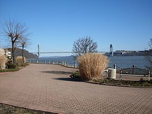
- George Washington Bridge: A famous bridge connecting New Jersey and New York.
Images for kids
 | DeHart Hubbard |
 | Wilma Rudolph |
 | Jesse Owens |
 | Jackie Joyner-Kersee |
 | Major Taylor |


