Exchange Place, Jersey City facts for kids
Quick facts for kids
Exchange Place
|
|
|---|---|
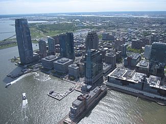
Aerial view (2010)
|
|
| Country | |
| State | |
| City | Jersey City |
| Population
(2010)
|
|
| • Total | 83,828 |
| • Summer (DST) | [[UTCUTC−05:00]] |
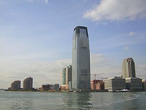
Exchange Place is a cool area in Downtown Jersey City, New Jersey, USA. People sometimes call it "Wall Street West" because many big financial companies have offices here.
The name comes from a square about 200 feet long. This square is at the end of Montgomery Street, right by the Hudson River. It was made by adding land to the shore at Paulus Hook. This spot has been a busy travel center for a very long time, even since colonial days.
Contents
Exploring Exchange Place
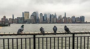
Exchange Place is home to many tall office and apartment buildings. Since the 1990s, it has become the main business area in Hudson County. It's a key business spot along the newly developed waterfront.
The Mack-Cali building here is special. It has several nesting spots for peregrine falcons. You can even watch these amazing birds on a special Jersey City Peregrine Cam!
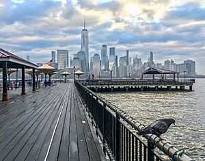
The Hudson River Waterfront Walkway goes through Exchange Place. On the other side is J. Owen Grundy Park, which stretches out into the Hudson River.
You can also find the Katyń Memorial here. This memorial was created by Polish-American artist Andrzej Pitynski. It honors those who died in the Katyń Forest massacre. It was the first memorial of its kind in America.
To the south, you'll find the Paulus Hook Ferry Terminal. This is where ferries leave from. Nearby are the two tallest buildings in New Jersey: the Goldman Sachs Tower and 99 Hudson.
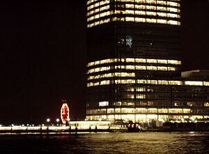
The famous Colgate Clock is also here. It's promoted by Colgate-Palmolive as the biggest clock in the world! This huge clock is 50 feet (about 15 meters) wide. Its minute hand alone weighs 2,200 pounds (about 1,000 kg). It was put up in 1924. The clock faces Battery Park in Lower Manhattan.
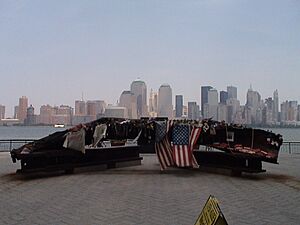
The riverfront path offers amazing views of Lower Manhattan. It ends at the Morris Canal Little Basin, which is part of Liberty State Park. To the north, there's a former warehouse that is now the Harborside Financial Center.
A Look Back in Time
Travel has always been important at Exchange Place. As early as 1764, a ferry started running from Paulus Hook to Manhattan. In 1812, the first steam ferry in New York Harbor began here. It was started by Robert Livingston and Robert Fulton.
This ferry dock was at the start of a major road to Newark. In 1838, the New Jersey Railroad opened its line from this ferry dock. The railroad later bought the ferry service. They built bigger and better train and ferry stations over the years. Passengers could easily switch between trains and ferries without going outside.
Local transportation, like street railways (trolleys), also used Exchange Place. In 1860, horsecars started connecting the ferry to different parts of Jersey City. An off-street terminal called "Exchange Place" was built in 1891. It was very close to the water and the railroad station.
In 1901, the land was given to the city. The Hudson and Manhattan Railroad opened its tunnels to New York in 1910. At first, their station was called "Pennsylvania Railroad Station." But by the 1920s, everyone knew the area and all the stations as Exchange Place.
For many years, Exchange Place was a busy hub for trolley lines from all over Hudson County. By 1949, buses had replaced the trolleys.
Ferry services also stopped in 1949. The Pennsylvania Railroad service ended in 1962. After that, the old terminal was taken down. This created a lot of open space along the waterfront. This land was then used for new buildings and developments. The name "Exchange Place" stuck because of the PATH train station (which used to be the Hudson and Manhattan station) and the bus routes.
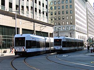
Since 2000, both trolley service (the Hudson Bergen Light Rail) and ferry service (by NY Waterway) have returned! Exchange Place is still a very important spot for travel today.
Getting Around Exchange Place
PATH Trains
The PATH train service from Exchange Place is super convenient.
- You can go east to the World Trade Center in New York City.
- You can go north to Hoboken Terminal.
- You can go west to Journal Square and Newark Penn Station.
Light Rail
The Hudson Bergen Light Rail has three stations in this area:
- Harborside Financial Center
- Essex Street
- Exchange Place
At Exchange Place, you can switch to the PATH train or a ferry.
Ferry Boats
Ferry service across the Hudson River started way back in 1764! It was known as the Jersey City Ferry. After almost 200 years, the regular ferry service stopped in the 1960s. But it came back in 1986!
Today, ferries are run by NY Waterway. There's even a free bus service during busy times in Paulus Hook. This bus connects the ferry to Grove Street Station for ferry passengers.
Here are some places you can go by ferry from Exchange Place:
| route | destination | notes |
|---|---|---|
| West Midtown Ferry Terminal Midtown Manhattan |
Pier 79 West 39th St Javits Convention Center |
You can transfer for free to "loop" buses in Manhattan. |
| Battery Park City Ferry Terminal at World Financial Center |
Hudson River Park at Vesey Street Battery Park City |
You can transfer to other ferry routes here (paid). |
| Wall Street | Pier 11 South Street south of South Street Seaport |
You can transfer to other ferry routes here (paid). |
| Belford | Raritan Bayshore Monmouth County |
This route goes through The Narrows and Upper Bay. |
Bus Services
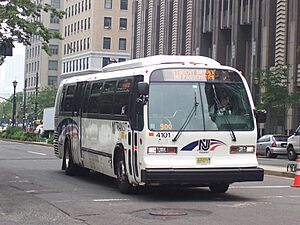
Many bus routes also start or end at Exchange Place. These buses can take you to different neighborhoods in Jersey City and other towns.
 | Jessica Watkins |
 | Robert Henry Lawrence Jr. |
 | Mae Jemison |
 | Sian Proctor |
 | Guion Bluford |


