North River (Hudson River) facts for kids
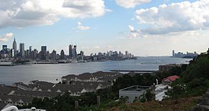
The North River is another name for the southern part of the Hudson River. This area is near New York City and northeastern New Jersey in the United States. Long ago, in the 1600s, the Dutch called the entire Hudson River the North River. But over time, people mostly stopped using this name for the whole river.
Today, the name "North River" is only used by some local sailors and on old maps. It also refers to things built on or under this part of the river. Examples include the North River piers, the North River Tunnels, and the North River Wastewater Treatment Plant.
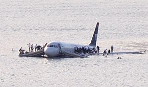
Over the years, "North River" has meant different things:
- The entire Hudson River.
- The part of the Hudson River (about 160 miles long) that has tides. This is the section below where it meets the Mohawk River.
- The part of the river between Manhattan and New Jersey.
- The section flowing between Lower Manhattan and Hudson County, New Jersey.
The history of this river is closely tied to the Port of New York and New Jersey. This port was once very busy with ships. However, in the mid-1900s, most shipping moved to Port Newark. This happened because of new tunnels and bridges, and new ways of packing goods in large containers.
The names for the lower part of the river have been used interchangeably for hundreds of years. In 1909, two tunnels were being built: one was called the North River Tunnels, and the other, the Hudson Tubes. That same year, a big celebration was held for Henry Hudson (the first European to explore the river) and Robert Fulton (who built the first paddle steamer in America, called the North River Steamboat). This led to debates about what the river should be called.
Today, much of the riverfront that was once used for shipping and trains has become public parks and walkways. In New Jersey, the Hudson River Waterfront Walkway stretches for about 18 miles. In Manhattan, the Hudson River Park runs from Battery Park to 59th Street.
Contents
Where Did the Name "North River" Come From?
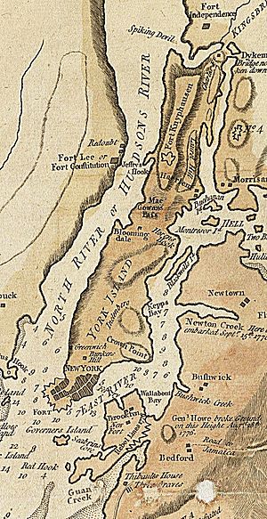
The name North River likely came from the Dutch. When they described the main rivers in their New Netherland colony, they called the Hudson the North River. They called the Connecticut River the Fresh River and the Delaware River the South River. Another idea is that the "North" River and "East" River were named for the directions they led once you entered Upper New York Bay.
In 1808, a government official named Albert Gallatin wrote a report about important transportation routes. He said the North River was the best way to travel to western and northern lands. This idea was later used for building canals like the Erie Canal.
Gallatin described the North River as a "narrow and long bay." He noted that its tides reached far inland, up to Albany and Troy, about 160 miles from New York. This was special because tides in other U.S. rivers didn't go nearly as far. He also mentioned that the Hudson and Mohawk rivers join to form the North River.
How "North River" Appears on Maps
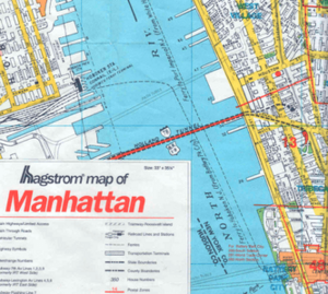
The National Oceanic and Atmospheric Administration (NOAA) now calls the lower river the "Hudson." The United States Geological Survey (USGS) lists "North River" as another name for the Hudson River, but it doesn't say it's only for a specific part.
Hagstrom Maps, a famous mapmaker in the New York metropolitan area, sometimes used older or unusual names on their maps. For example, a 1997 Hagstrom Map of Manhattan labeled the river between Hudson County, New Jersey, and Lower Manhattan as "North River." The name "Hudson River" was used further north, near Midtown Manhattan.
On a 2000 Hagstrom map, the entire river next to Manhattan was labeled "Hudson River (North River)." Further north, at Tappan Zee, it was just called "Hudson River."
North River Piers: Where Ships Once Docked
Piers along the Manhattan side of the Hudson River were once busy places for ships and cargo. In shipping news, they were called things like "Pier 14, North River." Now, people usually say "Hudson River piers" or just the pier number, like "Pier 54." Pier 40 is at Houston Street, and the piers to the north are numbered based on the closest street plus 40. So, North River Pier 86 is at West 46th Street.
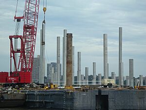
Many of the old piers in lower Manhattan were either no longer used or were torn down in the late 1900s. The piers that are left run from Pier A at the Battery to Pier 99 at 59th Street. Many of these piers and the waterfront are now part of the Hudson River Park. This park stretches from 59th Street to the Battery. The park project started in 1998 and has rebuilt many piers for new uses.
What Are the Piers Used For Now?
- Pier A is a historic landmark. Its building dates back to 1886 and was used by the city's dock department and fireboats. After being closed for renovations, it reopened as a restaurant in 2014.
- Piers 1 through 21 were mostly covered with dirt from the World Trade Center construction in 1973. This area became Battery Park City.
- Pier 25, at North Moore Street, has sports facilities and a mini-golf course.
- Pier 26 was rebuilt and a new park is planned to open there soon.
- Pier 34, at Canal Street, has a ventilation shaft for the Holland Tunnel.
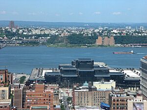
- Pier 40, at Houston Street, was once a ship terminal. Now it has sports fields, parking, and a trapeze school on its roof.
- The "Christopher Street Pier" usually means Pier 45. It's part of Hudson River Park and has a water-themed playground.
- Piers 52 and 53 are being turned into a public park. Pier 53 also has a FDNY fireboat station.
- Pier 54 was closed because it was unsafe. A new park is being built there and is expected to open in 2021.
- A new "floating park" at Pier 55 is also expected to open in 2021.
- Pier 57 was once a shipping terminal and later a bus depot. It is now being redeveloped for commercial use.
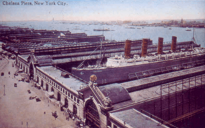
- Piers 59–62 are known as Chelsea Piers. They were once a passenger ship terminal for famous ships like the RMS Lusitania and were the destination for the RMS Titanic. Today, they are a large sports and entertainment complex.
- Pier 63 was a ferry terminal and later a railroad transfer point.
- Pier 66 is part of Hudson River Park. It's at 26th Street and is used for sailing and paddle sports.
- Pier 76 is where New York City's car tow pound for Manhattan is located.
- Pier 79 is the West Midtown Ferry Terminal for NY Waterway ferries. Pier 83 is used by Circle Line Sightseeing Cruises. Pier 79 also connects to a ventilation shaft for the Lincoln Tunnel.
- Pier 84 was once a concert venue. It now has a playground, a stop for New York Water Taxi, and bike rentals.
- Pier 86 at West 46th Street is home to the Intrepid Sea, Air & Space Museum. The main attraction is the USS Intrepid, an aircraft carrier.
- Piers 88–92 are part of the New York Passenger Ship Terminal, used by many modern cruise ships. Pier 94 is now a large exhibition hall.
- Piers 96 and 97 are part of Hudson River Park. Pier 97 is being converted into a park.
- Pier 98 is used by Con Edison for parking and fuel storage.
- Pier 99 houses a sanitation department facility.
- Pier I and parts of Riverside Park South were once a railroad yard. Pier I is the only remaining rail pier.
Railroads and Ferries: Connecting the Shores
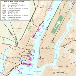
Before tunnels were built in the early 1900s, people and goods had to cross the river by boat to get to places east. This led to many train stations, rail yards, and ferry docks along the river. The west side of the river, from the mid-1800s to the mid-1900s, had huge facilities run by different railroad companies. Most of these are now gone.
Today, these areas are public parks, walkways, and marinas along the Hudson River Waterfront Walkway. New ferry docks have also been built for people to use.
- Communipaw Terminal was open from 1864 to 1967. It was owned by the Central Railroad of New Jersey. Its main ferry went to Pier 11 at Liberty Street. This historic building is now part of Liberty State Park and is a ferry terminal for Ellis Island and Liberty Island.
- Pennsylvania Railroad Station was first built in 1834. Its main ferry went to Cortlandt Street. Today, this area is known as Wall Street West because of its many financial buildings. Ferries now travel to Battery Park City Ferry Terminal, Pier 11 at Wall Street, and the West Midtown Ferry Terminal.
- Pavonia Terminal operated from 1861 to 1958. It was built by the Erie Railroad. Its main ferry went to Chambers Street and 23rd Street. The terminal and yards are now a residential and business area called Pavonia-Newport.
- Hoboken Terminal is the only one of the old Hudson River terminals still in use. It is now run by New Jersey Transit. The main ferries from Hoboken went to Barclay Street, Christopher Street, and 23rd Street. Today, New York Waterway ferries travel to the Battery Park City Ferry Terminal, Pier 11 at Wall Street, and the West Midtown Ferry Terminal.
- Weehawken Terminal operated from 1884 to 1959 for the New York Central Railroad. Its main ferry went to 42nd Street. The original tunnel under Bergen Hill is now used by the Hudson Bergen Light Rail. Ferries now run from Weehawken Port Imperial to the West Midtown Ferry Terminal, BPC Ferry Terminal, and Wall Street.
- The New York, Susquehanna and Western Railway terminal in Shadyside, Edgewater opened in 1894 for shipping coal. This led to many factories being built. Many workers from Manhattan took a ferry from 125th Street to get to their jobs. The factories in Edgewater have been torn down, and the land is now used for homes, shops, and parks. Ferries now travel from Edgewater Landing to the West Midtown Ferry Terminal.
Tunnels and Bridges: Crossing the River
| Crossing | Carries | Location |
|---|---|---|
| Downtown Hudson Tubes | PATH trains | Exchange Place and World Trade Center |
| Holland Tunnel | Jersey City and Lower Manhattan | |
| Uptown Hudson Tubes | PATH trains | Jersey City and Midtown Manhattan |
| North River Tunnels | Amtrak and New Jersey Transit trains | Weehawken and Midtown Manhattan |
| (These are part of the New York Tunnel Extension between North Bergen and Long Island City) | ||
| Lincoln Tunnel | NJ 495 and |
Weehawken and Midtown Manhattan |
| George Washington Bridge | Fort Lee and Upper Manhattan | |
The last major crossing built was the south tube of the Lincoln Tunnel in 1957. However, in 1962, another deck was added to the George Washington Bridge to carry more traffic. Since 2003, there have been ideas to add new train lines, like the Gateway Project.
 | Bayard Rustin |
 | Jeannette Carter |
 | Jeremiah A. Brown |


