Interstate 495 (New York) facts for kids
Quick facts for kids
Interstate 495 |
||||
|---|---|---|---|---|
| Long Island Expressway | ||||
|
Map of Long Island with I-495 highlighted in red, and service routes in pink
|
||||
| Route information | ||||
| Auxiliary route of I-95 | ||||
| Maintained by NYSDOT, NYCDOT, MTAB&T, and PANYNJ | ||||
| Length | 71.02 mi (114.30 km) | |||
| Existed | 1958–present | |||
| Restrictions | No hazardous goods allowed inside the Queens-Midtown Tunnel | |||
| Major junctions | ||||
| West end | Queens–Midtown Tunnel portal in Murray Hill | |||
|
||||
| East end | ||||
| Location | ||||
| Counties: | New York, Queens, Nassau, Suffolk | |||
| Highway system | ||||
| Auxiliary route of the Interstate Highway System Main • Auxiliary • Business Numbered highways in New York
|
||||
Interstate 495 (I-495) is a major highway in New York. It is usually called the Long Island Expressway (LIE). This road is managed by several groups, including the New York State Department of Transportation (NYSDOT) and the New York City Department of Transportation (NYCDOT).
The LIE is about 71 miles (114 km) long. It stretches across Long Island from Manhattan in the west to Riverhead in the east. It connects with other important highways like I-295, which leads to I-95.
While people call the whole road the Long Island Expressway, only the part in Nassau and Suffolk counties is officially named that. In Queens, the section from the Queens–Midtown Tunnel to Queens Boulevard is the Queens–Midtown Expressway. The part between Queens Boulevard and the Nassau County line is the Horace Harding Expressway. Smaller roads that run next to the expressway are called service roads.
Contents
Exploring the Route
Through New York City
The Long Island Expressway starts in Manhattan at the Queens–Midtown Tunnel. This tunnel goes under the East River to Queens. Once in Queens, the road becomes the Queens–Midtown Expressway.
About a mile into Queens, I-495 meets I-278, also known as the Brooklyn–Queens Expressway. The LIE then goes through Rego Park, where it connects with NY 25 (Queens Boulevard). Here, it changes its name to the Horace Harding Expressway.
The highway continues northeast through Corona and Flushing Meadows–Corona Park. In the park, it crosses the Grand Central Parkway and the Van Wyck Expressway (I-678). Because these connections are close, the highway uses special lanes called collector/distributor roads to help traffic flow smoothly.
As the expressway goes east, it passes by the "Queens Giant". This is the oldest and tallest tree in the New York metropolitan area. You can see it from the westbound lanes of the highway. Further east, the LIE connects to the Cross Island Parkway before leaving New York City and entering Nassau County. Here, it officially becomes the Long Island Expressway (LIE).
Even though the official name changes, most people and signs call the entire road "the Long Island Expressway" or "the LIE." The service roads in Queens have different names, like Borden Avenue and Horace Harding Expressway.
The Horace Harding Expressway is named after J. Horace Harding. He was a finance leader who helped build roads on Long Island. He strongly supported Robert Moses's plans for parkways. Harding pushed for a highway from Queens Boulevard to Nassau County to make it easier to reach his country club. After he passed away, the road was named in his honor.
Across Nassau and Suffolk Counties
When the LIE enters Nassau County, it gains a special lane called a High-Occupancy Vehicle Lane (HOV). This lane starts at exit 33 and goes into central Suffolk County. The HOV lane is for vehicles with two or more people, buses, motorcycles, and special "Clean Pass" cars during busy hours.
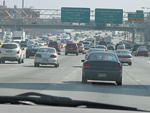
In Nassau County, the LIE crosses the Northern State Parkway and connects with the Seaford–Oyster Bay Expressway (NY 135). Traffic can often be heavy here.
In Suffolk County, the LIE continues with eight lanes, including the HOV lane, until exit 64 (NY 112). After this point, the HOV lane ends, and the highway becomes six lanes wide. The road also changes from asphalt to concrete, and there are no more streetlights. This shows that the road is now in a more rural area of Long Island.
East of NY 112, the expressway goes through more wooded areas towards Riverhead. The service roads end around exit 68 (William Floyd Parkway). Exit 70 (CR 111) in Manorville is the last full exit. After exit 71 (NY 24), the expressway gets narrower. At exit 73, all traffic is directed onto a ramp leading to eastbound CR 58. This is where the Long Island Expressway officially ends.
Building the LIE: A Look Back
Early Construction in Queens
The Long Island Expressway was built over many years. The first part was the Queens–Midtown Tunnel, which opened in 1940. The road connecting the tunnel to Queens Boulevard was called the "Midtown Highway."
In the 1950s, work began to extend the Midtown Highway eastward. This section became known as the "Queens–Midtown Expressway" and opened in 1955. It reached the junction of Queens Boulevard and Horace Harding Boulevard.
Horace Harding Expressway and Western Nassau
The LIE was built over existing roads like Horace Harding Boulevard. In 1951, plans were approved to widen Horace Harding Boulevard and build an expressway in the middle. In 1955, New York State Governor Thomas E. Dewey approved plans to extend the LIE another 64 miles (103 km) to Riverhead.
Building the Horace Harding Expressway faced delays due to weather and worker strikes. By 1959, it reached Parsons Boulevard in Queens. A section near Alley Pond Park opened in 1957, making travel easier.
In 1958, the first part of the Long Island Expressway outside New York City opened. This was a 5-mile (8 km) section from the Queens–Nassau line to Willis Avenue. The western part of the Long Island Expressway was named I-495 in October 1958. By 1959, the LIE was open from Bayside to Roslyn.
By 1960, over 120,000 vehicles used the Long Island Expressway daily. However, traffic jams were common where the highway was not yet finished. A section near the Clearview Expressway (I-295) opened in August 1960, completing the road between Manhattan and Roslyn.
East of Roslyn
After the Clearview interchange opened, the LIE was continuous from Manhattan to Roslyn. It was then extended to NY 106/107 in Jericho by 1960. By 1962, the LIE was officially designated as I-495.
More sections of I-495 in Suffolk County opened between 1962 and 1963. A 5-mile (8 km) extension to NY 110 in Melville opened in 1962, bringing the highway into Suffolk County. By 1969, most of the LIE in Suffolk County was completed.
The final 2 miles (3.2 km) of I-495, from exit 71 to CR 58, opened in June 1972. By then, over 150,000 vehicles used the highway every day. A minimum speed limit of 40 mph (64 km/h) was set for the Nassau and Suffolk county sections.
Improvements and Changes
Traffic and Lighting Upgrades
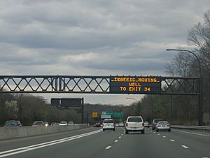
Traffic on I-495 grew quickly in the 1960s. By the late 1960s, some parts of the highway were too busy, with rush-hour speeds as low as 5 mph (8 km/h). Key problem areas were near the intersections with I-278, Grand Central Parkway, and I-678.
In 1966, plans were approved to rebuild the interchange between I-495 and I-278 in Queens. This project aimed to replace tight ramps and traffic lights with a modern, multi-level interchange.
For many years, I-495 in Nassau and Suffolk counties had no streetlights. This made driving at night very dark. After many requests, streetlights were finally installed starting in 1980. The goal was to light up the heavily used section between the Queens-Nassau border and NY 112 (exit 64). The last streetlights in Nassau County were put in place in 2002.
HOV Lanes and Interchange Updates
In 1991, the state approved adding a fourth lane in each direction to I-495 east of the Cross Island Parkway. These new lanes were designated as high-occupancy vehicle lanes (HOV). The first HOV section opened in Suffolk County in 1994. These lanes became very popular. They were fully completed on June 30, 2005, running from exit 32 in Queens to exit 64 in Suffolk County.
The HOV lanes in Queens were not built due to local opposition. Instead, these lanes were used as regular entrance and exit lanes.
Starting in 1998, I-495 was rebuilt between exit 15 and exit 22 in Queens. This project improved the main and service roads, bridges, and drainage systems. Another major renovation began in 2000 for the section near Alley Pond Park and the Cross Island Parkway. This project cost $112 million and included restoring parts of the park and building new ramps.
From 2004, the state looked into redesigning exit 22 with I-678 and the Grand Central Parkway in Flushing Meadows–Corona Park. The interchange with Grand Central Parkway was rebuilt from 2015 to 2018. This $55 million project replaced bridges, extended merge lanes, and improved lighting.
HOV Lane Rules
There is one HOV lane in each direction in the middle of the highway. They run from exit 32 (Little Neck Parkway) near the Queens-Nassau border to exit 64 (NY 112) in central Suffolk County.
- Hours: Monday to Friday, from 6:00 AM to 10:00 AM and from 3:00 PM to 8:00 PM.
- Who can use them:
* Buses * Motorcycles * "Clean Pass" vehicles (special low-emission cars) with no passenger limit * Passenger vehicles with at least two people inside.
- Who cannot use them: Trailers and commercial trucks are never allowed in HOV lanes.
Unbuilt Plans
Mid-Manhattan Expressway
Original plans for I-495 included extending it across Manhattan as the Mid-Manhattan Expressway. This road would have connected to the Lincoln Tunnel and continued into New Jersey. However, this project was canceled. The I-495 name was removed from the New Jersey part in 1970.
The idea for a Mid-Manhattan Expressway first came up in 1936. It was planned as a tunnel or an elevated highway near 34th Street. Later, Robert Moses suggested a six-lane elevated expressway along 30th Street. This road would have been ten stories high, allowing buildings to be constructed both above and below it. One unusual idea was to run the road through the sixth and seventh floors of the Empire State Building.
In 1965, Moses canceled his plans because the city government wanted a tunnel instead. The Mid-Manhattan Expressway project was officially canceled in 1970. In 1971, Governor Nelson Rockefeller removed state plans for this and other highway projects in New York City.
Subway Line Along the LIE
There were also plans for a New York City Subway line to run along the Long Island Expressway. This idea was first suggested in 1929. In 1968, a new plan proposed extending a subway line from the IND Queens Boulevard Line to Kissena Boulevard and then to Fresh Meadows and Bayside. The subway tracks would have been built under the expressway or its service roads.
This subway line was approved in 1968. However, many local residents were against it because it would mean widening I-495, which would require tearing down nearby homes. In 1973, the plan for the LIE subway line was canceled. This happened because New York state voters rejected a $3.5 billion bond measure that would have paid for several subway extensions.
Exit List
| County | Location | Mile | Roads intersected | Notes | ||
|---|---|---|---|---|---|---|
| Manhattan | Murray Hill | 0.00 | 0.00 | 34th Street / 35th Street / Second Avenue / 37th Street / Third Avenue / 38th Street / 41st Street – Downtown, Crosstown, Uptown | Westbound exits from the Queens–Midtown Tunnel | |
| Second Avenue / 34th Street / 40th Street | Eastbound entrances to the Queens–Midtown Tunnel | |||||
| East River | 1.01 | 1.63 | Queens–Midtown Tunnel (toll) | |||
| Queens | Hunters Point | 1.43 | 2.30 | 13 | Borden Avenue – Pulaski Bridge | Eastbound exit and entrance |
| 1.53 | 2.46 | 14 | Eastbound exit and westbound entrance; western terminus of NY 25A | |||
| Long Island City | 2.09 | 3.36 | 15 | Van Dam Street – Ed Koch Queensboro Bridge | Westbound exit and entrance | |
| 2.34 | 3.77 | 16 | Hunters Point Avenue / Greenpoint Avenue – Ed Koch Queensboro Bridge | Westbound exit and eastbound entrance | ||
| 2.61 | 4.20 | 17W | Exits 35A-B on I-278; access via service roads | |||
| 17E | Westbound exit is via exit 17W and 48th Street | |||||
| Maspeth | 3.47 | 5.58 | 18 | Maurice Avenue | Eastbound exit is part of exit 17 | |
| Elmhurst | 4.30 | 6.92 | – | 69th Street / Grand Avenue | Westbound exit and eastbound entrance; part of exit 19 | |
| 5.27 | 8.48 | 19 | No eastbound entrance from Woodhaven Boulevard | |||
| 5.58 | 8.98 | 20 | Junction Boulevard | Westbound exit and eastbound entrance | ||
| Corona | 6.91 | 11.12 | 21 | 108th Street | Westbound exit is part of exit 22A | |
| 7.25 | 11.67 | 22A | Signed eastbound as exits 22A (east) and 22B (west); exits 10E-W on Grand Central Parkway | |||
| 7.35 | 11.83 | 22B | Signed eastbound as exits 22C (I-678 south), 22D (I-678 north), 22E (C.P. Blvd); exits 12A-B on I-678 | |||
| Flushing | 8.45 | 13.60 | 23 | Main Street | ||
| 9.10 | 14.65 | 24 | Kissena Boulevard | Eastbound access to 164th Street | ||
| Fresh Meadows | 10.02 | 16.13 | 25 | Utopia Parkway / 164th Street / 188th Street – St. John's University | Signed for 188th Street eastbound and 164th Street westbound | |
| 11.04 | 17.77 | 26 | Francis Lewis Boulevard | Eastbound exit and westbound entrance | ||
| Bayside | 11.43 | 18.39 | 27 | Signed as exits 27S (south) and 27N (north); exits 4E-W on I-295 | ||
| 11.93 | 19.20 | 28 | Oceania Street / Francis Lewis Boulevard | Westbound exit and eastbound entrance; also serves 188th Street | ||
| 12.31 | 19.81 | 29 | Springfield Boulevard | |||
| 12.91 | 20.78 | 30 | East Hampton Boulevard / Douglaston Parkway | Eastbound exit only | ||
| Oakland Gardens | 13.27 | 21.36 | 31S | Exits 30E-W on Cross Island Parkway | ||
| 31N | Westbound exit and eastbound entrance | |||||
| Little Neck | 14.25 | 22.93 | 32 | Little Neck Parkway / Douglaston Parkway | No eastbound signage for Douglaston Parkway | |
| Nassau | Lake Success | 15.43 | Lakeville Road (CR 11) / Community Drive (CR 11A) – Great Neck | |||
| none | HOV 2+ Lane east | Western terminus of HOV lane | ||||
| North Hills | 16.37 | New Hyde Park Road (CR 5B) | ||||
| 17.57 | Shelter Rock Road (CR 8) – Manhasset | Westbound exit is via exit 36 | ||||
| 18.43 | Searingtown Road (CR 101) – Port Washington | |||||
| Roslyn Heights | 18.95 | Willis Avenue – Mineola, Roslyn | ||||
| East Hills | 20.14 | Eastbound exit and westbound entrance; exit 29A on Northern Parkway | ||||
| 20.31 | Glen Cove Road (CR 1) – Hempstead, Glen Cove | |||||
| Jericho | 24.07 | Signed as exits 40W (west) and 40E (east) | ||||
| 25.23 | Signed as exits 41S (south) and 41N (north) | |||||
| 26.05 | Same-directional exit ramps only; entrance ramps located west of exit 46 | |||||
| Syosset | Robbins Lane | Westbound exit and eastbound entrance | ||||
| 27.07 | South Oyster Bay Road (CR 9) – Bethpage, Syosset | |||||
| 27.83 | Signed as exits 44S (south) and 44N (north) eastbound; exits 13E-W on NY 135 | |||||
| Woodbury | 28.17 | Manetto Hill Road – Plainview, Woodbury | Eastbound exit and westbound entrance | |||
| Plainview | 28.95 | Sunnyside Boulevard – Plainview | ||||
| 29.65 | ||||||
| 29.68 | Round Swamp Road (CR 110) – Old Bethpage, Farmingdale | |||||
| Suffolk | Melville | 31.82 | Signed as exits 49S (south) and 49N (north) | |||
| 34.25 | Bagatelle Road – Dix Hills, Wyandanch | |||||
| Dix Hills | 35.87 | |||||
| 37.00 | ||||||
| 38.56 | Westbound exit is part of exit 53 | |||||
| 39.28 | Exits S1E-W on Sagtikos Parkway | |||||
| Brentwood | none | Now an unnumbered interchange via exit 53 | ||||
| 41.72 | ||||||
| Hauppauge | 42.66 | |||||
| Islandia | 44.30 | |||||
| 45.64 | Old Nichols Road – Central Islip, Nesconset | |||||
| Ronkonkoma | 47.50 | |||||
| Lake Ronkonkoma | 48.19 | CR 29 (Ronkonkoma Avenue) – Lake Ronkonkoma, Sayville | ||||
| Holbrook | 49.62 | |||||
| Holtsville | 51.24 | |||||
| 53.04 | ||||||
| Medford | 54.29 | |||||
| none | HOV 2+ Lane west | Eastern terminus of HOV lane | ||||
| 55.44 | ||||||
| Yaphank | 57.41 | |||||
| 58.55 | ||||||
| 60.17 | Signed as exits 68S (south) and 68N (north) westbound | |||||
| Manorville | 64.05 | Wading River Road (CR 25) – Wading River, Center Moriches | ||||
| 65.25 | Northern terminus of CR 111 | |||||
| 69.27 | Eastbound exit and westbound entrance; northbound terminus of NY 24 | |||||
| Calverton | 70.75 | Eastbound exit and westbound entrance | ||||
| 71.02 | ||||||
| 1.000 mi = 1.609 km; 1.000 km = 0.621 mi | ||||||
 | James Van Der Zee |
 | Alma Thomas |
 | Ellis Wilson |
 | Margaret Taylor-Burroughs |


