East Hills, New York facts for kids
Quick facts for kids
East Hills, New York
|
||
|---|---|---|
| Incorporated Village of East Hills | ||
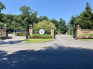
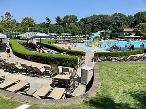
The entrance to the Park at East Hills in 2021
|
||
|
||
| Motto(s):
"Like No Other!"
|
||
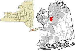
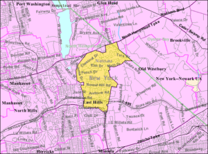
Location in Nassau County and the state of New York
|
||
| Country | ||
| State | ||
| County | Nassau | |
| Towns | North Hempstead Oyster Bay |
|
| Incorporated | June 24, 1931 | |
| Named for | Its hilly location immediately east of Roslyn | |
| Area | ||
| • Total | 2.28 sq mi (5.90 km2) | |
| • Land | 2.28 sq mi (5.90 km2) | |
| • Water | 0.00 sq mi (0.00 km2) | |
| Elevation | 187 ft (57 m) | |
| Population
(2020)
|
||
| • Total | 7,284 | |
| • Density | 3,196.14/sq mi (1,233.91/km2) | |
| Demonym(s) | East Hillsian Roslynian Roslynite |
|
| Time zone | UTC−5 (Eastern (EST)) | |
| • Summer (DST) | UTC−4 (EDT) | |
| ZIP Codes |
11548, 11576, 11577
|
|
| Area codes | 516, 363 | |
| FIPS code | 36-22260 | |
| GNIS feature ID | 0949124 | |
East Hills is a small village in Nassau County, located on the North Shore of Long Island, in New York. It's considered part of the larger Roslyn area. In 2020, about 7,284 people lived here.
Most of East Hills is in the Town of North Hempstead. A small part of its northeastern side is in the Town of Oyster Bay.
Contents
Discovering East Hills: A Look at Its Past
How East Hills Began
East Hills officially became a village on June 24, 1931. Its first election was held shortly after, on July 8 of the same year. But the area's history goes back much further. In 1643, two men, Robert Fordham and John Carman, sailed from Stamford, Connecticut. They bought land from local Native American tribes. This land later became the towns of Hempstead and North Hempstead.
Settlers arrived the next year. They named the area Hempstead, after their home city in England. For about 100 years, the area was not widely known.
Important Places and Stories
While George Washington didn't sleep in East Hills, his diary mentions visiting nearby Oyster Bay. He even had breakfast at what is now the George Washington Manor in Roslyn. He also checked out a paper mill in Roslyn park. It's easy to imagine him near what would become East Hills.
One of the oldest man-made features in East Hills is Harbor Hill Road. Records from 1661 already mention "a path alongside Harboure Hill."
For many years, East Hills was home to a few very wealthy families. The area now called Fairfield Park was once a polo field. The Country Estates neighborhood was part of the large Harbor Hill estate. This estate belonged to the Clarence Mackay family for 30 years, starting in 1898. Important guests visited the Mackay estate. The Prince of Wales (who later became King Edward VIII) was entertained there in 1924. Also, Charles A. Lindberg rested at the estate in 1927. This was after his famous solo flight across the Atlantic Ocean.
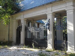
Three buildings from the Harbor Hill estate are still standing. They were added to the National Register of Historic Places in 1991. These are the Mackay Estate Dairyman's Cottage, the Mackay Estate Gate Lodge, and the Mackay Estate Water Tower.
How the Village Government Started
On June 24, 1931, 269 people who lived in the future village met. They gathered at the home of Robert H. Willets. His family had lived in the area for eight generations. The name "East Hills" was suggested by H. Stewart McKnight. He was the Nassau County Attorney at the time.
Two weeks after the village was officially formed, an election was held. It took place in barns on the Mackay estate. Mr. Willets was elected as the first Mayor. John Mackay, Ellen A. Hennessy, Stephen Willets, and Catherine Hechler became Trustees. Charles Hechler, Catherine's husband, was named Village Clerk.
Robert Willets served as Mayor until 1945. Other mayors followed, including William W. Murray, Jr., Raymond E. Dolar, and William R. Fleischer.
East Hills: Then and Now
When East Hills became a village in 1931, most of its land (98%) was farms and large estates. Only 2% had homes, with about 65 houses. Today, this is completely different. Now, 98% of the land has homes. Less than 2% is undeveloped. There are now about 2,300 homes in East Hills. The population is close to 7,200 people.
This shows how East Hills has changed. It went from Native American lands to large estates. Now, it offers a pleasant living for many families.
Geography and Location
East Hills is located at 40°47′39″N 73°37′37″W / 40.79417°N 73.62694°W.
The United States Census Bureau says the village covers about 2.3 square miles (5.9 km2). All of this area is land.
Some of the highest points in Nassau County are in East Hills. These are found on Harbor Hill, which was once part of Clarence Mackay's estate.
Population Details
| Historical population | |||
|---|---|---|---|
| Census | Pop. | %± | |
| 1940 | 343 | — | |
| 1950 | 2,547 | 642.6% | |
| 1960 | 7,184 | 182.1% | |
| 1970 | 8,624 | 20.0% | |
| 1980 | 7,160 | −17.0% | |
| 1990 | 6,746 | −5.8% | |
| 2000 | 6,842 | 1.4% | |
| 2010 | 6,955 | 1.7% | |
| 2020 | 7,284 | 4.7% | |
| U.S. Decennial Census | |||
Population in 2010
In 2010, there were 6,955 people living in East Hills. Most residents (89.85%) were White. About 7.40% were Asian, and 0.95% were African American. A small number were from other races or mixed races. About 2.24% of the population was Hispanic or Latino.
Population in 2000
In 2000, East Hills had 6,842 people. There were 2,245 households, and 2,029 families. The village had about 2,991.5 people per square mile (1,153.6/km2).
Many households (46.2%) had children under 18 living there. Most (84.4%) were married couples. The average household had 3.04 people. The average family had 3.2 people.
The population was spread out by age. About 29.9% were under 18. About 14.4% were 65 or older. The average age was 41 years.
The median income for a household was $149,726. For a family, it was $159,316. The income per person was $59,297. A small percentage of families (1.5%) and people (1.6%) lived below the poverty line.
Fun and Recreation
East Hills has several places for fun and relaxation:
- Arlene Park
- The Park at East Hills
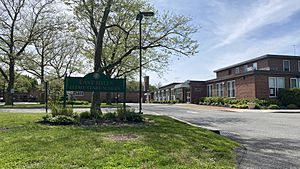
Also, there are recreation areas at local schools. These include East Hills and Harbor Hill elementary schools. Roslyn Middle School and St. Mary's Parochial School also have areas. Some parts of Roslyn High School's recreation areas are in the village too.
Learning and Libraries
School Districts
Most of East Hills is part of the Roslyn Union Free School District. This means most children go to schools in this district. However, some parts of the village are served by other districts. The southeastern areas are in the East Williston Union Free School District. The small part in the Town of Oyster Bay is in the Jericho Union Free School District. So, where a child lives in East Hills decides which public school district they attend.
Library Districts
Similarly, most of East Hills is served by Roslyn's library district. But some southeastern parts are in the Shelter Rock Library District and the Westbury Library District. The small section in the Town of Oyster Bay is served by the Jericho Library District.
Getting Around and Services
Transportation
Roads
Major Highways
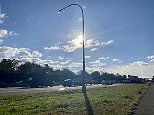
 Long Island Expressway (Interstate 495) – This major highway runs through the southern part of the village. It stretches between Glen Cove Road and Roslyn Road.
State Roads
Two state roads go through East Hills:
 Northern Boulevard (NY 25A) – This road forms part of the village's northern border. It separates East Hills from Greenvale and Old Brookville.
 Northern State Parkway – This parkway forms the southern edge of the village. It borders Roslyn Heights.
Other Important Roads
Other main roads in East Hills include Chestnut Drive, Glen Cove Road, Harbor Hill Road, Locust Lane, Old Powerhouse Road, Old Westbury Road, Red Ground Road, Roslyn Road, and Round Hill Road.
Train Travel
East Hills does not have its own train station. However, the Oyster Bay Branch of the Long Island Rail Road runs along part of the Roslyn–East Hills border. The closest station is the Roslyn station. It's located in the nearby area of Roslyn Heights.
Bus Services
East Hills is served by the n20H and n27 bus routes. These buses are run by Nassau Inter-County Express (NICE). The n20H bus travels along Northern Boulevard, which is the village's northern border. The n27 bus goes through the middle of the village on Harbor Hill Road and also along Glen Cove Road.
Utility Services
Natural Gas
National Grid provides natural gas to homes and businesses in East Hills that are connected to gas lines.
Electricity
PSEG Long Island supplies electricity to all homes and businesses in the Village of East Hills.
Water
The Village of East Hills gets its water from four different water districts:
- The Roslyn Water District – This serves most of East Hills in the Town of North Hempstead.
- The Jericho Water District – This serves the parts of East Hills in the Town of Oyster Bay.
- The Village of Old Westbury Water System – This serves a specific maintenance yard on Glen Cove Road.
Some parts of the Northern State Parkway in the village also get water from the Albertson Water District.
Historic Landmarks
Even though the main mansion of the Mackay family was taken down, several buildings from their old Harbor Hill estate still stand. Three of these were added to the National Register of Historic Places in 1991:
- Mackay Estate Dairyman's Cottage
- Mackay Estate Gate Lodge
- Mackay Estate Water Tower
Another important landmark in East Hills is the Townsend Cemetery. It is located near the northeastern part of the village.
Famous People from East Hills
- Henry D. Cooke – A United States Navy officer.
- Michael Crichton – The author of Jurassic Park and creator of the TV show ER. He grew up on Barberry Lane.
- Hal David – A lyricist (someone who writes song lyrics). He lived in the Mackay Estate Dairyman's Cottage.
- James V. Forrestal – The first United States Secretary of Defense. He served from 1947 to 1949. Forrestal lived in his East Hills home, "Old Brick," until he passed away in 1949.
- Wendy Liebman – A comedian.
- Clarence H. Mackay – A very successful financier (someone who deals with money). He lived at Harbor Hill.
- Katherine Duer Mackay – A suffragist (someone who fought for women's right to vote) and socialite. She was Clarence's former wife.
- Abraham H. Salkowitz – An architect. He lived in a home he designed himself.
- Elliott Mendelson – A mathematician and author.
See also
 In Spanish: East Hills (Nueva York) para niños
 | Janet Taylor Pickett |
 | Synthia Saint James |
 | Howardena Pindell |
 | Faith Ringgold |


