Northern State Parkway facts for kids
Quick facts for kids
Northern State Parkway |
|
|---|---|
| Purple Heart Way | |
|
Northern State Parkway highlighted in red
|
|
| Route information | |
| Maintained by NYSDOT | |
| Length | 28.88 mi (46.48 km) |
| Existed | July 15, 1933–present |
| History | First section opened July 15, 1933 Full length opened June 9, 1965 |
| Restrictions | No commercial vehicles |
| Major junctions | |
| West end | |
| East end | |
| Location | |
| Counties: | Nassau, Suffolk |
| Highway system | |
| Numbered highways in New York Interstate • U.S. • N.Y. (former) • Reference • County |
|
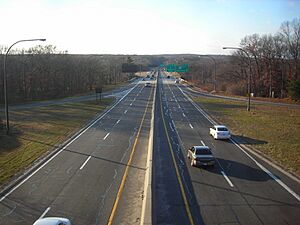
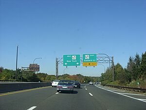
The Northern State Parkway is a special road on Long Island, New York. It's about 28.88 miles (46.48 km) long. This road is called a "parkway" because it's designed for cars, not big trucks. It's also a "controlled-access highway," meaning you can only get on and off at specific exits.
The parkway starts near the border of Queens and Nassau County. It then stretches eastward across Long Island, ending in Hauppauge, in Suffolk County. As its name suggests, it serves the northern part of Long Island. Since 2011, it has also been known as Purple Heart Way, honoring those who have been wounded in military service.
The Northern State Parkway was built in different stages, starting in the 1930s and finishing in 1965. It was a big part of master planner Robert Moses's plan to build many roads on Long Island. It was designed to be like a "sister road" to the Southern State Parkway. Over the years, parts of the parkway have been updated and widened to handle more cars.
Contents
Driving on the Northern State Parkway
Like other parkways in New York, large commercial trucks are not allowed on the Northern State Parkway. This is because many of the bridges over the parkway are too low for big trucks to pass safely. The Long Island Expressway was built later to handle truck traffic. In some areas of Nassau County, the Long Island Expressway runs right next to the Northern State Parkway.
From Lake Success to Woodbury
The Northern State Parkway begins at the border of Queens and Nassau County. It starts as a six-lane road, with three lanes going east and three going west. As you drive east, you'll pass by the Long Island Jewish Medical Center.
Further east, the parkway has exits for local roads like Lakeville Road and New Hyde Park Road. It stays close to the Long Island Expressway (I-495) in this area. You'll drive through towns like North Hills and Searingtown.
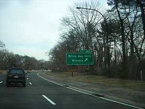
The parkway continues east through Albertson, with an exit for Willis Avenue. It then enters Old Westbury, where you might see some baseball fields. As you get closer to Carle Place, you'll find an exit for NY 25.
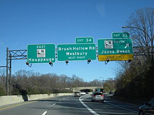
In Westbury, there's a major interchange with the Meadowbrook State Parkway. After this, the Northern State Parkway continues northeast, passing under Carle Road and having an exit for Post Road. It then reaches another important junction, the northern end of the Wantagh State Parkway. After this, the parkway narrows from six lanes to four lanes.
The parkway then goes through Jericho, with an exit for NY 106 and NY 107. It continues to run parallel to the Long Island Expressway for a bit. Finally, it reaches an exit for South Oyster Bay Road before entering Woodbury.
From Woodbury to Commack
In Woodbury, the Northern State Parkway continues east. It has an interchange with NY 135, also known as the Seaford–Oyster Bay Expressway. After this, you'll find exits for Manetto Hill Road and Sunnyside Boulevard.
The parkway then enters Trail View State Park, where it becomes a four-lane road surrounded by thick woods. It crosses into Suffolk County and has an exit for Round Swamp Road in Melville.
Further east, the parkway goes through West Hills County Park and has an exit for NY 110. This exit was rebuilt in 2011 to improve traffic flow. The parkway then continues northeast through Huntington, with an exit for Wolf Hill Road.
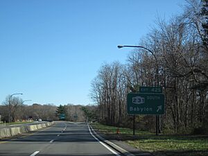
Next, you'll reach an interchange with NY 231 (Deer Park Road). This is the northern end of NY 231. The Northern State Parkway then bends northeast again, passing through the Vanderbilt area of Huntington.
In Commack, there's an exit for Commack Road. Immediately after this, you'll see a large interchange where the Northern State Parkway connects with the Sagtikos State Parkway and the Sunken Meadow State Parkway. These parkways share the same road for a short distance.
After these major junctions, the Northern State Parkway continues as a divided four-lane road. It has an exit for New Highway. Finally, the parkway ends at a large interchange with New York State Route 347 and New York State Route 454 (Veterans Memorial Highway) in Hauppauge. The eastbound lanes of the parkway merge directly into NY 347/NY 454 east.
How the Parkway Was Built
Planning the Road
The idea for the Long Island parkway system, including the Northern State Parkway, came from Robert Moses in 1925. He was the chairman of the Long Island State Park Commission. The plan was to build a beautiful road through areas like Wheatley Hills, which often had a lot of traffic during holidays.
However, some wealthy residents in Wheatley Hills didn't want the parkway to go through their neighborhood. They worried it would lower their property values. They suggested building a "Middle Parkway" instead, which would go through less developed land. But the state decided that the middle route would be too expensive and difficult to build.
Despite the disagreements, the State of New York approved the plan to get land for parks and parkways more easily. Governor Alfred E. Smith supported the idea, saying that the roads coming out of Queens couldn't handle all the traffic from New York City.
Political Debates
The debates over the parkway's route continued for several years. In 1928, Governor Smith, who was running for president, criticized some Republican leaders for blocking money needed to survey the Northern State Parkway. He argued that the state would lose valuable land options if the money wasn't approved.
The politicians he criticized, Senator Charles Hewitt and Assemblyman Eberly Hutchinson, said Smith was just trying to distract from his presidential campaign. They refused to approve the funds until the Southern State Parkway was finished.
Robert Moses kept pushing for the parkway system, explaining how it would help Long Island residents. By 1928, most of the land for the Northern State Parkway was acquired, except for a few spots in Westbury and Jericho.
In 1929, the newly elected governor, Franklin Delano Roosevelt, also supported the Long Island State Park Commission over the Wheatley Hills residents. He called their arguments "misleading propaganda." He pointed out that it was amazing how much land had been acquired despite the strong opposition.
Finding a Solution
In May 1929, a group called the Nassau County Citizens Committee (NCCC) was formed to fight the parkway's route. They claimed the route was "uneconomic" and "destructive." They also said that the Park Commission was exaggerating how much land they had acquired.
Eventually, in December 1929, Robert Moses and the opposing groups reached an agreement. Governor Smith, August Heckscher, and Henry Winthrop helped settle the dispute. The Northern State Parkway's route was moved slightly south to satisfy the Wheatley Hills residents. The original plan was for the parkway to be 160 feet (49 m) wide, but the deal widened it to 250 feet (76 m). This agreement finally ended the four-year battle over the parkway's route.
Building the First Sections
Starting Construction
In March 1931, Robert Moses announced that construction of the Northern State Parkway would begin in Nassau County. The first part would go from the New York City line (where it would connect to the Grand Central Parkway) east to Willis Avenue in Roslyn Heights. This first section involved building five bridges and cost about $350,000.
In July 1931, Governor Roosevelt laid a cornerstone to mark the spot where the Northern State and Grand Central parkways would meet. He called it a big improvement for traffic. The Park Commission asked for over $5.5 million to complete the projects in 1932.
However, in February 1932, the state legislature cut the budget for parkway construction. Moses then applied for federal grants to help pay for the Northern State and Grand Central parkways. In July 1932, the federal government approved $1.5 million to pave these roads.
On July 15, 1933, the first section of the Northern State Parkway, from the Queens line to Willis Avenue, officially opened to traffic. It was 44 feet (13 m) wide and had twenty access points. Governor Herbert Lehman opened the new parkways, saying it was the end of isolation for Long Island.
Extending to Wantagh State Parkway
Soon after the first section opened, Moses announced plans to extend the Northern State Parkway further east to Jericho Turnpike in Old Westbury. This new 3-mile (4.8 km) section was built quickly and opened in August 1934. It cost $748,000 and helped reduce traffic on Jericho Turnpike. New interchanges and bridges were built along this part of the road.
In August 1936, Moses announced another extension of the Northern State Parkway, along with a new north-south parkway to connect the Northern and Southern State parkways. This new section would extend the Northern State to the Wantagh State Parkway. The goal was to make it easier for drivers to reach Jones Beach State Park from the 1939 New York World's Fair.
On December 17, 1938, this new extension of the Northern State Parkway opened. It cost $4.4 million and was finished three months ahead of schedule. This new section connected towns like Carle Place, Westbury, and Hicksville to New York City via the parkway system.
Reaching the Sagtikos State Parkway
After the parkway reached Westbury, plans shifted to extending it into Suffolk County. In April 1941, Governor Lehman approved $30 million to be used for parkway construction on Long Island and in Westchester. This money would help extend the Northern State Parkway to NY 110.
Construction on this extension didn't start until after World War II. In April 1946, another 4-mile (6.4 km) extension from NY 110 to Deer Park Avenue was approved, bringing the total cost to $6.225 million.
In April 1949, the first part of this extension opened, from Union Avenue to Plainview Road in Woodbury. Unlike earlier openings, there was no public ceremony. In December 1949, another section opened, extending the parkway from Plainview Road to NY 110, bringing it into Suffolk County.
By May 1950, the extension to Deer Park Avenue (NY 231) was open. Moses then announced that the next section, connecting to the Sagtikos State Parkway, would begin construction soon.
On September 29, 1952, the Northern State Parkway was completed from Deer Park to Commack, opening alongside the new Sagtikos State Parkway. Again, there was no public ceremony for this opening.
Changes in the 1950s and 1960s
In the 1950s, the Northern State Parkway underwent improvements. A new divider was installed in the middle of the road in 1951. By 1953, the parkway was widened to make the lanes 12 feet (3.7 m) wide, and the original concrete surface was paved over with asphalt. New shoulders were also added for broken-down vehicles. These changes were made because the parkway was being used by nearly 60,000 cars daily.
In December 1953, construction began on an extension of the Meadowbrook State Parkway north to the Northern State Parkway. This new section, costing $10 million, opened on October 13, 1956. It helped ease traffic on other north-south roads in Nassau County.
Another parkway, the Sunken Meadow State Parkway, was also being built in the early 1950s. This parkway, which connects to the Northern State, opened its first section in November 1954. The full parkway opened on April 1, 1957.
On June 9, 1965, the Northern State Parkway was extended to its current eastern end at Veterans Memorial Highway in Hauppauge. This project cost $4 million. Later that year, plans were announced to widen the western part of the Northern State Parkway from four lanes to six lanes, from the Queens-Nassau line to Old Westbury. This widening project began in 1967 and was completed in mid-1969.
Westbury Interchange Updates
In 1989, during a project to rebuild the interchange in Westbury, a lawsuit was filed. The Village of Westbury sued the New York State Department of Transportation (NYSDOT), saying that the department didn't follow environmental rules. They claimed that the environmental report for the project didn't consider the effects of a future widening project on the Northern State Parkway.
Construction had started in May 1988 and was supposed to finish in October 1991. The lawsuit temporarily stopped the work. A court ruled that NYSDOT needed to provide a new environmental report. Eventually, the lawsuit was settled, and construction restarted in February 1990, finishing in 1991.
Former Service Stations
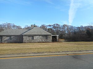
Robert Moses also had service stations built along the Northern State Parkway. One was located in Carle Place and closed in 1986. Another was in Commack, which opened in the early 1950s and closed in 1985. In 1989, there was a proposal to save the Commack station, which was in danger of being torn down, and turn it into a landmark or a welcome center.
Recent Changes (Since 1992)
The interchange with New York State Route 110 was rebuilt starting in 2011. The old cloverleaf exit was replaced with a single exit that has traffic lights on NY 110. The bridge over NY 110 was also replaced, and a third lane was added in each direction on NY 110 to help with traffic. This project was completed in late 2013.
In 2011, the Northern State Parkway was officially named Purple Heart Way to honor military veterans.
Future Ideas for the Parkway
Possible Extensions
Even though the Northern State Parkway ends in Hauppauge, there were ideas in 1963 to extend it further east. This extension would have gone through Smithtown to Caleb Smith State Park and connected with NY 25. It would have also included new interchanges with Veterans Memorial Highway and NY 111.
The plan also suggested extending the parkway south, crossing the Long Island Motor Parkway and connecting with the Long Island Expressway and the Heckscher State Parkway. However, these plans were changed in the mid-1960s. A new proposal suggested the parkway would end at NY 25 in the Village of the Branch. Later, the New York State Department of Transportation studied the idea but decided it wasn't practical because of too much development in Suffolk County and the high cost of buying land.
Spur to Caumsett State Park
In 1961, there was a plan to build a new parkway connecting the Northern State Parkway to Caumsett State Park on the North Shore of Long Island. This new road would have been an extension of the Bethpage State Parkway. It was planned as a four-lane scenic road that would go through Cold Spring Harbor and Lloyd Harbor.
To build this, the Bethpage Parkway would have been extended north from Plainview to the Northern State Parkway, with new interchanges along the way. However, this extension of the Bethpage Parkway was never built. The idea was brought up again in 1990 as part of a plan to expand road capacity in Nassau County.
Exit list
Exit numbers continue sequentially from those of the Grand Central Parkway.
| County | Location | Mile | Roads intersected | Notes | |
|---|---|---|---|---|---|
| Nassau | Lake Success | 0.00 | Continues into Queens as the Grand Central Parkway | ||
| 0.54 | Lakeville Road – New Hyde Park, Great Neck | Signed as exits 25S (south) and 25N (north) westbound | |||
| 1.35 | New Hyde Park Road – New Hyde Park, North Hills | Signed as exits 26S (south) and 26N (north) | |||
| Searingtown | 2.53 | Shelter Rock Road – Searingtown, Manhasset | Signed as exits 27S (south) and 27N (north) eastbound | ||
| 3.85 | Willis Avenue – Roslyn, Mineola | Signed as exits 28S (south) and 28N (north) eastbound | |||
| Roslyn Heights | 4.40 | Roslyn Road – East Hills, East Williston | |||
| Old Westbury | 5.13 | Westbound exit and eastbound entrance; exit 38 on I-495 | |||
| 5.60 | I.U. Willets Road – Albertson, Old Westbury | Eastbound exit and entrance | |||
| 6.20 | Glen Cove Road – Glen Cove, Hempstead | Westbound exit only | |||
| Carle Place | 6.60 | No westbound exit | |||
| 6.80 | Access to NY 25 via Glen Cove Road; no eastbound access to NY 25 | ||||
| Westbury | 8.65 | Post Avenue – Westbury, Old Westbury | |||
| 9.77 | Northern end of Wantagh Parkway | ||||
| 10.10 | Brush Hollow Road – Westbury | ||||
| Jericho | 11.91 | Signed as exits 35S (south) and 35N (north) | |||
| Plainview | 13.65 | South Oyster Bay Road – Bethpage, Syosset | Signed as exits 36S (south) and 36N (north) | ||
| Woodbury | 14.53 | No westbound exit; signed as exits 36A (south) and 36B (north); exits 12E-W on NY 135 | |||
| 14.92 | Manetto Hill Road – Woodbury, Plainview | ||||
| 15.20 | Same-directional access only; no entrance ramps | ||||
| 15.60 | Sunnyside Boulevard – Plainview | ||||
| Suffolk | Melville | 17.20 | Round Swamp Road – Farmingdale | ||
| 18.38 | |||||
| Dix Hills | 21.04 | Wolf Hill Road – Dix Hills, South Huntington | |||
| 23.30 | Signed as exits 42S (south) and 42N (north) | ||||
| Commack | 26.38 | CR 67 not signed | |||
| 26.56 | Signed as exits 44 (south) and 45 (north); exit SM1 on Sunken Meadow Parkway | ||||
| 26.68 | New Highway | ||||
| 28.88 | Eastern terminus; western terminus of NY 347 | ||||
| 1.000 mi = 1.609 km; 1.000 km = 0.621 mi | |||||
 | Stephanie Wilson |
 | Charles Bolden |
 | Ronald McNair |
 | Frederick D. Gregory |


