Huntington, New York facts for kids
Quick facts for kids
Huntington, New York
|
||
|---|---|---|
| Town of Huntington | ||
|
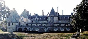
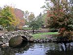
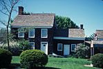
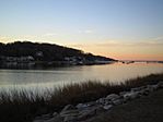
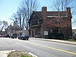
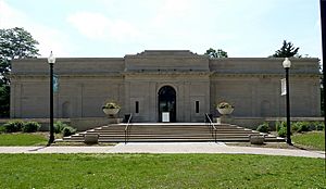
Oheka Castle, Heckscher Park, Walt Whitman's Birthplace, sunset at Centerport Harbor, the historic former Huntington Sewing and Trade School, and the Heckscher Museum of Art
|
||
|
||
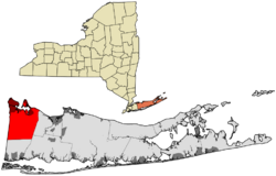
Location in Suffolk County
|
||
| Country | ||
| State | ||
| County | Suffolk | |
| Town Seat | Huntington | |
| Area | ||
| • Total | 137.1 sq mi (355 km2) | |
| • Land | 94.0 sq mi (243 km2) | |
| • Water | 43.1 sq mi (112 km2) | |
| Elevation | 135 ft (41 m) | |
| Population
(2020)
|
||
| • Total | 204,127 | |
| • Density | 2,162/sq mi (835/km2) | |
| Time zone | UTC−5 (EST) | |
| • Summer (DST) | UTC−4 (EDT) | |
| ZIP Codes |
11721, 11724, 11731, 11740, 11743, 11746, 11747, 11750, 11768
|
|
| Area code(s) | 631, 934 | |
| FIPS code | 36-68000 | |
| GNIS feature ID | 0979498 | |
Huntington is a town in Suffolk County, New York, United States. It's one of ten towns in the county. In 2020, about 204,127 people lived here, making it one of the largest towns in New York State.
The Town of Huntington was founded in 1653. It is located on the North Shore of Long Island. To its north is the Long Island Sound, and to its west is Nassau County. Huntington is also part of the larger New York metropolitan area.
Contents
History of Huntington
In 1653, three men from Oyster Bay bought land from the Matinecock tribe. This area, known as the "First Purchase," stretched from Cold Spring Harbor to Northport Harbor. It went south to what is now Old Country Road and north to Long Island Sound. The land was immediately given to the settlers already living there.
No one knows for sure how Huntington got its name. Most historians believe it was named after the birthplace of Oliver Cromwell. He was the leader of England when the town was founded.
Over time, Huntington grew to include all the land that makes up the modern Towns of Huntington and Babylon. In 1872, the southern part of the town officially became the separate town of Babylon.
Because many English settlers lived in Huntington, the town decided in 1660 to join the Connecticut colony. This was different from the rest of the New Amsterdam colony. When the British took control of New Amsterdam in 1664 and renamed it New York, Huntington officially became part of New York again.
During the American Revolutionary War, after the Battle of Long Island, British troops used Huntington as their main base. They stayed there until the war ended.
When the Long Island Rail Road arrived in 1867, it changed Huntington's economy. Before, it was mostly about farming and shipping. After the railroad, tourism and commuting became more important. Cold Spring Harbor became a popular place for summer vacations.
After World War II, Huntington's population grew very quickly. Farms and resorts were replaced by homes. Huntington became a major town for people who work in nearby New York City.
In 1988, the Supreme Court made an important decision about fair housing in Huntington. The court ruled that the town had to allow affordable housing to be built in all neighborhoods. This was to make sure everyone had fair housing options. Construction on one such project began in 2023.
In 2019, Huntington stopped new basement apartments from being created. However, in 2023, a local leader suggested allowing them again. This was to help with the housing shortage in Huntington and other areas near New York City.
Geography of Huntington
Huntington is bordered by the Long Island Sound to the north. To the west is Nassau County. To the south is Babylon, and to the east is Smithtown. It also has a small border with Islip in the southeast.
The town covers a total area of about 137.1 square miles (355.1 km2). About 94.0 square miles (243.5 km2) of this is land, and 43.1 square miles (111.6 km2) is water.
Population and People
| Historical population | |||
|---|---|---|---|
| Census | Pop. | %± | |
| 1790 | 3,260 | — | |
| 1800 | 3,894 | 19.4% | |
| 1810 | 4,424 | 13.6% | |
| 1820 | 4,935 | 11.6% | |
| 1830 | 5,582 | 13.1% | |
| 1840 | 6,562 | 17.6% | |
| 1850 | 7,481 | 14.0% | |
| 1860 | 8,924 | 19.3% | |
| 1870 | 10,704 | 19.9% | |
| 1880 | 8,098 | −24.3% | |
| 1890 | 8,277 | 2.2% | |
| 1900 | 9,483 | 14.6% | |
| 1910 | 12,004 | 26.6% | |
| 1920 | 13,893 | 15.7% | |
| 1930 | 25,582 | 84.1% | |
| 1940 | 31,768 | 24.2% | |
| 1950 | 47,506 | 49.5% | |
| 1960 | 126,221 | 165.7% | |
| 1970 | 200,172 | 58.6% | |
| 1980 | 201,512 | 0.7% | |
| 1990 | 191,474 | −5.0% | |
| 2000 | 195,289 | 2.0% | |
| 2010 | 203,264 | 4.1% | |
| 2020 | 204,127 | 0.4% | |
| 2021 (est.) | 204,197 | 0.5% | |
| U.S. Decennial Census | |||
| Year | Population | White | Black | Asian | Native Americans | Pacific Islanders | Hispanic/Latino | Other | Two or more races |
|---|---|---|---|---|---|---|---|---|---|
| 2000 Census | 195,289 | 88.31% | 4.22% | 3.50% | 0.13% | 0.02% | 6.58% | 2.27% | 1.55% |
| 2010 Census | 203,264 | 84.15% | 4.68% | 4.96% | 0.20% | 0.02% | 11.00% | 3.89% | 2.10% |
| 2020 Census | 204,127 | 79.0% | 4.2% | 5.5% | 0.5% | 0.0% | 11.9% | 4.1% | 6.6% |
In 2000, there were 195,289 people living in Huntington. There were 65,917 households, and 52,338 families. The population density was about 2,078 people per square mile (802 per km2).
About 25.5% of the population was under 18 years old. The median age was 39 years. This means half the people were younger than 39 and half were older.
In 2023, the average income for a household in Huntington was about $164,196. For a family, it was about $190,280. About 4% of the people lived below the poverty line.
Economy and Jobs
Huntington is home to many businesses. Sbarro's main office was in Melville until 2015. Swiss International Air Lines's North American headquarters used to be in Melville. Aer Lingus also moved its North American headquarters to Melville in 1997 to save money.
Top Employers in Huntington
Here are some of the biggest employers in Huntington:
| # | Employer | # of Employees |
|---|---|---|
| 1 | Canon | 3,103 |
| 2 | Northport Veterans Affairs Medical Center | 1,929 |
| 3 | Huntington Hospital | 1,810 |
| 4 | Estée Lauder | 1,700 |
| 5 | Half Hollow Hills School District | 1,682 |
| 6 | Henry Schein | 1,268 |
| 7 | Western Suffolk BOCES | 1,140 |
| 8 | South Huntington Union Free School District | 1,110 |
| 9 | Northport-East Northport School District | 945 |
| 10 | Huntington, NY - Town Government | 773 |
Education in Huntington
Huntington has several schools and colleges.
Colleges and Universities
- Five Towns College in Dix Hills
- Seminary of the Immaculate Conception
Elementary and High Schools
- Cold Spring Harbor Jr./Sr. High School
- Goosehill Primary School
- Lloyd Harbor School
- Westside School
- Commack High School
- Commack Middle School
- Burr Intermediate School
- Sawmill Intermediate School
- Rolling Hills Primary School
- North Ridge Primary School
- John Glenn High School
- Elwood Middle School
- James H. Boyd Intermediate School
- Harley Avenue Primary School
- Half Hollow Hills High School East
- Half Hollow Hills High School West
- West Hollow Middle School
- Candlewood Middle School
- Otsego Elementary School
- Paumanok Elementary School
- Signal Hill Elementary School
- Sunquam Elementary School
- Vanderbilt Elementary School
- Harborfields High School
- Oldfield Middle School
- Thomas J. Lahey Elementary School
- Washington Drive Primary School
- Huntington High School
- J. Taylor Finley Middle School
- Woodhull Intermediate School
- Jack Abrams Intermediate School
- Flower Hill Primary School
- Jefferson Primary School
- Southdown Primary School
- Washington Primary School
- Northport High School
- East Northport Middle School
- Northport Middle School
- 5th Avenue Elementary School
- Pulaski Rd Elementary School
- Bellerose Elementary School
- Dickinson Elementary School
- Norwood Elementary School
- Ocean Ave Elementary School
- Walt Whitman High School
- Henry L. Stimson Middle School (with 6th grade at Silas Wood Center)
- Birchwood Intermediate School
- Maplewood Intermediate School
- Countrywood Primary School
- Oakwood Primary School
- St. Patrick's School
- St. Anthony's High School
- Upper Room Christian School
Local News and Media
Several weekly newspapers cover local news in Huntington, like The Long-Islander (since 1838) and The Times of Huntington. The Village Connection Magazine focuses on lifestyle and entertainment in the town. Online news websites like Patch and Huntington Buzz also report on local issues and events.
Famous People from Huntington
Many well-known people have lived in or are from Huntington:
- Jason Alexander, actor
- Mariah Carey, singer-songwriter
- Harry Chapin, singer-songwriter and humanitarian
- John Coltrane, famous jazz saxophonist
- Gerry Cooney, former heavyweight boxer
- Bob Costas, sportscaster
- James L. Dolan, CEO of Cablevision
- Edie Falco, actress (known for The Sopranos)
- Jackie Gleason, comedian
- Sean Hannity, talk show host
- Melissa Joan Hart, actress
- Billy Joel, singer
- Jack Kerouac, famous novelist
- Lindsay Lohan, actress
- Ralph Macchio, actor (The Karate Kid)
- Barbara McClintock, Nobel Prize-winning scientist
- Rosie O'Donnell, talk show host
- Antoine de Saint-Exupéry, author of The Little Prince
- Dee Snider, lead singer for Twisted Sister
- Henry L. Stimson, former Secretary of State and Secretary of War
- James D. Watson, Nobel Prize winner (co-discovered DNA structure)
- Meg Whitman, former CEO of eBay
- Walt Whitman, famous poet
Communities and Areas
Huntington has several villages and hamlets.
Villages (Incorporated)
Hamlets (Unincorporated)
- Centerport
- Cold Spring Harbor
- Commack (partly in Town of Smithtown)
- Dix Hills
- East Northport
- Eatons Neck
- Elwood
- Fort Salonga (partly in Town of Smithtown)
- Greenlawn
- Halesite
- Huntington
- Huntington Station
- Melville
- South Huntington
- Vernon Valley
- West Hills
- Wincoma
Transportation in Huntington
Train Lines
The Long Island Rail Road's Port Jefferson Branch serves Huntington. You can find stations from Cold Spring Harbor to Northport. The Huntington station is where the electric train line ends on this branch.
Bus Service
The town of Huntington has its own bus system called Huntington Area Rapid Transit. Some routes from Suffolk County Transit also serve the town.
Major Roads
 Interstate 495 is also known as the Long Island Expressway. It's the only interstate highway in Huntington.
 Northern State Parkway was the main highway in Huntington before the Long Island Expressway was built.
 New York State Route 25A is a state highway that runs through Cold Spring Harbor, downtown Huntington, Centerport, Northport, and Fort Salonga.
 New York State Route 25 is another state highway, also known as Jericho Turnpike. It passes through West Hills, South Huntington, Elwood, and Commack.
- Old Country Road is a major road that goes through West Hills, Melville, Dix Hills, and South Huntington.
 New York State Route 108 runs from the Cold Spring Harbor train station to NY 25A.
 New York State Route 110 is a big highway that goes through Melville, South Huntington, Huntington Station, and downtown Huntington.
 New York State Route 231 is a four-lane highway that enters the town from Deer Park and goes through Dix Hills.
 County Route 2 is called Straight Path.
 County Route 3 is known as Wellwood Avenue and Pinelawn Road.
 County Route 11 includes Woodbury Road and Pulaski Road.
 County Route 35
 County Route 67 includes part of the old Long Island Motor Parkway.
 County Route 92 includes Oakwood Road and High Street.
Gas Station Rules
Huntington is the only town in the United States that does not allow self-service gas stations. This means that at every gas station in Huntington, an attendant must pump your gas for you. Only the entire state of New Jersey and a part of Oregon have similar laws.
See also
 In Spanish: Huntington (Nueva York) para niños
 | John T. Biggers |
 | Thomas Blackshear |
 | Mark Bradford |
 | Beverly Buchanan |


