Suffolk County, New York facts for kids
Quick facts for kids
Suffolk County
|
|||
|---|---|---|---|
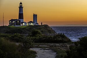
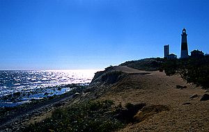
Dawn over Montauk Point Light
|
|||
|
|||
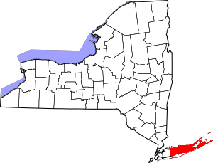
Location within the U.S. state of New York
|
|||
 New York's location within the U.S. |
|||
| Country | |||
| State | |||
| Founded | 1683 | ||
| Named for | Suffolk, England | ||
| Seat | Riverhead | ||
| Largest town | Brookhaven | ||
| Area | |||
| • Total | 2,373 sq mi (6,150 km2) | ||
| • Land | 912 sq mi (2,360 km2) | ||
| • Water | 1,461 sq mi (3,780 km2) 62% | ||
| Population
(2020)
|
|||
| • Total | 1,525,920 | ||
| • Estimate
(2022)
|
1,525,465 |
||
| • Density | 1,673.16/sq mi (646.01/km2) | ||
| Time zone | UTC−5 (Eastern) | ||
| • Summer (DST) | UTC−4 (EDT) | ||
| Congressional districts | 1st, 2nd, 3rd | ||
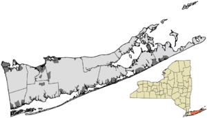
Suffolk County is the farthest east county in New York State. It makes up the eastern two-thirds of Long Island. To its west is Nassau County. To its east and south is the Atlantic Ocean. To its north is Long Island Sound.
In 2020, over 1.5 million people lived here. This makes Suffolk the fourth-most populated county in New York. It is also the most populated county outside of New York City. The main government office, called the county seat, is in Riverhead. However, many county offices are in Hauppauge. The county got its name from Suffolk, England. This is where many of its first European settlers came from.
Suffolk County is the largest of Long Island's four counties. It is the second-largest of New York's 62 counties. The county is about 86 miles (138 km) long. It is 26 miles (42 km) wide at its widest point. Most of the land is close to sea level. It has over 1,000 miles (1,600 km) of coastline.
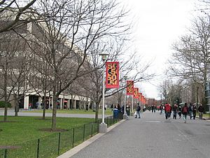
Because many people live here and it is close to New York City, Suffolk County has many types of jobs. These include science, farming, fishing, and tourism. Important science places are Brookhaven National Laboratory in Upton. Another is the Plum Island Animal Disease Center on Plum Island. The county is also home to Stony Brook University and Farmingdale State College.
Contents
History of Suffolk County
Suffolk County was once part of the Connecticut Colony. In 1683, it became one of the first twelve counties of the Province of New York. Before 1683, it was called the East Riding of Yorkshire. Its borders are mostly the same today. Only small changes happened with its western neighbor. This was first Queens County. It became Nassau County in 1899.
During the American Revolutionary War, Great Britain took control of Suffolk County. This happened after George Washington's forces left after the Battle of Long Island. The British stayed until November 25, 1783.
Suffolk County is a top farming county in New York State. The county's website says the weather is good and there is plenty of clean water. The soil is also very rich. This helps Suffolk County stay number one in farming. This is true even with all the new buildings and growth.
Geography of Suffolk County
Suffolk County covers 2,373 square miles (6,146 km²). About 912 square miles (2,362 km²) is land. The rest, 1,461 square miles (3,784 km²), is water. It is the second-largest county in New York by total area. It makes up 66% of Long Island's land.
Suffolk County is in the central and eastern part of Long Island. The eastern end of the county splits into two narrow land areas. These are called the North Fork and the South Fork. Water surrounds the county on three sides. This includes the Atlantic Ocean and Long Island Sound. It has about 980 miles (1,580 km) of coastline. The eastern end has many large bays.
The highest point in the county is Jayne's Hill. It is in West Hills. It is 401 feet (122 m) above sea level. Because the land is low, much of the county could be affected by sea level rise.
Suffolk County Climate
Suffolk County has a mix of climates. Summers are cooler on the east end than in the western part. The average temperature in Hauppauge is 31.0°F (–0.6°C) in January. It is 74.0°F (23.3°C) in July. In Riverhead, it ranges from 30.1°F (–1.1°C) in January to 72.8°F (22.7°C) in July. On February 9, 2013, Suffolk County had 30 inches (76 cm) of snow. This was the most snowfall ever recorded in one day.
| Climate data for Montauk, New York (1981–2010 normals) | |||||||||||||
|---|---|---|---|---|---|---|---|---|---|---|---|---|---|
| Month | Jan | Feb | Mar | Apr | May | Jun | Jul | Aug | Sep | Oct | Nov | Dec | Year |
| Mean daily maximum °F (°C) | 38.1 (3.4) |
40.1 (4.5) |
45.6 (7.6) |
54.5 (12.5) |
64.2 (17.9) |
73.3 (22.9) |
79.3 (26.3) |
78.9 (26.1) |
71.9 (22.2) |
62.6 (17.0) |
53.0 (11.7) |
43.6 (6.4) |
58.8 (14.9) |
| Daily mean °F (°C) | 32.3 (0.2) |
33.7 (0.9) |
39.0 (3.9) |
47.5 (8.6) |
56.6 (13.7) |
66.4 (19.1) |
72.4 (22.4) |
72.2 (22.3) |
65.7 (18.7) |
56.4 (13.6) |
47.2 (8.4) |
37.9 (3.3) |
52.3 (11.3) |
| Mean daily minimum °F (°C) | 26.4 (−3.1) |
27.3 (−2.6) |
32.4 (0.2) |
40.4 (4.7) |
48.9 (9.4) |
59.5 (15.3) |
65.5 (18.6) |
65.5 (18.6) |
59.4 (15.2) |
50.3 (10.2) |
41.4 (5.2) |
32.3 (0.2) |
45.8 (7.7) |
| Average precipitation inches (mm) | 2.87 (73) |
3.38 (86) |
4.75 (121) |
3.45 (88) |
2.21 (56) |
3.80 (97) |
3.81 (97) |
3.92 (100) |
3.93 (100) |
3.66 (93) |
4.22 (107) |
3.58 (91) |
43.58 (1,109) |
| Source: NOAA | |||||||||||||
Neighboring Counties
Suffolk County shares water borders with five other U.S. counties. It is connected by land only to Nassau County.
- Nassau County - west
- Fairfield County, Connecticut - northwest
- New Haven County, Connecticut - north
- Middlesex County, Connecticut - north
- New London County, Connecticut - north
- Washington County, Rhode Island - northeast
Protected Natural Areas
Suffolk County has several national protected areas. These are places where nature is kept safe.
- Amagansett National Wildlife Refuge
- Conscience Point National Wildlife Refuge
- Elizabeth A. Morton National Wildlife Refuge
- Fire Island National Seashore
- Sayville National Wildlife Refuge
- Seatuck National Wildlife Refuge
- Target Rock National Wildlife Refuge
- Wertheim National Wildlife Refuge
Population of Suffolk County
| Historical population | |||
|---|---|---|---|
| Census | Pop. | %± | |
| 1790 | 16,400 | — | |
| 1800 | 19,735 | 20.3% | |
| 1810 | 21,113 | 7.0% | |
| 1820 | 23,936 | 13.4% | |
| 1830 | 26,780 | 11.9% | |
| 1840 | 32,469 | 21.2% | |
| 1850 | 36,922 | 13.7% | |
| 1860 | 43,275 | 17.2% | |
| 1870 | 46,924 | 8.4% | |
| 1880 | 52,888 | 12.7% | |
| 1890 | 62,491 | 18.2% | |
| 1900 | 77,582 | 24.1% | |
| 1910 | 96,138 | 23.9% | |
| 1920 | 110,246 | 14.7% | |
| 1930 | 161,055 | 46.1% | |
| 1940 | 197,355 | 22.5% | |
| 1950 | 276,129 | 39.9% | |
| 1960 | 666,784 | 141.5% | |
| 1970 | 1,124,950 | 68.7% | |
| 1980 | 1,284,231 | 14.2% | |
| 1990 | 1,321,864 | 2.9% | |
| 2000 | 1,419,369 | 7.4% | |
| 2010 | 1,493,350 | 5.2% | |
| 2020 | 1,525,920 | 2.2% | |
| 2022 (est.) | 1,525,465 | 2.2% | |
| U.S. Decennial Census 1790-1960 1900-1990 1990-2000 2010, 2020, and 2022 |
|||
In 2010, there were about 1.5 million people living in Suffolk County. The population density was about 1,637 people per square mile (632 people/km²). In 2006, Suffolk County was the 21st most populated county in the United States.
In 2014, most people in the county were White (85.2%). About 8.3% were African American. About 4.0% were Asian. People who identified as Hispanic or Latino made up 18.2% of the population. In 2007, the most common backgrounds were Italian (29.5%), Irish (24.0%), and German (17.6%).
In 2008, Forbes magazine listed Suffolk County as one of the top 25 richest counties in America. In 2016, the area of Sagaponack in Southampton was named the most expensive zip code in the U.S. The average home sale price there was $8.5 million.
The average income for a family in the county was $72,112. About 6.4% of the population lived below the poverty line.
Education in Suffolk County
Colleges and Universities
Suffolk County has many colleges and universities.
- State University of New York
- Stony Brook University in Stony Brook. It also has a campus in Southampton.
- Farmingdale State College in East Farmingdale.
- Suffolk County Community College has campuses in Selden, Riverhead, and Brentwood.
- Private Colleges
- Five Towns College in Dix Hills.
- St. Joseph's University in Patchogue.
- Touro University System has its School of Health Sciences and Law Center in Central Islip.
- Cold Spring Harbor Laboratory School of Biological Sciences in Cold Spring Harbor.
- Other Campuses
- Adelphi University in Hauppauge.
- Long Island University in Brentwood and Riverhead.
- Molloy University in Amityville.
School Districts
Suffolk County has many school districts for students from kindergarten to 12th grade.
- Amagansett Union Free School District
- Amityville Union Free School District
- Babylon Union Free School District
- Bay Shore Union Free School District
- Bayport-Blue Point Union Free School District
- Brentwood Union Free School District
- Bridgehampton Union Free School District
- Brookhaven-Comsewogue Union Free School District
- Center Moriches Union Free School District
- Central Islip Union Free School District
- Cold Spring Harbor Central School District
- Commack Union Free School District
- Connetquot Central School District
- Copiague Union Free School District
- Deer Park Union Free School District
- East Hampton Union Free School District
- East Islip Union Free School District
- East Moriches Union Free School District
- East Quogue Union Free School District
- Eastport-South Manor Central School District
- Elwood Union Free School District
- Farmingdale Union Free School District
- Fire Island Union Free School District
- Fishers Island Union Free School District
- William Floyd Union Free School District
- Greenport Union Free School District
- Half Hollow Hills Central School District
- Hampton Bays Union Free School District
- Harborfields Central School District
- Hauppauge Union Free School District
- Huntington Union Free School District
- Islip Union Free School District
- Kings Park Central School District
- Lindenhurst Union Free School District
- Middle Country Central School District
- Longwood Central School District
- Mattituck-Cutchogue Union Free School District
- Miller Place Union Free School District
- Montauk Union Free School District
- Mount Sinai Union Free School District
- New Suffolk Common School District
- North Babylon Union Free School District
- Northport-East Northport Union Free School District
- Oysterponds Union Free School District
- Patchogue-Medford Union Free School District
- Port Jefferson Union Free School District
- Quogue Union Free School District
- Remsenburg-Speonk Union Free School District
- Riverhead Central School District
- Rocky Point Central School District
- Sachem Central School District
- Sag Harbor Union Free School District
- Sagaponack Common School District
- Sayville Union Free School District
- Shelter Island Union Free School District
- Shoreham-Wading River Central School District
- Smithtown Central School District
- South Country Central School District
- South Huntington Union Free School District
- Southampton Union Free School District
- Southold Union Free School District
- Springs Union Free School District
- Three Village Central School District
- Tuckahoe Common School District
- Wainscott Common School District
- West Babylon Union Free School District
- West Islip Union Free School District
- Westhampton Beach Union Free School District
- Wyandanch Union Free School District
Media in Suffolk County
Newspapers
Many local newspapers serve Suffolk County. Some of them are:
- Amityville Record
- Bayport-Blue Point Gazette
- Dan's Papers
- Fire Island News
- Newsday
- Sayville Gazette
- Shelter Island Reporter
- The East Hampton Press
- The East Hampton Star
- The Islip Bulletin
- The Long Island Advance
- The Riverhead News-Review
- The Southampton Press
- The Suffolk County News
- The Suffolk Times
Radio Stations
Suffolk County has many radio stations. Some popular ones include:
- WALK-FM, Patchogue
- WBAB, Babylon
- WBLI, Patchogue
- WEHM, Manorville
- WJJF, Montauk
- WLIM, Medford
- WLIR-FM, Hampton Bays
- WLNG, Sag Harbor
- WUSB, Stony Brook
Television Stations
Television stations in Suffolk County include:
- WFTY-DT, Smithtown
- WLNY-TV, Riverhead
- WVVH-CD, Southampton
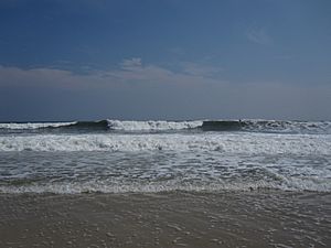
Suffolk County Seashore
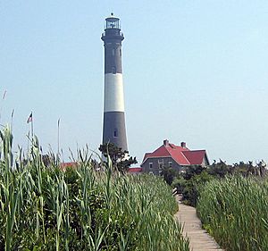
The Fire Island Lighthouse was very important for ships coming to New York Harbor. For many immigrants from Europe, this lighthouse was the first land they saw when they arrived in America.
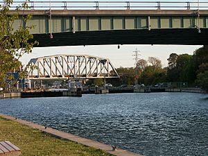
The Robert Moses Causeway connects to Robert Moses State Park on the western tip of Fire Island. The Great South Bay Bridge, which is part of the causeway, opened in 1954. It is 2 miles (3.2 km) long. It crosses the Great South Bay to Captree Island. The causeway also connects to the Ocean Parkway. This road gives access to Captree State Park, Gilgo State Park, and Jones Beach State Park.
The Fire Island Inlet Bridge continues the road across Fire Island Inlet. It ends at Robert Moses State Park and The Fire Island Lighthouse. The Robert Moses Causeway opened fully in 1964.
Suffolk County has more lighthouses than any other county in the United States. Out of 26 original lighthouses, 15 are still standing. Eight of these are in Southold township alone. This means Southold has more lighthouses than any other township in the U.S.
Ideas for a New County
Sometimes, people have suggested splitting Suffolk County into two parts. The western part would stay Suffolk County. The eastern part would become a new county called Peconic County. Peconic County would include five eastern towns: East Hampton, Riverhead, Shelter Island, Southampton, and Southold. It would also include the Shinnecock Indian Reservation.
The proposed flag for Peconic County showed the two forks of Long Island. These forks are separated by Peconic Bay. A star on the north fork would represent Southold. Stars on the South Fork would represent Southampton and East Hampton. Riverhead would be at the start of the forks, and Shelter Island would be in between them.
This idea to split the county has not been active since 1998.
Transportation in Suffolk County
The county has many roads and public transport options. The local Suffolk County Legislature helps manage these. In 2019, they decided that all new projects must plan for future climate change and sea level rise.
Main Roads
- I-495 (Long Island Expressway) goes across the county. It starts at the Nassau County line in the west. It ends in Riverhead in the east. This expressway connects to Manhattan through the Queens-Midtown Tunnel.
- New York State Route 27 crosses the county from the Nassau County line to Montauk Point. Montauk Point is the easternmost spot in New York State.
Airports
Suffolk County has one commercial airport and several smaller airports.
- Commercial Airport:
- Long Island MacArthur Airport (ISP)
- General Aviation Airports:
- Republic Airport (FRG)
- Brookhaven Calabro Airport (WSH)
- Francis S. Gabreski Airport (FOK)
- Town of East Hampton Airport (JPX)
- Elizabeth Field (Fisher's Island) (FID)
Public Transportation
Suffolk County Transit provides bus service in Suffolk County. The Long Island Rail Road, the Hampton Jitney, and Hampton Luxury Liner connect Suffolk County to New York City. Some parts of Suffolk County also have bus service from NICE bus.
Notable People from Suffolk County
Many famous people have lived in Suffolk County. Some of them are:
- Craig Biggio (baseball player)
- Jimmy Buffett (singer)
- Mariah Carey (singer)
- Mick Foley (wrestler)
- Kevin James (actor)
- Loudon Wainwright III (singer-songwriter)
- Carl Yastrzemski (baseball player)
Communities in Suffolk County
In New York State, a town is a main part of each county. Towns provide most services for people living in hamlets and some services for people in villages. Everyone in New York who does not live in a city lives in a town. A village is a smaller, defined area. It usually provides services like trash collection and street maintenance. A hamlet is a populated area within a town that is not a village.
Here are the towns, villages, and some other communities in Suffolk County:
Towns
- Babylon (217,656 people in 2022)
- Brookhaven (488,497 people in 2022)
- East Hampton (28,607 people in 2022)
- Huntington (203,243 people in 2022)
- Islip (337,922 people in 2022)
- Riverhead (35,834 people in 2022)
- Shelter Island (3,276 people in 2022)
- Smithtown (115,768 people in 2022)
- Southampton (69,490 people in 2022)
- Southold (23,912 people in 2022)
Villages (incorporated)
- Amityville
- Asharoken
- Babylon
- Belle Terre
- Bellport
- Brightwaters
- Dering Harbor
- East Hampton
- Greenport
- Head of the Harbor
- Huntington Bay
- Islandia
- Lake Grove
- Lindenhurst
- Lloyd Harbor
- Nissequogue
- North Haven
- Northport
- Ocean Beach
- Old Field
- Patchogue
- Poquott
- Port Jefferson
- Quogue
- Sag Harbor
- Sagaponack
- Saltaire
- Shoreham
- Southampton
- Village of the Branch
- Westhampton Beach
- West Hampton Dunes
Census-designated places (unincorporated)
- Amagansett
- Aquebogue
- Baiting Hollow
- Bay Shore
- Bayport
- Baywood
- Blue Point
- Bohemia
- Brentwood
- Bridgehampton
- Brookhaven
- Calverton
- Captree
- Center Moriches
- Centereach
- Centerport
- Central Islip
- Cold Spring Harbor
- Commack
- Copiague
- Coram
- Cutchogue
- Deer Park
- Dix Hills
- East Farmingdale
- East Hampton North
- East Islip
- East Marion
- East Moriches
- East Northport
- East Patchogue
- East Quogue
- East Setauket
- East Shoreham
- Eastport
- Eatons Neck
- Elwood
- Farmingville
- Fire Island
- Fishers Island
- Flanders
- Fort Salonga
- Gilgo
- Gordon Heights
- Great River
- Greenlawn
- Greenport West
- Halesite
- Hampton Bays
- Hauppauge
- Holbrook
- Holtsville
- Huntington
- Huntington Station
- Islip
- Islip Terrace
- Jamesport
- Kings Park
- Lake Ronkonkoma
- Laurel
- Manorville
- Mastic
- Mastic Beach
- Mattituck
- Medford
- Melville
- Middle Island
- Miller Place
- Montauk
- Moriches
- Mount Sinai
- Napeague
- Nesconset
- New Suffolk
- North Amityville
- North Babylon
- North Bay Shore
- North Bellport
- North Great River
- North Lindenhurst
- North Patchogue
- North Sea
- Northampton
- Northville
- Northwest Harbor
- Noyack
- Oak Beach
- Oakdale
- Orient
- Peconic
- Port Jefferson Station
- Quiogue
- Remsenburg-Speonk
- Ridge
- Riverhead
- Riverside
- Rocky Point
- Ronkonkoma
- Sayville
- Selden
- Setauket
- Shelter Island
- Shelter Island Heights
- Shinnecock Hills
- Shirley
- Smithtown
- Sound Beach
- South Huntington
- Southold
- Springs
- St. James
- Stony Brook
- Stony Brook University
- Terryville
- Tuckahoe
- Wading River
- Wainscott
- Water Mill
- West Babylon
- West Bay Shore
- West Hills
- West Islip
- West Sayville
- Westhampton
- Wheatley Heights
- Wyandanch
- Yaphank
Islands in Suffolk County
Gardiners Island
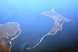
Gardiners Island is an island off eastern Suffolk County. It is 6 miles (9.7 km) long and 3 miles (4.8 km) wide. It has 27 miles (43 km) of coastline. The same family has owned this island for almost 400 years. It is one of the largest privately owned islands in America. It is also the only American property still owned as part of an original gift from the English Crown.
Robins Island
Robins Island is in Peconic Bay. It is between the North and South Forks of eastern Suffolk County. It is part of the Town of Southold. The island is 435 acres (1.76 km²) and is not developed. It is privately owned, so the public cannot visit it.
Indian Reservations
Two Indian reservations are located within Suffolk County:
See also
 In Spanish: Condado de Suffolk (Nueva York) para niños
 | Emma Amos |
 | Edward Mitchell Bannister |
 | Larry D. Alexander |
 | Ernie Barnes |


