North Fork (Long Island) facts for kids
The North Fork is a long piece of land, like a finger, on the northeast side of Long Island in New York. It's about 30 miles (48 km) long and runs next to another, longer "finger" called the South Fork. Both of these areas are part of the "East End" of Long Island. Even though the North Fork officially starts east of Riverhead, people often use the name "North Fork" to talk about the entire towns of Riverhead and Southold. It's about 75 miles (120 kilometers) east of Manhattan.
Contents
Exploring the North Fork's Geography
Long Island splits into two main parts, or "forks," near the town of Riverhead. The Peconic River forms the western border between the North Fork and the South Fork. The North Fork includes all of the Town of Southold on its eastern side and part of the Town of Riverhead on its western side.
Waterways and Islands of the North Fork
To the north of the North Fork is the Long Island Sound. To the south, you'll find several connected bodies of water. These include the Great Peconic Bay, Little Peconic Bay, and Gardiners Bay.
Between the North Fork and the South Fork are several islands. These include Robins Island and the larger islands of Shelter Island and Gardiners Island. Shelter Island sits right between the two forks. Ferries can take you from Greenport Village to Shelter Island Heights. You can also take a ferry from Shelter Island to North Haven on the South Fork.
The very tip of the North Fork is Orient Point. Beyond this point, there are three more important islands that are part of the Town of Southold. These are Plum Island, Great Gull Island, and Fisher's Island. The North Fork and these islands were formed by a natural land feature called the Harbor Hill Moraine.
Farms and Towns of the North Fork
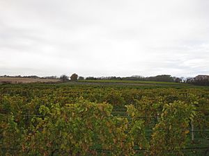
The North Fork is known for its farms. You'll find many vineyards, apple orchards, potato farms, and sod farms here. At the eastern end of the fork, there are two parks: Orient Point County Park and Orient Beach State Park. There's also a ferry terminal here that connects Long Island to eastern Connecticut.
Moving from west to east, some of the towns and villages on the North Fork include:
- Wading River
- Baiting Hollow
- Calverton
- Aquebogue
- Jamesport
- Laurel
- Mattituck
- Cutchogue
- New Suffolk
- Peconic
- Southold
- Greenport
- East Marion
- Orient
- Orient Point
The North Fork also has active fishing and clamming industries. These activities take place in the bays, the Sound, and nearby creeks and beaches.
Getting Around the North Fork
You can reach the North Fork by car from the west using roads like New York State Route 25. The Long Island Rail Road offers train service to Greenport on certain weekdays and weekends. The Hampton Jitney is a bus service that runs every day, all year, connecting the East End of Long Island to New York City.
Ferry Connections
Ferries also connect the North Fork to other places. You can take a ferry to Plum Island and to New London, Connecticut. Ferries also link the North Fork to the South Fork by way of Shelter Island's roads. From the North Fork, you can easily visit Shelter Island, which is located in the Peconic Bay.
Fun Activities and Tourism on the North Fork

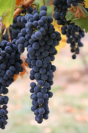
The North Fork is a popular place for visitors. It's home to more than 30 vineyards, which are places where grapes are grown to make wine. Many of these vineyards have tasting rooms where you can try and buy their wines. The very first vineyard in the area, Hargrave, started in 1973. Today, it's known as Castello De Borghese.
Wineries and Farm Fun
The North Fork of Long Island AVA was created in 1985. Since then, the vineyards and wineries have become a very important part of the area's economy. They stretch from Baiting Hollow in the west to Southold in the east. New vineyards have even been planted in Greenport and Orient recently.
Many family farms have been operating in the region for generations. Their farmstands are a big attraction for visitors. During the fall harvest season, many farms offer fun activities like pumpkin picking. These activities are often called "agritainment." On fall weekends, the roads can get busy with many people driving from other parts of Long Island and New York City to enjoy the harvest season fun.
Main Roads and Travel Tips
The North Fork is located east of the end of the Long Island Expressway (LIE). You can get around using three main east-to-west roads:
- Route 25, also called Main Road
- Sound Avenue
- County Road 48, also called Middle Road
At the easternmost point, the Cross Sound Ferry runs daily. This ferry carries cars and passengers to and from New London, Connecticut. The Long Island Railroad also provides daily train service to the region.
Towns and Villages of the North Fork
Riverhead Town
- Wading River — This area is shared with the Town of Brookhaven, but most of Wading River is in Riverhead Town.
- Calverton — This area is also shared with the Town of Brookhaven, but most of Calverton is in Riverhead Town.
- Baiting Hollow
- Riverhead
- Northville
- Aquebogue
- Jamesport
- Laurel — This area is shared with the Town of Southold.
Southold Town
- Laurel — This area is shared with the Town of Riverhead, but most of Laurel is in Southold Town.
- Mattituck
- Cutchogue
- New Suffolk
- Robins Island
- Peconic
- Nassau Point
- Southold
- Greenport (Village)
- East Marion
- Orient
- Orient Point


