Middlesex County, Connecticut facts for kids
Quick facts for kids
Middlesex County
|
|
|---|---|

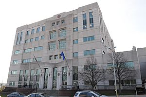
Raymond E Baldwin Courthouse
|
|

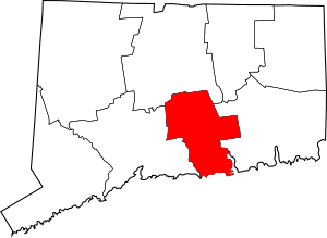
Location within the U.S. state of Connecticut
|
|
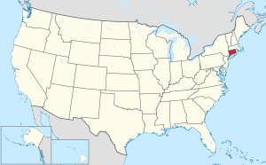
 Connecticut's location within the U.S. |
|
| Country | |
| State | |
| Founded | May, 1785 |
| Named for | Middlesex, England |
| Seat | none (since 1960) Middletown (before 1960) |
| Largest city | Middletown |
| Area | |
| • Total | 439 sq mi (1,140 km2) |
| • Land | 369 sq mi (960 km2) |
| • Water | 70 sq mi (200 km2) 15.9%% |
| Population
(2020)
|
|
| • Total | 164,245 |
| • Density | 370/sq mi (140/km2) |
| Time zone | UTC−5 (Eastern) |
| • Summer (DST) | UTC−4 (EDT) |
| Congressional districts | 1st, 2nd, 3rd |
Middlesex County is a county located in the south-central part of Connecticut, a state in the United States. As of the 2020 census, about 164,245 people live here. The county was created a long time ago, in May 1785. It was formed from parts of Hartford County and New London County.
Middlesex County is part of a larger area called Greater Hartford. This area includes the cities of Hartford, East Hartford, and Middletown.
Like all eight counties in Connecticut, Middlesex County doesn't have its own county government anymore. This means there's no "county seat" or main government office for the county. Instead, local towns handle most government activities. These include things like local police, fire and rescue services, snow removal, and schools. Sometimes, nearby towns will share resources like water or gas. In 2022, the U.S. Census Bureau started to recognize "councils of governments" in Connecticut as similar to counties for official purposes. These councils took over some local government jobs after the county governments were stopped in 1960. The old counties still exist in name, but they don't have a government role.
Contents
Exploring Middlesex County's Geography
Middlesex County covers a total area of 439 square miles. Out of this, 369 square miles is land, and 70 square miles (about 15.9%) is water. It is the smallest county in Connecticut when you look at just its land area. It's the second smallest by total area.
The land in the county changes from mostly flat areas near the Connecticut River and the Atlantic coast to gently rolling hills further away. The highest point in the county is in the Meshomasic State Forest, which is about 916 feet above sea level. The lowest point is at sea level, along the coast.
Middlesex County is also home to the beautiful Wadsworth Falls.
Neighboring Counties
Middlesex County shares borders with several other counties:
- Hartford County (to the north)
- New London County (to the east)
- New Haven County (to the west)
- Suffolk County, New York (to the south, across the water)
Protected Natural Areas
Parts of these national protected areas are found in Middlesex County:
People of Middlesex County
As of the 2010 United States census, there were 165,676 people living in Middlesex County. There were 67,202 households and 43,743 families. The population density was about 448.6 people per square mile.
Most people in the county (89.2%) were white. Other groups included 4.7% black or African American, 2.6% Asian, and 0.2% American Indian. About 4.7% of the population was of Hispanic or Latino origin. Many people had ancestors from Italy (24.6%), Ireland (21.2%), England (14.0%), and Germany (13.5%).
The average age of people in the county was 43.1 years. The median income for a household was $74,906. This means half of the households earned more than this, and half earned less. About 6.1% of all people in the county lived below the poverty line.
Communities in Middlesex County
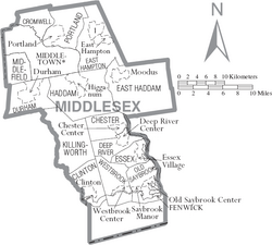
Middlesex County has one city and several towns. Some towns also have smaller areas called "villages." These villages are part of the town and don't have their own separate governments.
City
Towns
- Chester
- Clinton
- Cromwell
- Deep River
- Deep River Center
- Winthrop
- Durham
- East Haddam
- East Hampton
- Essex
- Haddam
- Hidden Lake
- Higganum
- Killingworth
- Middlefield
- Old Saybrook
- Portland
- Westbrook
See also
 In Spanish: Condado de Middlesex (Connecticut) para niños
 | May Edward Chinn |
 | Rebecca Cole |
 | Alexa Canady |
 | Dorothy Lavinia Brown |


