Cromwell, Connecticut facts for kids
Quick facts for kids
Cromwell, Connecticut
|
|||
|---|---|---|---|
| Town of Cromwell | |||

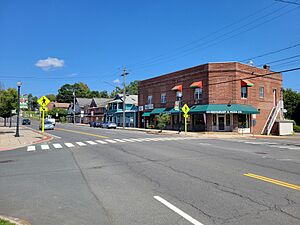
Main Street
|
|||
|
|||
| Nickname(s):
Crossroads of Connecticut, or the Rose City
|
|||
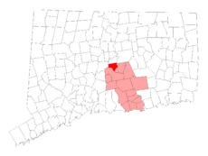
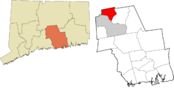
 Middlesex County and Connecticut Middlesex County and Connecticut |
|||
| Country | |||
| U.S. state | |||
| County | Middlesex | ||
| Region | Lower CT River Valley | ||
| Incorporated | June 18, 1851 | ||
| Government | |||
| • Type | Council-Manager | ||
| Area | |||
| • Total | 13.5 sq mi (35.0 km2) | ||
| • Land | 12.4 sq mi (32.1 km2) | ||
| • Water | 0.5 sq mi (1.3 km2) | ||
| Elevation | 128 ft (39 m) | ||
| Population
(2021)
|
|||
| • Total | 14,302 | ||
| • Density | 1,059.4/sq mi (445.5/km2) | ||
| Time zone | UTC-5 (EST) | ||
| • Summer (DST) | UTC-4 (EDT) | ||
| ZIP code |
06416
|
||
| Area code(s) | 860/959 | ||
| FIPS code | 09-18080 | ||
| GNIS feature ID | 0213414 | ||
| Interstates | |||
| U.S. Highways | |||
Cromwell (/ˈkrɑːmwɛl/ CRAHM-wel) is a town in Middlesex County, Connecticut, United States. It's part of the Lower Connecticut River Valley Planning Region. In 2020, about 14,225 people lived here.
Contents
History of Cromwell
Early Days and Native Americans
The land where Cromwell is today was once called Mattabesset. This area was home to Native American groups who spoke Eastern Algonquian languages. These groups might have included the Tunxis, Quinnipiac, Wangunk, and Wappinger.
In 1651, English settlers officially made Mattabesset a town. By 1653, the colonists had renamed the settlement Middletown.
From Upper Houses to Independence
The area we now call Cromwell had many names before it became its own town. People often called it the Upper Houses or Upper Middletown. This area was naturally protected by the Connecticut River, Mattabesset River, and hills.
By 1715, the Upper Houses had 50 homes. They also had their own school, church, and cemetery. Before 1713, people were buried in Middletown. The oldest known burial in the new cemetery is Martha Gipson, who died in February 1713.
As Middletown grew into a busy port, the Upper Houses also saw more shipping businesses. A group of wealthy merchants grew in the village. Some of these families owned enslaved people. Middletown officially became a city in 1784.
Growth and New Industries
In the 1800s, the War of 1812 slowed down shipping. This caused the Upper Houses to return to farming. But by the mid-1800s, new businesses brought life back to the area.
In 1843, John and Elisha Stevens started the J & E Stevens Company. They first planned to make metal tools and a few iron toys. But their iron toys became very popular! The company soon became the biggest maker of cast-iron toys in the country. Today, these toys are valuable collector's items.
In the early 1870s, Andrew N. Pierson came from Sweden. He started A.N. Pierson’s Inc. It began as a small flower nursery. Later, it became the largest commercial rose-growing business in the country. These new jobs attracted immigrants, including Irish, German, and Italian families. They often found homes along the river on lower Main Street.
Becoming Its Own Town
As the Upper Houses grew, it became harder to stay connected to Middletown. The Upper Houses had their own school and church. But by the mid-1800s, people wanted to be fully independent.
In 1851, the State of Connecticut officially recognized Cromwell as a new town. It had a population of 1,259 people.
The town's name is still debated. Many believe it was named after either the 17th-century English leader Oliver Cromwell, or a privateer ship called the Oliver Cromwell.
Cromwell stayed mostly rural until the mid-1900s. After World War II, the town changed a lot and its population grew. In the 1970s, new highways were built. Cromwell became a meeting point for three major highways. This led to more shops and people moving to the town. By 1980, the population had grown to 10,265. This was more than three times its size 40 years earlier!
Fun Places to Visit in Cromwell
Parks and Green Spaces
- River Highlands State Park
- Cromwell Meadow Wildlife Management Area
- Cromwell Landings
- Pierson Park - named after Andrew N. Pierson, known as the "Rose King of America."
- Riverport Park at Frisbee Landing
- Watrous Park
- Patriot's Corner - at Main Street and Wall Streets
- Memorial Town Green - at Main Street and West Street
- Valour Memorial Green - at Main Street and Fritsch Lane
- Gold Star Green - on West Street, across from St. John Church
Historic Sites
- On the National Register of Historic Places:
- Main Street Historic District – a historic area with many old buildings.
- Middletown Upper Houses Historic District – another historic area on Connecticut Route 99.
- Sage-Kirby House – a historic house at 93 Shunpike Road.
- Other Historically Significant Places:
- Cromwell Historical Society - located in the historic home of John Stevens, built in 1853.
- Cromwell Belden Public Library’s Elizabeth Maselli Room
- The Old Burial Ground - on Timber Hill Road and Ranney Road.
- Hillside Cemetery, East and West - on Hillside Road and Shelley Street.
- Former Home of Emily Pierson: listed on the National Votes for Women Trail - on Main Street.
Businesses and Sports
- TPC River Highlands – a famous golf course that hosts the Travelers Championship, a PGA Tour event.
- Horton Brasses, Inc. - a long-time hardware manufacturing company.
Cromwell's Geography
Cromwell covers about 12.9 square miles (33.4 square kilometers). Most of this is land, with about 0.5 square miles (1.3 square kilometers) being water.
The riverfront area sometimes experiences floods, especially when seasons change. Small floods have happened for a long time. But some floods have been more serious, like in March 1936, 1955 (during Hurricanes Connie and Diane), and 1984.
Major highways run through Cromwell. Interstate 91 goes north and south, with two exits in town. Connecticut Route 9, also known as the Central Connecticut Expressway, opened in 1989. It connects Cromwell to other major highways like I-95 and I-84. This makes Cromwell a great central location.
Cromwell's Population
Cromwell has grown quite a bit over the years!
| Historical population | |||
|---|---|---|---|
| Census | Pop. | %± | |
| 1870 | 1,856 | — | |
| 1880 | 1,640 | −11.6% | |
| 1890 | 1,987 | 21.2% | |
| 1900 | 2,031 | 2.2% | |
| 1910 | 2,188 | 7.7% | |
| 1920 | 2,454 | 12.2% | |
| 1930 | 2,814 | 14.7% | |
| 1940 | 3,281 | 16.6% | |
| 1950 | 4,286 | 30.6% | |
| 1960 | 6,780 | 58.2% | |
| 1970 | 7,400 | 9.1% | |
| 1980 | 10,265 | 38.7% | |
| 1990 | 12,286 | 19.7% | |
| 2000 | 12,871 | 4.8% | |
| 2010 | 14,005 | 8.8% | |
| 2020 | 14,225 | 1.6% | |
| U.S. Decennial Census | |||
In 2010, there were 14,005 people living in Cromwell. There were 5,212 households and 3,262 families. The average household had about 2.35 people. The average family had about 2.99 people.
The median age in Cromwell was 40 years old.
Cromwell Public Schools
Cromwell has four public schools for students:
- Edna C. Stevens Elementary School (Pre-K to 2nd grade)
- Woodside Intermediate School (3rd to 5th grade)
- Cromwell Middle School (6th to 8th grade)
- Cromwell High School (9th to 12th grade)
Fire Protection in Cromwell
The Cromwell Fire Department provides fire protection for the town. It's a combination fire department, meaning it has both full-time and volunteer firefighters. They operate out of three stations.
The department works 24/7 with six Firefighter/EMTs on each shift. They also operate ambulances to provide emergency medical care to people in Cromwell. Full-time firefighters are supported by part-time and volunteer firefighters.
Cromwell's Economy
Many people work in Cromwell. Here are some of the top employers in town, based on a 2023 report:
| # | Employer | # of Employees |
|---|---|---|
| 1 | Town of Cromwell | 462 |
| 2 | Adelbrook Behavior & Developmental Services | 356 |
| 3 | Walmart | 313 |
| 4 | Covenant Village | 274 |
| 5 | GKN Aerospace | 250 |
| 6 | Stop & Shop | 160 |
| 7 | ShopRite | 138 |
| 8 | Lowe's | 132 |
| 9 | Autumn Lake Healthcare | 130 |
| 10 | Tournament Players Club | 126 |
Notable People from Cromwell
Many interesting people have connections to Cromwell:
- David Gere: An actor and film producer who grew up in Cromwell.
- Donald Honig: A novelist, historian, and editor who lived in Cromwell for over 40 years. The Cromwell Belden Public Library has a special "Donald Honig Collection" of his books.
- Elizabeth Maselli: Cromwell's Town Historian. She helped restore and protect the historic Old Burying Ground.
- Chad Ripperger: A Catholic Priest, theologian, philosopher, and exorcist who studied in Cromwell.
- Josiah Belden: Born in the Upper Houses in 1815. He was part of the first wagon train to California in 1841. He became wealthy during the Gold Rush. In 1888, he donated a lot of money for Cromwell's new public library.
- Sarah Savage: A teacher who became Cromwell's first Public Librarian for the Belden Library, serving from 1888 to 1919.
- Dr. Emily Pierson: A doctor who worked in Cromwell for 40 years. She was also very active in the fight for women's right to vote.
- James Timothy Pratt: A U.S. Representative born in Cromwell in 1802.
- Dr. Winthrop Hallock: Opened a private sanatorium called Cromwell Hall in 1877. His son, Dr. Frank Hallock, also worked there and helped found the Middlesex Hospital.
- Rufus B. Sage: Born in the Upper Houses in 1817. He was a writer, journalist, and mountain man who returned to Cromwell later in life.
- Captain Nathan Sage: Commanded several ships during the American Revolution. He was honored by Congress for his help in the war.
- Thomas Ranney: One of the first settlers of the Upper Houses. He was an important landowner and community member. He is the only original settler buried in the Old Burying Ground in Cromwell.
- Jenn McKinlay: An author who worked at the Cromwell Belden Public Library. She even mentions them in her novel, Books Can Be Deceiving.
See also
 In Spanish: Cromwell (Connecticut) para niños
 | Misty Copeland |
 | Raven Wilkinson |
 | Debra Austin |
 | Aesha Ash |


