Chester, Connecticut facts for kids
Quick facts for kids
Chester, Connecticut
|
||
|---|---|---|
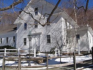
The Old Town Hall
|
||
|
||
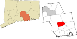
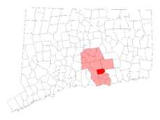 Middlesex County and Connecticut Middlesex County and Connecticut |
||
| Country | ||
| U.S. state | ||
| County | Middlesex | |
| Region | Lower CT River Valley | |
| Incorporated | 1836 | |
| Government | ||
| • Type | Selectman-town meeting | |
| Area | ||
| • Total | 16.8 sq mi (43.5 km2) | |
| • Land | 16.0 sq mi (41.5 km2) | |
| • Water | 0.8 sq mi (2.1 km2) | |
| Elevation | 377 ft (115 m) | |
| Population
(2020)
|
||
| • Total | 3,749 | |
| • Density | 223.2/sq mi (86.18/km2) | |
| Time zone | UTC-5 (EST) | |
| • Summer (DST) | UTC-4 (EDT) | |
| ZIP code |
06412
|
|
| Area code(s) | 860/959 | |
| FIPS code | 09-14300 | |
| GNIS feature ID | 0213407 | |
Chester is a small town located in Middlesex County, Connecticut, in the United States. It is part of the Lower Connecticut River Valley Planning Region. In 2020, about 3,749 people lived there. The main part of town, called Chester Center, is recognized as a special area by the U.S. Census Bureau. The town's name comes from Chester, a city in England.
Contents
History of Chester
The area where Chester is now was once home to Native American people, possibly the Hammonasset tribe. They had a village called Pattaquonk. This name also referred to a 30-acre area set aside for the Wangunk tribe in 1662. This was part of the land bought by the English that included the towns of Haddam and East Haddam.
English settlers started living in the area around 1692. Chester officially became a town in 1836. It was formed from the northern part of a larger town called Saybrook.
In 1769, a man named Jonathan Warner received permission to start a ferry service across the Connecticut River. This ferry became known as the Chester-Hadlyme Ferry. It is the second-oldest ferry in Connecticut that has been running continuously. Today, its location is a state historical landmark.
Geography of Chester
Chester covers a total area of about 16.8 square miles (43.5 square kilometers). Most of this area, about 16.0 square miles (41.5 square kilometers), is land. The rest, about 0.8 square miles (2.1 square kilometers), is water, making up about 4.75% of the town's total area.
People of Chester
Chester has grown over the years. Here's how the population has changed:
| Historical population | |||
|---|---|---|---|
| Census | Pop. | %± | |
| 1840 | 974 | — | |
| 1850 | 992 | 1.8% | |
| 1860 | 1,015 | 2.3% | |
| 1870 | 1,094 | 7.8% | |
| 1880 | 1,177 | 7.6% | |
| 1890 | 1,301 | 10.5% | |
| 1900 | 1,328 | 2.1% | |
| 1910 | 1,419 | 6.9% | |
| 1920 | 1,675 | 18.0% | |
| 1930 | 1,463 | −12.7% | |
| 1940 | 1,676 | 14.6% | |
| 1950 | 1,920 | 14.6% | |
| 1960 | 2,520 | 31.3% | |
| 1970 | 2,982 | 18.3% | |
| 1980 | 3,068 | 2.9% | |
| 1990 | 3,417 | 11.4% | |
| 2000 | 3,743 | 9.5% | |
| 2010 | 3,994 | 6.7% | |
| 2020 | 3,749 | −6.1% | |
| U.S. Decennial Census | |||
In 2000, there were 3,743 people living in Chester. Most residents were White (about 96.79%). Other groups included African American (0.85%), Native American (0.35%), and Asian (0.83%). About 1.71% of the population identified as Hispanic or Latino.
The average age of people in Chester in 2000 was 42 years old. About 22.3% of the population was under 18 years old.
Education in Chester
Chester is part of Regional School District #4, along with the nearby towns of Essex and Deep River.
- Middle School: Students in grades 7 and 8 attend John Winthrop Junior High School, located in Deep River.
- High School: Students in grades 9 through 12 go to Valley Regional High School, also in Deep River.
- Elementary School: Each town in the district, including Chester, has its own elementary school for students in kindergarten through 6th grade.
Chester in Media
Chester has been a filming location for movies!
- The 1959 film It Happened to Jane, starring Doris Day and Jack Lemmon, was filmed in Chester.
- Parts of the 1971 horror film Let's Scare Jessica to Death were also filmed here, including scenes at the Chester–Hadlyme Ferry.
Points of Interest in Chester
Chester has several interesting places to visit:
- The Beth Shalom Rodfe Zedek synagogue is known for its unique and beautiful building design.
- Goodspeed-at-Chester is a second theater location for Goodspeed Musicals, which puts on plays and shows.
- The Chester Museum at the Mill is a museum run by the Chester Historical Society, where you can learn about the town's past.
- The Chester–Hadlyme Ferry is a historic ferry service that has been running for a very long time.
- Camp Hazen YMCA is a popular summer camp.
Historic Places in Chester
Several buildings and places in Chester are listed on the National Register of Historic Places, meaning they are important historical sites:
- Charles Daniels House – added in 1988
- Dr. Ambrose Pratt House – added in 1972
- Jonathan Warner House – added in 1978
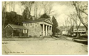
- Old Town Hall – added in 1972
- Villa Bella Vista – added in 2000
Industry in Chester
Chester is home to the Whelen Engineering Corporation. This company is a major designer and seller of warning equipment, like lights and sirens, used by public services across North America.
Transportation in Chester
Air Travel
The Chester Airport is a local airport with one paved runway. It is privately owned by Whelen Aviation.
Ground Travel
The Estuary Transit District provides public transportation services in Chester and nearby towns through its 9 Town Transit Service. You can use these services to connect to the Old Saybrook Train Station, where you can catch Amtrak and Shoreline East trains.
Notable People from Chester
Many interesting people have connections to Chester:
- Constance Baker Motley (1921–2005), a famous civil rights leader.
- Art Carney (1918–2003), an actor who lived and passed away in Chester.
- Paul Hopkins (1904–2004), a major league baseball pitcher who was born in town.
- Sol LeWitt (1928–2007), a well-known artist.
- Michael P. Price (born 1938), a theater producer and artistic director.
- Morley Safer (1931–2016), a famous CBS news correspondent and anchor on 60 Minutes.
- Max Showalter (1917–2000), a film and television actor who retired to Chester.
- Washington F. Willcox (1834–1909), a US Congressman who lived in Chester.
Pictures of Chester
See also
 In Spanish: Chester (Connecticut) para niños
 | Aaron Henry |
 | T. R. M. Howard |
 | Jesse Jackson |


