Mount Sinai, New York facts for kids
Quick facts for kids
Mount Sinai, New York
|
|
|---|---|
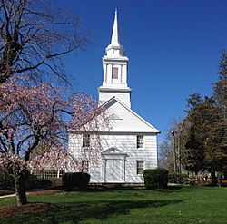
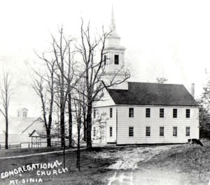
The c.1807 Mount Sinai Congregational Church
|
|
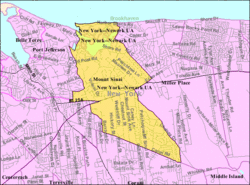
U.S. Census map
|
|
| Country | United States |
| State | New York |
| County | Suffolk |
| Area | |
| • Total | 7.44 sq mi (19.27 km2) |
| • Land | 6.00 sq mi (15.54 km2) |
| • Water | 1.44 sq mi (3.73 km2) |
| Elevation | 33 ft (10 m) |
| Population
(2020)
|
|
| • Total | 11,623 |
| • Density | 1,937.49/sq mi (748.02/km2) |
| Time zone | UTC−05:00 (Eastern Time Zone) |
| • Summer (DST) | UTC−04:00 |
| ZIP Code |
11766
|
| Area code(s) | 631, 934 |
| FIPS code | 36-49066 |
| GNIS feature ID | 0957909 |
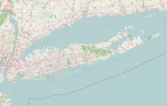
Mount Sinai is a small community called a hamlet in Suffolk County, New York, United States. It's located on the North Shore of Long Island. In 2020, about 11,623 people lived there.
Mount Sinai was first settled in the 1660s. Back then, it was known as Old Mans. The name changed in the 1840s. It started as a farming area. Later, in the late 1800s, it became a popular vacation spot. By the mid-1900s, it grew into a suburb of New York City. Today, it's mostly a place where people live. It also has Mount Sinai Harbor and a popular public beach called Cedar Beach.
Contents
A Look Back: Mount Sinai's History
Mount Sinai has a long and interesting history, starting in the 1660s.
How Mount Sinai Began
The Native American Seatocot tribe originally called this area Nonowatuck. This name meant "stream that dries up." European settlers from nearby Setauket bought the land from the Native Americans in 1664.
The first European name for the town was "Old Mans." No one is quite sure why it was called this. One story says it was a joke. An old Englishman named Major John Gotherson was tricked into thinking he bought land here. When his representatives were turned away, people started calling the area "the Old Mans."
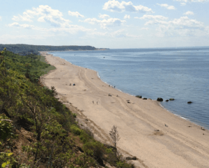
During the American Revolution, the British controlled this area. But because it was so far away, they didn't keep soldiers here. Many families moved to Connecticut to escape the British. American spies visited local patriots to get information and supplies for the war. In 1780, American Major Benjamin Tallmadge and his soldiers landed at Cedar Beach. They marched south and successfully attacked the British at Manor St. George. The path they took is now a historic trail.
From Farms to a Growing Community
Houses were built slowly at first. Most early homes were within a mile of the harbor. Not many houses were built south of North Country Road until the late 1800s. Much of the land there was used for farming.
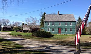
No buildings from the 1600s are still standing. Six buildings from the 1700s (1705 to 1790) still exist. Many more historic buildings from the 1800s remain.
In 1840, the people of Old Mans wanted a post office. They thought "Old Mans" wasn't a good name. So, they changed it to Mount Vernon. But there was already a Mount Vernon in New York! So, they went back to Old Mans for a short time. Then, the first postmaster, Charles Phillips, chose the name Mount Sinai. This name comes from the biblical mountain. Legend says he picked it by randomly pointing a needle at his Bible. Residents have used the name Mount Sinai since 1841 or 1842.
Besides farms, the town's trees provided wood for shipbuilding. This industry was big in nearby Port Jefferson. Some shipbuilders and sail-makers lived in Mount Sinai and traveled to Port Jefferson for work. There were also mills along Pipe Stave Hollow and Crystal Brook Hollow roads. Records show that windmills stood on the hills overlooking the harbor.
As more people moved in, some businesses opened along Route 25A. However, Mount Sinai never developed a large town center. Residents usually went to Port Jefferson for shopping and other services.
Places of Worship
Before 1740, people in Mount Sinai had to go to Setauket for church services. In the 1740s, a Protestant church was built, but it's no longer there. The local Congregational group started in 1789. In 1807, they built the Mount Sinai Congregational Church, which is still active today. In the early 1800s, a Methodist church was built on Shore Road. But this church was later sold when its members joined the church in Port Jefferson.
Becoming a Resort Town
When the Long Island Rail Road reached Port Jefferson in 1879, more visitors came. From 1895 to 1938, the train even went through Mount Sinai to Wading River. People from New York City and other parts of Long Island came to enjoy the beaches and peaceful countryside.
Mount Sinai began to develop as a resort area in 1841. A special care facility for sick children was built on the southwest side of Mount Sinai Harbor. This place had housing and volunteers on a 130-acre (53 ha) plot. It was chosen because it was close to St. Charles Hospital in Port Jefferson. On April 2, 1892, this land was sold to Dr. Jerome Walker. He created the Crystal Brook Park Association, which is still a private community today.
Seasonal vacation homes were built along Mount Sinai Harbor. Cedar Beach, located on a strip of land between the harbor and the Long Island Sound, became a very popular spot. The Chandler Estate, on the south side of the harbor, was turned into vacation cottages. Famous people like Marilyn Monroe and Arthur Miller stayed there in the 1950s.
Suburban Growth
In the first half of the 1900s, building slowed down. Large farms still existed, but small groups of homes popped up around the hamlet. For example, there were "colonies" of homes off Pipe Stave Hollow Road.
It wasn't until the 1960s that many new housing developments appeared. This happened as suburbanization spread eastward. Farmland was sold and turned into homes for new residents. This included the 404-acre Davis Peach Farm, which was developed in the early 2000s.
Geography and Weather
Mount Sinai is located on the North Shore of Long Island, right next to Long Island Sound. It covers about 16.6 square kilometers (6.4 square miles). Most of this is land, with about 1.1 square kilometers (0.4 square miles) being water.
Mount Sinai has a humid subtropical climate. This means it has hot, humid summers and mild winters. The average temperature for the year is about 54.7°F (12.6°C). July is the warmest month, averaging 75.3°F (24.1°C). January is the coldest, averaging 33.7°F (0.9°C). The area gets about 48.50 inches (123 cm) of rain each year.
| Climate data for Mount Sinai, NY (1991-2020 normals, extremes 2010−present) | |||||||||||||
|---|---|---|---|---|---|---|---|---|---|---|---|---|---|
| Month | Jan | Feb | Mar | Apr | May | Jun | Jul | Aug | Sep | Oct | Nov | Dec | Year |
| Record high °F (°C) | 71 (22) |
68 (20) |
79 (26) |
90 (32) |
93 (34) |
93 (34) |
97 (36) |
96 (36) |
94 (34) |
91 (33) |
82 (28) |
71 (22) |
97 (36) |
| Mean daily maximum °F (°C) | 41.0 (5.0) |
42.9 (6.1) |
50.0 (10.0) |
63.7 (17.6) |
71.7 (22.1) |
78.2 (25.7) |
83.1 (28.4) |
81.8 (27.7) |
74.7 (23.7) |
64.8 (18.2) |
56.0 (13.3) |
46.1 (7.8) |
62.8 (17.1) |
| Daily mean °F (°C) | 33.7 (0.9) |
35.3 (1.8) |
41.4 (5.2) |
53.2 (11.8) |
61.6 (16.4) |
69.6 (20.9) |
75.3 (24.1) |
74.4 (23.6) |
68.0 (20.0) |
56.8 (13.8) |
48.2 (9.0) |
39.1 (3.9) |
54.7 (12.6) |
| Mean daily minimum °F (°C) | 26.3 (−3.2) |
27.8 (−2.3) |
32.8 (0.4) |
42.8 (6.0) |
51.4 (10.8) |
61.1 (16.2) |
67.5 (19.7) |
67.0 (19.4) |
61.3 (16.3) |
48.8 (9.3) |
40.3 (4.6) |
32.1 (0.1) |
46.6 (8.1) |
| Record low °F (°C) | −1 (−18) |
−3 (−19) |
7 (−14) |
22 (−6) |
35 (2) |
38 (3) |
52 (11) |
46 (8) |
41 (5) |
30 (−1) |
17 (−8) |
10 (−12) |
−3 (−19) |
| Average precipitation inches (mm) | 3.71 (94) |
3.20 (81) |
4.65 (118) |
4.42 (112) |
3.89 (99) |
3.93 (100) |
3.88 (99) |
4.02 (102) |
4.30 (109) |
4.24 (108) |
3.70 (94) |
4.56 (116) |
48.50 (1,232) |
| Source: NOAA | |||||||||||||
Mount Sinai Harbor: A Natural Treasure
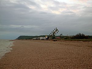
The northern part of Mount Sinai Harbor is a busy recreation area. It's on a 2-mile long strip of land. This includes Cedar Beach, which is one of the most popular beaches on the North Shore in summer. A special area for marine life and a nature preserve connect parts of Cedar Beach. They have walking trails and protect the sand dunes.
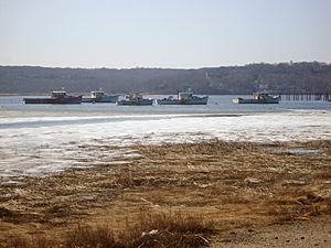
Lands set aside in 1664 are now used for public fun. Some are rented for a fishing station, a yacht club, and a boatyard. Many commercial fishermen work from the harbor and fish in Long Island Sound. The strip of land, best reached from Miller Place, has old vacation houses. Most of these are now used all year round.
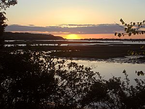
The southern part of the harbor is much quieter. People enjoy clamming when the tide is low and fishing when it's high. Throughout history, Mount Sinai Harbor has been used for catching shellfish, fishing for snapper and flounder, hunting waterfowl, and harvesting salt hay. Satterly Landing, a small park, offers nice views across the harbor.
The harbor's original opening was on the east side. But winds and tides kept making it narrower. Local people worked hard to widen it. In the mid-1800s, a new opening was dug on the west side. Tides still bring in sand, making the harbor entrance narrow. It needs to be dredged (dug deeper) to let boats get to the Sound. In the 1900s, there were three big disagreements about plans to dredge the harbor. Two projects were approved, creating the channels and deep basin we see today. Local groups finally stopped the dredging in the late 1960s.
People of Mount Sinai
| Historical population | |||
|---|---|---|---|
| Census | Pop. | %± | |
| 2020 | 11,623 | — | |
| U.S. Decennial Census | |||
In 2010, Mount Sinai had 12,118 residents. Most people (about 92%) were White. About 4% were Asian, and 1.5% were Black or African American. About 5.8% of the population was Hispanic or Latino.
The average household had about 2.96 people. Many households (46.4%) had children under 18 living with them. The median age in Mount Sinai was 41.9 years old. This means half the people were younger than 41.9 and half were older.
The median income for a household in Mount Sinai was about $85,605. This means half the households earned more than this, and half earned less. About 1.8% of families and 3.6% of all people lived below the poverty threshold.
Learning in Mount Sinai
For some time, Mount Sinai didn't have enough schools. Children had to go to school in the neighboring Port Jefferson School District. But new school buildings were built in 1966 and 1978. This allowed students up to grade 9 to stay in Mount Sinai. Mount Sinai High School opened in September 1991. All three schools in the Mount Sinai School District are located on one shared campus.
Famous People from Mount Sinai
Mount Sinai has been home to or visited by several notable people:
- Lionel Barrymore – a famous actor from movies, stage, and radio, rented a summer home here.
- Ritchie Blackmore – a guitarist known for the bands Deep Purple and Rainbow, lives in Mount Sinai.
- Sam Faber – an ice hockey player, was born in Mount Sinai.
- Dawn Powell – a novelist, playwright, and short story writer, rented a summer home here.
- Norman Rosten – a poet, playwright, and novelist, rented a summer home here.
- Trent Beretta – a professional wrestler, was born in Mount Sinai.
Images for kids
See also
 In Spanish: Mount Sinai para niños
 | Emma Amos |
 | Edward Mitchell Bannister |
 | Larry D. Alexander |
 | Ernie Barnes |


