Southampton, New York facts for kids
Quick facts for kids
Southampton, New York
|
|||
|---|---|---|---|
| Town of Southampton | |||
|
|||

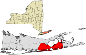
Location in Suffolk County
|
|||
| Country | United States | ||
| State | New York | ||
| County | Suffolk | ||
| Government | |||
| • Type | Civil township | ||
| Area | |||
| • Total | 293.46 sq mi (760.06 km2) | ||
| • Land | 139.13 sq mi (360.35 km2) | ||
| • Water | 154.33 sq mi (399.71 km2) | ||
| Elevation | 26 ft (8 m) | ||
| Population
(2020)
|
|||
| • Total | 69,036 | ||
| • Density | 496.19/sq mi (191.58/km2) | ||
| Time zone | UTC−5 (Eastern (EST)) | ||
| • Summer (DST) | UTC−4 (EDT) | ||
| ZIP Codes |
11968-11969
|
||
| Area code(s) | 631 | ||
| FIPS code | 36-103-68473 | ||
| GNIS feature ID | 0965893 | ||
Southampton is a town in Suffolk County, New York. It is located on the South Fork of Long Island. In 2020, about 69,036 people lived there.
Southampton is part of a famous area called the Hamptons. Stony Brook University also has a campus in Southampton.
Contents
History of Southampton
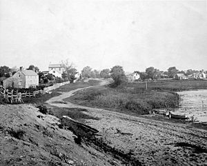
The town of Southampton was started in 1640. Settlers from Lynn, Massachusetts, came here. They bought land from the local Shinnecock Indian Nation. The first group included eight men, one woman, and a boy. They landed at a place called Conscience Point.
By July 7, 1640, they had decided on the town's borders. More families moved to Southampton in the next few years. Today, thousands of people live in Southampton.
Whaling and Early Life
From 1644, the colonists started hunting whales. This was important for the history of whaling in New England. They would chase pilot whales onto the beaches to catch them. They also used whales that washed up on shore.
The settlers learned hunting methods from the Native Americans. They made their weapons and boats better. Then, they started hunting whales in the ocean.
The first meeting house was on a hill. Today, Southampton Hospital is on that same spot. The oldest house still standing is the Halsey House. It was built by Thomas Halsey, one of the first English traders with the Shinnecocks.
Southampton has 47 public and private cemeteries. Shinnecock Hills Golf Club is also said to be an old Native American burial ground. The town is named after the port city of Southampton in Hampshire, England.
You can visit Southampton's official history website. It shows over 100 interesting places and more than 1500 photos.
Native American Land Claim
In 2005, the Shinnecock Indian Nation filed a lawsuit. They wanted 3,500 acres (14 km2) of land back in Southampton. This land is near their reservation. They also asked for money for damages from past land deals.
The land in question includes the Shinnecock Hills Golf Club. The Shinnecock people say it is a burial ground for their tribe. They argued that the state's approval of an 1859 land sale was wrong. They said it broke a 1,000-year lease from 1703. The court ruled against the tribe in 2006.
Geography and Climate
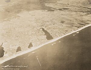
Southampton is bordered by the Atlantic Ocean to the south. The Peconic Bay is to the north. East Hampton is to the east, and Brookhaven is to the west. It also has a small border with Riverhead in the northwest.
The town covers about 293.5 square miles (760.1 km2). About 139.1 square miles (360.3 km2) is land. The rest, about 154.3 square miles (399.7 km2), is water.
Southampton has seven villages and 16 unincorporated areas. These unincorporated areas are called hamlets in New York state.
Villages (incorporated)
- North Haven
- Quogue
- Sag Harbor – partly in the Town of East Hampton
- Sagaponack
- Southampton (village)
- Westhampton Beach
- West Hampton Dunes
Hamlets (unincorporated)
- Bridgehampton
- Eastport – partly with the Town of Brookhaven
- East Quogue
- Flanders
- Hampton Bays
- Northampton
- North Sea
- Noyack
- Quiogue
- Remsenburg
- Riverside
- Shinnecock Hills
- Speonk
- Tuckahoe
- Water Mill
- Westhampton
Southampton Weather
Southampton has a climate with hot summers. It gets cold enough for one or two months to average below freezing. Six months average above 50°F (10°C). One or two months average above 72°F (22°C).
| Climate data for Bridgehampton, New York (1991–2020 normals, extremes 1930–present) | |||||||||||||
|---|---|---|---|---|---|---|---|---|---|---|---|---|---|
| Month | Jan | Feb | Mar | Apr | May | Jun | Jul | Aug | Sep | Oct | Nov | Dec | Year |
| Record high °F (°C) | 67 (19) |
63 (17) |
79 (26) |
92 (33) |
93 (34) |
95 (35) |
102 (39) |
100 (38) |
94 (34) |
88 (31) |
77 (25) |
70 (21) |
102 (39) |
| Mean maximum °F (°C) | 56.3 (13.5) |
54.5 (12.5) |
63.6 (17.6) |
72.7 (22.6) |
82.1 (27.8) |
88.4 (31.3) |
92.1 (33.4) |
89.6 (32.0) |
84.4 (29.1) |
76.3 (24.6) |
66.5 (19.2) |
60.1 (15.6) |
93.7 (34.3) |
| Mean daily maximum °F (°C) | 38.5 (3.6) |
39.7 (4.3) |
45.7 (7.6) |
55.3 (12.9) |
65.1 (18.4) |
74.5 (23.6) |
80.6 (27.0) |
79.5 (26.4) |
72.8 (22.7) |
62.6 (17.0) |
52.6 (11.4) |
44.0 (6.7) |
59.2 (15.1) |
| Daily mean °F (°C) | 30.7 (−0.7) |
31.6 (−0.2) |
37.7 (3.2) |
46.7 (8.2) |
56.2 (13.4) |
65.8 (18.8) |
72.0 (22.2) |
70.9 (21.6) |
64.2 (17.9) |
53.7 (12.1) |
44.3 (6.8) |
36.1 (2.3) |
50.8 (10.4) |
| Mean daily minimum °F (°C) | 23.0 (−5.0) |
23.6 (−4.7) |
29.7 (−1.3) |
38.1 (3.4) |
47.4 (8.6) |
57.1 (13.9) |
63.5 (17.5) |
62.2 (16.8) |
55.6 (13.1) |
44.8 (7.1) |
36.0 (2.2) |
28.3 (−2.1) |
42.4 (5.8) |
| Mean minimum °F (°C) | 6.4 (−14.2) |
9.5 (−12.5) |
15.8 (−9.0) |
26.7 (−2.9) |
35.0 (1.7) |
44.8 (7.1) |
53.2 (11.8) |
51.4 (10.8) |
42.7 (5.9) |
30.6 (−0.8) |
21.6 (−5.8) |
14.3 (−9.8) |
4.7 (−15.2) |
| Record low °F (°C) | −11 (−24) |
−12 (−24) |
4 (−16) |
14 (−10) |
29 (−2) |
36 (2) |
45 (7) |
41 (5) |
35 (2) |
22 (−6) |
10 (−12) |
−6 (−21) |
−12 (−24) |
| Average precipitation inches (mm) | 4.05 (103) |
3.61 (92) |
4.94 (125) |
4.34 (110) |
3.57 (91) |
3.86 (98) |
3.16 (80) |
3.94 (100) |
4.79 (122) |
4.72 (120) |
3.81 (97) |
4.97 (126) |
49.76 (1,264) |
| Average snowfall inches (cm) | 7.2 (18) |
8.6 (22) |
6.0 (15) |
0.8 (2.0) |
0.0 (0.0) |
0.0 (0.0) |
0.0 (0.0) |
0.0 (0.0) |
0.0 (0.0) |
0.0 (0.0) |
0.1 (0.25) |
4.1 (10) |
26.8 (68) |
| Average extreme snow depth inches (cm) | 3.9 (9.9) |
5.3 (13) |
3.4 (8.6) |
0.5 (1.3) |
0.0 (0.0) |
0.0 (0.0) |
0.0 (0.0) |
0.0 (0.0) |
0.0 (0.0) |
0.0 (0.0) |
0.0 (0.0) |
2.6 (6.6) |
8.1 (21) |
| Average precipitation days (≥ 0.01 in) | 10.4 | 9.9 | 9.9 | 10.8 | 10.4 | 9.0 | 7.8 | 7.9 | 8.1 | 9.4 | 9.6 | 10.5 | 113.7 |
| Average snowy days (≥ 0.1 in) | 3.0 | 3.0 | 2.2 | 0.3 | 0.0 | 0.0 | 0.0 | 0.0 | 0.0 | 0.0 | 0.1 | 1.9 | 10.5 |
| Source: NOAA | |||||||||||||
| Climate data for Westhampton, New York (Francis S. Gabreski Airport), 1991–2020 normals, extremes 1951–present | |||||||||||||
|---|---|---|---|---|---|---|---|---|---|---|---|---|---|
| Month | Jan | Feb | Mar | Apr | May | Jun | Jul | Aug | Sep | Oct | Nov | Dec | Year |
| Record high °F (°C) | 67 (19) |
71 (22) |
76 (24) |
88 (31) |
93 (34) |
96 (36) |
100 (38) |
99 (37) |
94 (34) |
88 (31) |
80 (27) |
71 (22) |
100 (38) |
| Mean maximum °F (°C) | 56.7 (13.7) |
55.3 (12.9) |
64.8 (18.2) |
75.0 (23.9) |
82.4 (28.0) |
88.8 (31.6) |
93.1 (33.9) |
90.6 (32.6) |
84.9 (29.4) |
77.6 (25.3) |
67.1 (19.5) |
61.0 (16.1) |
94.8 (34.9) |
| Mean daily maximum °F (°C) | 38.7 (3.7) |
40.4 (4.7) |
46.8 (8.2) |
56.6 (13.7) |
66.2 (19.0) |
75.4 (24.1) |
81.3 (27.4) |
80.3 (26.8) |
73.6 (23.1) |
63.4 (17.4) |
53.3 (11.8) |
44.5 (6.9) |
60.0 (15.6) |
| Daily mean °F (°C) | 29.4 (−1.4) |
30.6 (−0.8) |
37.2 (2.9) |
46.1 (7.8) |
55.9 (13.3) |
65.6 (18.7) |
71.9 (22.2) |
70.8 (21.6) |
63.7 (17.6) |
52.9 (11.6) |
43.5 (6.4) |
35.2 (1.8) |
50.2 (10.1) |
| Mean daily minimum °F (°C) | 20.0 (−6.7) |
20.9 (−6.2) |
27.6 (−2.4) |
35.6 (2.0) |
45.6 (7.6) |
55.8 (13.2) |
62.5 (16.9) |
61.4 (16.3) |
53.9 (12.2) |
42.5 (5.8) |
33.7 (0.9) |
25.8 (−3.4) |
40.4 (4.7) |
| Mean minimum °F (°C) | −1.7 (−18.7) |
2.8 (−16.2) |
9.2 (−12.7) |
20.3 (−6.5) |
29.0 (−1.7) |
39.6 (4.2) |
49.5 (9.7) |
47.6 (8.7) |
38.0 (3.3) |
25.7 (−3.5) |
15.7 (−9.1) |
8.1 (−13.3) |
−3.4 (−19.7) |
| Record low °F (°C) | −15 (−26) |
−12 (−24) |
−9 (−23) |
11 (−12) |
24 (−4) |
33 (1) |
42 (6) |
39 (4) |
32 (0) |
16 (−9) |
6 (−14) |
−1 (−18) |
−15 (−26) |
| Average precipitation inches (mm) | 3.19 (81) |
2.72 (69) |
4.28 (109) |
3.79 (96) |
3.31 (84) |
3.50 (89) |
2.88 (73) |
3.74 (95) |
3.75 (95) |
4.65 (118) |
3.48 (88) |
4.17 (106) |
43.46 (1,104) |
| Average snowfall inches (cm) | 8.4 (21) |
9.5 (24) |
7.5 (19) |
0.9 (2.3) |
0.0 (0.0) |
0.0 (0.0) |
0.0 (0.0) |
0.0 (0.0) |
0.0 (0.0) |
0.0 (0.0) |
0.8 (2.0) |
6.8 (17) |
33.9 (85.3) |
| Average precipitation days (≥ 0.01 in) | 10.5 | 10.1 | 10.7 | 11.9 | 13.6 | 11.1 | 9.5 | 9.7 | 10.2 | 12.0 | 10.5 | 11.0 | 130.8 |
| Average snowy days (≥ 0.1 in) | 4.6 | 4.5 | 3.7 | 0.4 | 0.0 | 0.0 | 0.0 | 0.0 | 0.0 | 0.0 | 0.3 | 3.4 | 16.9 |
| Source: NOAA (mean maxima/minima 1998–2020, snow/snow days 1951–1969) | |||||||||||||
People in Southampton
| Historical population | |||
|---|---|---|---|
| Census | Pop. | %± | |
| 1790 | 3,408 | — | |
| 1800 | 3,670 | 7.7% | |
| 1810 | 3,899 | 6.2% | |
| 1820 | 4,229 | 8.5% | |
| 1830 | 4,850 | 14.7% | |
| 1840 | 6,205 | 27.9% | |
| 1850 | 6,501 | 4.8% | |
| 1860 | 6,803 | 4.6% | |
| 1870 | 6,135 | −9.8% | |
| 1880 | 6,352 | 3.5% | |
| 1890 | 8,200 | 29.1% | |
| 1900 | 10,371 | 26.5% | |
| 1910 | 11,240 | 8.4% | |
| 1920 | 11,614 | 3.3% | |
| 1930 | 15,341 | 32.1% | |
| 1940 | 15,295 | −0.3% | |
| 1950 | 16,830 | 10.0% | |
| 1960 | 27,095 | 61.0% | |
| 1970 | 36,154 | 33.4% | |
| 1980 | 42,849 | 18.5% | |
| 1990 | 44,976 | 5.0% | |
| 2000 | 54,713 | 21.6% | |
| 2010 | 56,790 | 3.8% | |
| 2020 | 69,036 | 21.6% | |
| U.S. Decennial Census | |||
In 2000, there were 54,712 people living in Southampton. There were 21,504 households. About 27.1% of households had children under 18. Most households (50.8%) were married couples.
The average household had 2.45 people. The average family had 2.99 people. The median age in the town was 40 years old.
In 2016, the 11962 zip code in Sagaponack was very expensive. It was listed as the most expensive in the U.S. The average home there sold for $8.5 million.
Southampton Economy
Here are some of the biggest employers in Southampton:
| Employer | Community |
|---|---|
| Southampton Hospital | Southampton |
| Stop & Shop | Southampton |
| Village of Southampton | Southampton |
| Southampton Union Free School District | Southampton |
| Meadow Club of Southampton | Southampton |
| Hardy Fuel | Shinnecock Hills |
| The Hamptons Center for Rehabilitation and Nursing | Southampton |
| Hampton Jitney | North Sea |
| Bathing Corporation of Southampton | Southampton |
Media in Southampton
Print News
- The Southampton Press
Radio Stations
- Bridgehampton - WBAZ (102.5 FM)
- Hampton Bays - WLIR (107.1 FM)
- Sag Harbor - WLNG (92.1 FM)
- Southampton - WHFM (95.3 FM), WLIW (88.3 FM), WRLI (91.3 FM)
- Westhampton - WBON (98.5 FM)
Transportation in Southampton
Train Lines
The Long Island Rail Road has a line in Southampton called the Montauk Branch. It has stations in:
- Speonk
- Westhampton
- Hampton Bays
- Southampton
- Bridgehampton
The stations at Quogue and Southampton Campus closed in 1998.
Bus Service
Suffolk County Transit buses serve Southampton. You can also take Hampton Jitney buses to and from New York City.
Main Roads
 New York State Route 24
 New York State Route 27
 New York State Route 114
 County Route 38 (Suffolk County, New York)
 County Route 51 (Suffolk County, New York)
 County Route 79 (Suffolk County, New York)
 Montauk Highway, including County Route 80 (Suffolk County, New York)
 County Route 104 (Suffolk County, New York)
 County Route 105 (Suffolk County, New York)
Airports and Ferries
Southampton has two airports:
- Francis S. Gabreski Airport (north of Westhampton)
- East Hampton Airport (on the border with East Hampton)
The Southampton Heliport is also on the east side of the Shinnecock Inlet.
A ferry in Southampton takes cars across the Shelter Island Sound. It connects North Haven to Shelter Island.
Famous People from Southampton
- Riley Biggs, American football player
- Tim Bishop, U.S. Representative
- Amanda Clark, Olympic sailor
- Mary L. Cleave, engineer and NASA astronaut
- Pyrrhus Concer, former slave
- Pamela Council, artist
- Scott Disick, reality television celebrity
- Michael J. Fox, actor
- Paul Gibson, Major League baseball pitcher
- Grenville Goodwin, anthropologist
- Nicoll Halsey, U.S. Representative
- George Rogers Howell, historian
- Andre Johnson, NFL football player
- John William Kilbreth, U.S. Army brigadier general
- Calvin Klein, fashion designer
- David Koch, billionaire
- Howard Lutnick, billionaire businessman
- Orson Desaix Munn II, publisher
- Jacqueline Bouvier Kennedy Onassis, First Lady of the United States (1961–63)
- Jean Shafiroff, philanthropist and socialite
- Howard Stein, financier
- Howard Stern, radio host
- Carlos Eduardo Stolk, business magnate
- Carole Terry, musician
- Foots Walker, NBA basketball player
- P. G. Wodehouse, writer
- Zach Erdem, restaurateur and reality television celebrity
- Carl Yastrzemski, Hall of Fame Major League baseball player
See also
 In Spanish: Southampton (Nueva York) para niños
 | Roy Wilkins |
 | John Lewis |
 | Linda Carol Brown |


