Sag Harbor, New York facts for kids
Quick facts for kids
Sag Harbor, New York
|
|
|---|---|
| Incorporated Village of Sag Harbor | |
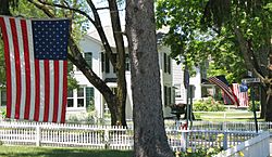
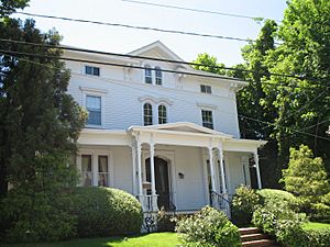
Sag Harbor street scene
|
|
 |
|
| Country | United States |
| State | New York |
| County | Suffolk |
| Town | |
| Incorporated | March 26, 1846 |
| Area | |
| • Total | 1.80 sq mi (4.68 km2) |
| • Land | 1.79 sq mi (4.63 km2) |
| • Water | 0.02 sq mi (0.05 km2) |
| Elevation | 26 ft (8 m) |
| Population
(2020)
|
|
| • Total | 2,772 |
| • Density | 1,551.20/sq mi (598.79/km2) |
| Time zone | UTC−5 (Eastern (EST)) |
| • Summer (DST) | UTC−4 (EDT) |
| ZIP Code |
11963
|
| Area codes | 631, 934 |
| FIPS code | 36-64485 |
| GNIS feature ID | 0963216 |
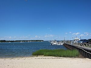
Sag Harbor is a small village in Suffolk County, New York, United States. It is located on eastern Long Island, partly in the town of Southampton and partly in East Hampton. The village grew up around a busy port on Gardiners Bay. In 2020, about 2,772 people lived there.
The main business area of Sag Harbor is a historic place. It is called the Sag Harbor Village District and is listed on the National Register of Historic Places. In the 1800s, it was a very important port for whaling and shipping. Later, it became a popular summer spot for wealthy people.
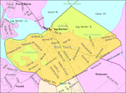
Sag Harbor is mostly in Southampton, with about two-fifths of it in East Hampton. Division Street marks the border between the two towns. The village has many old buildings and places that remind us of its past as a whaling port. It was even the first official port of entry for the new United States. It also had the first custom house on Long Island.
Contents
History of Sag Harbor
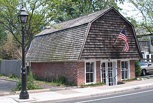
English colonists first settled Sag Harbor between 1707 and 1730. Many settlers came by water from New England. The name "Sag Harbor" was first used in a shipping document in 1730.
Some people think the village was named after nearby Sagaponack. But historians say both places were named after a plant called sagabon. This plant was a root vegetable grown by the local Pequot people. It was an important food source and one of the first crops sent to England by the colonists. Today, this plant is known as the Apios americana.
Sag Harbor During Wars
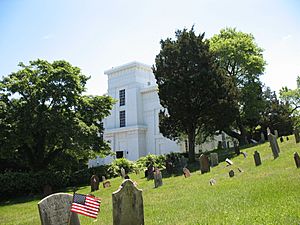
During the American Revolutionary War, many New York Patriots (Americans who wanted independence) left Sag Harbor by boat. They were trying to escape British and Loyalist forces. In 1777, American raiders led by Return Jonathan Meigs attacked a British fort in Sag Harbor. They killed six British soldiers and captured 90 others in an event called Meigs Raid. After the war, the fort was taken down. This area is now known as the Old Burying Ground and is next to the Old Whaler's Church.
During the War of 1812, British ships controlled much of Long Island Sound. One night, some British sailors secretly entered Sag Harbor. They tried to set fire to a ship docked there. But an alarm was sounded, and they quickly left.
Whaling and Shipping Port
Sag Harbor became a very important port for the whaling industry. Whaling involved hunting whales for their oil, which was used in lamps. The village took over from Northwest, another port that was too shallow for bigger ships.
By 1789, Sag Harbor had more large ships for trade than even New York City. It was a major international port. On July 31, 1789, the United States government declared Sag Harbor the first official port of entry for the new country. This meant it was the first stop for ships entering the U.S. The government built a customs house there, the first on Long Island, to collect taxes on goods.
The whaling industry was at its busiest in Sag Harbor in the 1840s. The writer Herman Melville even mentioned Sag Harbor in his famous novel Moby Dick.
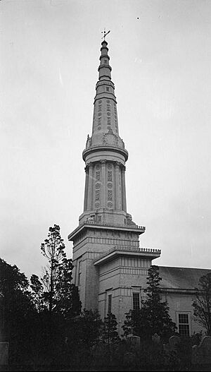
Many historic buildings from this time still stand. The Old Whaler's Church, a Presbyterian church, opened in 1843. It had a tall steeple, 185 feet high, making it the tallest building on Long Island. However, the steeple fell down during the Great Hurricane of 1938 and has not been rebuilt.
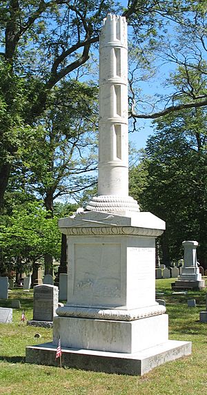
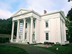
The Sag Harbor Whaling & Historical Museum is in a beautiful Greek Revival home built in 1845. It was designed by architect Minard Lafever for a whaling merchant. Lafever also designed the Old Whaler's Church. The Broken Mast Monument in Oakland Cemetery remembers sailors who died at sea.
The whaling business ended after 1847. New ways to make kerosene and other fuels were found, like from coal oil and later petroleum. The last whaling ship, the Myra, sailed from Sag Harbor in 1871.
Some Sag Harbor ships carried miners around South America to San Francisco during the California Gold Rush. Many of these ships were left there.
Sailor Mercator Cooper left Sag Harbor in 1843 on the ship Manhattan. He was one of the first Americans to visit Tokyo Bay in Japan. Pyrrhus Concer, an African-American sailor, was also on this trip. Cooper later became the first person to step on East Antarctica in 1853.
Modern Sag Harbor
In 1870, the Long Island Rail Road built a train line to Sag Harbor. This brought many visitors and summer residents to the village. The old train station is now a gardening store.
New residents continued to move to Sag Harbor. In 1896, the oldest synagogue on Long Island, Temple Adas Israel, was founded here.
During World War I, the E. W. Bliss Company tested torpedoes in the harbor. They did not have live explosives. The Long Wharf was strengthened with concrete for this. Thomas Alva Edison even watched some of these tests. Divers sometimes still find old torpedoes on the bay floor.
Sag Harbor was the home of writer John Steinbeck from 1955 until he passed away in 1968. He wrote some of his books here, like The Winter of Our Discontent, which was set in a made-up version of Sag Harbor. Steinbeck also started an 11-week road trip across the U.S. from Sag Harbor with his dog, Charley, which he wrote about in Travels with Charley.
Today, the Steinbeck Writers' Retreat offers a place for writers to stay and work at his old home. They also share their work with the community. The Church, an arts center founded by artists Eric Fischl and April Gornik, opened in 2021.
The bridge connecting Sag Harbor and North Haven was renamed in 2008. It is now called The LCpl Jordan Haerter Veterans' Memorial Bridge.
African-American History in Sag Harbor
By the 1830s, houses were shown in the Eastville area on maps. In 1840, the St. David A.M.E. Zion church was built on Eastville Avenue.
Poet Olivia Ward Bush-Banks (1869–1944) was born in Sag Harbor. She had African and Montauk heritage. Author Colson Whitehead wrote a novel called Sag Harbor about his childhood summers in the area.
After World War II, African Americans began to settle in neighborhoods like Sag Harbor Hills, Ninevah, Azurest, Eastville, and Chatfield's Hill. Mrs. Hunter J. Terry encouraged the development of Azurest as a peaceful resort for African Americans. The streets Terry Drive, Richards Drive, and Meredith Avenue are named after her family. Walker and Milton roads are named after African-American whalers. Cuffee Drive is named after Paul Cuffee, a famous African-American whaler.
These neighborhoods are now recognized for their history. In 2019, the Sag Harbor Hills, Azurest, and Ninevah Beach Subdivisions Historic District was listed as a historic place. This helps protect the unique character of these areas.
Geography and Environment
Sag Harbor covers about 4.7 square kilometers (1.8 square miles) of land. It also has about 1.4 square kilometers (0.5 square miles) of water.
In the past, Sag Harbor got its drinking water from wells. As more people moved to the village, fresh water had to be brought in through pipes. The village also works to keep the bay water clean. Sewage is treated before it enters the bay. By 2014, the village was using a special ultra-violet system to kill bacteria in the water.
Natural Areas and Wildlife
Most of Sag Harbor is on a flat, sandy coastal plain. This area was formed by a retreating glacier. Small hills rise up from the shore. These hills have many oak trees and pine trees. Along the bay shores, you can find wetlands and sand dunes.
Sag Harbor is home to many animals. Some endangered species, like the eastern tiger salamander, live in the wetlands around the village. The "Long Pond Greenbelt" is a chain of ponds formed by glaciers. Other natural spots include Barcelona Neck Preserve, Millers Ground Preserve, and Sag Harbor Woods Preserve.
You might see white-tailed deer, red fox, and eastern coyote in these areas. In the bay, you might spot Bottlenose dolphins and harbour porpoises. There are also many types of amphibians and reptiles, like box turtles and different kinds of snakes. A Polish poet named Kazimierz Wierzyński, who lived in Sag Harbor, wrote about the many birds and animals he saw there.
Cilli Farm Preserve
The Cilli Farm was a dairy farm in the early 1900s. The village bought it to create a safe place for wildlife. It acts like an "ecological island" for animals like white-tailed deer. The farm has different habitats, including marshes, grasslands, and forests. These areas help support many different plants and animals.
Sometimes, the bay waters experience "Brown Tide," which is when too many algae grow. This can harm shellfish like scallops and mussels.
The Sag Harbor Oyster Club
The Sag Harbor Oyster Club is a group that works to keep the water clean. They started an "oyster garden" under the village docks. Oysters help clean the water by filtering it.
In 2016, the New York State Department of Environmental Conservation stopped this oyster project. This was because oysters were being grown too close to the sewage treatment plant's outlet pipe. It is against the rules to grow shellfish for people to eat in waters that are not certified as clean. The club said their oysters were not for eating, but the state still stopped the project to be safe.
Media and Entertainment
Local News
Long Island's first newspaper, Frothingham's Long-Island Herald, was published in Sag Harbor from 1791 to 1796. The community newspaper The Corrector started in 1822. Later, it became the Sag Harbor Corrector.
Today, The Sag Harbor Express is the main newspaper for Sag Harbor Village and nearby areas.
Radio Station
WLNG is a radio station that has been broadcasting from Sag Harbor at 92.1 FM since 1969.
Movies and Theater
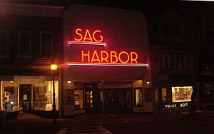
Since 1915, four movie theaters have been at 90 Main Street. The last one was the Sag Harbor Cinema, known for its cool art deco neon sign. A fire destroyed the cinema in 2016, but it was rebuilt and reopened in 2021.
The 1986 film Sweet Liberty, starring Alan Alda, was filmed in Sag Harbor.
In 1991, The Bay Street Theater was started by Sybil Christopher, Emma Walton Hamilton, and Stephen Hamilton. It is located on Long Wharf and offers shows all year.
Actress Julie Andrews lives in Sag Harbor.
Education in Sag Harbor
The local school district is the Sag Harbor Union Free School District. It includes the Sag Harbor Elementary School and Pierson Middle-High School.
Stella Maris Regional School, a private Catholic school, used to be in Sag Harbor but closed in 2011. In 2016, the school district bought the Stella Maris property. It now houses the district's pre-kindergarten program.
Notable People from Sag Harbor
- Julie Andrews, actress
- Jimmy Buffett, musician and singer-songwriter
- William Demby, writer
- Wendy Gaynor, entrepreneur and author
- Billy Joel, singer, songwriter, and pianist
- Dan C. Rizzie, artist and musician
- Roy Scheider, actor
- George Sterling, poet
- Nate Williams, NBA Player
See also
 In Spanish: Sag Harbor para niños
 | Anna J. Cooper |
 | Mary McLeod Bethune |
 | Lillie Mae Bradford |


