
Manorville, New York facts for kids
Quick facts for kids
Manorville, New York
|
|
|---|---|

|
|

U.S. Census map
|
|

Manorville, New York
Location in New York
|
|
| Country | |
| State | |
| County | Suffolk |
| Town | Brookhaven |
| Area | |
| • Total | 25.47 sq mi (65.98 km2) |
| • Land | 25.43 sq mi (65.87 km2) |
| • Water | 0.04 sq mi (0.11 km2) |
| Elevation | 52 ft (16 m) |
| Population
(2020)
|
|
| • Total | 14,317 |
| • Density | 562.97/sq mi (217.36/km2) |
| Time zone | UTC−05:00 (Eastern Time Zone) |
| • Summer (DST) | UTC−04:00 |
| ZIP Code |
11949
|
| Area code(s) | 631, 934 |
| FIPS code | 36-45139 |
| GNIS feature ID | 0970329 |
Manorville is a community located in Suffolk County, New York. It is known as a hamlet and a census-designated place (CDP). A CDP is a special area defined by the government for collecting population data. In 2020, about 14,317 people lived here.
Most of Manorville is within the Town of Brookhaven. However, a small part of its northeast corner is in the Town of Riverhead. Because it is so close to The Hamptons, Manorville is often called "The Gateway to the Hamptons".
Contents
Manorville's Past: A Look at Its History
For a long time, Manorville was a quiet farming community. The land where Manorville now sits was once part of a huge area called Manor St. George. This land was given to Colonel William "Tangier" Smith in 1693. He received it for his work as governor of Tangier in Morocco.
How Manorville Got Its Name
In 1844, the Long Island Rail Road built a train station here. It was first named "St. George's Manor." However, the station agent, Seth Raynor, was a patriot during the American Revolutionary War. He did not like the name because it sounded too British. St. George is a symbol of the English monarchy. So, Seth Raynor painted over part of the sign, leaving only the word "Manor." The community officially changed its name to "Manorville" when its post office opened in 1907. But train schedules still used "Manor" until 1907 or 1908.
Fighting Wildfires in Manorville
On April 9, 2012, several large brush fires started around Manorville. They also affected nearby areas like Ridge and Brookhaven. These fires burned over 2,000 acres (810 ha) of woodland. The fires were so strong that parts of the Long Island Expressway had to close. Some parts of Riverhead were even evacuated.
About 600 firefighters from 109 different fire departments worked to put out the fires. They used many special trucks and equipment. State Police helicopters also dropped water from the air. The fires burned about 1,124 acres (455 ha) of pine forests.
Manorville's Location and Natural Features
Manorville is located at 40°50′53″N 72°47′38″W / 40.84806°N 72.79389°W.
Land and Water Area
According to the United States Census Bureau, Manorville covers an area of about 25.5 square miles (66.1 km2). Most of this area, about 25.5 square miles (66.0 km2), is land. Only a small part, about 0.04 square miles (0.1 km2), or 0.16%, is water.
Pine Barrens and Water Supply
Manorville is on the western edge of the Long Island Central Pine Barrens. This area has many trees and some wetlands, especially near the Peconic River in the north. A large part of Manorville's northeast section is in the Pine Barrens' "Core Preservation Area." This means no new buildings can be built there. This area is very important because it helps provide clean groundwater for all of Long Island.
"The Gateway to the Hamptons"
Manorville is well-known for being very close to the Hamptons. This is why it has the nickname "The Gateway to the Hamptons."
Unique Landforms
Manorville is in the middle of Long Island and does not have direct access to the ocean. It sits partly on the Ronkonkoma terminal moraine. This is a type of landform left behind by glaciers, which creates gently rolling hills. The area also has several kettle hole ponds. One famous pond is Punk's Hole, where a Revolutionary War captain was said to have hidden from the British.
People and Population in Manorville
| Historical population | |||
|---|---|---|---|
| Census | Pop. | %± | |
| 2000 | 11,131 | — | |
| 2010 | 14,314 | 28.6% | |
| 2020 | 14,317 | 0.0% | |
| U.S. Decennial Census | |||
Population Details (2000 Census)
In 2000, there were 11,131 people living in Manorville. There were 4,122 households and 2,938 families. The population density was about 438.9 inhabitants per square mile (169.5/km2) people per square mile.
Most of the people in Manorville were White (96.38%). Other groups included African American (1.18%), Native American (0.12%), and Asian (0.66%). About 4.14% of the population was Hispanic or Latino.
Many households (36.4%) had children under 18 living with them. Most households (63.4%) were married couples. The average household had 2.69 people, and the average family had 3.25 people.
The population was spread out by age. About 27.6% were under 18, and 13.2% were 65 or older. The average age was 37 years.
Income Information
In 2018, the average income for a household in Manorville was estimated to be $95,851. For families, the average income was $131,910. The average income per person was $41,120. A small number of families (2.4%) and people (2.8%) lived below the poverty threshold.
Education in Manorville
Students in Manorville attend schools in the Eastport-South Manor Central School District.
Media and Radio Stations
Manorville is home to two radio stations: W245BA and WEHM. These stations are licensed to serve the Manorville area.
Notable People from Manorville
- Tom Clarke – He had a 60-acre (240,000 m2) farm in Manorville from 1906 to 1907 before he went back to Ireland.
- Seth Raynor – A famous golf course architect. He designed many golf courses.
Fun Places to Visit in Manorville
One popular attraction is the Shrine of Our Lady of the Island. It was built in 1975 and is 18-foot-high (5.5 m). It overlooks Moriches Bay. The area around the statue covers 70 acres and has other interesting features. These include a Rosary walk through the woods, the Stations of the Cross, and a large Pietà.
Images for kids
-
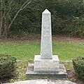
Wicklow granite memorial dedicated in 1987 on the farm of Tom Clarke
-
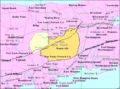
U.S. Census map
See also
 In Spanish: Manorville (Nueva York) para niños
