Long Island Central Pine Barrens facts for kids
Quick facts for kids Long Island Central Pine Barrens |
|
|---|---|
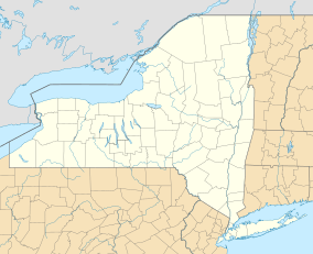
| Location | New York, United States |
| Nearest city | Manorville |
| Area | 100,000 acres (400 km2) |
| Established | 1993 |
| Governing body | Central Pine Barrens Joint Planning and Policy Commission |
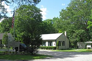
The Long Island Central Pine Barrens is a huge protected natural area in Suffolk County, New York, on Long Island. It covers more than 100,000 acres (about 405 square kilometers) of special pine barrens forests.
This area works a lot like Adirondack Park. It has public lands managed by different government groups (like federal, state, and local) mixed with private lands. It's Long Island's biggest natural space and its last true wilderness. This region is a leftover piece of the Atlantic coastal pine barrens ecoregion, which is a type of forest that once covered a quarter million acres (1,000 square kilometers) on Long Island.
The Central Pine Barrens is super important because it sits over a special underground water supply called a "sole source aquifer". This aquifer provides all of Long Island's drinking water! All the water people drink on Long Island comes from groundwater wells, not from big reservoirs. Also, most of the Peconic River and Carmans River (two of Long Island's four biggest rivers) flow through the Barrens.
Contents
Protecting the Pine Barrens
Early Efforts to Save the Land
In the 1970s, the State of New York started buying large pieces of land. Their goal was to create a "greenbelt," which is a protected natural area around cities. For example, Brookhaven National Laboratory gave 2,300 acres (about 9.3 square kilometers) in 1971. Later, in 1978, RCA transferred 7,200 acres (about 29 square kilometers) near Rocky Point for just $1!
By 1984, a group called the Pine Barrens Review Commission was set up. Their job was to look at any new building plans in the region. In 1986, Suffolk County started an "Open Space Program." This program used a small sales tax to buy land. It helped create 28 new Suffolk County Parks in the region, adding up to 4,600 acres (about 18.6 square kilometers).
The Pine Barrens Protection Act
Even with these efforts, people still wanted to build in the area. So, in 1993, the New York State Legislature passed the Long Island Pine Barrens Protection Act. This law was made to protect the region by creating a detailed plan for how the land could be used.
The act also created the Central Pine Barrens Joint Planning & Policy Commission. This group oversees the protection plan. The law divided the Pine Barrens into two main areas:
- Core Area: This is a central area of about 53,000 acres (about 214 square kilometers). It grew to 55,000 acres (about 223 square kilometers) in 1998 when the Wertheim National Wildlife Refuge was added. In this core area, no new building is allowed at all. The goal is to buy 75% of the land in this core area. If someone owns land in the core area, they can use a "transfer of development rights" plan. This means they can sell their right to build on their core land to someone else who wants to build in a different, approved area. This helps protect the core while still being fair to landowners.
- Compatible Growth Area: This area is about 47,000 acres (about 190 square kilometers). Here, some limited building is allowed, but only if it's friendly to the environment.
The first towns involved in this protection were Brookhaven, Riverhead, and Southampton. In 1998, East Hampton also set aside a small part of its land for the Barrens, which grew to 1,000 acres (about 4 square kilometers) in 2007.
Wildfires in the Pine Barrens
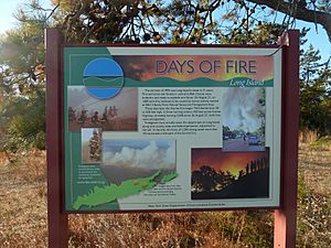
Pine Barrens ecosystems are actually very good at dealing with fire. They often need fires every now and then to stay healthy and keep their unique plants and animals thriving.
The Sunrise Wildfire of 1995
In late August and early September of 1995, a series of big brush fires swept through the pine barrens. The first big fire was in Rocky Point, but it was put out quickly.
However, a much larger and more serious fire started in the Westhampton area soon after. Strong winds and dry weather helped the fire spread very fast. It threatened homes and businesses. This fire was called the "Sunrise Wildfire" because it burned on both sides of Sunrise Highway. This is a major road connecting the Hamptons with the rest of Long Island. The fires closed the highway and stopped train service, cutting off the Hamptons for days. Firefighters from all over Long Island, the FDNY, and even Connecticut worked tirelessly to fight the blaze.
By early September, the Sunrise Wildfire was out. But the fires had caused a lot of damage:
- About 7,000 acres (about 28 square kilometers) had burned.
- Many homes and small businesses were damaged.
- 400 people had to leave their homes for safety.
- The fire happened during the busiest tourist time for the Hamptons, which hurt the local economy.
Luckily, very few people were hurt. A few firefighters had injuries, but no one died. As of 2007, the area has mostly recovered, though some plants still show signs of the fire.
The Brookhaven Blaze of 2012
On April 9, 2012, several brushfires joined together. They burned over 2,000 acres (about 8 square kilometers) of woodland around Manorville, Ridge, and Brookhaven. The fires became so strong that parts of the Long Island Expressway had to be closed. Some areas of Riverhead were even told to evacuate.
In total, 1,124 acres (about 4.5 square kilometers) of pine lands burned. About 600 firefighters from 109 different fire departments fought the fire. They used many special trucks and even had a New York State Police helicopter drop water from the sky.
Sister Parks Around the World
The Central Pine Barrens Commission has a special connection with another park: the Migliarino-San Rossore-Massaciuccoli (MSRM) Regional Park in Tuscany, Italy. They are considered "twin parks" under a New York State program. This program helps parks in different countries share ideas and learn from each other. It's a way for people from both regions to work together and protect their natural areas.
 | Percy Lavon Julian |
 | Katherine Johnson |
 | George Washington Carver |
 | Annie Easley |


