Albertson, New York facts for kids
Quick facts for kids
Albertson, New York
|
|
|---|---|
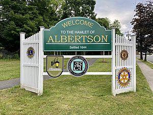
An Albertson welcome sign at Reflection Park
|
|
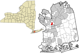
Location in Nassau County and the state of New York
|
|
| Country | |
| State | |
| County | Nassau |
| Town | North Hempstead |
| Area | |
| • Total | 0.68 sq mi (1.76 km2) |
| • Land | 0.68 sq mi (1.76 km2) |
| • Water | 0.00 sq mi (0.00 km2) |
| Elevation | 128 ft (39 m) |
| Population
(2020)
|
|
| • Total | 5,220 |
| • Density | 7,687.78/sq mi (2,968.34/km2) |
| Demonym(s) | Albertsonian |
| Time zone | UTC-5 (Eastern (EST)) |
| • Summer (DST) | UTC-4 (EDT) |
| ZIP code |
11507
|
| Area code(s) | 516, 363 |
| FIPS code | 36-01011 |
| GNIS feature ID | 0942241 |
Albertson is a small community in Nassau County, New York. It is located on Long Island. Albertson is known as a hamlet and a census-designated place (CDP). This means it's a small area that doesn't have its own local government. In 2020, about 5,220 people lived here.
Contents
History of Albertson
The first European person to settle in this area was John Seren in 1644. He came from Connecticut. Later, a man named Townsend Albertson started a farm and a gristmill here. Because of him, the community became known as Albertson.
In 1850, a new road was built through Albertson. It crossed land owned by Isaac Underhill Willets. This road is still called I U Willets Road today. The Long Island Rail Road opened a train station in Albertson in 1864. This made it easier for people to travel to and from the area.
A famous road called the Long Island Motor Parkway was built in 1908. It ran along the southern edge of Albertson. This parkway was closed in 1938. In 1940, the Northern State Parkway took its place. This new road runs along the northern part of Albertson.
After World War II, in 1946, more homes started to be built in Albertson. This was part of a big change called suburbanization. The last farms in the area were turned into neighborhoods by the mid-1960s.
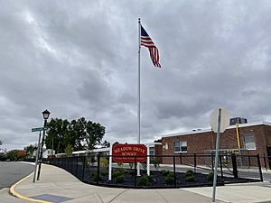
A school in Albertson, the Searingtown School, was part of an important court case. This case was called Engel v. Vitale in 1962. The Supreme Court decided that government-led prayers were not allowed in public schools.
Geography of Albertson
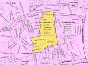
Albertson is located south of Roslyn and east of Searingtown. The exact border between Albertson and Searingtown can be a bit confusing. This is because they share the same post office. Also, neither area has its own local government.
Generally, Searingtown is west of Searingtown Road. Albertson is usually east of Willis Avenue. Even some places like Searingtown School use Albertson as their address.
The total area of Albertson is about 0.7 square miles (1.76 square kilometers). All of this area is land.
Population and People
| Historical population | |||
|---|---|---|---|
| Census | Pop. | %± | |
| 2020 | 5,220 | — | |
| U.S. Decennial Census | |||
In 2020, the population of Albertson was 5,220 people. In 2010, there were 5,182 people living here. The community is made up of many different people. Most families in Albertson are married couples.
Parks and Fun Places
Albertson has a few parks where people can relax and play:
- Albertson Triangle
- John D. Caemmerer Park
- Reflection Park
Education in Albertson
School Districts
Children in Albertson go to public schools in one of four different school districts. These districts are:
- Mineola Union Free School District
- East Williston Union Free School District
- Herricks Union Free School District
- Roslyn Union Free School District
Which school district a child attends depends on where they live in Albertson.
Library Districts
Albertson is also served by two library districts. These libraries provide books and resources for the community.
- The Bryant Library (for areas in the Roslyn school district)
- The Shelter Rock Library District (for areas in the Herricks and Mineola school districts)
How Albertson Works (Infrastructure)
Getting Around (Transportation)
Roads
The Northern State Parkway is a major road that forms the northern border of Albertson. Other important roads include I.U. Willets Road and Willis Avenue. The old Long Island Motor Parkway also used to run through Albertson.
Trains
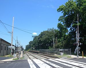
Albertson has its own train station. It is called the Albertson station. This station is on the Long Island Rail Road's Oyster Bay Branch line.
Buses
The n23 bus route serves Albertson. This bus is run by Nassau Inter-County Express (NICE). It travels along Willis Avenue. This bus route follows an old trolley path from the early 1900s.
Utilities
Natural Gas
National Grid USA provides natural gas to homes and businesses in Albertson.
Electricity
PSEG Long Island supplies electricity to all the homes and businesses in Albertson.
Sewage
All of Albertson is connected to the Nassau County Sewage District. This system helps manage wastewater.
Water
Most of Albertson gets its water from the Albertson Water District. Some smaller parts of the community get water from other districts. These include the Garden City Park Water District, the Roslyn Water District, and the Village of Williston Park's water system.
Famous People from Albertson
- Rick Pasqualone – An American actor and voice actor.
See also
 In Spanish: Albertson (Nueva York) para niños
 | William L. Dawson |
 | W. E. B. Du Bois |
 | Harry Belafonte |


