The Bronx facts for kids
Quick facts for kids
The Bronx
Bronx County, New York
|
|||
|---|---|---|---|
|
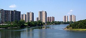
Co-op City, as seen from the east, sits along the Hutchinson River.
The Hub
|
|||
|
|||
| Nickname(s):
BX, The Boogie Down
|
|||
| Motto(s):
Ne cede malis – "Yield Not to Evil"
(lit. "Yield Not to Evil Things") |
|||
| Country | |||
| State | |||
| County | Bronx (coterminous) | ||
| City | New York | ||
| Settled | 1639 | ||
| Named for | Jonas Bronck | ||
| Government | |||
| • Type | Borough of New York City | ||
| Area | |||
| • Total | 57 sq mi (150 km2) | ||
| • Land | 42.2 sq mi (109 km2) | ||
| • Water | 15 sq mi (40 km2) 27% | ||
| Highest elevation | 280 ft (90 m) | ||
| Population
(2020)
|
|||
| • Total | 1,472,654 | ||
| • Density | 34,918/sq mi (13,482/km2) | ||
| • Demonym | Bronxite | ||
| GDP | |||
| • Total | US$43.675 billion (2022) | ||
| Time zone | UTC−05:00 (Eastern) | ||
| • Summer (DST) | UTC−04:00 (EDT) | ||
| ZIP Code prefix |
104
|
||
| Area codes | 718/347/929, 917 | ||
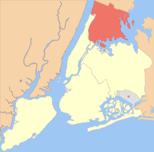
The Bronx (/brɒŋks/ bronks) is the northernmost part of New York City. It is also known as Bronx County, which is a county in the state of New York. The Bronx is located south of Westchester County. It is north and east of Manhattan (across the Harlem River) and north of Queens (across the East River).
The Bronx is special because it's the only part of New York City that is mostly on the mainland of North America. The other four parts of the city are either islands or on islands. The Bronx covers about 42 square miles (109 km2) of land. In 2020, about 1.47 million people lived there. Among New York City's five boroughs, the Bronx is fourth in size and population. It is third in how many people live per square mile.
The Bronx River splits the borough into two main areas. The western part, called the West Bronx, has more hills. The eastern part, the East Bronx, is flatter. Street names in the Bronx are divided into "East" and "West" by Jerome Avenue. The West Bronx became part of New York City in 1874. The areas east of the Bronx River joined in 1895. Bronx County became a separate county from New York County (Manhattan) in 1914.
About one-quarter of the Bronx is made up of open green spaces. These include Woodlawn Cemetery, Van Cortlandt Park, Pelham Bay Park, the New York Botanical Garden, and the Bronx Zoo. These parks are mostly in the northern and central parts of the borough. The Thain Family Forest at the New York Botanical Garden is very old. It is the largest remaining piece of the original forest that once covered New York City. These open spaces were saved in the late 1800s as the city grew.
The name "Bronx" comes from Jonas Bronck. He was a settler from Sweden (or the Faroe Islands) who started the first European settlement here in 1639. This was part of the New Netherland colony. European settlers moved the native Lenape people out after 1643. In the 1800s and 1900s, many different groups of immigrants and migrants came to the Bronx. They helped turn it into a busy city area. These groups came from Europe (like Ireland, Germany, Italy, and Eastern Europe). Later, people came from the Caribbean (like Puerto Rico and the Dominican Republic) and West Africa. Many African Americans also moved here from the southern United States.
The Bronx has some areas with higher incomes, like Riverdale and Pelham Bay. However, it also has the poorest congressional district in the United States, which is New York's 15th. Some parts of the Bronx saw a big drop in population and housing quality from the 1960s to the 1980s. This was a time when hip hop music started to grow. The South Bronx especially faced many challenges. But since the late 1990s, the Bronx has been growing again.
Contents
- What's in a Name? The Bronx's History
- The Bronx Through Time: A Brief History
- Exploring the Geography of the Bronx
- Understanding Bronx Neighborhoods
- People and Cultures in the Bronx
- Culture and Fun in the Bronx
- Economy and Shopping in the Bronx
- Learning in the Bronx: Schools and Colleges
- Getting Around: Transportation in the Bronx
- Climate in the Bronx
- See also
What's in a Name? The Bronx's History
How the Bronx Got Its Name
The native Lenape people, specifically the Siwanoy group, called the Bronx Rananchqua. Other Native Americans knew it as Keskeskeck. The area was divided by the Aquahung River, which we now call the Bronx River.
The Bronx is named after Jonas Bronck (around 1600–1643). He was a European settler whose exact origin is debated. Records show he was a Swedish immigrant who arrived in New Netherland in 1639. Bronck was the first European to settle in the area we now call the Bronx. He built a farm called "Emmaus" near what is now Willis Avenue and 132nd Street. He rented land from the Dutch West India Company and bought more from local tribes. He ended up with about 500 acres (200 ha) between the Harlem River and the Aquahung. This river became known as Bronck's River or the Bronx [River]. Dutch and English settlers then called the whole area Bronck's Land.
Why We Say "The Bronx"
The Bronx is usually called "the Bronx" or "The Bronx" in both official and everyday language. Even "County of the Bronx" uses "the" before "Bronx." The United States Postal Service uses "Bronx, NY" for mail. People think the "the" comes from how we refer to rivers, like "the Bronx River." The area was first called the "Annexed District of The Bronx" in 1874. This was when part of Westchester County joined New York City. It continued with the "Borough of The Bronx" in 1898.
Some people believe the "The" should always be capitalized, like "The Bronx." They argue it's part of the proper name. Others, like the United States Postal Service, use a lowercase "the" unless it starts a sentence.
The Bronx Through Time: A Brief History
European settlement in the Bronx began in 1639. The Bronx was first part of Westchester County. Later, it became part of New York County in two main sections: the West Bronx in 1874 and the East Bronx in 1895. Finally, it became its own county, Bronx County, in 1914. Before Europeans arrived, the area was part of the Lenape's Lenapehoking territory. Over time, the land was turned into farms by European colonists.
Before 1914: Early Growth
The Bronx's growth is linked to its important location between New England and New York (Manhattan). Controlling the bridges over the Harlem River was a big deal during British rule. The King's Bridge, built in 1693, had tolls that farmers didn't like. In 1759, local farmers built a free bridge. After the American Revolutionary War, the King's Bridge toll was removed.
The land that is now Bronx County was originally part of Westchester County. This was one of the first 12 counties in the English Province of New York. In 1873, the town of Kingsbridge was created. It included areas like Riverdale and Woodlawn Cemetery.
Famous people who lived in the Bronx in the 1800s and early 1900s included author Willa Cather and inventor Jordan L. Mott. Mott created Mott Haven to house workers for his iron factories.
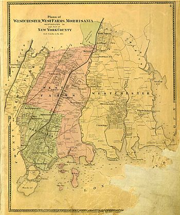
The Bronx joined New York City in two steps. In 1874, Kingsbridge, West Farms, and Morrisania became part of New York City. The rest of the Bronx, east of the Bronx River, joined in 1895. This included the Town of Westchester and parts of Eastchester and Pelham. City Island joined in 1896.
After these changes, the Bronx's land moved from Westchester County to New York County. On January 1, 1898, the bigger City of New York was formed. The Bronx became one of its five distinct boroughs. However, it stayed part of New York County until Bronx County was officially created in 1914.
On April 19, 1912, the parts of New York County that came from Westchester County became Bronx County. This was the 62nd and last county created by the state. Bronx County's courts opened on January 2, 1914.
After 1914: Changes and Comeback
The Bronx's history in the 1900s can be split into four periods. From 1900 to 1929, the population grew six times, from 200,000 to 1.3 million. The Great Depression and the years after World War II saw slower growth. From 1950 to 1985, the Bronx changed from a middle-income area to a lower-income area. Some parts faced many challenges. But since the late 1980s, the Bronx has been improving.
New York City Grows
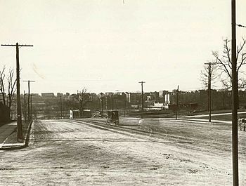
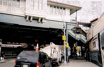
For many years, the Bronx was mostly rural with small farms. But in the late 1800s, it grew into a railroad suburb. Faster transportation, like elevated trains and the subway (which connected to Manhattan in 1904), helped the population grow quickly.
The South Bronx was a center for manufacturing. In the early 1900s, it was known for making pianos. In 1919, there were 63 piano factories in the Bronx.
After World War I, the Bronx grew very fast. New subway lines helped thousands of immigrants move to the Bronx. This led to a big boom in building homes. Many Irish Americans, Italian Americans, and especially Jewish Americans settled here. Other immigrants from France, Germany, and Poland also moved in. By 1937, almost half of the Bronx's population was Jewish. Today, many old synagogues are still in the Bronx, but most are used for other purposes.
Challenges and Changes
From the mid-1960s to the early 1980s, life became harder for some Bronx residents. Many reasons are suggested for this. Some say that Robert Moses' Cross Bronx Expressway cut through neighborhoods and caused problems. Others point to the building of tall housing projects, especially in the South Bronx. Another factor was "redlining," where some areas of the Bronx had fewer real estate and financial services. Some also suggest that city services, like fire-fighting, were reduced.
In the 1970s, parts of the Bronx faced many challenges. Buildings were often damaged, especially in the poorest communities like the South Bronx. By the early 1980s, the South Bronx had lost 60% of its population and 40% of its homes. However, starting in the 1990s, many damaged buildings were replaced with new homes.
In 1984, it was decided that Marble Hill, Manhattan is part of Manhattan borough but part of Bronx County. This was made official by the New York Legislature.
The Bronx's Comeback
Since the late 1980s, the Bronx has seen a lot of new development. The city's "Ten-Year Housing Plan" and community groups helped build affordable housing. For example, church groups in the South Bronx built the Nehemiah Homes. Stores like Marshalls and Target opened in the Bronx. More bank branches also opened.
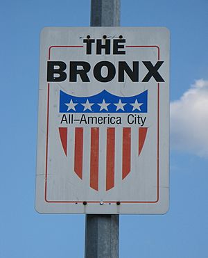
In 1997, the Bronx was named an All America City. This award recognized its recovery. In 2006, The New York Times said that "construction cranes have become the borough's new visual metaphor." Between 2002 and 2007, over 33,000 new homes were built or planned. Billions of dollars were invested in new housing. Much of this new building is happening on empty lots in the South Bronx.
Existing homes in areas like Hunts Point and the Lower Concourse are also being improved. Several new hotels opened in the South Bronx in the 2010s.
New projects are still happening. The Bronx General Post Office is being turned into a market, shops, and restaurants. The Kingsbridge Armory, one of the world's largest armories, is also planned for new uses.
Even with these improvements, some challenges remain. The Bronx still has the highest rate of people facing economic hardship in New York City. The greater South Bronx is the area with the most challenges.
Exploring the Geography of the Bronx
Where is the Bronx?
Bronx County covers about 57 square miles (148 km2). About 42 square miles (109 km2) is land, and 15 square miles (39 km2) (27%) is water.
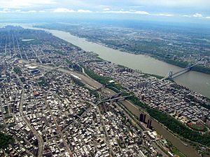
The Bronx is the northernmost borough of New York City. It is the only part of New York City that is almost entirely on the mainland. The Hudson River is to the west, separating the Bronx from New Jersey. The Harlem River is to the southwest, separating it from Manhattan. The East River is to the southeast, separating it from Queens. To the east, Long Island Sound separates it from Nassau County on Long Island. North of the Bronx are the towns of Yonkers, Mount Vernon, Pelham Manor, and New Rochelle in Westchester County.
The Bronx River flows south through the borough and into the East River. It is the only completely freshwater river in New York City. Another smaller river, the Hutchinson River, flows through the East Bronx.
The Bronx also includes small islands in the East River and Long Island Sound. These include City Island and Hart Island. Rikers Island, which has a large jail, is also part of the Bronx.
The highest point in the Bronx is about 280 feet (85 m) high. It is in the northwest corner, near Van Cortlandt Park. The southeastern side of the Bronx has four large, low areas of land that stick out into the water. These are Hunts Point, Clason's Point, Screvin's Neck, and Throggs Neck.
Parks and Green Spaces
| Sample of open spaces and parks in the Bronx | |||||
|---|---|---|---|---|---|
| Acquired | Name | acres | sq. mi. | hectares | |
| 1863 | Woodlawn Cemetery | 400 | 0.6 | 162 | |
| 1888 | Pelham Bay Park | 2,772 | 4.3 | 1,122 | |
| Van Cortlandt Park | 1,146 | 1.8 | 464 | ||
| Bronx Park | 718 | 1.1 | 291 | ||
| Crotona Park | 128 | 0.2 | 52 | ||
| St. Mary's Park | 35 | 0.05 | 14 | ||
| 1890 | Jerome Park Reservoir | 94 | 0.15 | 38 | |
| 1897 | St. James Park | 11 | 0.02 | 4.6 | |
| 1899 | Macombs Dam Park † | 28 | 0.04 | 12 | |
| 1909 | Henry Hudson Park | 9 | 0.01 | 4 | |
| 1937 | Ferry Point Park | 414 | 0.65 | 168 | |
| Soundview Park | 196 | 0.31 | 79 | ||
| 1962 | Wave Hill | 21 | 0.03 | 8.5 | |
| Land area of the Bronx in 2000 | 26,897 | 42.0 | 10,885 | ||
| Water area | 9,855 | 15.4 | 3,988 | ||
| Total area | 36,752 | 57.4 | 14,873 | ||
| † closed in 2007 to build a new park & Yankee Stadium | |||||
| Main source: New York City Department of Parks & Recreation | |||||
Even though the Bronx is one of the most crowded counties in the U.S., about one-fifth of its area is parkland. This includes about 7,000 acres (28 km2) of green space.
Woodlawn Cemetery is a large cemetery covering 400 acres (160 ha). It opened in 1863 and is near the Bronx River.
The Bronx has the largest park in New York City, Pelham Bay Park. It includes Orchard Beach. The third-largest park, Van Cortlandt Park, is also in the Bronx. It is west of Woodlawn Cemetery. Wave Hill is a beautiful estate with gardens overlooking the Hudson River.
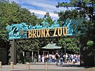
Along the Bronx River is Bronx Park. Its northern part has the New York Botanical Gardens. These gardens protect the last piece of the original hemlock forest that once covered the area. The southern part of Bronx Park is home to the Bronx Zoo. This is the largest urban zoo in the United States.
South of Van Cortlandt Park is the Jerome Park Reservoir. It is surrounded by stone walls and small parks. The land for these parks was bought by New York City in 1888. This was done to save open spaces for the future.
The Bronx also has beautiful parkways, which are roads lined with trees and greenery. These include the Grand Concourse and Pelham Parkway. Later projects included the Bronx River Parkway, which helped restore the riverbank.
In 2006, a big project started to improve 70 parks in the Bronx. This project focused on opening more of the Bronx River's banks and making them more natural.
Understanding Bronx Neighborhoods
How the Bronx is Divided
The Bronx is divided in a couple of ways. One way is by the Bronx River. This river splits the borough almost in half. The western side is older, more urban, and hillier. The eastern side is newer, more suburban, and flatter. This division reflects how the Bronx grew over time.
- West Bronx: This includes all parts of the Bronx west of the Bronx River.
- East Bronx: This includes all parts of the Bronx east of the Bronx River.
Another way to divide the borough is into:
- North Bronx: This is all areas not in the South Bronx.
- South Bronx: This area is generally south of Fordham Road and west of the Bronx River. It includes the neighborhoods often thought of as the South Bronx.
Key Neighborhoods in the Bronx
The Bronx has many neighborhoods, and their exact borders can sometimes be confusing. Even city officials have different numbers for how many neighborhoods there are. Here are some of the major ones:
East Bronx Communities
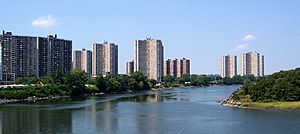
East of the Bronx River, the land is flatter. This area has older apartment buildings, public housing, and homes for multiple families. It also has single-family homes. The East Bronx is home to New York City's largest park, Pelham Bay Park.
Some neighborhoods here include: Clason's Point, Soundview, Castle Hill, Parkchester, Throggs Neck, Country Club, City Island, Pelham Bay, Co-op City, Westchester Square, Morris Park, Williamsbridge, and Eastchester.
City Island and Hart Island
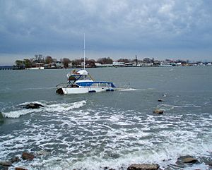
City Island is located east of Pelham Bay Park in Long Island Sound. It is famous for its seafood restaurants and waterfront homes. City Island Avenue, its main shopping street, feels like a small New England town. A bridge connects it to the mainland.
East of City Island is Hart Island. This island is not inhabited and is not open to the public. It has been used as a prison in the past.
West Bronx Communities
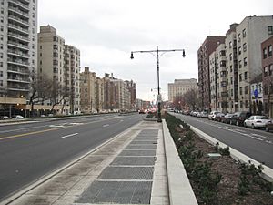
The western parts of the Bronx are hillier. They have many older apartment buildings, public housing, and multi-family homes. More wealthy areas like Riverdale and Fieldston have larger single-family homes. The West Bronx includes Van Cortlandt Park, the city's third-largest park. The Grand Concourse, a wide road, runs through this area.
Some neighborhoods in the Northwest Bronx include: Fordham-Bedford, Bedford Park, Norwood, Kingsbridge, Riverdale, and Woodlawn Heights. Marble Hill, Manhattan is also connected to the Bronx by land.
South Bronx Communities
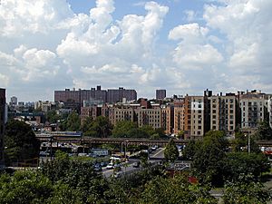
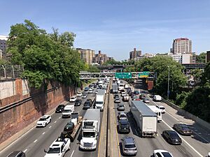
The South Bronx doesn't have official borders. It is often used to describe the parts of the Bronx that faced more challenges. By the 2000s, Fordham Road was often seen as its northern border. The Bronx River usually forms its eastern border. The South Bronx has many apartment buildings and multi-unit homes. It is home to the Bronx County Courthouse and Yankee Stadium. The Cross Bronx Expressway cuts through it.
Neighborhoods in the South Bronx include: The Hub (a shopping area), Port Morris, Mott Haven, Melrose, Morrisania, Hunts Point, Longwood, Highbridge, Concourse, West Farms, Belmont, Tremont, Morris Heights, and University Heights.
People and Cultures in the Bronx
| Historical population | |||
|---|---|---|---|
| Census | Pop. | %± | |
| 1790 | 1,781 | — | |
| 1800 | 1,755 | −1.5% | |
| 1810 | 2,267 | 29.2% | |
| 1820 | 2,782 | 22.7% | |
| 1830 | 3,023 | 8.7% | |
| 1840 | 5,346 | 76.8% | |
| 1850 | 8,032 | 50.2% | |
| 1860 | 23,593 | 193.7% | |
| 1870 | 37,393 | 58.5% | |
| 1880 | 51,980 | 39.0% | |
| 1890 | 88,908 | 71.0% | |
| 1900 | 200,507 | 125.5% | |
| 1910 | 430,980 | 114.9% | |
| 1920 | 732,016 | 69.8% | |
| 1930 | 1,265,258 | 72.8% | |
| 1940 | 1,394,711 | 10.2% | |
| 1950 | 1,451,277 | 4.1% | |
| 1960 | 1,424,815 | −1.8% | |
| 1970 | 1,471,701 | 3.3% | |
| 1980 | 1,168,972 | −20.6% | |
| 1990 | 1,203,789 | 3.0% | |
| 2000 | 1,332,650 | 10.7% | |
| 2010 | 1,385,108 | 3.9% | |
| 2020 | 1,472,654 | 6.3% | |
| Sources: 1790–1990; | |||
|
New York City's five boroughs
|
||||||
|---|---|---|---|---|---|---|
| Jurisdiction | Population | Land area | Density | |||
| Borough | County | Estimate (2015) |
square miles |
square km |
persons / sq. mi |
persons / sq. km |
|
|
|
1,644,518 | 22.83 | 59.1 | 72,033 | 27,826 |
|
|
|
1,455,444 | 42 | 110 | 34,653 | 13,231 |
|
|
|
2,636,735 | 71 | 180 | 37,137 | 14,649 |
|
|
|
2,339,150 | 109 | 280 | 21,460 | 8,354 |
|
|
|
474,558 | 58.5 | 152 | 8,112 | 3,132 |
|
|
8,550,405 | 303.33 | 781.1 | 28,188 | 10,947 | |
|
|
19,795,791 | 47,214 | 122,284 | 416.4 | 159 | |
|
|
||||||
Who Lives in the Bronx?
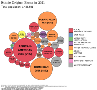
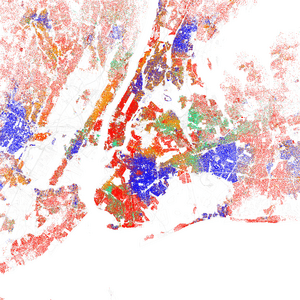
The Bronx is a very diverse place. In 2018, about 14.9% of the people were white. This is a big change from 1920, when almost everyone (99.3%) was white.
The Bronx has about 532,487 homes. About 19.7% of people own their homes, which is the lowest rate among the five boroughs. In most homes (59.3%), people speak a language other than English. This is the highest rate in New York City.
The average income per person in the Bronx is $19,721. The average income for a household is $36,593. Both of these are the lowest among the five boroughs. About 27.9% of residents live in poverty, which is the highest rate in the city.
A Look at the 2010 Census
According to the 2010 Census, over half (53.5%) of the Bronx's population was of Hispanic or Latino background. Many of these are Puerto Ricans and Dominicans. About 30.1% of the population was non-Hispanic Black or African American. Non-Hispanic White people made up 10.9% of the population.
In 2010, about 46.29% of Bronx residents aged five and older spoke Spanish at home. About 44.02% spoke English. Many other languages are also spoken, including African languages, French, and Italian. Overall, more than half (55.98%) of the Bronx's population aged five and older spoke a language other than English at home. There is also a community of people who speak Garifuna from Honduras and Guatemala.
The Bronx has the lowest number of white residents compared to other New York City boroughs. In 2009, white people (including Hispanic and non-Hispanic) made up about one-fifth (22.9%) of the Bronx's population. Most non-Hispanic white people are of Italian and Irish descent. The Bronx also has the largest Albanian community in the United States.
Culture and Fun in the Bronx
The Bronx is known as an important center for African-American culture. Fordham University has a special project called the Bronx African-American History Project (BAAHP) to study this.
Music and Entertainment
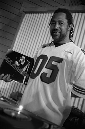
The Bronx has a rich music history. In the early 1900s, it was a key place for the development of Latin jazz. The Bronx Opera was started in the 1960s.
In the 1970s, the Bronx became strongly linked to the birth of hip hop music. One of the first hip hop artists, DJ Kool Herc, held parties in an apartment building at 1520 Sedgwick Avenue. He experimented with mixing and scratching records and rapping over the music. Other important Bronx DJs from this time include Grandmaster Flash and Afrika Bambaataa.
Sports in the Bronx
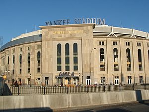
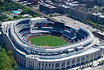
The Bronx is home to the New York Yankees, a famous Major League Baseball team. They are nicknamed "the Bronx Bombers." The original Yankee Stadium opened in 1923. It was the largest MLB stadium at the time. Many baseball legends played there, including Babe Ruth and Derek Jeter.
The original stadium closed in 2008. A new Yankee Stadium opened in 2009, just north of the old one. The Yankees won 26 World Series titles at the first stadium. They won their 27th in 2009, their first season in the new stadium. The current Yankee Stadium is also home to New York City FC, a Major League Soccer team.
Arts and Museums
The Bronx Academy of Arts and Dance (BAAD!) offers dance, theater, and art workshops. It focuses on modern art related to race and gender.
The Bronx Museum of the Arts, founded in 1971, shows 20th-century and modern art. Many of its exhibits focus on topics important to the Bronx. Its collection has over 800 artworks, mostly by artists from Africa, Asia, and Latin America.
The Bronx also has a special tribute to the poet Heinrich Heine. It's called the "Heinrich Heine Memorial" or the Lorelei Fountain. It was moved to Joyce Kilmer Park near Yankee Stadium in 1899. In 1999, it moved to 161st Street and the Concourse.
Maritime History
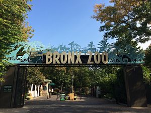
The Bronx has a strong connection to the sea. The City Island Historical Society and Nautical Museum is on City Island. The state's Maritime College in Fort Schuyler has the Maritime Industry Museum.
The Harlem River is becoming a popular place for "Scullers' Row" (rowing). This is thanks to the Bronx River Restoration Project. Canoeing and kayaking on the Bronx River are also popular. The river flows past the New York Botanical Gardens, the Bronx Zoo, and the Bronx River Art Center.
Community Events
"Bronx Week" is a yearly celebration, usually in May. It started as a one-day event and grew into a week-long festival. It includes the Bronx Week Parade and inductions into the "Bronx Walk of Fame."
Many Bronx neighborhoods have their own celebrations. The Arthur Avenue "Little Italy" neighborhood has an annual Autumn Ferragosto Festival. Hunts Point hosts a "Fish Parade and Summer Festival." There are also parades to celebrate Dominican, Italian, and Irish heritage.
Local News and Media
The Bronx has several local newspapers, including The Bronx Daily and The Bronx Times Reporter. There are also non-profit news outlets that serve different communities.
WFUV is a major non-commercial radio station in the Bronx. It broadcasts from Fordham University. The City of New York has its own television station, run by NYC Media, which broadcasts from Bronx Community College. Cablevision also operates News 12 The Bronx, which features local programming. BronxNet is a public-access television station that broadcasts from Lehman College.
Economy and Shopping in the Bronx
Shopping Areas
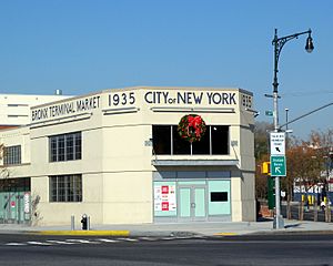
Popular shopping areas in the Bronx include Fordham Road, Bay Plaza in Co-op City, The Hub, and the Riverdale/Kingsbridge shopping center. Shops are also found under elevated train lines, like Westchester Avenue and White Plains Road. The Bronx Terminal Market has several large stores. It opened in 2009 near Yankee Stadium.
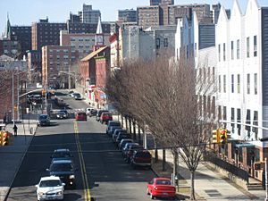
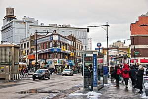
The Hub is the main shopping area in the South Bronx. It's where four roads meet: East 149th Street, Willis, Melrose, and Third Avenues. It's known for having a lot of traffic and many buildings.
The Bronx Terminal Market is a shopping center with almost one million square feet of stores. It was built on a 17-acre (6.9 ha) site that used to be a wholesale market and a jail. The $500 million shopping center was finished in 2009. It has new buildings and a large garage for cars.
Learning in the Bronx: Schools and Colleges
Education in the Bronx is provided by many public and private schools. The New York City Department of Education manages the public schools. In 2000, almost 280,000 Bronx residents attended public schools. There are also public charter schools. Private schools include independent schools and religious schools run by the Roman Catholic Archdiocese of New York and Jewish groups.
A small area of the Bronx near Pelham Bay Park is cut off from the rest of the borough. The New York City government pays for children from these 35 houses to go to schools in the Pelham Union Free School District. This has been happening since 1948.
High Schools in the Bronx
In 2000, about 79,240 Bronx high school students attended public schools.
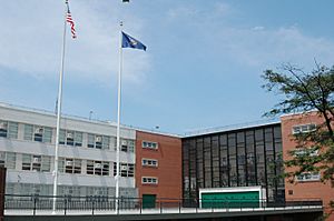
The Bronx has many public high schools. These include the highly-rated Bronx High School of Science, Celia Cruz Bronx High School of Music, and DeWitt Clinton High School. It is also home to three well-known private schools: Fieldston, Horace Mann, and Riverdale Country School.
Many high schools are connected to the Catholic Church. These include St. Raymond Academy for Girls, Fordham Preparatory School, and Cardinal Spellman High School. The SAR Academy and SAR High School are Jewish schools in Riverdale.
In the 1990s, New York City started closing large public high schools in the Bronx. They were replaced with smaller high schools. This was done to improve graduation rates and safety.
Colleges and Universities
The Bronx is home to several colleges and universities.
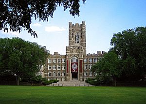
Fordham University was founded in 1841 as St. John's College. It was the first Catholic higher education school in the Northeast. Its main campus, Rose Hill, is in the Bronx.
Three campuses of the City University of New York are in the Bronx: Hostos Community College, Bronx Community College, and Lehman College.
The College of Mount Saint Vincent is a Catholic college in Riverdale. It was founded in 1847 as a school for girls. Manhattan University is another Catholic college in Riverdale. It offers programs in arts, business, education, and engineering.
The Albert Einstein College of Medicine is part of the Montefiore Medical Center. It is located in Morris Park.
Mercy College has a campus in the Bronx near Westchester Square. The State University of New York Maritime College in Fort Schuyler is a national leader in maritime education. It also has the Maritime Industry Museum.
Monroe College, which focuses on business, started in the Bronx in 1933. It still has a campus in the Bronx.
Getting Around: Transportation in the Bronx
Roads and Streets
The streets in the Bronx are not always in a perfect grid. The West Bronx has hills, so its streets are less regular. Many street numbers in the West Bronx continue from upper Manhattan. East 132nd Street is the lowest numbered street in the Bronx.
The East Bronx is flatter, so its streets are more regular. Most east-west streets are called "East" or "West" depending on which side of Jerome Avenue they are on.
Important north-south roads include the Grand Concourse, Jerome Avenue, and White Plains Road. Major east-west roads include Mosholu Parkway, Gun Hill Road, and Fordham Road.
The historic Boston Post Road runs through parts of the Bronx. It was an important road connecting Boston with other cities before the American Revolution.
About 61.6% of homes in the Bronx do not have a car.
Major Highways
Several major highways cross the Bronx. These include:
- the Bronx River Parkway
- the Bruckner Expressway (I-278/I-95)
- the Cross Bronx Expressway (I-95/I-295)
- the New England Thruway (I-95)
- the Henry Hudson Parkway (NY-9A)
- the Hutchinson River Parkway
- the Major Deegan Expressway (I-87)
Bridges and Tunnels
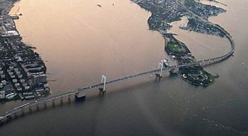
Many bridges and tunnels connect the Bronx to Manhattan and Queens.
- To Manhattan: There are 13 bridges and 3 tunnels. These include the Henry Hudson Bridge, the Broadway Bridge, and the Alexander Hamilton Bridge.
- To both Manhattan and Queens: The Robert F. Kennedy Bridge (formerly the Triborough Bridge).
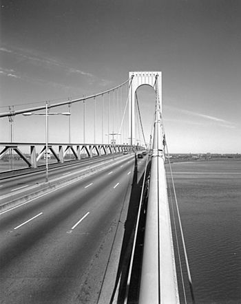
- To Queens: The Bronx–Whitestone Bridge and the Throgs Neck Bridge.
Public Transportation
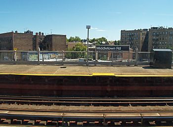
The Bronx has a large subway system with 70 stations. It is served by seven New York City Subway lines.
There are also many MTA Regional Bus Operations bus routes in the Bronx. These include local and express buses, as well as Bee-Line Bus System routes.
Two Metro-North Railroad commuter train lines serve 11 stations in the Bronx. These are the Harlem Line and the Hudson Line. Some trains on the New Haven Line also stop at Fordham Plaza. New train stops are planned along the New Haven Line for areas like Hunts Point and Co-op City.
In 2018, the NYC Ferry's Soundview line opened. It connects the Soundview landing to Manhattan. Another ferry landing opened in Throggs Neck in 2021.
Climate in the Bronx
| Climate data for The Bronx | |||||||||||||
|---|---|---|---|---|---|---|---|---|---|---|---|---|---|
| Month | Jan | Feb | Mar | Apr | May | Jun | Jul | Aug | Sep | Oct | Nov | Dec | Year |
| Mean daily maximum °F (°C) | 39.7 (4.3) |
42.6 (5.9) |
50.3 (10.2) |
61.4 (16.3) |
72.3 (22.4) |
80.9 (27.2) |
86.1 (30.1) |
84.1 (28.9) |
77.1 (25.1) |
65.8 (18.8) |
54.1 (12.3) |
44.8 (7.1) |
63.3 (17.4) |
| Mean daily minimum °F (°C) | 27.3 (−2.6) |
28.7 (−1.8) |
34.6 (1.4) |
44.4 (6.9) |
54.6 (12.6) |
64.3 (17.9) |
70.6 (21.4) |
69.1 (20.6) |
62.1 (16.7) |
50.7 (10.4) |
41.3 (5.2) |
33.1 (0.6) |
48.4 (9.1) |
| Average precipitation inches (mm) | 3.74 (95) |
3.19 (81) |
4.37 (111) |
3.95 (100) |
4.06 (103) |
4.55 (116) |
4.37 (111) |
4.82 (122) |
4.55 (116) |
4.13 (105) |
3.45 (88) |
4.67 (119) |
49.85 (1,266) |
| Average snowfall inches (cm) | 8.4 (21) |
8.9 (23) |
4.3 (11) |
0.5 (1.3) |
0 (0) |
0 (0) |
0 (0) |
0 (0) |
0 (0) |
0 (0) |
0.4 (1.0) |
4.1 (10) |
26.6 (68) |
| Source: NOAA | |||||||||||||
The Bronx has a climate with warm summers and cold winters. The average high temperature in July is about 86.1°F (30.1°C). The average low temperature in January is about 27.3°F (-2.6°C). The Bronx gets a good amount of rain throughout the year, with an average of about 49.85 inches (1,266 mm) annually. It also gets snow, with an average of about 26.6 inches (68 cm) per year.
See also
 In Spanish: El Bronx para niños
 | Leon Lynch |
 | Milton P. Webster |
 | Ferdinand Smith |


