Ferry Point Park facts for kids
Quick facts for kids Ferry Point Park |
|
|---|---|
 |
|
| Type | Municipal park |
| Location | Throggs Neck, The Bronx, New York |
| Area | 413.8 acres (167.5 ha) |
| Owned by | New York City Department of Parks and Recreation |
| Status | open all year |
| Water | East River |
| Public transit access | New York City Bus: Q44, Q50 |
| Facilities | golf course, community park, and waterfront promenade |
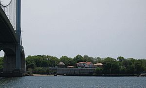
Ferry Point Park is a large park in the Bronx, New York City. It covers about 413.8-acre (167.5 ha) of land. The park is on a piece of land that sticks out into the East River. It is across from the College Point and Malba areas of Queens.
Ferry Point Park is next to the Throggs Neck neighborhood. It is also on the eastern side of Westchester Creek. The New York City Department of Parks and Recreation manages the park. The Hutchinson River Expressway (also called Interstate 678) goes through the park. It leads to the Bronx–Whitestone Bridge. This road divides the park into two main parts: an east side and a west side.
The east side of the park has a golf course, a community park, and a path along the water. This side is next to Saint Raymond's Cemetery, Bronx, and some streets like Balcom Avenue. The west side of the park is very popular for sports. People play soccer and cricket there. It's also a great spot for fishing and barbecues.
Park History: How it Began
Ferry Point Park gets its name from the Ferris family. They lived in Throggs Neck in the 1700s. Later, in the 1800s, the area became a popular summer spot. People would come to enjoy the outdoors and visit large German beer gardens. They often arrived by steamboat on the East River.
The first house built in the Bronx was said to be the Charlton Ferris House in 1687. It was located near Ferris Avenue. Other old Ferris houses were also in the area. Some of these houses lasted until the 1960s.
In 1937, New York City bought the land for Ferry Point Park. This was done to prepare for building the Bronx–Whitestone Bridge. The land used to belong to a group called the Roman Catholic House of the Good Shepherd. The original park land was about 171-acre (69 ha). It was called 'Old Ferry'.
In the 1930s, Robert Moses, a city planner, had big ideas for the park. He wanted to build a beach, a bathhouse, and a cafeteria. He also planned a bus station and a parking lot. However, these plans were never built. The west side of the park, with its green spaces, opened to the public in 1940.
In 1948, the park grew even larger. About 243 acres (98 ha) were added. This made the park its current size. The west side of the park was used a lot by churches, schools, and people from nearby neighborhoods. The east side of the park was used as a landfill for garbage from 1952 until 1970.
In the early 2000s, there were plans to make Ferry Point Park even better. These plans included building an 18-hole golf course. They also added a community park and a waterfront path. The community park opened in 2012. The golf course opened in 2015.
Park Facilities and Fun Activities
Ferry Point Park offers many things to do. The east side of the park has sports fields. You can find basketball and handball courts there.
The west side of the park is great for outdoor gatherings. It has barbecue areas for picnics. There are also 8 soccer fields and 2 cricket fields. This side is home to the 9/11 Living Memorial Forest. This forest has 3,000 trees that were donated by the Prince of Monaco. These trees were planted to remember the events of 9/11.
The community park section has a baseball field and a basketball court. There is also a playground for younger kids. You can find trails for walking or running. Plans for the waterfront path include picnic areas and more trails. Some parts of the park do not have running water or restrooms.
Getting to Ferry Point Park
It's easy to get to Ferry Point Park using public transportation. The New York City Bus lines Q44 and Q50 stop near the park. You can also reach the park by car using the Bronx–Whitestone Bridge.
 | Stephanie Wilson |
 | Charles Bolden |
 | Ronald McNair |
 | Frederick D. Gregory |


