Bronx River facts for kids
Quick facts for kids Bronx River |
|
|---|---|
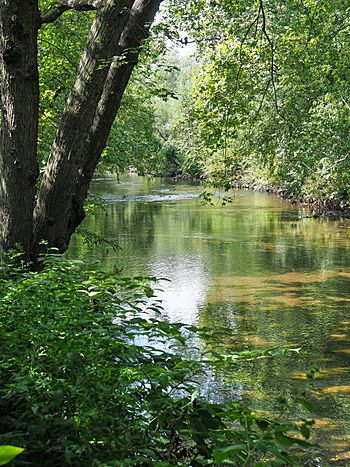
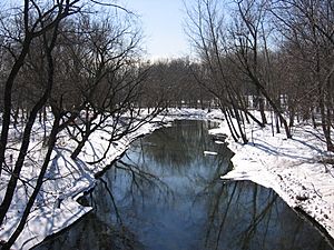
The Bronx River in from Shoelace Park, in The Bronx.
|
|
| Country | United States |
| State | New York |
| Region | Hudson Valley |
| County | Westchester and The Bronx |
| Municipalities | Mount Pleasant, White Plains, Greenburgh, Scarsdale, Eastchester, Yonkers, Bronx |
| Physical characteristics | |
| Main source | Kensico Reservoir New Castle 354 ft (108 m) 41°4′27″N 73°46′0″W / 41.07417°N 73.76667°W |
| River mouth | East River Hunts Point and Soundview in The Bronx 0 ft (0 m) 40°48′11″N 73°51′49.0″W / 40.80306°N 73.863611°W |
| Length | 24 mi (39 km) |
| Basin features | |
| Basin size | 38.4 sq mi (99 km2) |
| Tributaries |
|
The Bronx River is about 24 miles (39 km) long. It flows through southeastern New York State in the United States. This river drains an area of about 38.4 square miles (99 km²). It is named after an early settler, Jonas Bronck. The Bronx River is special because it's the only fresh water river in New York City.
The Bronx River used to start in what is now the Kensico Reservoir in Westchester County. This is north of New York City. However, when the Kensico Dam was built in 1885, the river's natural starting point was cut off. Today, a smaller stream feeds the river.
The Bronx River flows south past White Plains. Then it goes southwest through northern New York suburbs. It passes through towns like Edgemont, Tuckahoe, Eastchester, and Bronxville. The river forms the border between the cities of Yonkers and Mount Vernon. It then flows into the northern part of The Bronx. Here, it divides East Bronx from West Bronx. The river continues through Bronx Park, the New York Botanical Garden, and the Bronx Zoo. Finally, it flows through neighborhoods in the South Bronx. It empties into the East River, which is a tidal strait connected to Long Island Sound. This happens between the Soundview and Hunts Point areas.
Hundreds of years ago, Native Americans called this river "Aquehung." It was a boundary between different groups of people. The east side of the river was the land of the Siwanoy people, who were known for fishing. This same boundary was used later when Dutch and English settlers were given land. The name "Aquehung" likely came from an Algonquian word meaning "watery place."
In 1639, Jonas Bronck bought land between the Harlem River and the river that later became known as "Bronck's river."
Contents
Why the Bronx River is Important
The Bronx River is a vital part of New York City's environment and history. It provides a natural habitat for wildlife and offers green spaces for people to enjoy.
A River's Journey: From Pollution to Progress
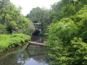
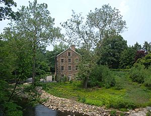
For many years, especially in the 1800s and 1900s, the Bronx River became very polluted. Factories and communities along its banks dumped industrial waste and raw sewage into it. One of the early factories on the river was the Lorillard Snuff Mill, which you can still see at the New York Botanical Garden.
Even after factories closed, the river continued to get dirty from local communities. In 1948, part of the river's path in Bronxville was changed. This was done to make space for an addition to Lawrence Hospital. During this work, a large sand bar was found. It had formed over hundreds of years from sand collecting at a bend in the river.
In the 2000s, environmental groups like the Bronx River Alliance started working to clean up the river. They wanted to bring it back to its natural, clean state. A U.S. Representative named José Serrano helped a lot. He got $14.6 million in government money to help clean the river.
Some towns in Westchester County were still dumping sewage into the river as late as 2006. But in November 2006, several towns agreed to stop dumping sewage by May 1, 2007.
Even today, pollution from rainwater runoff is a problem. This is when rain washes pollution from streets and land into the river. The Bronx River Watershed Coalition is a group of agencies and organizations working together. They create plans to reduce this pollution and make the water cleaner.
Amazing Wildlife Returns to the River
The cleanup efforts have helped wildlife return to the Bronx River.
Fish Come Back
In March 2006, a type of fish called alewife were released into the river. These fish were brought from a nearby river in Connecticut. Scientists hoped the alewife would lay their eggs in the river's upper parts. The young fish would then grow in the river, swim out to sea in the fall, and return to the river to lay their own eggs in a few years.
Alewife are important because they eat tiny organisms at the bottom of the food chain. This helps keep the river healthy. In 2009, adult alewife were found in the river. Scientists believe these were the children of the fish released in 2006! The next step is to build fish ladders over the dams. This will help the alewife swim further up the river to find good places to lay eggs.
Beavers Make a Comeback
In February 2007, biologists saw a beaver in the Bronx River! This was a huge surprise. Beavers had not been seen in New York City for over 200 years. They were hunted for their fur in the early 1800s and disappeared from the state.
The beaver was named Jose Serrano, after the Congressman who helped clean the river. In 2010, a second beaver joined Jose, doubling the beaver population in New York City! Beavers were once very important to the city's economy. You can even see two beavers on the city's official seal and flag.
Fun Activities and Green Spaces
Along much of the river in Westchester County and the northern Bronx, there's a special path. It's called the Bronx River Parkway and has a bike path next to it. This path goes from Bronxville to the Kensico Dam.
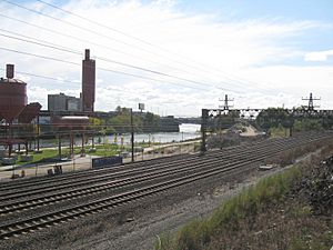
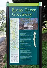
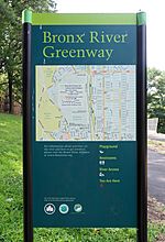
There's also a big project called the Bronx River Greenway. This plan aims to connect all the small green spaces along the river. It covers an 8-mile (13 km) stretch of the river in Westchester County and the Bronx. It's part of a larger project called the East Coast Greenway. The Bronx River Greenway includes parks like Concrete Plant Park and Starlight Park. Construction on this greenway started in October 2016.
In the southern Bronx, the river has become a popular place for canoeing. It's a unique way to explore nature right in New York City! The river also flows through Bronx Park and the Bronx Zoo. The Zoo even has a monorail that takes visitors over the river. It shows them an exhibit of Asian animals and pretends the Bronx River is the Irrawaddy River.
See also
 In Spanish: Río Bronx para niños
 | William Lucy |
 | Charles Hayes |
 | Cleveland Robinson |


