Norwood, Bronx facts for kids
Quick facts for kids
Norwood
|
|
|---|---|
|
Neighborhood of the Bronx
|
|

|
|
| Country | |
| State | |
| City | New York City |
| Borough | Bronx |
| Community District | Bronx 7 |
| Area | |
| • Total | 1.36 km2 (0.525 sq mi) |
| Population
(2010)
|
|
| • Total | 40,494 |
| • Density | 29,781/km2 (77,130/sq mi) |
| Economics | |
| • Median income | $37,465 |
| ZIP Codes |
10467
|
| Area code | 718, 347, 929, and 917 |
Norwood, also called Bainbridge, is a lively neighborhood in the northwest Bronx, New York City, U.S. It's bordered by Van Cortlandt Park and Woodlawn Cemetery to the north. The Bronx River is to its east, and Mosholu Parkway to the southwest.
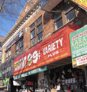
This area was once known for Valentine's Hill. The highest point is near 210th Street and Bainbridge Avenue. Montefiore Medical Center is a major part of Norwood. It is the largest landowner and employer here. Norwood's main shopping streets are Gun Hill Road, Jerome Avenue, Webster Avenue, and Bainbridge Avenue.
Norwood is part of Bronx Community District 7. The NYPD's 52nd Precinct keeps the area safe. In 2000, about 40,748 people lived in Norwood.
Contents
What's in a Name? Norwood's Identity
"Norwood" is the most common name for this neighborhood. You'll see it on subway maps and in local news. But the area is also known as "Bainbridge." This name is often used by the formerly Irish American community. Their main gathering spot was around Bainbridge Avenue and East 204th Street.
A Look Back: Norwood's History
During the Civil War, Norwood was farmland in Westchester County. Families like the Valentines, Varians, and Bussings owned much of the land. Woodlawn Cemetery was started in 1863 to the north.
New York City took over this area in 1873. By the early 1900s, it changed from farms to a more suburban place. Streets were planned in 1889 by Josiah Briggs. At that time, it was thought of as part of Williamsbridge. They still share a post office today. The Williamsbridge Reservoir opened in 1890. It supplied water to New York City until 1934.
Sporting Events and War Hospital
A 19-acre piece of land, called "Columbia Oval," was owned by Columbia University. It was at Gun Hill Road and Bainbridge Avenue. This oval was used for sports. The first United States marathon (25 miles) was held here in 1896. It started in Stamford, Connecticut.
Later, Columbia Oval became Columbia University's War Hospital. During World War I, the United States Army took it over. It was called "U.S. Army General Hospital No. 1."
How Norwood Got Its Name
Around the early 1900s, the area had a few names. It was called North Bedford Park, after the nearby neighborhood. It was also called Brendan Hill, named after St. Brendan the Navigator. A church, St. Brendan's, was founded here in 1908. The name Brendan Hill became official in 1910.
The name "Norwood" first appeared as Norwood Heights. It might have been named after Carlisle Norwood, a friend of Leonard Jerome. Or, it could simply be a shorter way of saying "North Woods." Many places in English-speaking countries use this name.
A Diverse Community Grows
In the first half of the 20th century, many European families moved to the Bronx. These included Catholic, Protestant, and Jewish families from Manhattan. Later, Puerto Ricans moved in during the Great Depression and after World War II.
After 1965, many other groups joined them. These included other Latinos, especially Dominicans. Also, Bangladeshis, Albanians, West Indians (like Guyanese), and West Africans (like Ghanaians) came. A new group of Irish immigrants also arrived.
The Irish Community in Bainbridge
From the 1970s to the 1990s, Norwood was known for its Irish population. Many immigrants came from Catholic areas of Northern Ireland. They were seeking work and a new home. During this time, the neighborhood became known as Bainbridge. This was because of the shops and pubs on Bainbridge Avenue and East 204th Street. Some even called it Little Belfast.
The area became a center for Irish and Irish-American culture. The band Black 47, made up of Irish musicians, started by playing in local bars. Their songs often talked about the experiences of the Irish in the area. Irish pubs here were known for supporting Irish causes.
Over time, the Irish population in Bainbridge changed. A downturn in the U.S. economy in the late 1980s caused some Irish immigrants to return home. The end of a conflict period in Northern Ireland also encouraged some to go back. The economy in the Republic of Ireland also improved, drawing people there. Many Irish-American residents moved to other parts of the Bronx or nearby Yonkers. The last Irish pub in the area closed in 2011.
Norwood's Population: A Snapshot
Who Lives in Norwood?
In 2010, Norwood had 40,494 people. This was a small decrease from 2000. The neighborhood covers about 360.93 acres.
The population is very diverse. In 2010, about 9.9% were White, 17.9% African American, and 11.0% Asian. About 58.7% of the population were Hispanic or Latino.
Most people in Norwood and Bedford Park are young or middle-aged adults. About 26% are under 18, 31% are between 25 and 44, and 23% are between 45 and 64. The average life expectancy here is about 79.4 years.
Economic Life in Norwood
In 2017, the average household income in this area was $35,355. About 26% of residents lived in poverty in 2018. This is similar to the rest of the Bronx. Many residents (61%) find it hard to pay their rent. This shows that Norwood and Bedford Park are considered lower-income areas.
Important Places: Norwood's Landmarks
Norwood has several important landmarks:
- Montefiore Medical Center: A large hospital and employer.
- Williamsbridge Oval: Often called "the Oval" or "Oval Park." It has playgrounds, dog runs, basketball and tennis courts, and a football field. It used to be a water reservoir.
- The Keeper's House at Williamsbridge Reservoir: Built in 1889. It was bought and fixed up by the Mosholu Preservation Corporation. It's now a community space and the home of the Norwood News. Both the Oval and the Keeper's House are New York City landmarks.
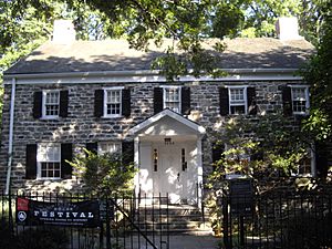
- The Valentine–Varian House: A stone farmhouse built in 1758. It is now the Museum of Bronx History.
- St. Brendan's Church and School: Started in 1908. It also has the St. Brendan's School of Music.
- The Shrine Church of St. Ann: Founded in 1927. Its school merged with others in 2012.
- Mosholu Library: A branch of the New York Public Library.
- The Lenru: A historic building.
Keeping Norwood Safe
The New York City Fire Department (FDNY) has two fire stations near Norwood. Engine Co. 79/Ladder Co. 37/Battalion 27 is on Briggs Avenue. Engine Co. 62/Ladder Co. 32 is on White Plains Road.
Mail and ZIP Codes
Norwood uses ZIP Code 10467. The United States Postal Service has the Van Cott Station at 3102 Decatur Avenue.
Learning in Norwood: Schools and Libraries
Norwood and Bedford Park have fewer college-educated residents than other parts of New York City. In 2018, about 23% of adults had a college degree or higher. Many residents (32%) have less than a high school education.
However, students are improving in math and reading. The percentage of students doing well in math went from 21% in 2000 to 48% in 2011. Reading achievement also increased.
Schools in the Area
The New York City Department of Education runs public schools here. PS/MS 280 Mosholu Parkway (grades K-8) and PS 56 (grades K-5) are local schools. Students also attend high schools like Evander Childs High School and DeWitt Clinton High School. St. Brendan's School is a Catholic K–8 school in the area.
The Mosholu Library
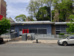
The New York Public Library (NYPL) operates the Mosholu branch. It is located at 285 East 205th Street. The library opened in 1955 and has two floors.
Getting Around: Transportation in Norwood
Norwood is well-connected by public transport.
Subway Stations
The following New York City Subway stations serve Norwood:
Commuter Rail
The Metro-North Railroad's Harlem Line serves Norwood. The Williams Bridge station is on the eastern edge of the neighborhood. It connects to Grand Central.
Bus Routes
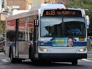
Several MTA Regional Bus Operations bus routes serve Norwood:
- Bx10: Travels to Riverdale.
- Bx16: Goes to Eastchester.
- Bx28: Connects to Co-op City or Fordham.
- Bx34: Travels to Woodlawn or Fordham.
- Bx38: Goes to Bay Plaza Shopping Center.
- Bx41 (including Select Bus Service): Connects to subway stations like Gun Hill Road or Third Avenue–149th Street.
The Bee-Line Bus System also serves Norwood, connecting to Westchester County, New York:
- BL4: To Getty Square, Yonkers.
- BL20: To White Plains.
Neighboring Areas
Norwood is surrounded by other interesting neighborhoods. These include Bedford Park, Williamsbridge, Olinville, Woodlawn Heights, and Allerton. Sometimes, Norwood is mistakenly called a part of Williamsbridge. This might be because they share the same zip code (10467) or due to the "Williamsbridge Oval" park located in Norwood.
 |
Van Cortlandt Park | Woodlawn Heights, Bronx and Woodlawn Cemetery | Williamsbridge, Bronx |  |
| Van Cortlandt Park | Allerton, Bronx | |||
| Bedford Park, Bronx | Bedford Park, Bronx | New York Botanical Garden |
 | Bayard Rustin |
 | Jeannette Carter |
 | Jeremiah A. Brown |


