Hutchinson River facts for kids
Quick facts for kids Hutchinson River |
|
|---|---|
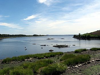
Mouth of the Hutchinson River in Pelham Bay Park
|
|
| Native name | Aquacanounck, Aqueanounck, Aqueanouncke |
| Other name(s) | East Chester Creek, Eastchester Creek, Eastchester River, Hutchins Creek, Hutchinson Creek, Hutchinson's Brook, Hutchinson's River, Hutchinsons River |
| Country | United States |
| State | New York |
| Counties | Westchester, and The Bronx |
| Physical characteristics | |
| Main source | Unnamed pond Scarsdale, New York 216 ft (66 m) 40°59′14″N 073°47′08″W / 40.98722°N 73.78556°W |
| River mouth | Eastchester Bay Bronx, New York 0 ft (0 m) 40°51′14″N 73°48′28″W / 40.85389°N 73.80778°W |
| Length | 10 mi (16 km) |
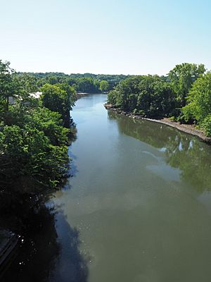
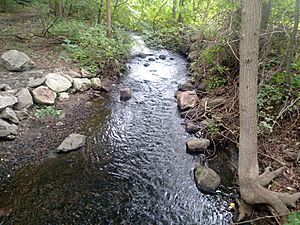
The Hutchinson River is a freshwater stream in New York State. It flows through the Bronx and Southern Westchester County. The river starts in Scarsdale and travels about 10 miles (16 km) south. It eventually flows into Eastchester Bay in New York City's Bronx borough.
This river helps form the border between several towns. It separates New Rochelle from Scarsdale and Eastchester. Further south, it also divides Mount Vernon and Pelham.
The river is named after Anne Hutchinson. She moved to Pelham Neck in 1642, settling near the river. Sadly, Anne and most of her family died the next year during a conflict.
River Travel and Use
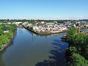
The Hutchinson River can be traveled by boats for its last 3 miles (5 km). Even today, tugs and barges use the river. They carry goods to and from different terminals.
One important terminal is Sprague Energy in Mount Vernon. It receives barges carrying heating oil and other fuels. Other docks, like PASCAP, export scrap metal. The former Colonial Sand and Gravel dock gets materials like gravel for making cement and asphalt.
The river needs more care. It was dredged (cleaned out) in 2010, but some parts were missed. These areas are now filling up with silt (mud and sand). This makes it hard for larger barges to reach some terminals, especially at low tide.
Bridges Over the River
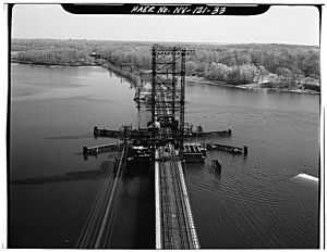
There are six bridges that cross the part of the river where boats can travel. These bridges carry both trains and cars.
From downstream (closer to the bay) to upstream (closer to the source), they are:
- Pelham Bridge (can open for boats)
- Amtrak's Pelham Bay Bridge (can open for boats)
- Hutchinson River Parkway bridge (can open for boats)
- New England Thruway bridge (fixed, does not open)
- Eastchester Bridge (Boston Post Road) (fixed, does not open)
- Fulton Ave Bridge in Pelham Manor (can open for boats)
The bridges that can open still have people called "tenders" who operate them. They open daily to let boats pass through.
River Reservoirs
The New Rochelle Water Company built dams on the Hutchinson River in three spots. This happened between 1886 and 1907. These dams created three reservoirs (large artificial lakes) at the northern end of the area.
In 1927, the Westchester County Park Commission bought these reservoirs and the land around them. They wanted to use the land for parks and a parkway (a scenic road). Part of this land became the Hutchinson River Parkway, which runs alongside the river for most of its length.
The three reservoirs are named by the order they were built:
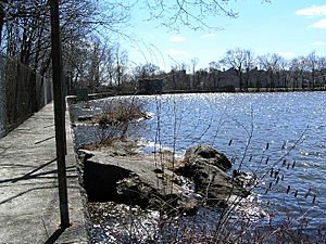
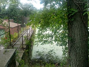
- Reservoir No. 1 (built in 1886) is now called Lake Innisfree. It's the largest of the three. Most of it is surrounded by private land. You can reach its dam and part of its eastern shore by walking on the Leatherstocking Trail.
- The Hutchinson River flows about 0.75 miles (1.2 km) from Lake Innisfree to Reservoir 3 (built in 1907).
- Right after leaving Reservoir 3, the river goes under the Hutchinson River Parkway. Then it flows about 0.1 mile (0.16 km) to Reservoir 2 (built in 1892). This is the smallest of the three.
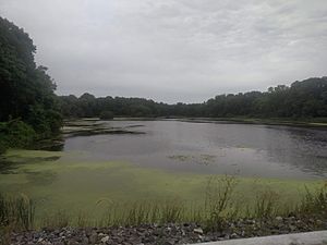
Reservoir 3 and Reservoir 2 are both inside Twin Lakes County Park. You can explore them using the Leatherstocking Trail and other paths. None of these three reservoirs are used for water supply anymore.
 | James Van Der Zee |
 | Alma Thomas |
 | Ellis Wilson |
 | Margaret Taylor-Burroughs |


