Hudson County, New Jersey facts for kids
Quick facts for kids
Hudson County
|
|||
|---|---|---|---|
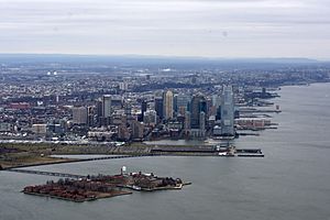
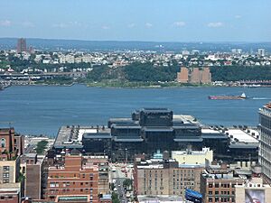
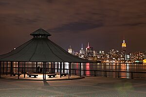
View north on Hudson Waterfront
|
|||
|
|||
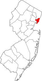
Location within the U.S. state of New Jersey
|
|||
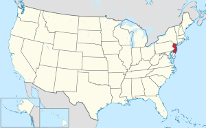 New Jersey's location within the U.S. |
|||
| Country | |||
| State | |||
| Founded | 1840 | ||
| Named for | Henry Hudson | ||
| Seat | Jersey City | ||
| Largest city | Jersey City (population and area) | ||
| Area | |||
| • Total | 62.35 sq mi (161.5 km2) | ||
| • Land | 46.19 sq mi (119.6 km2) | ||
| • Water | 16.15 sq mi (41.8 km2) 25.9% | ||
| Population
(2020)
|
|||
| • Total | 724,854 | ||
| • Estimate
(2023)
|
705,472 |
||
| • Density | 11,625.6/sq mi (4,488.7/km2) | ||
| Time zone | UTC−5 (Eastern) | ||
| • Summer (DST) | UTC−4 (EDT) | ||
| Congressional districts | 8th, 9th, 10th | ||
Hudson County is the smallest and most crowded county in New Jersey. It is located west of the lower Hudson River. This river was named after Henry Hudson, a sea captain who explored the area in 1609. Hudson County is part of New Jersey's Gateway Region. It is also part of the larger New York metropolitan area.
The main city and government center is Jersey City. This city is the largest in the county by both population and size. Hudson County is in the North Jersey part of the state.
In 2020, the county had 724,854 people. This made it the fourth-most-populated county in New Jersey. It was also the fastest-growing county in the past ten years. Its population grew by over 90,000 people since 2010.
Hudson County is New Jersey's smallest county by land area. It covers about 46 square miles. It is also the most densely populated, with over 15,000 residents per square mile in 2020. The county has many public transportation links. These connect it to Manhattan (across the Hudson River) and other parts of New Jersey.
Contents
- Geography and Climate: What is Hudson County Like?
- History: How Did Hudson County Begin?
- Demographics: Who Lives in Hudson County?
- Economy: What Kinds of Businesses are in Hudson County?
- Municipalities: What Towns Make Up Hudson County?
- Education: Where Do Students Learn?
- Transportation: How Do People Get Around?
- Parks and Points of Interest: What Can You See and Do?
- Museums, Galleries, Exhibitions: Places to Explore
- See also
Geography and Climate: What is Hudson County Like?
Climate: What is the Weather Like?
The average temperature in Hudson County is about 51.89 degrees Fahrenheit. This is very close to the state average. It is a bit cooler than the national average.
Hudson County is on the U.S. East Coast. It is about halfway between the Equator and the North Pole. This means its weather can change a lot. It gets wet, dry, hot, and cold air. Hudson County is in New Jersey's Central climate region. This area has many cities and industries. Buildings made of asphalt, brick, and concrete hold more heat. This makes the area a "heat island" that is warmer than nearby rural areas.
Hudson County gets rain or snow about 116 days a year. It receives about 48 inches of rain annually. This is more than the national average of 38 inches. It gets about 26 inches of snow each year. The highest summer temperature in July is around 86 degrees. The lowest winter temperature in January is 25 degrees. The county has about 219 sunny days per year. This is more than the national average of 205.
| Weather chart for Jersey City | |||||||||||||||||||||||||||||||||||||||||||||||
|---|---|---|---|---|---|---|---|---|---|---|---|---|---|---|---|---|---|---|---|---|---|---|---|---|---|---|---|---|---|---|---|---|---|---|---|---|---|---|---|---|---|---|---|---|---|---|---|
| J | F | M | A | M | J | J | A | S | O | N | D | ||||||||||||||||||||||||||||||||||||
|
3.7
38
27
|
3.2
42
29
|
4.4
50
35
|
4.5
61
45
|
4.2
71
54
|
4.4
79
64
|
4.6
84
69
|
4.4
83
68
|
4.3
75
61
|
4.4
64
50
|
4
54
42
|
4
43
32
|
||||||||||||||||||||||||||||||||||||
| temperatures in °F precipitation totals in inches source: The Weather Channel |
|||||||||||||||||||||||||||||||||||||||||||||||
|
Metric conversion
|
|||||||||||||||||||||||||||||||||||||||||||||||
In Jersey City, temperatures usually range from 27°F in January to 84°F in July. The coldest temperature ever recorded was -15°F in February 1934. The hottest was 106°F in July 1936.
Landforms and Borders: What Does the Land Look Like?
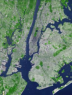
Hudson County covers about 62.35 square miles in total. About 46.19 square miles is land, and 16.15 square miles is water. It is the smallest of New Jersey's 21 counties by land area. It is also one of the smallest counties in the entire United States.
Hudson County is in the middle of the New York metropolitan area. It is in northeastern New Jersey. It shares borders with several important waterways. To the east are the Hudson River and Upper New York Bay. To the south is Kill Van Kull. To the west are Newark Bay and the Hackensack River or Passaic River. Its only land border is with Bergen County to the north.
The northern part of the county has the New Jersey Palisades. These are tall cliffs overlooking the Hudson River. To the west, the land slopes more gently. The southern part of the county is flat and coastal. The western area, near the Hackensack and Passaic Rivers, is part of the New Jersey Meadowlands. Much of the land along the county's coast was created by land reclamation. This means land was built up using materials like dirt and rocks.
The highest point in Hudson County is 260 feet above sea level, in West New York. The lowest point is at sea level. North Bergen has the second most hills per square mile in the United States, after San Francisco.
Ellis Island and Liberty Island are in Hudson County's waters. These islands are across from Liberty State Park. Liberty Island is actually part of New York State. Much of Ellis Island was created by adding land. Shooters Island, in the Kill van Kull, is also shared with New York.
Most of Hudson County is on a long, narrow piece of land between the Hackensack and Hudson Rivers. This area is very urban. It can be hard to tell where one town ends and another begins. These borders and the hills and waterways create unique neighborhoods. Kennedy Boulevard runs the entire length of this land. Many roads and train tracks cut through the hills.
Because it is so close to Manhattan, Hudson County is sometimes called "New York City's sixth borough."
History: How Did Hudson County Begin?
Etymology: Where Did the Name Come From?
Hudson County is named after the explorer Henry Hudson. He mapped much of this area.
Early Days: The Lenape and New Netherland
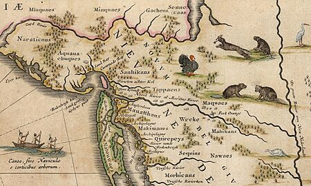
Before Europeans arrived in the 1600s, the Lenape people lived in Hudson County. These were groups like the Hackensack and Tappan. They moved with the seasons, growing some crops and also hunting and gathering food. They likely fished and trapped a lot, given the area's land. These groups traded often with the first Europeans. Many local place names still come from their Algonquian language. Examples include Communipaw, Hoboken, and Secaucus.
Henry Hudson claimed this area for the Dutch in 1609. He anchored his ship, the Halve Maen (Half Moon), in the local coves. Europeans from the Netherlands settled the west bank of the Hudson River around the same time as New Amsterdam (now New York City). In 1630, Michiel Pauw bought land between the Hudson and Hackensack Rivers. He named it Pavonia.
Small settlements were built at places like Communipaw (1633) and Paulus Hook (1638). Relations with the Lenape were difficult. This led to Kieft's War, which started with a Dutch attack at Communipaw. In 1658, Peter Stuyvesant, a Dutch leader, bought the area called Bergen from the Lenape. This included the whole peninsula. In 1661, a new village was founded at what is now Bergen Square. This is considered New Jersey's oldest self-governing town. The British took control of the area in 1664. The Dutch officially gave up control in 1674.
British Rule and Early America
By 1675, the area became part of the British colony of East Jersey. It was in the Bergen Township district. The county's main town moved to Hackensack in 1709. Small villages and farms supplied New York City with food. This included oysters from the large beds in Upper New York Bay.
During the American Revolutionary War, the British controlled the area. Colonial troops watched enemy movements from the high ground. The Battle of Paulus Hook in 1779 was a surprise attack on a British fort. It boosted the morale of the revolutionary forces. Many streets in downtown Jersey City are named after military heroes.
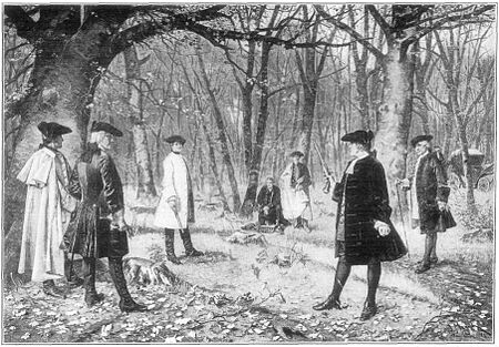
Weehawken became famous for duels. The most well-known was between Alexander Hamilton and Aaron Burr in 1804. Border disputes with New York limited growth. However, some towns like Paulus Hook and Hoboken grew. Hoboken became a popular vacation spot for wealthy New Yorkers.
The Morris Canal, early railroads, and the growth of the harbor helped the area develop more. In September 1840, Hudson County was created. It was separated from Bergen County. It also gained some land from Essex County. In the 1800s, Hudson County was important for the Underground Railroad. Four escape routes for enslaved people met in Jersey City.
Urbanization and Immigration: A Growing Area
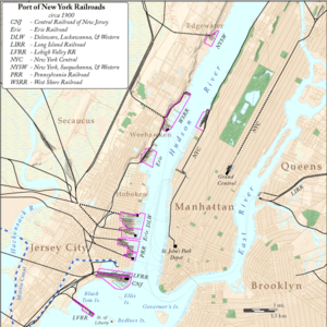
From the late 1800s to the early 1900s, Hudson County grew a lot. New ports and railroad stations were built in Jersey City, Bayonne, Hoboken, and Weehawken. This changed the coastline a lot, as land was filled in. Many European immigrants, especially Germans and Irish, came to the area. This caused a big population boom.
New neighborhoods grew as farms were divided for homes. Streets were built, some with trolley lines. Stevens Institute of Technology and Saint Peter's University were founded.
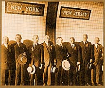
Before 1910, trains ended on the west side of the Hudson River. Passengers and cargo had to take ferries to New York. The Hudson and Manhattan Railroad (now PATH) opened in 1908. This allowed people to travel under the river. Hoboken Terminal, built in 1907, is the only major train and ferry station still operating.
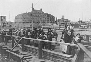
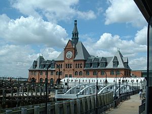
The Central Railroad of New Jersey's Communipaw Terminal was near Ellis Island and the Statue of Liberty. It was very important for the many immigrants arriving at that time. Many new arrivals started their lives in America from this station. Many stayed in Hudson County. They found jobs on the docks, railroads, factories, and refineries.
Many famous companies set up businesses here. These included Colgate, Maxwell House, and Standard Oil. North Hudson, especially Union City, became the "embroidery capital of America." This industry included many small shops making embroidered products.
During this time, many homes and apartment buildings were built. Town borders were set, and neighborhoods became established. Shopping areas like Bergenline, Central, Newark, and Ocean Avenues became popular. Journal Square became a center for business, shopping, and entertainment.
World Wars and New Deal: Changes and Growth
When the U.S. entered World War I, the government took over the piers in Hoboken. Hudson County became a major departure point for over three million soldiers. In 1916, German agents set off bombs at a munitions depot in New York Bay. This event, known as the Black Tom explosion, caused a lot of damage.
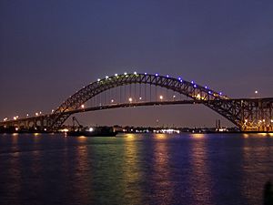
The Port Authority of New York and New Jersey was created in 1921. Large transportation projects opened between the World Wars. These included the Holland Tunnel (1927), the Bayonne Bridge (1931), and the Lincoln Tunnel (1937). These allowed cars to travel between New Jersey and New York City. Other bridges, like the Pulaski Skyway, were also built.
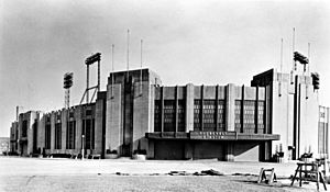
New Jersey City University opened during this time. Big projects were built under the Works Progress Administration. These included stadiums in Jersey City and Union City. President Franklin D. Roosevelt attended the opening of the largest project, the Jersey City Medical Center.
During this era, the "Hudson County Democratic Machine" was very powerful. It was known for its political connections. Industries in Hudson County were vital for the war effort during WWII. This included making PT boats in Bayonne. The Military Ocean Terminal at Bayonne (MOTBY) opened in 1942 as a military base. It operated until 1999.
Recent Years: Post-War to Today
After World War II, shipping and manufacturing were still important. Union jobs offered good pay. Many soldiers moved to nearby suburbs. But many with strong family ties stayed in Hudson County. Baseball legend Jackie Robinson played his first minor league game at Roosevelt Stadium. He helped break the color barrier in baseball.
Hudson County saw many groups move in and out. This is common in older urban areas. When big businesses left, Hudson County's economy changed. Efforts were made to improve neighborhoods. Some older areas were torn down to build new housing. This sometimes caused conflicts between neighborhoods. Riots happened in Jersey City in 1964.
Lower property values allowed new immigrants, many from Latin America, to move in. North Hudson, especially Union City, saw many people fleeing the Cuban revolution. Unlike other old industrial areas, North Hudson did not suffer as much from urban decay or crime. Its population and economy stayed stable. This was partly due to good housing, strong neighborhoods, and schools.
Since the mid-1990s, Hudson County has seen a lot of new building. Many new residents bought homes or apartments. Many people from the suburbs, other parts of the U.S., and other countries moved here. They were drawn by jobs in New York and New Jersey. This led to a "real-estate boom." Old rail yards and other industrial sites were redeveloped for businesses.
The destruction of the World Trade Center in 2001 greatly affected Hudson County. It was a place for people to evacuate to. Many residents who worked there lost their jobs or lives. Many companies moved their offices across the river. New zoning rules and the Hudson-Bergen Light Rail helped new construction. Even with all this growth, Hudson County's towns have remained separate. This is due to local government rules, geography (like cliffs and rivers), and different ethnic groups.
Demographics: Who Lives in Hudson County?
| Historical population | |||
|---|---|---|---|
| Census | Pop. | %± | |
| 1840 | 9,483 | — | |
| 1850 | 21,822 | 130.1% | |
| 1860 | 62,717 | 187.4% | |
| 1870 | 129,067 | 105.8% | |
| 1880 | 187,944 | 45.6% | |
| 1890 | 275,126 | 46.4% | |
| 1900 | 386,048 | 40.3% | |
| 1910 | 537,231 | 39.2% | |
| 1920 | 629,154 | 17.1% | |
| 1930 | 690,730 | 9.8% | |
| 1940 | 652,040 | −5.6% | |
| 1950 | 647,437 | −0.7% | |
| 1960 | 610,734 | −5.7% | |
| 1970 | 607,839 | −0.5% | |
| 1980 | 556,972 | −8.4% | |
| 1990 | 553,099 | −0.7% | |
| 2000 | 608,975 | 10.1% | |
| 2010 | 634,266 | 4.2% | |
| 2020 | 724,854 | 14.3% | |
| 2023 (est.) | 705,472 | 11.2% | |
| Historical sources: 1790-1990 1970-2010 2000 2010-2019 2020 |
|||
Hudson County is the most densely populated county in New Jersey. It is the sixth-most densely populated county in the United States. In 2020, it had 15,693 residents per square mile. Jersey City was the only city in Hudson County among the 100 most populated cities in the U.S.
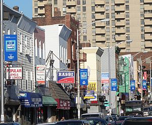
Union City is the most densely populated city in the United States for places with over 50,000 people. Several other Hudson County towns are also among the most densely populated in the U.S. and worldwide. Guttenberg is the most densely populated town in the United States.
North Hudson has the second-largest Cuban American population in the U.S., after Miami. Jersey City is one of the most ethnically diverse cities in the U.S. and the most diverse on the East Coast. Hudson County has three towns where over 50% of residents were born in other countries. These are West New York (65.2%), Union City (58.7%), and Guttenberg (48.7%). Hudson County also has the smallest percentage of people over 65 in New Jersey.
Population in 2020
In 2020, Hudson County had 724,854 people. The population density was about 15,693 people per square mile. The county's racial makeup was:
- 28.49% White
- 9.84% African American
- 0.14% Native American
- 17.02% Asian
- 2.75% from two or more races.
- Hispanic or Latino people made up 40.4% of the population.
About 20.3% of the population was under 18 years old. The average age was 35.5 years. The county had slightly more females (50.23%) than males (49.76%).
The average household income was $78,808. About 13.9% of the population lived below the poverty line. This included 22.2% of those under 18.
Community Diversity: A Mix of Cultures
Hudson County is a major entry point for immigration to the United States. It is also a big job center near New York City. Because of this, Hudson County has become very diverse. People from many different countries, religions, and backgrounds live here. The top five countries of birth for foreign-born residents are Cuba, Dominican Republic, Ecuador, Philippines, and India. Jersey City is one of the most diverse cities in the world.
Latin American Communities
In 2013, there were about 273,611 Hispanic Americans in Hudson County. This was a small increase from 2010. Many towns in northern Hudson County are very densely populated. Several towns on the Hudson Palisades have populations where over 50% of residents were born outside the U.S. Often, most of these are Hispanic.
Puerto Rican Americans
In 2013, there were about 58,197 Puerto Rican Americans in Hudson County.
Cuban Americans
In 2013, there were about 28,900 Cuban Americans in Hudson County. North Hudson has the second-largest Cuban American population in the U.S. The Cuban Day Parade of New Jersey is a big event. It runs along Bergenline Avenue.
European American Communities
In 2013, there were about 194,192 non-Hispanic whites in Hudson County. This was a small decrease from 2010.
Italian Americans
Italian Americans have played an important cultural role in Hudson County's history.
Irish Americans
Irish Americans, especially Irish Catholics, were very important in Jersey City's politics. Many of the city's mayors were of Irish descent. The Greenville, Jersey City neighborhood was the center of the city's Irish community for a long time.
Asian American Communities
In 2013, there were about 89,164 Asian Americans in Hudson County. This was a 5% increase from 2010.
Indian Americans
India Square in Jersey City is also called "Little India" or "Little Bombay." It has the largest group of Asian Indians in the Western Hemisphere. This area hosts large outdoor Navratri celebrations and Hindu temples. An annual spring Holi festival also takes place here. In 2013, there were about 39,477 Indian Americans in Hudson County.
Filipino Americans
About 7% of Jersey City's population is Filipino. The Five Corners area has a lively Filipino community. This is Jersey City's Little Manila. It is the second-largest Asian American group in the city. You can find many Filipino restaurants, stores, and businesses here. Manila Avenue in Downtown Jersey City was named for the Philippine capital. Many Filipinos built their homes on this street in the 1970s. A memorial for Filipino American veterans is on Manila Avenue. Jersey City hosts the annual Philippine-American Friendship Day Parade in June. In 2013, there were about 21,622 Filipino Americans in Hudson County.
Chinese Americans
Hudson County is easy to reach from Lower Manhattan and its Chinatown. In 2013, there were about 13,381 Chinese Americans in Hudson County. This was a fast growth of 19.1% from 2010.
African American Communities
In 2013, there were about 83,576 African Americans in Hudson County. This was a small decrease from 2010. However, the number of African immigrants, especially Nigerian Americans in Jersey City, is growing. This helps balance the decrease in the American-born Black population.
Arab American Communities
In 2012, there were about 14,518 Arab Americans in Hudson County. This was 2.3% of the county's population. This is the second-highest percentage in New Jersey. Arab Americans are mostly in Jersey City and Bayonne. This group includes the largest population of Coptic Christians in the United States.
Muslim American Communities
Hudson County has a growing Muslim American population. This includes many Latino people who have converted to Islam.
Jewish American Communities
A growing Jewish American population has been noted in Hudson County. This is especially true in Jersey City and Bayonne.
Economy: What Kinds of Businesses are in Hudson County?
In 2021, Hudson County's economy produced $41.7 billion in goods and services. This ranked fifth in New Jersey.
Many businesses and industries started or have their main offices in Hudson County. Secaucus is home to The Vitamin Shoppe, Goya Foods, and The Children's Place. Jersey City is home to Verisk Analytics and WFMU radio station. Hoboken is where the first Blimpie restaurant opened. It is also home to publisher John Wiley & Sons. In the 1900s, Union City was the "embroidery capital of the United States." Weehawken is home to NY Waterway.
Television shows have filmed in Hudson County because of tax credits. The HBO show Oz was filmed in an old warehouse in Bayonne. The NBC show Law and Order: Special Victims Unit filmed scenes in North Bergen and Secaucus. These shows moved to New York in 2010. This happened after New Jersey stopped offering tax credits for film and TV production.
Municipalities: What Towns Make Up Hudson County?
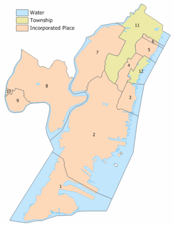
There are 12 towns and cities in Hudson County. They are listed below with their population and area from the 2010 Census. North Hudson and West Hudson are distinct areas with their own towns.
| Municipality | Map key |
Mun. type |
Pop. | Housing units |
Total area |
Water area |
Land area |
Pop. density |
Housing density |
School district |
|---|---|---|---|---|---|---|---|---|---|---|
| Bayonne | 1 | city | 71,686 | 27,799 | 11.08 | 5.28 | 5.80 | 10,858.3 | 4,789.4 | Bayonne |
| East Newark | 10 | borough | 2,594 | 794 | 0.12 | 0.02 | 0.10 | 23,532.1 | 7,765.8 | Harrison (9-12) (S/R) East Newark (K-8) |
| Guttenberg | 6 | town | 12,017 | 4,839 | 0.24 | 0.05 | 0.20 | 57,116.0 | 24,730.2 | North Bergen (9-12) (S/R) Guttenberg (PK-8) |
| Harrison | 9 | town | 19,450 | 5,228 | 1.32 | 0.12 | 1.20 | 11,319.3 | 4,344.9 | Harrison |
| Hoboken | 3 | city | 60,419 | 26,855 | 2.01 | 0.74 | 1.28 | 39,212.0 | 21,058.7 | Hoboken |
| Jersey City | 2 | city | 292,449 | 108,720 | 21.08 | 6.29 | 14.79 | 16,736.6 | 7,349.1 | Jersey City |
| Kearny | 8 | town | 41,999 | 14,180 | 10.19 | 1.42 | 8.77 | 4,636.5 | 1,616.0 | Kearny |
| North Bergen | 11 | township | 63,361 | 23,912 | 5.57 | 0.44 | 5.13 | 11,838.0 | 4,657.8 | North Bergen |
| Secaucus | 7 | town | 22,181 | 6,846 | 6.60 | 0.78 | 5.82 | 2,793.7 | 1,175.9 | Secaucus |
| Union City | 4 | city | 68,589 | 24,931 | 1.28 | 0.00 | 1.28 | 51,810.1 | 19,436.9 | Union City |
| Weehawken | 12 | township | 17,197 | 6,213 | 1.48 | 0.68 | 0.80 | 15,764.6 | 7,801.9 | Weehawken |
| West New York | 5 | town | 52,912 | 20,018 | 1.33 | 0.32 | 1.01 | 49,341.7 | 19,870.5 | West New York |
| Hudson County | county | 724,854 | 270,335 | 62.31 | 16.12 | 46.19 | 13,731.4 | 5,852.5 |
Education: Where Do Students Learn?
Colleges and Universities
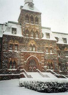
Hudson County has several colleges and universities. These include Hudson County Community College (HCCC), New Jersey City University (NJCU), and Saint Peter's University. All three are in Jersey City. Stevens Institute of Technology is in Hoboken. Rutgers University also offers classes in the county.
School Districts: Public Schools in Hudson County
Each town in Hudson County has its own public school district. Most have their own public high schools. Students from East Newark go to Harrison High School. Students from Guttenberg attend North Bergen High School. The Hudson County Schools of Technology offers vocational and technical training. It has locations in Secaucus, Jersey City, Union City, and Harrison. There are also many private schools.
School districts include:
- Bayonne School District
- East Newark School District (K–8)
- Guttenberg Public School District (K–8)
- Harrison Public Schools
- Hoboken Public Schools
- Hudson County Schools of Technology (9–12)
- Jersey City Public Schools
- Kearny School District
- North Bergen School District
- Secaucus Public Schools
- Union City School District
- Weehawken School District
- West New York School District
Transportation: How Do People Get Around?
Hudson County is a major transportation hub. It has many roads and railways. It connects to a large network of highways and toll roads. Many long-distance trains and buses pass through. However, major national services like Amtrak do not stop in the county.
There are many local bus routes. These go within Hudson County and to Manhattan. There is also a growing light rail system. Ferries cross the Hudson River. Commuter trains go to North Jersey, the Jersey Shore, and Trenton. Most public transportation helps people travel to Newark, Manhattan, and the Hudson Waterfront. NJ Transit, the Port Authority of New York and New Jersey, and NY Waterway operate public transport.
Transportation Hubs
Major transportation centers include Hoboken Terminal, Bergenline Avenue at 32nd Street, and Journal Square Transportation Center. The Port Authority Bus Terminal and Penn Station in Manhattan are also important. Secaucus Junction provides access to eight commuter train lines.
Rail Travel
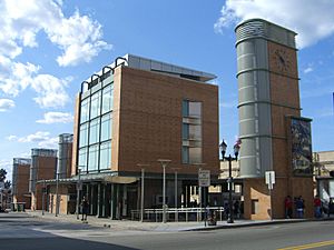
- The Hudson-Bergen Light Rail serves Bayonne, Jersey City, Hoboken, and North Hudson.
- NJ Transit trains from Hoboken Terminal go to various parts of New Jersey and New York.
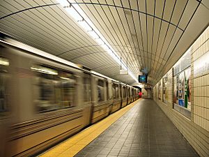
- The PATH is a 24-hour subway system. It connects Newark, Harrison, Jersey City, Hoboken, and Manhattan.
Bus Travel
NJ Transit bus routes 120-129 serve Hudson County and Manhattan. NJ Transit bus routes 1-89 serve the county and other parts of North Jersey. Private bus companies also offer service.
Water Travel
Hudson County is in the middle of the Port of New York and New Jersey. Since the 1980s, its ferry system has been restored.
- NY Waterway operates ferries from Weehawken, Hoboken, and Paulus Hook. These go to various points in Manhattan.
- Liberty Water Taxi connects Liberty State Park, Paulus Hook, and Battery Park City.
- Statue Cruises provides service to Ellis Island and Liberty Island.
- Cape Liberty Cruise Port in Bayonne is one of the port's passenger terminals.
- Port Jersey is one of the port's container shipping terminals.
Roads and Highways
In 2010, Hudson County had over 616 miles of roads. Major highways include New Jersey Routes 3, 7, 139, 185, 440, and 495. Interstates 78, 95, and 280 also pass through. U.S. Routes 1/9 and 1/9 Truck are important. The New Jersey Turnpike and the Pulaski Skyway are also here.
You can drive to New York City through the Lincoln Tunnel (from Weehawken to Midtown Manhattan) and the Holland Tunnel (from Jersey City to Lower Manhattan). The Bayonne Bridge connects to Staten Island. County Route 501 runs through Hudson County as Kennedy Boulevard.
In 2013, Kennedy Boulevard and U.S. Route 1/9 were listed among the most dangerous roads for pedestrians. Six pedestrians died on Kennedy Boulevard from 2009 to 2011. Five died on Route 1/9 during the same period.
Airports
Most airports serving Hudson County are operated by the Port Authority of New York and New Jersey.
- Newark Liberty International Airport (EWR) is the closest airport with regular passenger flights. It is about 12.8 miles away in Newark.
- LaGuardia Airport (LGA) is 12.8 miles away in Queens, New York.
- John F. Kennedy Airport (JFK) is 19 miles away in Queens, New York.
- Teterboro Airport serves private planes.
- Essex County Airport is a general aviation airport.
Parks and Points of Interest: What Can You See and Do?
The Hudson County Park System includes several parks. Some of these are Lincoln Park, Washington Park, and North Hudson Park. The newest is Laurel Hill. Many city parks were developed as "city squares" in the 1800s. Examples include Hamilton Park and Church Square Park.
The German-American Volksfest has been held every year since 1874 at Schuetzen Park. This private park and nearby cemeteries create a "green lung" for North Hudson County.
Jersey City Reservoir No.3 and Pershing Field are large green spaces. The reservoir is no longer used for water. It is now a nature preserve.
Walking paths are being built along the rivers. These include the Hudson River Waterfront Walkway and Hackensack RiverWalk. Sections of the Secaucus Greenway are in place. They will eventually connect different parts of the town. Kearny Riverbank Park runs along the Passaic River.
Liberty State Park is the county's largest park. It was built on land that was once an oyster bed. This land was filled in for industrial use. It was reclaimed in the 1970s. Ellis Island and Liberty Island are national protected areas. They are home to the Statue of Liberty National Monument. You can take a ferry to them from Liberty State Park.
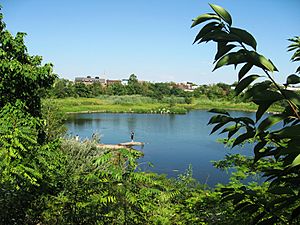
The New Jersey Meadowlands Commission has set aside several areas as wetlands preservation zones. These include the Riverbend Wetlands Preserve and Kearny Marsh.
Hudson County has several golf courses. These include Skyway Golf Course, Bayonne Golf Club, and Liberty National Golf Club.
- See Historic districts in Hudson County, New Jersey
- See List of cemeteries in Hudson County, New Jersey
- See List of bridges, tunnels, and cuts in Hudson County, New Jersey
Museums, Galleries, Exhibitions: Places to Explore
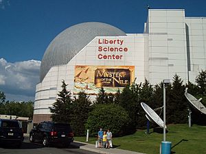
There are several museums and exhibition spaces in Hudson County. Some have permanent collections. Others focus on local culture, history, or the environment. There are also events throughout the year that highlight architecture, local artists, or ethnic culture. Private art galleries are also available.
Places to visit include:
- Afro-American Historical and Cultural Society Museum
- Bayonne Community Museum
- Bayonne Firefighter's Museum
- Central Railroad of New Jersey Terminal
- Cultural Thread/El Hilo, which shows the history of embroidery.
- Ellis Island Immigration Museum
- Hoboken Artists Studio Tour
- Hoboken Fire Department Museum
- Hoboken Historical Museum
- Hudson County Courthouse with murals showing early history.
- Hudson River Waterfront Walkway with displays about history and development.
- Kearny Museum
- Jersey City Artists Studio Tour
- Jersey City Museum
- Liberty Science Center for science education.
- Liberty State Park Interpretive Center for nature and urban environment.
- Museum of Russian Art
- New Jersey City University galleries and sculpture garden.
- Saints Peter's College Art Gallery
- Statue of Liberty National Monument
- William V. Musto Cultural Center
See also
 In Spanish: Condado de Hudson para niños
 | Isaac Myers |
 | D. Hamilton Jackson |
 | A. Philip Randolph |


