
County Route 501 (New Jersey) facts for kids
Quick facts for kids
|
||||
|---|---|---|---|---|
|
CR 501 highlighted in red
|
||||
| Route information | ||||
| Length | 40.24 mi (64.76 km) | |||
| Existed | January 1, 1953–present | |||
| Middlesex County section | ||||
| Length | 10.12 mi (16.29 km) | |||
| West end | ||||
| Major junctions |
|
|||
| East end | ||||
| Hudson / Bergen County section | ||||
| Length | 30.12 mi (48.47 km) | |||
| South end | ||||
| Major junctions |
|
|||
| North end | ||||
| Location | ||||
| Counties: | Middlesex, Hudson, Bergen | |||
| Highway system | ||||
| County routes in New Jersey 500-series
|
||||

County Route 501 (CR 501) is a special road in New Jersey. It's called a "county highway" because it's managed by the counties it passes through. This road is split into two main parts. One part is in Middlesex County. The other part goes through Hudson and Bergen Counties.
The two sections of CR 501 are not directly connected. Instead, they link up using another road, New York State Route 440 (NY 440), which crosses over to Staten Island in New York. The New Jersey Department of Transportation sees CR 501 as one long road, including the part on NY 440. It measures about 53 miles (85 kilometers) in total.
Contents
Exploring County Route 501: A New Jersey Road Trip
Middlesex County: The Southern Stretch
_at_Middlesex_County_Route_529_(Stelton_Road)_on_the_border_of_Piscataway_Township_and_South_Plainfield_in_Middlesex_County,_New_Jersey.jpg)
In Middlesex County, CR 501 is marked as going "east-west." It starts in South Plainfield at CR 529. From there, it heads east towards Metuchen. For a short distance, it shares the road with Route 27. This is called a "concurrency."
The road then continues east. It crosses the Garden State Parkway near Woodbridge. It also shares parts of the road with Route 184 and Route 440. This southern section of CR 501 ends at the Outerbridge Crossing, which is a bridge connecting New Jersey to Staten Island.
Hudson County: John F. Kennedy Boulevard
The northern part of CR 501 begins in Bayonne. It starts near the Route 440 and Bayonne Bridge junction. From there, it travels north to Route 63 in North Bergen. Along the way, it crosses other important roads like Route 139, which leads to the Holland Tunnel. It also crosses Route 495, which goes to the Lincoln Tunnel.
When CR 501 meets Route 63 in North Bergen, they share the road for a bit, heading into Bergen County. This part of CR 501 is also known as John F. Kennedy Boulevard. This boulevard is a major road in Hudson County.
Landmarks on John F. Kennedy Boulevard
_just_north_of_63rd_Street_in_Jersey_City,_Hudson_County,_New_Jersey.jpg)
Many important places are located along CR 501, especially on the John F. Kennedy Boulevard section. These include:
- Several high schools, like Marist High School and Union City High School.
- Universities, such as New Jersey City University and Saint Peter's University.
- Journal Square, a busy area in Jersey City.
- Four county parks: Stephen R. Gregg Park, Mercer Park, Lincoln Park, and James J. Braddock Park. These parks offer green spaces and recreation for the community.
Near Journal Square, CR 501 crosses over Port Authority Trans-Hudson (PATH) train tracks. It does this on an old concrete bridge built in 1926. This bridge is a cool example of older engineering.
Bergen County: The Northern End
_at_5th_Street_in_Palisades_Park,_Bergen_County,_New_Jersey.jpg)
When CR 501 enters Bergen County, it eventually leaves Route 63 in Palisades Park. Here, it uses a road called Central Boulevard. This connects it to other major roads like US 1/9 and 46, and Route 93.
CR 501 then shares the road with Route 93 for a while. This shared section ends when Route 93 finishes at Route 4 in Englewood. CR 501 keeps going north from this point, passing through Rockleigh. Finally, it crosses the New York State Line and becomes New York State Route 340.
History of County Route 501
Roads like CR 501 have a long history. Back in 1808, a road called the Perth Amboy Turnpike was planned. It was supposed to run from Perth Amboy to Bound Brook. However, the company building it had trouble finishing the road. They only managed to build it as far as Piscataway.
_at_the_exit_for_Bergen_Avenue_in_Jersey_City,_Hudson_County,_New_Jersey.jpg)
The section of CR 501 known as John F. Kennedy Boulevard was originally called Hudson Boulevard. People started talking about building a long county road in the 1870s. Parts of Hudson County Boulevard officially opened in 1896. By 1913, the entire boulevard was finished. It was considered a great road for "motoring," which meant driving cars.
In the 1960s, Hudson Boulevard was renamed in honor of John F. Kennedy, a former U.S. President. This road is very important for travel in Hudson County.
Making the Road Safer
Because John F. Kennedy Boulevard is so busy, safety is very important. In 2011, a report showed that it was one of the most challenging roads for people walking in New Jersey. To make it safer, county officials started a special safety campaign in November 2017. They focused on five intersections that had more accidents. These intersections were in Bayonne, Jersey City, Union City, West New York, and North Bergen.
Officials also wanted to build a bridge for people to walk over Kennedy Boulevard at 32nd Street, near the Union City and North Bergen border. This would help pedestrians cross the busy road safely. Construction for this bridge began in 2011.
Images for kids
-
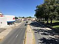
CR 501 northbound on John F. Kennedy Boulevard in Bayonne
_from_the_overpass_for_the_rail_line_between_New_Jersey_State_Route_440_and_West_63rd_Street_in_Bayonne,_Hudson_County,_New_Jersey.jpg)
