Perth Amboy, New Jersey facts for kids
Quick facts for kids
Perth Amboy, New Jersey
|
||
|---|---|---|
|
City
|
||
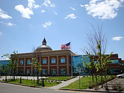
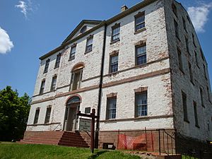
Perth Amboy courthouse and police station
|
||
|
||
| Nickname(s):
The City by the Bay
|
||
| Motto(s):
The City by the Bay
|
||
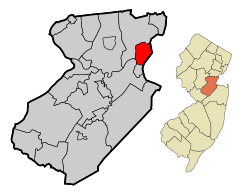
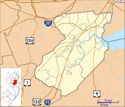
Location of Perth Amboy in Middlesex County highlighted in red (left). Inset map: Location of Middlesex County in New Jersey highlighted in orange (right).
|
||
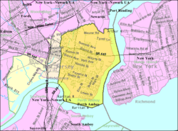
Census Bureau map of Perth Amboy, New Jersey
|
||
| Country | ||
| State | ||
| County | Middlesex | |
| Earliest European Settlement | 1683 | |
| Royal charter | August 4, 1718 | |
| Incorporated | December 21, 1784 | |
| Reincorporated | April 8, 1844 (included Township) | |
| Named for | James Drummond, 4th Earl of Perth | |
| Government | ||
| • Type | Faulkner Act (mayor–council) | |
| • Body | City Council | |
| Area | ||
| • Total | 5.96 sq mi (15.44 km2) | |
| • Land | 4.66 sq mi (12.07 km2) | |
| • Water | 1.30 sq mi (3.37 km2) 21.37% | |
| Area rank | 259th of 565 in state 13th of 25 in county |
|
| Elevation | 62 ft (19 m) | |
| Population
(2020)
|
||
| • Total | 55,436 | |
| • Estimate
(2023)
|
55,249 | |
| • Rank | 725th in country (as of 2022) 31st of 565 in state 5th of 25 in county |
|
| • Density | 11,891.0/sq mi (4,591.1/km2) | |
| • Density rank | 27th of 565 in state 1st of 25 in county |
|
| Time zone | UTC−05:00 (Eastern (EST)) | |
| • Summer (DST) | UTC−04:00 (Eastern (EDT)) | |
| ZIP Codes |
08861–08863
|
|
| Area code(s) | 732 Exchanges: 293,324,376,442,697,826 | |
| FIPS code | 3402358200 | |
| GNIS feature ID | 0885349 | |
Perth Amboy is a city in Middlesex County, New Jersey. It is part of the New York metropolitan area. In 2020, about 55,436 people lived there. Perth Amboy is known as the "City by the Bay" because it is next to Raritan Bay.
The first people to live here were the Lenape Native Americans. They called the area "Ompoge". Scottish colonists settled Perth Amboy in 1683. They named it "New Perth" after James Drummond, 4th Earl of Perth. The native name "Ompoge" later changed to "Amboy", and the two names were combined.
Perth Amboy became a city by Royal charter in 1718. It was the capital of the Province of New Jersey from 1686 to 1776. In the mid-1800s, the Industrial Revolution brought many new jobs and immigrants. This helped the city grow and become very diverse. Perth Amboy was once a popular resort town near the Raritan Bayshore. Since the 1990s, it has been redeveloped and has grown in other industries. Most of its residents are Hispanic.
Perth Amboy is next to the Arthur Kill waterway and has a historic waterfront. The Perth Amboy Ferry Slip was an important ferry stop for travelers from New York City. It was added to the National Register of Historic Places in 1978. The Raritan Yacht Club, one of the oldest yacht clubs in the U.S., is also here. Perth Amboy connects to Staten Island in New York City by the Outerbridge Crossing.
Contents
History of Perth Amboy
How Perth Amboy Got Its Name
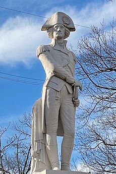
The Lenape Native Americans called this area "Ompoge". This word meant "level ground" or "standing upright". When Scottish settlers arrived in 1683, they named the new city "New Perth". This was to honor James Drummond, 4th Earl of Perth. You can see a statue of Drummond outside the city hall today. The native name "Ambo" or "Point Amboy" stayed popular. Eventually, the two names were put together, creating "Perth Amboy". The name also appears in nearby South Amboy.
Early Scottish Settlement
Scottish colonists settled Perth Amboy around 1683. They were encouraged to move here by Robert Barclay. He was a Quaker who owned part of the East Jersey colony.
Becoming a City
Perth Amboy officially became a city by a Royal charter on August 4, 1718. Later, the New Jersey Legislature confirmed its city status on December 21, 1784. The area around the city was known as Perth Amboy Township. This township was replaced by Perth Amboy city on April 8, 1844.
Perth Amboy as a Capital City
Elizabeth was the first capital of New Jersey in 1668. In 1686, Perth Amboy became the capital of East Jersey. Burlington was the capital of West Jersey. When the two parts of New Jersey joined in 1702, Perth Amboy and Burlington took turns being the capital. This continued until 1790, when Trenton became the permanent state capital. Trenton was chosen because it was between New York City and Philadelphia.
Some old buildings from this time are still standing. The Proprietary House was the home of William Franklin. He was the last Royal Governor of New Jersey and the son of Benjamin Franklin. William Franklin moved into the house in 1774. He was later arrested in 1776 for not supporting the American cause.
Perth Amboy City Hall was first built in 1714 as a courthouse. It also served as the meeting place for the East Jersey Provincial Assembly. The building was damaged by fires in 1731 and 1764 but was rebuilt each time. The current building was finished in 1767. It is the oldest city hall in the United States that has been used continuously. In 1789, the New Jersey General Assembly met here to approve the Bill of Rights. New Jersey was the first state to do this.
Market Square is a park across from City Hall. It was an outdoor market during colonial times. The park has a replica of the Liberty Bell and a statue of George Washington. There is also the Bill of Rights Arch, which celebrates New Jersey being the first state to ratify the Bill of Rights.
St. Peter's Church held its first service in 1685. It was the first Episcopal church in New Jersey. Its current building is from the 1850s. It has a graveyard with early settlers and beautiful stained-glass windows.
The Kearny Cottage is an example of an 18th-century house. It is now a historic house museum. The house was built in 1781 and has been moved a few times. It is now located near the mouth of the Raritan River.
Perth Amboy was an important stop for travelers between New York City and Philadelphia. This was because of a ferry that crossed the Arthur Kill to Tottenville, Staten Island. The first ferry started in 1684. Regular service began in 1709. The ferry became less important after the Outerbridge Crossing opened in 1928. It stopped running in 1963. In 1998, the Perth Amboy Ferry Slip was restored. A replica of the ticket office is now a small museum.
On March 31, 1870, Thomas Mundy Peterson became the first African-American in the United States to vote. This happened after the Fifteenth Amendment to the United States Constitution was passed. Peterson voted in a Perth Amboy city election.
Growth and Change
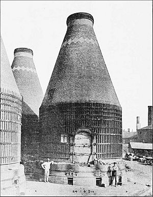
By the mid-1800s, Perth Amboy changed a lot due to new industries and immigrants. Factories like A. Hall and Sons Terra Cotta and the Copper Works Smelting Company created many jobs. The city also became a major shipping point for coal. This led to the development of different neighborhoods, where people from various countries lived. Immigrants from places like Denmark, Poland, and Hungary worked in the factories.
In 1903, the Perth Amboy Public Library opened. It was one of the first Carnegie libraries in New Jersey. It was built with money from Andrew Carnegie and local donations.
In 1914, Perth Amboy had a minor league baseball team called the Perth Amboy Pacers. They played in the Atlantic League.
In August 1923, a large crowd gathered in the city. This led to unrest and police involvement.
Perth Amboy was a popular resort town in the 19th and early 20th centuries. Since the early 1990s, the city has been redeveloped. New small businesses have opened, helped by the city being an Urban Enterprise Zone. The waterfront has also been improved with new promenades, parks, and housing.
The humorist James Thurber mentioned Perth Amboy in his book My Life and Hard Times. He also wrote the story The Secret Life of Walter Mitty, which features a character from Perth Amboy.
Geography of Perth Amboy
Perth Amboy covers about 5.93 square miles (15.36 km2). About 4.66 square miles (12.07 km2) is land, and 1.27 square miles (3.28 km2) is water.
Perth Amboy and South Amboy are often called "The Amboys". They are located across the Raritan River from each other. The Amboys mark the northern end of the Raritan Bayshore area.
Perth Amboy shares borders with Woodbridge to the north and west. It borders Sayreville across the Raritan River to the southwest. To the south, it borders South Amboy across Raritan Bay. To the east, it faces Staten Island in New York City across the Arthur Kill.
Perth Amboy has a thick layer of clay underground. This led to clay mining and factories like A. Hall and Sons Terra Cotta being built here in the late 1800s.
In 2005, Golf Magazine called Perth Amboy the "Golf Capital of the U.S.". This is because many top golf courses are within 150 miles of the city, even though there are no golf courses in Perth Amboy itself.
Perth Amboy Waterfront
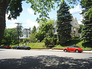
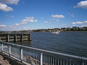
Perth Amboy has a historic waterfront that has been greatly improved. You can find the Perth Amboy Ferry Slip, two small museums, an art gallery, a yacht club, and a marina here. There is also a park with a bandshell where concerts are held in the summer. The waterfront has a redbrick walkway and many beautiful Victorian homes. Some of these homes are on hills overlooking the bay.
Points of interest on the waterfront include St. Peter's Episcopal Church and the Proprietary House. The Proprietary House is a former governor's mansion and now has a museum. The Kearny Cottage, which also has a museum, is here.
The Raritan Yacht Club is the second-oldest yacht club in New Jersey. It was founded in 1882. St. Demetrios, one of the first Greek Orthodox churches in central New Jersey, was founded on the waterfront in 1917.
Downtown Perth Amboy
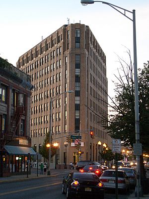
Downtown Perth Amboy is the main shopping area. It is centered on Smith Street. Because it is an Urban Enterprise Zone, shoppers pay a lower sales tax rate. This helps fund improvements to Smith Street, like new trees, Victorian streetlights, and redbrick sidewalks. Smith Street has many stores for working-class customers. The tallest building downtown is 'Amboy Towers', a 10-story bank skyscraper.
Harbortown Area
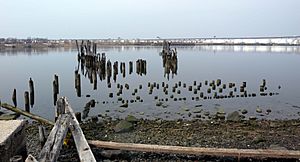
Harbortown is a neighborhood with many townhouses on the waterfront. It has been growing since 1987. This area used to be a railroad yard where coal was loaded onto boats.
Hall Avenue Neighborhood
Hall Avenue is a neighborhood east of the train tracks. It used to be a commercial area but is now mostly homes. There is a shopping center called "Firehouse Plaza" and a "Banco Popular" bank branch. Hall Avenue is a traditional Puerto Rican neighborhood. It hosts the city's annual Puerto Rican Day Festival. Rudyk Park, which has the Roberto Clemente Baseball Field, is also in this area.
Southwestern Section
This part of Perth Amboy is mainly a working-class neighborhood with some light industry. It has a large and diverse Hispanic population, including many Dominicans, Puerto Ricans, and Mexicans. This area was once called "Dublin" because of its large Irish population. Later, many Polish and Hungarian immigrants lived here. Most of the homes are small one- or two-family houses. The main shopping street is Smith Street, west of the train tracks.
Western Section
The western part of the waterfront is a mostly working-class Hispanic neighborhood. Many homes here are over 100 years old. Sadowski Parkway Park runs along the southern end of the neighborhood. It has a walkway and a beach. The park also hosts the Dominican festival and other events in the summer.
State Street Neighborhood
State Street is a neighborhood east of the train tracks. It is also mostly working-class Hispanic. This area used to have many factories. It has a large Caribbean Hispanic population. This section once had a big Cuban community.
Amboy Avenue Neighborhood
Amboy Avenue is a more suburban-like neighborhood. It is sometimes called the "Hospital section" or "High School section" because these places are located here. Today, most residents are Hispanic. Amboy Avenue once had a strong Italian population.
Maurer Neighborhood
Maurer is a working to middle-class neighborhood in the northern part of the city. It has many industrial areas, including oil refineries.
Chickentown Neighborhood
Chickentown is a neighborhood in the western part of the city. It is just south of Route 440. The city's largest park, Washington Park, is located here. The name "Chickentown" comes from the many chicken farms that were here before World War II.
Climate
Perth Amboy has a humid subtropical climate. This means it has hot, humid summers and cold, wet winters.
| Climate data for Perth Amboy, New Jersey | |||||||||||||
|---|---|---|---|---|---|---|---|---|---|---|---|---|---|
| Month | Jan | Feb | Mar | Apr | May | Jun | Jul | Aug | Sep | Oct | Nov | Dec | Year |
| Mean daily maximum °F (°C) | 39 (4) |
42 (6) |
51 (11) |
62 (17) |
72 (22) |
81 (27) |
86 (30) |
84 (29) |
77 (25) |
66 (19) |
55 (13) |
43 (6) |
63 (17) |
| Mean daily minimum °F (°C) | 24 (−4) |
26 (−3) |
33 (1) |
42 (6) |
51 (11) |
61 (16) |
66 (19) |
65 (18) |
57 (14) |
46 (8) |
37 (3) |
29 (−2) |
45 (7) |
| Average precipitation inches (mm) | 3.63 (92) |
3.06 (78) |
4.13 (105) |
4.01 (102) |
4.22 (107) |
4.21 (107) |
5.50 (140) |
3.73 (95) |
4.57 (116) |
4.21 (107) |
3.85 (98) |
4.00 (102) |
49.12 (1,248) |
Population and People
| Historical population | |||
|---|---|---|---|
| Census | Pop. | %± | |
| 1790 | 582 | — | |
| 1810 | 815 | — | |
| 1820 | 798 | −2.1% | |
| 1830 | 879 | 10.2% | |
| 1840 | 1,303 | 48.2% | |
| 1850 | 1,865 | 43.1% | |
| 1860 | 2,302 | 23.4% | |
| 1870 | 2,851 | 23.8% | |
| 1880 | 4,808 | 68.6% | |
| 1890 | 9,512 | 97.8% | |
| 1900 | 17,699 | 86.1% | |
| 1910 | 32,121 | 81.5% | |
| 1920 | 41,707 | 29.8% | |
| 1930 | 43,516 | 4.3% | |
| 1940 | 41,242 | −5.2% | |
| 1950 | 41,330 | 0.2% | |
| 1960 | 38,007 | −8.0% | |
| 1970 | 38,798 | 2.1% | |
| 1980 | 38,951 | 0.4% | |
| 1990 | 41,967 | 7.7% | |
| 2000 | 47,303 | 12.7% | |
| 2010 | 50,814 | 7.4% | |
| 2020 | 55,436 | 9.1% | |
| 2023 (est.) | 55,249 | 8.7% | |
| Population sources:1790–1920 1840 1850–1870 1850 1870 1880–1890 1850–1930 1940–2000 2000 2010 2020 |
|||
Perth Amboy is one of many U.S. cities where most of the people are Hispanic.
2010 Census Information
In 2010, Perth Amboy had 50,814 people living in 15,419 households. About 78.10% of the population was Hispanic or Latino. This was the second-highest percentage in New Jersey cities at that time.
About 27.3% of the people were under 18 years old. The average household had 3.25 people.
Economy
Perth Amboy is part of an Urban Enterprise Zone (UEZ). This means there are special benefits to help businesses and create jobs. Shoppers in the UEZ can pay a lower sales tax rate, which is half of the statewide rate. Perth Amboy became a UEZ in 1994. As of 2023, a lot of money is being invested to redevelop the city's waterfront area.
Transportation
Roads and Highways
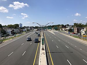
Perth Amboy has many major roads. These include Route 35, Route 184, and Route 440.
The Outerbridge Crossing is a large bridge that opened in 1928. It crosses the Arthur Kill and connects Perth Amboy to Staten Island. It is part of a major route to New York City and Long Island. The bridge was named after Eugenius H. Outerbridge, the first Chairman of the Port Authority.
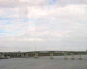
The Victory Bridge carries Route 35 over the Raritan River. It connects Perth Amboy with Sayreville. This bridge was built in 1926. A new version of the bridge was completed in 2005.
Public Transportation
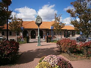
Perth Amboy has NJ Transit train service at Perth Amboy station. You can take trains on the North Jersey Coast Line to places like Newark Penn Station, Hoboken Terminal, and New York Penn Station.
NJ Transit buses also serve the city. You can take buses to the Port Authority Bus Terminal in New York City and to Elizabeth. Local bus service is also available.
Bicycle Rules
Since 1939, you need a license from the Perth Amboy police department to ride a bicycle legally. If you buy or sell a used bicycle, you must report it to the police. Businesses that sell or buy bicycles must also report their daily transactions to the Chief of Police.
Education
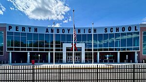
Public schools in Perth Amboy are run by Perth Amboy Public Schools. They serve students from pre-kindergarten through twelfth grade. The district has 12 schools and about 10,786 students.
Schools in the district include:
- Ignacio Cruz Early Childhood Center (Pre-K)
- Edmund Hmieleski Jr. Early Childhood Center (Pre-K)
- School #7 Early Childhood Center (Pre-K)
- Anthony V. Ceres Elementary School (K–4)
- James J. Flynn Elementary School (K–4)
- Rose M. Lopez Elementary School (K–3)
- Edward J. Patten Elementary Elementary School (K–4)
- Dr. Herbert N. Richardson 21st Century Elementary School (K–4)
- Robert N. Wilentz Elementary School (K–4)
- Dual Language School (4–8)
- William C. McGinnis Middle School (5–8)
- Samuel E. Shull Middle School (5–8)
- Perth Amboy High School (9–12)
The Academy for Urban Leadership Charter High School is a public high school that opened in 2010. It serves grades 7–12 and operates independently.
Eighth-grade students in Middlesex County can apply to high school programs at the Middlesex County Vocational and Technical Schools. These schools offer career and technical education.
Assumption Catholic School (Pre-K–8) and Perth Amboy Catholic Primary School / Upper School (Pre-K–8) are private schools. They are part of the Roman Catholic Diocese of Metuchen.
The Perth Amboy Public Library was the first Carnegie library in New Jersey. It opened in 1903 with money from Andrew Carnegie. The library reopened in 2015 after a big renovation.
Notable People
Many interesting people have been born in, lived in, or are connected to Perth Amboy. Here are a few:
- Soren Sorensen Adams (1879–1963), inventor of novelty products like the joy buzzer.
- Jon Bon Jovi (born 1962), famous singer, was born in Perth Amboy.
- Johnny Buff (1888–1955), a boxer who was a world champion.
- Stanley Norman Cohen (born 1935), helped create the first genetically modified organism.
- William Franklin (1730–1813), the last governor of New Jersey before the American Revolution.
- George Inness (1825–1894), a famous landscape painter.
- Lawrence Kearny (1789–1868), a "Sailor Diplomat" who helped open trade with China.
- Steve Mizerak (1944–2006), a champion pool player.
- Thomas Mundy Peterson (1824–1904), the first African-American to vote in a U.S. election.
- Richie Sambora (born 1959), guitarist for Bon Jovi, was born here.
- Alec John Such (1951–2022), a founding member and bass player for the band Bon Jovi.
- Brian Taylor (born 1951), a former professional basketball player.
- John Watson (1685–1768), one of the first painters in America.
Sister Cities
Perth Amboy has two sister cities:
See also
 In Spanish: Perth Amboy para niños
 | Mary Eliza Mahoney |
 | Susie King Taylor |
 | Ida Gray |
 | Eliza Ann Grier |


