Pulaski Skyway facts for kids
Quick facts for kids General Pulaski Skyway |
|
|---|---|
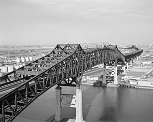
Looking east at Passaic River crossing, with Hackensack River bridge in background
|
|
| Coordinates | 40°44′09″N 74°05′30″W / 40.73583°N 74.09167°W |
| Carries | |
| Crosses | Passaic River Hackensack River New Jersey Meadowlands Kearny Point |
| Locale | Jersey City, Kearny, and Newark, New Jersey, United States |
| Maintained by | NJDOT |
| ID number | 0901150 (Hudson County) 0704150 (Essex County) |
| Characteristics | |
| Design | Steel deck truss cantilever bridge over Meadowlands Pratt truss for river crossings |
| Total length | 3.502 mi (5.636 km) (18,492 feet (5,636 m)) |
| Width | 56 ft (17 m) |
| Longest span | 550 ft (168 m) |
| Number of spans | 118 |
| Clearance above | 14 ft (4.3 m) |
| Clearance below | 135 ft (41 m) (for river crossings) |
| History | |
| Opened | November 24, 1932 |
|
Pulaski Skyway
|
|
|
U.S. Historic district
Contributing property |
|
| Location | US 1/9 between mileposts 51.25–54.55 |
| NRHP reference No. | 05000880 |
| Significant dates | |
| Added to NRHP | August 12, 2005 |
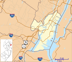
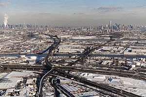
The Pulaski Skyway is a four-lane bridge and causeway in New Jersey, USA. It carries a major road called U.S. Route 1/9 (US 1/9). The entire structure is about 3.5 miles (5.6 km) long. Its longest bridge part stretches 550 feet (170 m). This roadway connects Newark and Jersey City. It crosses the Passaic and Hackensack rivers, a piece of land called Kearny Point, and the New Jersey Meadowlands.
Sigvald Johannesson designed the Pulaski Skyway. It opened in 1932. This bridge was the last part of the "Route 1 Extension." This was one of the first "super-highways" in the United States. It helped connect traffic to the Holland Tunnel in New York City. The Skyway is listed on both state and national lists of historic places.
The Skyway can get very crowded. Its old design makes it one of the least reliable roads in the U.S. Around 74,000 vehicles use it daily. Trucks have not been allowed on the Skyway since 1934. The bridge has changed very little since it opened. In 2007, the New Jersey Department of Transportation (NJDOT) started a big repair project. This project was estimated to cost over $1 billion. The Skyway was closed to eastbound traffic from 2014 to 2018 for these repairs.
Contents
About the Pulaski Skyway
The Pulaski Skyway is part of a 13-mile (21 km) long road project. Different sources give slightly different lengths for the Skyway. The National Bridge Inventory says the part in Hudson County is about 14,906 feet (4,543.5 m) long. The part in Essex County is about 3,592 feet (1,094.8 m). Many sources, including The New York Times, say it is 3.5 miles (5.6 km) long.
Where the Skyway Goes
The Skyway has four lanes and carries US 1/9. This road usually runs north–south, but the Skyway itself goes mostly east–west. The west end of the Skyway starts in Newark. It goes over Raymond Boulevard in the Ironbound area.
Near Tonnele Circle, US 1/9 leaves the Skyway. The Skyway then becomes Route 139. It continues towards the Holland Tunnel. The Skyway ends near Bergen Hill. It also crosses over the New Jersey Turnpike, but there is no way to switch roads between them. Underneath the Skyway are other roads, train tracks, and industrial areas. These were built on landfilled wetlands.
Some older maps showed the Skyway starting further south. Google Maps includes the Route 139 section as part of it. There are only a few places to get on or off the Skyway. These are single-lane ramps that connect to the inner lanes. They are located in Marion Section of Jersey City and South Kearny.
Rules for Using the Skyway
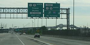
Trucks have been banned from the Skyway since 1934. This was done for public safety. Trucks must use a different route called U.S. Route 1/9 Truck. This was the main road before the Skyway was built. People walking or riding bikes are also not allowed on the Skyway. It does not have special lanes or sidewalks for them. The speed limit is 45 miles per hour (72 km/h). However, it is hard for police to enforce this. There are no shoulders for cars to pull over.
In 2011, a study found the Skyway to be one of the most unreliable roads. This is because traffic can be very unpredictable.
Building the Pulaski Skyway
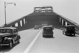
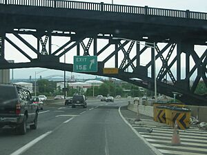
The main part of the Skyway is a steel deck truss cantilever bridge. It is held up by concrete piers. The parts that cross the two rivers are different. They are 1,250-foot (381 m) long and use a Pratt truss design. These river crossings are high enough for ships to pass underneath. They have a clearance height of 135 feet (41 m). In Jersey City, some shorter Pratt truss sections go over train lines.
Early Plans and Construction
Planning for the Holland Tunnel began in 1919. This tunnel was the first road connection between New Jersey and New York City. It opened in 1927. To connect to the tunnel, New Jersey decided to extend Route 1. This extension would go through Newark and Jersey City. It was planned as the country's first "super-highway." Sigvald Johannesson designed the Skyway part of this project.
Construction started in mid-1925. The highway was mostly built on raised embankments. Parts of it went through Bergen Hill in a cut. The eastern and western sections opened in December 1928. However, traffic still had to use older bridges to cross the Hackensack and Passaic rivers. These old bridges were drawbridges that often stopped traffic for ships.
The original plan for the Skyway's river crossings included vertical-lift bridges. These would be 35 feet (11 m) above the rivers. But the War Department wanted the new bridges to be much higher. They wanted to avoid stopping ship traffic. So, a compromise was reached to raise the river bridges to 135 feet (41 m). This meant the bridges would be fixed, not movable.
Construction of the main Skyway section began in April 1930. Four companies worked on it. The two river bridges were finished first. The entire $21 million road opened on November 24, 1932. An official ceremony was held the day before.
Naming the Skyway
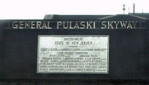
For about six months after it opened, the road had no official name. People called it the "Diagonal Highway" or "High-Level Viaduct." On May 3, 1933, the New Jersey Legislature named it the General Casimir Pulaski Memorial Skyway. It was named after Casimir Pulaski, a Polish military leader. He helped train and lead troops in the American Revolutionary War. An official ceremony to unveil the signs was held on October 11, 1933.
Studies in 1932 and 1933 showed the Skyway saved a lot of time. It shortened the distance by one-half mile (0.80 km). It also saved at least six minutes of travel time during normal traffic. Trucks saved even more time, from five to eleven minutes. During busy weekends, the Skyway could save 25 minutes or more. This was because it avoided traffic jams caused by the old drawbridges opening for ships. The Skyway also helped reduce traffic on other roads.
Safety and Improvements
The Skyway's original design had some safety problems. It had a slippery concrete surface. Its ramps were steep and on the left side. It also had a center breakdown lane. These features led to many crashes.
Truck Ban and Safety Upgrades
In November 1933, the mayor of Jersey City banned trucks from the Skyway. This ban started on January 15, 1934. The New Jersey State Highway Commission approved the ban. People voted on whether trucks should be banned, and the majority agreed. A court also upheld the ban, saying it was for public safety.
To help trucks, a new offramp called the Tonnele Circle Viaduct opened in 1938. This allowed westbound trucks to bypass a busy circle. Later, in 1956, the Newark Bay Extension of the New Jersey Turnpike opened. This gave trucks another way to avoid the old surface road.
By the 1950s, the Skyway had over 400 crashes each year. In 1956, an aluminum median barrier was added to separate traffic. A new pavement coating was also put down to make the road less slippery.
When the New Jersey Turnpike was built in 1951, engineers had to decide how it would cross under the Skyway. They chose to build it low enough to fit under the Skyway's trusses. In 2005, as part of a project to make the bridge stronger against earthquakes, the Turnpike bridge was lowered by four feet (1.2 m). This was done without closing the Turnpike to traffic.
Keeping the Skyway Strong
By the 2000s, the Pulaski Skyway was considered outdated. Its design did not meet modern highway standards. In 2007, it was rated "structurally deficient." This means it needed major repairs. After a bridge collapsed in Minneapolis in 2007, there were concerns about the Skyway's safety. NJDOT quickly started a $10 million repair project. This was the first major repair since 1984.
Major Rehabilitation Project
As work continued, it became clear that the repairs would be much bigger and more expensive. NJDOT estimated the full rehabilitation could cost over $1.2 billion. In 2011, money was moved from a rail project to help fund highway projects, including the Skyway.
In January 2013, NJDOT announced a $335 million project to repave and restore the road. The eastbound lanes were planned to close for two years starting in 2014. This was to allow for the replacement of the entire bridge deck. Local leaders were worried about the impact on traffic. The closure date was delayed to plan better traffic solutions.
The roadway stayed open with lane closures until April 12, 2014. On that date, the eastbound lanes closed for two years. The total rehabilitation project is estimated to cost $1.2–1.5 billion. It is being done in phases, with the final painting planned for 2020. These improvements are expected to make the bridge last until at least 2095.
The Skyway reopened to all traffic on June 30, 2018. This was two days earlier than planned. Other projects, like fixing ramps and rebuilding Route 139, are expected to continue until at least 2026.
Helping Traffic During Repairs
NJDOT worked with New Jersey Transit (NJT) to help people during the repairs. They encouraged carpooling and public transportation. They also worked with local officials and businesses to find solutions. Information about alternate routes was shared on TV, radio, and social media.
To reduce traffic jams, the Turnpike Authority turned a shoulder of the Newark Bay-Hudson County Extension into an extra lane. This extra lane opens during busy hours. Variable message signs give drivers traffic updates. A smart traffic light system was also installed. This system helps coordinate traffic lights at 15 intersections. It is part of a larger "intelligent transportation system" in the Meadowlands. Off-duty police officers were hired to direct traffic to the Holland Tunnel during rush hours.
To encourage public transport, NJT and PATH offered more frequent train services. These trains go to Newark, Hoboken, Jersey City, and Manhattan. NJT also added a new bus route and adjusted schedules to carry more passengers.
In Popular Culture
The Pulaski Skyway has appeared in many forms of media. It is the subject of the book The Last Three Miles (2007). The Skyway has been featured in radio shows, movies, and TV.
In the 1938 radio drama The War of the Worlds, a Martian machine stands over the Skyway. This scene was also shown in the 2005 film. The Skyway was in the 1979 film Hair. Alfred Hitchcock's 1943 film Shadow of a Doubt and the TV show The Sopranos (1999–2007) show the bridge in their opening scenes. The band Clutch has a song called "Pulaski Skyway" on their 2005 album Robot Hive/Exodus.
See also
 In Spanish: Pulaski Skyway para niños
 | Calvin Brent |
 | Walter T. Bailey |
 | Martha Cassell Thompson |
 | Alberta Jeannette Cassell |


