
Essex County, New Jersey facts for kids
Quick facts for kids
Essex County
|
|||
|---|---|---|---|

Newark Penn Station in Newark at dusk in June 2015
|
|||
|
|||

Location within the U.S. state of New Jersey
|
|||
 New Jersey's location within the U.S. |
|||
| Country | |||
| State | |||
| Founded | March 7, 1683 | ||
| Named for | Essex, England | ||
| Seat | Newark | ||
| Largest city | Newark (population and area) | ||
| Area | |||
| • Total | 129.42 sq mi (335.2 km2) | ||
| • Land | 126.09 sq mi (326.6 km2) | ||
| • Water | 3.34 sq mi (8.7 km2) 2.6% | ||
| Population
(2020)
|
|||
| • Total | 863,728 | ||
| • Estimate
(2023)
|
851,117 |
||
| • Density | 6,843.5/sq mi (2,642.3/km2) | ||
| Time zone | UTC−5 (Eastern) | ||
| • Summer (DST) | UTC−4 (EDT) | ||
| Congressional districts | 8th, 10th, 11th | ||


Essex County is a county located in the northeastern part of New Jersey, a state in the United States. It is part of the larger New York metropolitan area.
As of the 2020 census, Essex County was the second most populated county in New Jersey. It had 863,728 people living there. This was a big increase from the 2010 census.
The county seat, or main city, of Essex County is Newark. Newark is also the most populated city in New Jersey. In 2020, its population was 311,549 people.
In 2015, the average income per person in Essex County was $60,030. This was one of the highest incomes in New Jersey.
Contents
History of Essex County

How Essex County Got Its Name
Essex County is named after Essex, a county in England.
Early Days of the County
Essex County was first set up on March 7, 1683. It was one of the original four areas in a region called Province of East Jersey. The county kept its borders when East Jersey and West Jersey joined together in 1702.
Over time, parts of Essex County were used to create other counties.
- In 1741, some land went to Somerset County.
- In 1837, Passaic County was formed from parts of Essex and Bergen counties.
- In 1857, Union County was created from parts of Essex County.
Talks About Leaving the County
Some towns in western Essex County have talked about leaving the county. They wanted to form a new county or join Morris County. This was mainly because they felt that tax money was used more to help the poorer, city areas in the east. They thought this was unfair to the wealthier, suburban towns in the west.
Between 2001 and 2003, towns like Millburn, Montclair, and Roseland held votes on this idea. The mayor of Montclair at the time, Robert J. Russo, said in 2003 that the county was a "burden" to his town's people.
Geography of Essex County
Essex County covers about 129.42 square miles. Most of this is land (about 126.09 square miles), and a small part is water (about 3.34 square miles).
The county's land changes from flat areas in the east to two mountain ridges in the west. These ridges are called the Watchung Mountains. Beyond these mountains, the land goes down into the Passaic River valley.
The highest points in the county are around 660 feet above sea level. These spots are found near Verona, North Caldwell, and Cedar Grove. The lowest point is at sea level, along Newark Bay.
Climate and Weather
Essex County generally has a humid climate. This means it gets a good amount of rain and has warm summers. Temperatures can vary across the county.
In Newark, which is in the eastern part of the county, temperatures are usually cool to hot. Even in winter, it can be relatively mild. Western Essex County has similar temperatures. However, the higher elevation in the Watchung Mountains can cause small differences. For example, it might be raining in East Orange (lower elevation) but snowing at the top of a hill on Interstate 280 (higher elevation) due to a few degrees difference in temperature.
| Weather chart for Newark, New Jersey | |||||||||||||||||||||||||||||||||||||||||||||||
|---|---|---|---|---|---|---|---|---|---|---|---|---|---|---|---|---|---|---|---|---|---|---|---|---|---|---|---|---|---|---|---|---|---|---|---|---|---|---|---|---|---|---|---|---|---|---|---|
| J | F | M | A | M | J | J | A | S | O | N | D | ||||||||||||||||||||||||||||||||||||
|
3.5
39
24
|
2.9
42
27
|
4.1
51
34
|
4.2
62
44
|
4
72
53
|
4
82
63
|
4.7
86
69
|
3.7
84
68
|
3.8
77
60
|
3.6
65
48
|
3.6
55
39
|
3.8
44
30
|
||||||||||||||||||||||||||||||||||||
| temperatures in °F precipitation totals in inches source: The Weather Channel |
|||||||||||||||||||||||||||||||||||||||||||||||
|
Metric conversion
|
|||||||||||||||||||||||||||||||||||||||||||||||
In Newark, the average temperature in January is about 24°F (low) to 39°F (high). In July, it ranges from 69°F (low) to 86°F (high). The lowest temperature ever recorded was -14°F in February 1934. The highest was 108°F in July 2011, which is the highest temperature ever in New Jersey.
People of Essex County
| Historical population | |||
|---|---|---|---|
| Census | Pop. | %± | |
| 1790 | 17,785 | — | |
| 1800 | 22,269 | 25.2% | |
| 1810 | 25,984 | 16.7% | |
| 1820 | 30,793 | 18.5% | |
| 1830 | 41,911 | 36.1% | |
| 1840 | 44,621 | * | 6.5% |
| 1850 | 73,950 | 65.7% | |
| 1860 | 98,877 | * | 33.7% |
| 1870 | 143,839 | 45.5% | |
| 1880 | 189,929 | 32.0% | |
| 1890 | 256,098 | 34.8% | |
| 1900 | 359,053 | 40.2% | |
| 1910 | 512,886 | 42.8% | |
| 1920 | 652,089 | 27.1% | |
| 1930 | 833,513 | 27.8% | |
| 1940 | 837,340 | 0.5% | |
| 1950 | 905,949 | 8.2% | |
| 1960 | 923,545 | 1.9% | |
| 1970 | 932,526 | 1.0% | |
| 1980 | 851,304 | −8.7% | |
| 1990 | 778,206 | −8.6% | |
| 2000 | 793,633 | 2.0% | |
| 2010 | 783,969 | −1.2% | |
| 2020 | 863,728 | 10.2% | |
| 2023 (est.) | 851,117 | 8.6% | |
| Historical sources: 1790–1990 1970–2010 2000 2010 2020 * = Lost territory in previous decade. |
|||
Essex County is one of the most crowded counties in the United States. It is the second most crowded in New Jersey, after Hudson County.
Newark is the largest city in the county both in size and population. It has a population density of over 11,000 people per square mile. The smallest town in size is Caldwell. The town with the fewest people is Essex Fells.
Many of the smaller towns in Essex County are very crowded, similar to big cities. This is much higher than the average for New Jersey, which is already the most crowded state.
Around the year 2000, Newark started rebuilding many of its homes. This was because of city programs, a better economy, and a need for affordable housing close to Manhattan. Newark has become one of the fastest-growing cities in the Northeast. It has seen an increase in average income and a drop in poverty. This is a big change from the problems it faced in the 1970s and 1980s.
In contrast, Western Essex County is more suburban and wealthy. This area includes diverse towns like Montclair, West Orange, South Orange, and Maplewood. Many people from New York City move to these towns.
Some of the wealthiest towns in the county are Livingston, West Caldwell, South Orange, Maplewood, Millburn, North Caldwell, and Essex Fells. Short Hills (in Millburn) has a popular fancy shopping mall.
Newark has a lower average household income compared to other towns. On the other hand, Essex Fells is one of the wealthiest places in the county.
Economy of Essex County
In 2021, the total value of all goods and services produced in Essex County was $48.7 billion. This ranked it fourth in the state of New Jersey.
Education in Essex County
Colleges and Universities
Essex County has several colleges and universities. Some are public, and some are private.
- Public Colleges
- Essex County College – This is a two-year college that opened in 1968. It offers different types of associate degrees. Its main campus is in Newark, with another campus in West Caldwell.
- Montclair State University – Founded in 1908, this school has over 20,000 students. Its campus is spread across Montclair, Little Falls, and Clifton.
- New Jersey Institute of Technology (NJIT) – Located in Newark, this school started in 1881. It has about 11,400 undergraduate and graduate students.
- Rutgers University–Newark – This school has 12,000 students. It became part of Rutgers University in 1946.
- New Jersey Medical School – This medical school started in Newark in 1956. It became part of Rutgers University in 2013.
- Private Colleges
- Berkeley College – Located in Newark.
- Caldwell University – Founded in 1939, this is a Catholic college. It has 2,200 students at its campus in Caldwell.
- Seton Hall University – Founded in 1856, this university is connected to the Catholic Church. It has over 10,000 students in South Orange.
- Seton Hall University School of Law – Located in Newark, this is the only private law school in New Jersey.
School Districts
Here are the different school districts in Essex County:
- Schools for all grades (K-12)
- Belleville School District
- Bloomfield Public Schools
- Caldwell-West Caldwell Public Schools
- Cedar Grove Schools
- East Orange School District
- Essex County Vocational Technical Schools
- Glen Ridge Public Schools
- Irvington Public Schools
- Livingston Public Schools
- Millburn Township Public Schools
- Montclair Public Schools
- Newark Public Schools
- Nutley Public Schools
- Orange Board of Education
- South Orange-Maplewood School District
- Verona Public Schools
- West Orange Public Schools
- High School Districts (Secondary)
- West Essex Regional School District
- Elementary School Districts
- Essex Fells School District
- Fairfield School District
- North Caldwell Public Schools
- Roseland School District
Transportation in Essex County
Roads and Highways
_between_Exit_153_and_Exit_151,_entering_Bloomfield_Township,_Essex_County_from_Clifton,_Passaic_County,_New_Jersey.jpg)
Essex County has many roads, totaling about 1,668 miles. Local towns maintain most of these roads.
Several major highways cross the county:
- Interstate 95 (also known as the New Jersey Turnpike) runs north-south.
- Interstate 80 runs east-west.
- Interstate 78 also runs east-west.
- Interstate 280 goes through many towns in the county, making it important for travel within Essex County.
Four U.S. Routes also cross the county:
- Route 1/9 runs through Newark.
- U.S. Route 22 starts in Newark.
- U.S. Route 46 goes through Fairfield.
The Garden State Parkway is a very important state road. It runs north-south through the county and is a toll road. It connects Essex County to other parts of New Jersey.
Other state highways in the county include:
- New Jersey Route 7
- Route 10
- Route 21
- Route 23
- Route 24
- Route 27
- Route 124
- Route 159
- Eisenhower Parkway
Buses
Many bus lines operate in Essex County. The main office for NJ Transit (NJT) buses is near Newark Penn Station. There are two major bus terminals: Newark Penn Station and the Irvington Bus Terminal. Some bus lines go from Essex County to the Port Authority Bus Terminal in New York City.
Trains
Essex County has a large train network. Most train services help people commute to Newark and New York City. All passenger train lines in the county use electricity.
Commuter Trains
NJ Transit has five train lines that stop in Essex County. All of them stop at either Newark Penn Station or Newark Broad Street Station.
- The Northeast Corridor Line connects to Newark Airport and Newark Penn Station, then continues to New York City.
- The North Jersey Coast Line also stops at Newark Airport and Newark Penn Station, going to New York City or Hoboken Terminal.
- The Raritan Valley Line usually ends at Newark Penn Station.
- The Montclair-Boonton Line has stations in Montclair, Glen Ridge, and Bloomfield. It then goes to Newark Broad Street Station and on to New York City or Hoboken.
- The Morris and Essex Lines stop in Millburn, Maplewood, South Orange, Orange, and East Orange. They then go to Newark Broad Street and on to New York City or Hoboken.
Light Rail

The Newark Light Rail operates entirely within Essex County. It has 17 stations in Newark, Belleville, and Bloomfield. It also connects to Newark Penn Station.
The Newark Light Rail has two lines: the Newark City Subway and the Broad Street Extension. The Newark City Subway used to be a streetcar line. It runs underground in downtown Newark. The Broad Street Extension connects Newark Penn Station to Newark Broad Street Station and the waterfront.
Rapid Transit
The PATH train also runs from Newark Penn Station. It offers direct service to Harrison, Jersey City, and Lower Manhattan in New York City. You can also transfer to other PATH lines to reach Hoboken and other parts of Manhattan.
Intercity Trains
Amtrak has two stations in Essex County: Newark Penn Station and Newark Airport. These stations are on the Northeast Corridor.
- Newark Penn Station has service on the Acela Express, a high-speed train, to cities like Boston, Philadelphia, and Washington, D.C.
- It also offers service on other Amtrak trains to many cities across the U.S., including Chicago, Charlotte, New Orleans, and Miami.
- Newark Airport is served by some Amtrak trains as well.
Monorail
Newark Liberty International Airport has a monorail system called AirTrain Newark. It connects the airport terminals, parking areas, and the Newark Liberty International Airport train station. The monorail is free to ride within the airport.
Airports
Newark Liberty International Airport is a major airport located in Newark and Elizabeth. It is one of the main airports serving the New York area. It is a hub for United Airlines and a major cargo airport.
The Essex County Airport in Fairfield is a smaller airport used for general aviation (private planes).
Ports
The Port Newark-Elizabeth Marine Terminal is a very important port. It is located on Newark Bay and is the main facility for container ships in the New York-Newark area. It is one of the largest ports on the East Coast of the U.S.
Bridges
Several important bridges are in or near Essex County. Many of them cross Newark Bay or the Passaic River.
- The Newark Bay Bridge carries Interstate 78 over Newark Bay.
- The Pulaski Skyway is a famous bridge that carries Route 1/9 over the Passaic River and other areas.
- The Lincoln Highway Passaic River Bridge carries Truck 1/9 over the Passaic River.
- The Dock Bridge carries four train tracks, including the Northeast Corridor and PATH lines, over the Passaic River.
Parks and Recreation
Essex County was the first county in the United States to create its own county park system. This was done to make sure that green spaces were saved from development.
Here are some of the parks and attractions in Essex County:
- Anderson Park in Montclair
- Becker Park in Roseland
- Branch Brook Park in Newark and Belleville (This is the oldest county park in the country!)
- Brookdale Park in Montclair and Bloomfield
- Eagle Rock Reservation in West Orange and Montclair
- Glenfield Park in Montclair and Glen Ridge
- Grover Cleveland Park in Caldwell and Essex Fells
- Hilltop Reservation in Caldwell, Cedar Grove, North Caldwell, and Verona
- Irvington Park in Irvington
- Ivy Hill Park in Newark
- Kip's Castle Park in Verona and Montclair
- Mills Reservation in Cedar Grove and Upper Montclair
- Orange Park in Orange and East Orange
- South Mountain Reservation in West Orange, South Orange, Millburn, and Maplewood
- Vailsburg Park in Newark
- Thomas Edison National Historical Park in West Orange
- Verona Park in Verona
- Watsessing Park in Bloomfield and East Orange
- Weequahic Park in Newark
- West Essex Park in West Caldwell and Roseland
- West Side Park in Newark
- Yanticaw Park in Nutley
- Prudential Center in Newark. This arena opened in 2007 and is home to the New Jersey Devils hockey team.
- The Mall at Short Hills in Short Hills, Millburn. This is a popular shopping mall.
- Livingston Mall in Livingston.
- Christ Church Cemetery & Mausoleum in Belleville. This is a historic cemetery from 1746.
- Saint Stephen's Cemetery & The Chapel at Short Hills in Short Hills. This cemetery has been serving residents since 1858.
Other attractions include:
- The Newark Museum of Art
- New Jersey Historical Society
- Montclair Art Museum
- Turtle Back Zoo
- Grover Cleveland Birthplace
Essex County is also home to part of the Port Newark–Elizabeth Marine Terminal, which is the largest port on the East Coast. It also has two airports: Newark Liberty International Airport and Essex County Airport.
Towns and Cities in Essex County

Essex County has 22 towns and cities. The table below shows information about each one, including its population and size. Some towns also have smaller communities within them.
| Municipality | Map key | Municipal type |
Population | Housing units |
Total area |
Water area |
Land area |
Pop. density |
Housing density |
School district | Unincorporated communities |
|---|---|---|---|---|---|---|---|---|---|---|---|
| Belleville | 15 | township | 38,222 | 14,327 | 3.40 | 0.06 | 3.34 | 10,755.7 | 4,289.3 | Belleville | Silver Lake CDP (part; 3,769) |
| Bloomfield | 13 | township | 53,105 | 19,470 | 5.33 | 0.02 | 5.30 | 8,920.5 | 3,670.7 | Bloomfield | Ampere North CDP (5,132) Brookdale CDP (9,854) Silver Lake CDP (part; 474) Watsessing CDP (8,078) |
| Caldwell | 6 | borough | 9,027 | 3,510 | 1.17 | 0.00 | 1.17 | 6,710.3 | 3,011.1 | Caldwell-West Caldwell | |
| Cedar Grove | 10 | township | 12,980 | 4,661 | 4.38 | 0.13 | 4.25 | 2,918.6 | 1,096.1 | Cedar Grove | |
| East Orange | 2 | city | 69,612 | 28,803 | 3.92 | 0.00 | 3.92 | 16,377.1 | 7,339.5 | East Orange | |
| Essex Fells | 5 | borough | 2,244 | 758 | 1.42 | 0.01 | 1.41 | 1,496.3 | 536.8 | West Essex (7-12) Essex Fells (PK-6) |
|
| Fairfield | 8 | township | 7,872 | 2,723 | 10.46 | 0.16 | 10.30 | 725.1 | 264.5 | West Essex (7-12) Fairfield (PK-6) |
|
| Glen Ridge | 3 | borough | 7,802 | 2,541 | 1.29 | 0.00 | 1.28 | 5,872.8 | 1,982.6 | Glen Ridge | |
| Irvington | 22 | township | 61,176 | 23,196 | 2.93 | 0.00 | 2.93 | 18,417.0 | 7,922.0 | Irvington | |
| Livingston | 18 | township | 31,330 | 10,284 | 14.08 | 0.31 | 13.77 | 2,132.8 | 746.9 | Livingston | |
| Maplewood | 20 | township | 25,684 | 8,608 | 3.88 | 0.00 | 3.88 | 6,155.3 | 2,220.0 | South Orange-Maplewood | |
| Millburn | 19 | township | 21,710 | 7,106 | 9.88 | 0.55 | 9.32 | 2,161.3 | 762.2 | Millburn Township | Short Hills CDP (14,422) |
| Montclair | 12 | township | 40,921 | 15,911 | 6.32 | 0.01 | 6.31 | 5,971.2 | 2,522.2 | Montclair | Upper Montclair CDP (13,146) |
| Newark | 1 | city | 311,549 | 109,520 | 26.11 | 1.92 | 24.19 | 11,458.3 | 4,528.1 | Newark | |
| North Caldwell | 7 | borough | 6,694 | 2,134 | 3.02 | 0.00 | 3.01 | 2,053.2 | 708.6 | West Essex (7-12) North Caldwell (PK-6) |
|
| Nutley | 14 | township | 30,143 | 11,789 | 3.43 | 0.04 | 3.38 | 8,384.1 | 3,484.0 | Nutley | |
| Orange | 16 | township | 34,447 | 12,222 | 2.20 | 0.00 | 2.20 | 13,705.7 | 5,558.9 | Orange | |
| Roseland | 4 | borough | 6,299 | 2,432 | 3.56 | 0.02 | 3.54 | 1,644.4 | 687.3 | West Essex (7-12) Roseland (PK-6) |
|
| South Orange | 21 | village | 18,484 | 5,815 | 2.86 | 0.00 | 2.86 | 5,672.8 | 2,036.5 | South Orange-Maplewood | |
| Verona | 11 | township | 14,572 | 5,523 | 2.78 | 0.02 | 2.76 | 4,838.4 | 2,004.4 | Verona | |
| West Caldwell | 9 | township | 11,012 | 4,009 | 5.07 | 0.01 | 5.05 | 2,128.5 | 793.1 | Caldwell-West Caldwell | |
| West Orange | 17 | township | 48,843 | 17,612 | 12.17 | 0.13 | 12.05 | 3,836.0 | 1,462.1 | West Orange | Llewellyn Park CDP (821) Pleasantdale CDP (2,329) |
| Essex County | county | 863,728 | 312,954 | 129.63 | 3.42 | 126.21 | 6,211.5 | 2,479.6 |
Images for kids
-
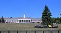
Essex Troop, New Jersey National Guard
-
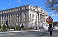
Essex County Hall of Records
-
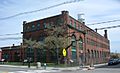
Thomas Edison Laboratory


See also
 In Spanish: Condado de Essex (Nueva Jersey) para niños
