Cedar Grove, New Jersey facts for kids
Quick facts for kids
Cedar Grove, New Jersey
|
||
|---|---|---|
|
Township
|
||
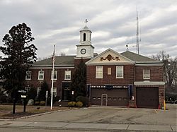
Cedar Grove Municipal Building and Center Fire Company
|
||
|
||
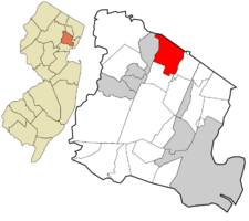
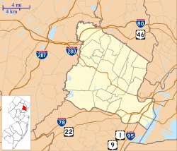
Location of Caldwell in Essex County highlighted in red (right). Inset map: Location of Essex County in New Jersey highlighted in orange (left).
|
||
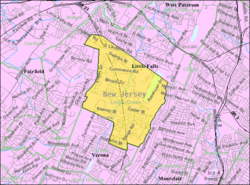
Census Bureau map of Cedar Grove, New Jersey
|
||
| Country | ||
| State | ||
| County | Essex | |
| Incorporated | February 7, 1892 as Verona Township | |
| Renamed | April 9, 1908 as Cedar Grove | |
| Named for | Cedar trees | |
| Government | ||
| • Type | Faulkner Act (council–manager) | |
| • Body | Township Council | |
| Area | ||
| • Total | 4.36 sq mi (11.29 km2) | |
| • Land | 4.24 sq mi (10.97 km2) | |
| • Water | 0.12 sq mi (0.32 km2) 2.82% | |
| Area rank | 286th of 565 in state 9th of 22 in county |
|
| Elevation | 243 ft (74 m) | |
| Population
(2020)
|
||
| • Total | 12,980 | |
| • Estimate
(2023)
|
13,321 | |
| • Rank | 196th of 565 in state 15th of 22 in county |
|
| • Density | 3,063.5/sq mi (1,182.8/km2) | |
| • Density rank | 214th of 565 in state 15th of 22 in county |
|
| Time zone | UTC−05:00 (Eastern (EST)) | |
| • Summer (DST) | UTC−04:00 (Eastern (EDT)) | |
| ZIP Code |
07009
|
|
| Area code(s) | 973 | |
| FIPS code | 3401311200 | |
| GNIS feature ID | 0882222 | |
Cedar Grove is a township located in the middle of northern Essex County, in the U.S. state of New Jersey. In 2020, about 12,980 people lived here. This was a small increase from 2010.
New Jersey Monthly magazine once said Cedar Grove was the fourth-best place to live in Essex County. It was also ranked 17th overall in New Jersey in 2008.
Cedar Grove was first called Verona Township when it became an official town on February 7, 1892. It was created from parts of Caldwell Township. Later, a part of it became Verona borough in 1907. On April 9, 1908, the name was officially changed to Cedar Grove. The town got its name from the many Eastern Red Cedar trees that used to grow in its valleys and on its hills.
Contents
Discovering Cedar Grove's Past
Cedar Grove was once part of a large area called the Horseneck Tract. This area included many towns you know today, like Caldwell and Verona.
In 1702, settlers bought the Horseneck Tract from the Lenape Native Americans. The land was about 14,000 acres (57 km2) and was bought for goods worth about $325. It was called "Horseneck" because its shape looked like a horse's neck and head.
Cedar Grove started as a small farming town. In 1896, a large county hospital called Overbrook was built here. In the 1950s and 1960s, many people moved to Cedar Grove from cities like Newark and New York City. They were looking for a quieter life away from the city.
Cedar Grove was also home to Frank Dailey's Meadowbrook Ballroom. This famous place hosted many well-known bands and singers. Stars like Frank Sinatra and Glenn Miller performed there. Today, the old ballroom building is used by a church.
Exploring Cedar Grove's Geography
Cedar Grove covers about 4.36 square miles (11.29 km2) of land and water. Most of it is land, about 4.24 square miles (10.97 km2).
The town is located between the First and Second Watchung Mountains. The center of Cedar Grove is in a valley, about 280 feet (85 m) above sea level. However, some parts of the town are much higher, over 400 feet (120 m). The highest point in Cedar Grove is on a hilltop, reaching over 600 feet (180 m). Cedar Grove is about 12 miles (19 km) west of Midtown Manhattan in New York City. It is also about 4 miles (6.4 km) northwest of Newark.
Cedar Grove shares borders with other towns. These include Montclair, North Caldwell, and Verona in Essex County. It also borders Little Falls in Passaic County.
Neighborhoods of Cedar Grove
Cedar Grove has three main sections:
- North End: This area starts after Fairview Avenue and Pompton Avenue. It has mostly homes, including some very expensive ones in the Park Ridge Estates. There are also a few businesses along Pompton Avenue.
- Central Cedar Grove: This is the heart of the town, from Fairview Avenue to Bradford Avenue on Pompton Avenue. It has Cedar Grove's main business area. On the west side, there's the former Essex County Hospital Center. On the east side, you'll find the Cedar Grove Reservoir and Mills Reservation.
- South End: This part of Cedar Grove has homes that are closer together. It stretches from Bradford Avenue to the Verona border. Like the North End, it also has some very expensive homes.
Cedar Grove has fewer people living per square mile than nearby towns. This is because large parts of the town are owned by the county or city governments. For example, Mills Reservation is a county park, and the Cedar Grove Reservoir is owned by the City of Newark.
Cedar Grove's Weather and Climate
Cedar Grove has a climate with warm, humid summers and cool, cold winters. It's a bit cooler than New York City because it doesn't have as much "urban heat."
January is usually the coldest month. High temperatures are around 30-40 degrees Fahrenheit (3-4 degrees Celsius). Lows are in the 20s Fahrenheit (-6 degrees Celsius). July is the warmest month. Highs are in the mid-80s Fahrenheit (29 degrees Celsius), and lows are in the mid-60s Fahrenheit (18 degrees Celsius).
Spring (April to June) and fall (September to early November) have pleasant temperatures. They range from the lower 60s to upper 70s Fahrenheit (16-26 degrees Celsius). Cedar Grove gets a good amount of rain, about 44 inches (1100 mm) each year. Snow is common from mid-January to early March. Big snowstorms, called nor'easters, can bring a lot of snow. In January 1996, Cedar Grove got a record 3 feet (0.91 m) of snow!
| Climate data for Cedar Grove, New Jersey | |||||||||||||
|---|---|---|---|---|---|---|---|---|---|---|---|---|---|
| Month | Jan | Feb | Mar | Apr | May | Jun | Jul | Aug | Sep | Oct | Nov | Dec | Year |
| Mean daily maximum °F (°C) | 38.0 (3.3) |
41.0 (5.0) |
50.0 (10.0) |
60.6 (15.9) |
71.2 (21.8) |
80.0 (26.7) |
84.9 (29.4) |
83.0 (28.3) |
75.4 (24.1) |
64.5 (18.1) |
53.3 (11.8) |
43.0 (6.1) |
62.0 (16.7) |
| Mean daily minimum °F (°C) | 22.4 (−5.3) |
24.5 (−4.2) |
33.9 (1.1) |
43.4 (6.3) |
53.0 (11.7) |
62.9 (17.2) |
68.0 (20.0) |
66.5 (19.2) |
58.9 (14.9) |
47.4 (8.6) |
38.8 (3.8) |
28.0 (−2.2) |
45.8 (7.7) |
| Average precipitation inches (mm) | 3.98 (101) |
2.96 (75) |
4.21 (107) |
3.92 (100) |
4.46 (113) |
3.40 (86) |
4.68 (119) |
4.02 (102) |
4.01 (102) |
3.16 (80) |
3.88 (99) |
3.57 (91) |
46.25 (1,175) |
| Average snowfall inches (cm) | 8.9 (23) |
8.4 (21) |
4.3 (11) |
.8 (2.0) |
0 (0) |
0 (0) |
0 (0) |
0 (0) |
0 (0) |
0 (0) |
.6 (1.5) |
3.0 (7.6) |
26.0 (66) |
| Average precipitation days (≥ 0.01 in) | 10.5 | 9.9 | 10.9 | 10.8 | 11.7 | 10.7 | 10.0 | 9.6 | 9.0 | 8.3 | 9.5 | 10.7 | 121.6 |
| Average snowy days (≥ 0.1 in) | 4.9 | 4.1 | 2.3 | .4 | 0 | 0 | 0 | 0 | 0 | 0 | .4 | 2.3 | 14.4 |
| Source: NOAA | |||||||||||||
People and Population in Cedar Grove
| Historical population | |||
|---|---|---|---|
| Census | Pop. | %± | |
| 1900 | 2,139 | — | |
| 1910 | 2,409 | 12.6% | |
| 1920 | 3,181 | 32.0% | |
| 1930 | 4,793 | 50.7% | |
| 1940 | 5,208 | 8.7% | |
| 1950 | 8,022 | 54.0% | |
| 1960 | 14,603 | 82.0% | |
| 1970 | 15,582 | 6.7% | |
| 1980 | 12,600 | −19.1% | |
| 1990 | 12,053 | −4.3% | |
| 2000 | 12,300 | 2.0% | |
| 2010 | 12,411 | 0.9% | |
| 2020 | 12,980 | 4.6% | |
| 2023 (est.) | 13,321 | 7.3% | |
| Population sources: 1900–1920 1900–1910 1910–1930 1940–2000 2000 2010 2020 |
|||
In 2020, Cedar Grove had 12,980 residents. Most people were White (75.15%). There were also growing numbers of Asian (7.83%) and Hispanic or Latino (11.29%) residents.
In 2010, the population was 12,411. About 20.2% of the people were under 18 years old. The average age was 46.8 years.
Cedar Grove's Economy
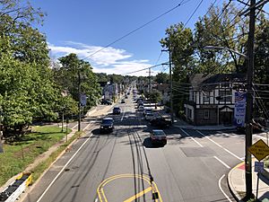
Most of Cedar Grove's businesses are located along Route 23. The main shopping area starts around Sweetwood Drive and goes past the railroad bridge to Little Falls Road.
The township also has an industrial area on Commerce Road, off Route 23. Here, you'll find light factories and different types of businesses.
Parks and Fun in Cedar Grove
Cedar Grove has many parks and places for recreation. These include county parks, town parks, and other fun spots.
County Parks to Explore
There are two county parks in Cedar Grove:
- Mills Reservation: This is a protected forest area of about 157 acres (0.64 km2). It has trails for walking and a great view of New York City.
- Hilltop Reservation: This park opened in 2003. It was created on the land of the old Essex Mountain Sanitorium.
Town Parks for Everyone
- Community Park: This park is in the center of town, off Little Falls Road. It has a baseball field, a large field for different sports, and barbecue areas. There are also two playgrounds and a bocce court. You can also find entrances to the Lenape Trail here, which is great for running, walking, and biking.
- Elmer Bowden Taylor Memorial Park: This park is on Little Falls Road. It has tennis courts, a basketball court, a small playground, and public bathrooms. It's named after Elmer Bowden Taylor, a Cedar Grove resident who died in World War I.
- South End School Park: This park and playground are at South End Elementary School. It has basketball courts, two baseball fields, and a playground.
- North End School Park: This park is very similar to the South End School Park.
- Cedar Grove High School: Behind the high school, there's a quarter-mile track for running or walking. There's also a football field, a soccer field, and a baseball field.
Recreational Fun Spots
- Tennis Courts: Public tennis courts are located along Little Falls Road.
- Cedar Grove Community Pool: This pool opened in 1963. It has a large pool with lanes for swimming and three diving boards. There's also a water slide and a baby pool for young children. You can buy snacks at the snack bar, sunbathe on the decks, and play basketball. The pool is open from the Saturday before Memorial Day until Labor Day.
Learning in Cedar Grove
Public Schools for All Ages
The Cedar Grove Schools serve students from pre-kindergarten all the way through twelfth grade. In the 2019–20 school year, the district had about 1,613 students and 148 teachers. This means there were about 10.9 students for every teacher.
The schools in the district are:
- North End Elementary School (Pre-K–4)
- South End Elementary School (Pre-K–4)
- Cedar Grove Memorial Middle School (grades 5–8)
- Cedar Grove High School (grades 9–12)
In 2021, North End School was recognized as a National Blue Ribbon Schools Program school. This is a special award for excellent schools in the United States.
Private Schools in Cedar Grove
- Washington Academy: This is a private school for students with special education needs. It was founded in 1982. The Academy helps students aged 3–21 (Pre-K–12th Grade) who need special support for their learning and behavior. It is located in the building that used to be the Leonard R. Parks Elementary School.
- St. Catherine of Siena School: This school was founded in 1958. It is located on Bradford Avenue and is part of the Roman Catholic Archdiocese of Newark.
Getting Around Cedar Grove
Cedar Grove has about 47 miles (76 km) of roads. Most of these roads are maintained by the town itself.
Route 23 goes right through Cedar Grove. This makes it easy to get to other major highways. These include Interstate 80, Interstate 280, U.S. Route 46, Route 3, and the Garden State Parkway. Cedar Grove is also close to big cities like New York City, Newark, Paterson, and Morristown.
Public Transportation Options
Cedar Grove has NJ Transit bus service.
- The 11 bus line takes you to Newark.
- The 195 bus line goes to the Port Authority Bus Terminal in Midtown Manhattan.
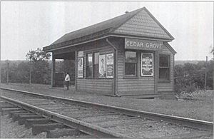
Train stations are in nearby towns like Little Falls and Montclair. There used to be a train line called the Caldwell Branch, but it was removed in the 1970s.
News and Media in Cedar Grove
Local Newspapers
- The Verona-Cedar Grove Times: This newspaper comes out every Thursday and covers news for both Cedar Grove and Verona.
- The Cedar Grove Observer: This newspaper is published 50 weeks a year and focuses on Cedar Grove news.
Online News
You can find local news for Cedar Grove online from the Cedar Grove Observer and the Verona-Cedar Grove Times.
Famous People from Cedar Grove
Many interesting people have lived in or are connected to Cedar Grove:
- Ralph L. Brinster (born 1932): A pioneer in genetic research.
- Jack Cafferty (born 1942): A well-known CNN commentator.
- Tommy DeVito: A quarterback for the New York Giants.
- Bob Diaco (born 1973): A head coach for the UConn Huskies football team.
- Allen B. DuMont (1901–1965): A scientist who improved the TV and started the first licensed TV network.
- Amanda Freitag (born 1972): A famous chef.
- Eli Gottlieb (born 1956): A novelist.
- Tommy James (born 1947): A musician and leader of the band Tommy James and the Shondells.
- Ellen Kuras (born 1959): A cinematographer who works on movies and documentaries.
- Jonathan Lebed (born 1984): Known for using the internet to promote stocks.
- Amanda Lepore (born 1967): A performance artist and entertainer.
- Marty Liquori (born 1949): An Olympic athlete in Track and Field.
- Tom Lutz (born 1953): A writer and critic who founded the Los Angeles Review of Books.
- C. Edward McVaney (born 1940): Co-founder of JD Edwards, a software company.
- Michael P. Moran (1944–2004): An actor and playwright.
- David Njoku (born 1996): A tight end drafted by the Cleveland Browns.
- Kevin J. O'Toole (born 1964): The chair of the Port Authority of New York and New Jersey.
- Todd Pettengill (born 1966): A former radio show host.
- Emilie Poulsson (1853–1939): A children's author.
- Michael Uslan (born 1951): The executive producer for the Batman movies.
- Arthur Wynne (1862–1945): The inventor of the crossword puzzle.
See also
 In Spanish: Municipio de Cedar Grove (Nueva Jersey) para niños
 | May Edward Chinn |
 | Rebecca Cole |
 | Alexa Canady |
 | Dorothy Lavinia Brown |


