Morris County, New Jersey facts for kids
Quick facts for kids
Morris County
|
|||
|---|---|---|---|
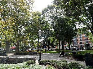
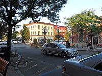
The Morristown Green, a historic park, serves as a gathering place and a center of culture within Morristown, the county seat of Morris County.
|
|||
|
|||
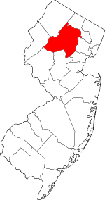
Location within the U.S. state of New Jersey
|
|||
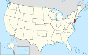 New Jersey's location within the U.S. |
|||
| Country | |||
| State | |||
| Founded | March 15, 1739 | ||
| Named for | Colonial governor Lewis Morris | ||
| Seat | Morristown | ||
| Largest township | Parsippany-Troy Hills Township (population) Rockaway Township (area) |
||
| Area | |||
| • Total | 481.52 sq mi (1,247.1 km2) | ||
| • Land | 460.97 sq mi (1,193.9 km2) | ||
| • Water | 20.55 sq mi (53.2 km2) 4.3% | ||
| Population
(2020)
|
|||
| • Total | 509,285 | ||
| • Estimate
(2023)
|
514,423 |
||
| • Density | 1,057.661/sq mi (408.365/km2) | ||
| Time zone | UTC−5 (Eastern) | ||
| • Summer (DST) | UTC−4 (EDT) | ||
| Congressional districts | 7th, 11th | ||
Morris County is a county located in New Jersey, a state in the United States. It is about 30 miles (48 km) west of New York City. In 2020, it was the tenth-most populated county in New Jersey. Its population was 509,285, which was the highest number ever recorded for the county.
Morris County is part of the larger New York metropolitan area. It has 39 different towns and communities. Many of these are commuter towns, meaning people live there and travel to work in bigger cities. The main town, or county seat, is Morristown. The town with the most people is Parsippany-Troy Hills Township. It had 56,162 residents in 2020. Rockaway Township is the largest in terms of land area.
Morris County is known for being a wealthy area. In 2015, it had the highest average income per person in New Jersey. It was also ranked as one of the healthiest counties in the state in 2017.
Contents
History of Morris County

How Morris County Got Its Name
Morris County was named after Colonel Lewis Morris. He was the governor of New Jersey from 1738 to 1739. The county was named in 1739, the same year he was governor.
Early People and Native Americans
Long ago, around 23,000 BC to 13,000 BC, a huge sheet of ice called the Wisconsin Glacier covered the northern part of Morris County.
After the glacier melted, people known as Paleo-Indians came to the area. They were looking for animals to hunt and plants to gather. The land was like a cold, grassy plain back then.
Around the year 1000, the Lenape Native Americans lived in the Morris County area. They came from the Mississippi River region. They lived near rivers, hunted, fished, and gathered plants and nuts.
Dutch and English Settlers Arrive
In 1609, Henry Hudson explored the Hudson River area. Later, the Dutch explored and claimed land for their colony, New Netherland. This land included northern New Jersey. The Dutch built forts to trade with Native Americans. They exchanged furs and food for metal pots, knives, guns, and blankets.
However, wars broke out between the Dutch and Native Americans from 1643 to 1660. This made it hard for the Dutch to settle in the Morris County region.
In 1664, English ships took control of New Netherland. Morris County then became part of the English colony of New York. Relations with Native Americans got better for a while.
European settlements in the Morris County area began in the early 1700s. At first, this area was part of Hunterdon County. Settlers bought land from Native Americans using items like blankets, shirts, and tools.
The first European settlement in what is now Morris County was in Pompton Plains in 1695. Between 1710 and 1730, iron mines and factories were built. The first was in Whippany in 1710.
By 1750, most Native Americans had left New Jersey. This was due to land sales, diseases from Europeans, and food shortages. Many moved to eastern Canada or the Ohio Valley.
Morris County was officially created on March 15, 1739. It was formed from parts of Hunterdon County. Later, other counties like Sussex and Warren were created from parts of the original Morris County.
The American Revolution
Morris County played a big role in the American Revolutionary War. The Continental Army, led by George Washington, spent two cold winters here. They camped in 1777 after important battles and again in 1779-80 at Jockey Hollow.
In the 1880s, Dover was a major center for iron ore mining. Many miners from Cornwall, England, worked there. They kept their customs and were mostly Methodists.
Geography and Nature
Morris County covers about 481.52 square miles (1,247.1 km²). Most of this is land, with about 4.3% being water.
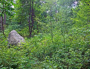
The land in Morris County gets higher and more hilly from east to west. The eastern parts, near the Passaic River, are flatter. The highest point is 1,395 feet (425 m) above sea level in Jefferson Township. The lowest point is about 160 feet (49 m) where the Passaic and Pompton rivers meet.
Several rivers flow through the county. The Rockaway River drains the northern part. The Whippany River drains the middle. The South Branch of the Raritan River and the Black River drain the western area.
Many of the county's borders are formed by rivers. The Pequannock River is on the northern border. The Pompton and Passaic rivers are on the eastern border. The Musconetcong River is on the western border.
Morris County also has several large lakes. These include Lake Hopatcong, which is New Jersey's largest lake. Other lakes are Budd Lake, Lake Parsippany, and the Boonton Reservoir.
Climate and Weather
Morris County has a humid continental climate. This means it has warm, humid summers and cold winters.
| Climate data for Morristown | |||||||||||||
|---|---|---|---|---|---|---|---|---|---|---|---|---|---|
| Month | Jan | Feb | Mar | Apr | May | Jun | Jul | Aug | Sep | Oct | Nov | Dec | Year |
| Mean daily maximum °F (°C) | 38 (3) |
41 (5) |
50 (10) |
61 (16) |
71 (22) |
80 (27) |
85 (29) |
83 (28) |
75 (24) |
65 (18) |
54 (12) |
43 (6) |
62 (17) |
| Mean daily minimum °F (°C) | 18 (−8) |
19 (−7) |
27 (−3) |
36 (2) |
46 (8) |
54 (12) |
59 (15) |
58 (14) |
51 (11) |
39 (4) |
32 (0) |
23 (−5) |
39 (4) |
| Average precipitation inches (mm) | 4.50 (114) |
3.00 (76) |
4.41 (112) |
4.64 (118) |
5.09 (129) |
4.40 (112) |
5.29 (134) |
4.37 (111) |
5.33 (135) |
4.17 (106) |
4.37 (111) |
4.10 (104) |
53.67 (1,363) |
| Weather chart for Morristown, New Jersey | |||||||||||||||||||||||||||||||||||||||||||||||
|---|---|---|---|---|---|---|---|---|---|---|---|---|---|---|---|---|---|---|---|---|---|---|---|---|---|---|---|---|---|---|---|---|---|---|---|---|---|---|---|---|---|---|---|---|---|---|---|
| J | F | M | A | M | J | J | A | S | O | N | D | ||||||||||||||||||||||||||||||||||||
|
4.5
38
18
|
3.1
41
19
|
4.4
50
27
|
4.6
61
36
|
5.1
71
46
|
4.4
80
54
|
5.3
85
59
|
4.4
83
58
|
5.3
75
51
|
4.2
65
39
|
4.4
54
32
|
4.1
43
23
|
||||||||||||||||||||||||||||||||||||
| temperatures in °F precipitation totals in inches source: The Weather Channel |
|||||||||||||||||||||||||||||||||||||||||||||||
|
Metric conversion
|
|||||||||||||||||||||||||||||||||||||||||||||||
In Morristown, the average temperatures in January are between 18 and 23°F (-8 to -5°C). In July, they range from 83 to 85°F (28 to 29°C). The lowest temperature ever recorded was -26°F (-32°C) in February 1934. The highest was 104°F (40°C) in August 2001.
Geology of the Land

About 500 million years ago, volcanic islands crashed into North America. This created the highlands in western and eastern Morris County.
Around 21,000 BC, the Wisconsin Glacier covered about half of Morris County. When the glacier melted around 13,000 BC, the melting water formed Glacial Lake Passaic. This huge lake was 30 miles (48 km) long and 10 miles (16 km) wide. When the glacier fully melted, the lake drained, forming the Passaic River.
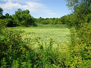
The swamps like Great Piece Meadows and Great Swamp were all once under Lake Passaic.
People of Morris County
| Historical population | |||
|---|---|---|---|
| Census | Pop. | %± | |
| 1790 | 16,216 | — | |
| 1800 | 17,750 | 9.5% | |
| 1810 | 21,828 | 23.0% | |
| 1820 | 21,368 | −2.1% | |
| 1830 | 23,666 | 10.8% | |
| 1840 | 25,844 | 9.2% | |
| 1850 | 30,158 | 16.7% | |
| 1860 | 34,677 | 15.0% | |
| 1870 | 43,137 | 24.4% | |
| 1880 | 50,861 | 17.9% | |
| 1890 | 54,101 | 6.4% | |
| 1900 | 65,156 | 20.4% | |
| 1910 | 74,704 | 14.7% | |
| 1920 | 82,694 | 10.7% | |
| 1930 | 110,445 | 33.6% | |
| 1940 | 125,732 | 13.8% | |
| 1950 | 164,371 | 30.7% | |
| 1960 | 261,620 | 59.2% | |
| 1970 | 383,454 | 46.6% | |
| 1980 | 407,630 | 6.3% | |
| 1990 | 421,353 | 3.4% | |
| 2000 | 470,212 | 11.6% | |
| 2010 | 492,276 | 4.7% | |
| 2020 | 509,285 | 3.5% | |
| 2023 (est.) | 514,423 | 4.5% | |
| Historical sources: 1790–1990 1970–2010 2000 2010 2000–2010 2010 2020 |
|||
Population in 2020
In 2020, Morris County had 509,285 people. There were 184,885 households, which are groups of people living together. The population density was about 1,107 people per square mile (428 per km²).
About 67% of the people were White, 3% were African American, and 11.3% were Asian. About 15% of the population identified as Hispanic or Latino.
About 21.4% of the population was under 18 years old. The average age was 43.3 years. The county had slightly more females (50.8%) than males (49.2%).
The average household income was $116,283. About 5.5% of the people lived below the poverty line.
Towns and Communities
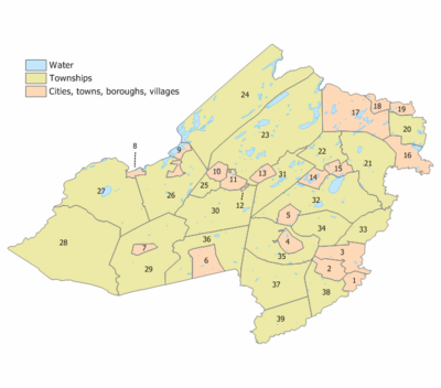
Morris County has 39 different towns and communities. Here is a table with information about them, including their population and area from the 2010 Census:
| Municipality (with map key) |
Municipal type |
Population | Housing Units |
Total Area |
Water Area |
Land Area |
Pop. Density |
Housing Density |
School District | Communities | |
|---|---|---|---|---|---|---|---|---|---|---|---|
| Boonton Town | 15 | town | 8,815 | 3,398 | 2.51 | 0.17 | 2.34 | 3,574.6 | 1,455.2 | Boonton | |
| Boonton Township | 22 | township | 4,380 | 1,647 | 8.63 | 0.39 | 8.24 | 517.2 | 199.8 | Mountain Lakes (9-12) (S/R) Boonton Township (PK-8) |
|
| Butler | 18 | borough | 8,047 | 3,169 | 2.09 | 0.05 | 2.04 | 3,703.2 | 1,556.6 | Butler | |
| Chatham Borough | 1 | borough | 9,212 | 3,210 | 2.42 | 0.05 | 2.37 | 3,776.1 | 1,352.5 | The Chathams | |
| Chatham Township | 38 | township | 10,983 | 4,128 | 9.36 | 0.38 | 8.98 | 1,164.2 | 459.8 | The Chathams | Green Village CDP (part; 1,103) |
| Chester Borough | 7 | borough | 1,681 | 647 | 1.60 | 0.00 | 1.59 | 1,034.8 | 406.0 | West Morris (9-12) Chester (PK-8) |
|
| Chester Township | 29 | township | 7,713 | 2,697 | 29.46 | 0.09 | 29.38 | 266.8 | 91.8 | West Morris (9-12) Chester (PK-8) |
|
| Denville | 31 | township | 17,107 | 6,734 | 12.64 | 0.77 | 11.87 | 1,401.8 | 567.4 | Morris Hills (9-12) Denville Township (PK-8) |
Cedar Lake Estling Lake Indian Lake Lake Arrowhead Mount Tabor CDP (part; 1,244) Union Hill |
| Dover | 11 | town | 18,460 | 5,783 | 2.73 | 0.05 | 2.68 | 6,765.5 | 2,154.8 | Dover | |
| East Hanover | 33 | township | 11,105 | 3,976 | 8.14 | 0.24 | 7.89 | 1,413.7 | 503.8 | Hanover Park (9-12) East Hanover (PK-8) |
|
| Florham Park | 3 | borough | 12,585 | 4,201 | 7.54 | 0.25 | 7.29 | 1,604.9 | 576.4 | Hanover Park (9-12) Florham Park (PK-8) |
|
| Hanover | 34 | township | 14,677 | 5,526 | 10.73 | 0.20 | 10.52 | 1,302.8 | 525.0 | Hanover Park (9-12) Hanover Township (PK-8) |
Cedar Knolls CDP (4,082) Whippany CDP (8,863) |
| Harding | 37 | township | 3,871 | 1,610 | 20.44 | 0.53 | 19.92 | 192.7 | 80.8 | Madison (9-12) (S/R) Harding Township (PK-8) |
Green Village CDP (part; 1,103) New Vernon CDP (825) |
| Jefferson | 24 | township | 20,538 | 8,597 | 43.11 | 3.98 | 39.13 | 544.7 | 219.7 | Jefferson Township | Lake Hopatcong CDP (10,232) Lake Swannanoa Lower Berkshire Valley CDP (part; 617) Newfoundland CDP (part; 1,145) Oak Ridge CDP (part; 10,996) Picatinny Arsenal Russia |
| Kinnelon | 17 | borough | 9,966 | 3,600 | 19.19 | 1.20 | 17.99 | 569.7 | 200.1 | Kinnelon | Jacksonville Smoke Rise |
| Lincoln Park | 16 | borough | 10,915 | 4,145 | 6.91 | 0.53 | 6.38 | 1,649.0 | 649.7 | Boonton (9-12) (S/R) Lincoln Park (PK-8) |
Jacksonville |
| Long Hill | 39 | township | 8,629 | 3,226 | 12.14 | 0.29 | 11.85 | 734.3 | 272.2 | Watchung Hills (9-12) Long Hill Township (PK-8) |
Gillette CDP (2,956) Millington CDP (3,038) Stirling CDP (2,555) |
| Madison | 2 | borough | 16,937 | 5,775 | 4.22 | 0.01 | 4.21 | 3,767.9 | 1,373.3 | Madison | |
| Mendham Borough | 6 | borough | 4,981 | 1,798 | 6.00 | 0.05 | 5.95 | 837.1 | 302.2 | West Morris (9-12) Mendham Borough (PK-8) |
|
| Mendham Township | 36 | township | 5,869 | 2,062 | 18.10 | 0.23 | 17.87 | 328.4 | 115.4 | West Morris (9-12) Mendham Township (PK-8) |
Brookside CDP (1,737) |
| Mine Hill | 25 | township | 4,015 | 1,380 | 3.03 | 0.09 | 2.94 | 1,241.6 | 469.3 | Dover (7-12) (S/R) Mine Hill (PK-6) |
|
| Montville | 21 | township | 22,450 | 7,823 | 19.06 | 0.58 | 18.48 | 1,165.0 | 423.3 | Montville Township | Jacksonville Pine Brook CDP (5,675) Towaco CDP (5,624) |
| Morris Plains | 5 | borough | 6,153 | 2,197 | 2.59 | 0.04 | 2.56 | 2,163.5 | 859.2 | Morris (9-12) (S/R) Morris Plains (PK-8) |
|
| Morris Township | 35 | township | 22,974 | 8,502 | 15.76 | 0.14 | 15.62 | 1,428.3 | 544.4 | Morris | Convent Station Washington Valley |
| Morristown | 4 | town | 20,180 | 8,172 | 3.03 | 0.10 | 2.93 | 6,284.9 | 2,789.6 | Morris | |
| Mount Arlington | 9 | borough | 5,909 | 2,545 | 2.92 | 0.75 | 2.17 | 2,325.2 | 1,171.8 | Roxbury (9-12) (S/R) Mount Arlington (K-8) |
|
| Mount Olive | 27 | township | 28,886 | 11,244 | 31.08 | 1.67 | 29.41 | 956.1 | 382.4 | Mount Olive Township | Budd Lake CDP (9,784) Flanders CDP (9,832) |
| Mountain Lakes | 14 | borough | 4,472 | 1,363 | 2.89 | 0.27 | 2.62 | 1,590.3 | 521.1 | Mountain Lakes | |
| Netcong | 8 | borough | 3,375 | 1,449 | 0.92 | 0.07 | 0.84 | 3,828.4 | 1,716.4 | Lenape Valley (9-12) Netcong (PK-8) |
|
| Parsippany-Troy Hills | 32 | township | 56,162 | 21,274 | 25.39 | 1.83 | 23.56 | 2,259.3 | 902.8 | Parsippany-Troy Hills | Greystone Park Lake Hiawatha CDP (10,194) Mount Tabor CDP (part; 1,244) Parsippany CDP (22,778) Rainbow Lakes CDP (1,255) Troy Hills CDP (5,081) |
| Pequannock | 20 | township | 15,571 | 6,794 | 7.17 | 0.42 | 6.75 | 2,302.7 | 1,006.7 | Pequannock Township | Jacksonville Pompton Plains CDP (11,144) |
| Randolph | 30 | township | 26,504 | 9,343 | 21.07 | 0.25 | 20.82 | 1,235.9 | 448.7 | Randolph Township | Ironia Mount Freedom Shongum |
| Riverdale | 19 | borough | 4,107 | 1,657 | 2.09 | 0.07 | 2.01 | 1,766.5 | 822.5 | Pompton Lakes (9-12) (S/R) Riverdale (PK-8) |
|
| Rockaway Borough | 13 | borough | 6,598 | 2,521 | 2.12 | 0.05 | 2.07 | 3,106.7 | 1,216.5 | Morris Hills (9-12) Rockaway Borough (PK-8) |
|
| Rockaway Township | 23 | township | 25,341 | 9,587 | 45.55 | 4.14 | 41.40 | 583.4 | 231.6 | Morris Hills (9-12) Rockaway Township (K-8) |
Green Pond Hibernia CDP (208) Lake Telemark CDP (1,172) Mount Hope CDP (2,930) |
| Roxbury | 26 | township | 22,950 | 8,582 | 21.89 | 1.06 | 20.83 | 1,119.9 | 412.1 | Roxbury | Flanders Kenvil CDP (1,806) Landing CDP (4,296) Ledgewood CDP (4,903) Lower Berkshire Valley CDP (part; 617) Port Morris CDP (754) Succasunna CDP (10,338) |
| Victory Gardens | 12 | borough | 1,582 | 566 | 0.15 | 0.00 | 0.15 | 10,419.2 | 3,879.8 | Dover | |
| Washington Township | 28 | township | 18,197 | 6,488 | 44.77 | 0.38 | 44.39 | 417.5 | 146.2 | West Morris (9-12) Washington Township (PK-8) |
Long Valley CDP (1,827) Middle Valley Pottersville Schooley's Mountain Scrappy Corner |
| Wharton | 10 | borough | 7,241 | 2,426 | 2.22 | 0.07 | 2.15 | 3,039.0 | 1,130.4 | Morris Hills (9-12) Wharton Borough (K-8) |
|
| Morris | county | 509,285 | 189,842 | 481.62 | 21.45 | 460.18 | 1,069.8 | 412.5 |
Economy and Jobs
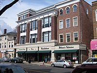
Morris County has a very strong economy. It has one of the highest average household incomes in the United States.
In 2021, the county's total economic output was $51.2 billion. This shows how much money is made from goods and services in the area.
Businesses and Employers
Many large companies have offices or major facilities in Morris County. These include well-known names like AT&T, Honeywell, Colgate-Palmolive, Pfizer, and Johnson & Johnson.
The main types of jobs in the county are in finance, insurance, real estate, and healthcare. There are also many jobs in research, development, and technology.
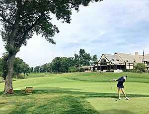
Morris County has 28 county parks covering 13,000 acres (53 km²). There are also four county golf courses.
Here are some of the biggest employers in Morris County:
| # | Employer | # of employees |
|---|---|---|
| 1 | Novartis | 5,000+ |
| 2 | Atlantic Health System | 2,500–4,999 |
| 3 | Louis Berger Group | 2,500–4,999 |
| 4 | Picatinny Arsenal | 2,500–4,999 |
| 5 | Saint Clare's Hospital Inc. | 2,500–4,999 |
| 6 | UPS Logistics | 1,000–2,499 |
| 7 | Avis Budget Group | 1,000–2,499 |
| 8 | BASF Chemicals | 1,000–2,499 |
| 9 | ADP Services | 1,000–2,499 |
| 10 | AT&T Info Tech | 1,000–2,499 |
Housing Costs
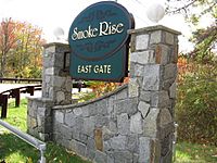
In 2018, the average house price in Morris County was $469,900. This was the second highest in New Jersey.
Some areas in Morris County are very expensive. For example, New Vernon was ranked as one of the most expensive places in the country in 2012. The average home there sold for over $2.7 million. Other expensive areas include Mountain Lakes and Mendham.
Education in Morris County
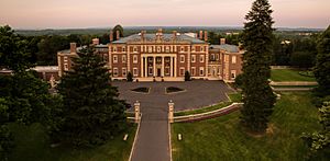
Many people in Morris County have college degrees. In 2018, about 56.1% of residents were college graduates. This was the second highest percentage in New Jersey.
- The County College of Morris is a two-year public college. It serves students from Morris County and has its main campus in Randolph. It was started in 1965.
- The Assumption College for Sisters is a private two-year college for women. It is a Roman Catholic school located in Mendham.
The area around Florham Park, Madison, and Convent Station has three universities:
- Fairleigh Dickinson University (FDU) has a campus here. It is New Jersey's largest private university.
- Drew University is a small, private university in Madison. It is known as the "University in the Forest" because of its large, wooded campus.
- Saint Elizabeth University (SEU) is a private Roman Catholic university. It became a coeducational school in 2016, meaning both men and women can attend.
Arts and Culture

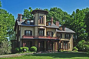
Morris County has many places to enjoy arts and culture:
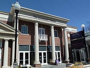
- Mayo Performing Arts Center is a theater that used to be a movie theater. It now hosts many live performances.
- Shakespeare Theatre of New Jersey is a professional theater. It focuses on plays by Shakespeare and other classic works.
- Pax Amicus Castle Theatre is a community theater. It looks like a medieval castle and puts on many different shows.
- Acorn Hall is a historic mansion from 1853. It is now a museum and the home of the Morris County Historical Society.
- Morris Museum is the second-largest museum in New Jersey. It has displays of rocks, minerals, fossils, and Native American crafts.
- Museum of Early Trades and Crafts shows a collection of over 8,000 tools and items. These were used in New Jersey before 1860.
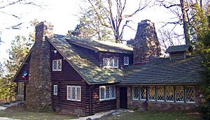
- Stickley Museum at Craftsman Farms is a historic farm. It was designed by Gustav Stickley, a famous furniture maker. It shows his original designs.
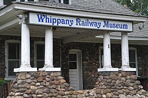
- Whippany Railway Museum works to save the history of New Jersey's railroads. It restores and operates old train equipment.
- Morristown Green is a historic park in the center of Morristown. It has monuments from the Revolutionary War. It is surrounded by old churches and shops.
- Morristown National Historical Park has four historic sites. These sites are important to the American Revolutionary War.
- Jockey Hollow was a winter camp for George Washington's Continental Army. It has a visitor center and hiking trails.
- Fort Nonsense was a hilltop fort. It may have been used for signal fires during the war.
- Ford Mansion in Morristown was Washington's headquarters during a very cold winter.
- Washington's Headquarters Museum is next to the Ford Mansion. It has exhibits and a video about the war.
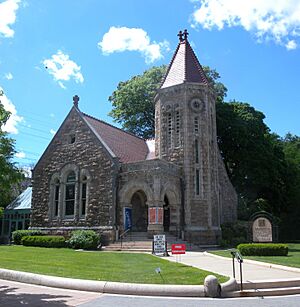
- St. Peter's Episcopal Church is a beautiful church. It has a tall bell tower and stained glass windows.
- Speedwell Ironworks is a historic site and museum. The electric telegraph was first shown to the public here in 1838.
Sports and Recreation
The United States Equestrian Team was started in Morristown in 1950. This team represents the U.S. in horse riding competitions.
Morristown also has the first cricketing club in North America.
The Mennen Arena in Morris Township hosts many sports events. These include ice hockey, figure skating, and indoor football.
Fun Places to Visit
Parks and Outdoor Fun
The Morris County Park Commission manages the county's parks. It is the largest park system in New Jersey. It has over 20,000 acres (81 km²) of land.
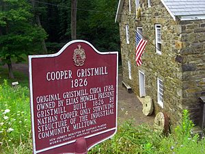
As of 2022, it runs 38 places. These include parks, trails, a marina, and an ice skating arena. There is also a horse stable, a historic farm, and a working mill.
Lewis Morris County Park was the first park opened by the commission in 1958. It was named after Governor Lewis Morris. Morristown National Historical Park became the country's first National Historical Park in 1933.
Protected Natural Areas
Other Interesting Places
- Morris County Golf Club was started in 1894. It was unique because women established and ran it.
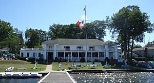
- Lake Hopatcong Yacht Club was built in 1905. Its clubhouse is on Bertrand Island in Lake Hopatcong. It is listed on historic places registers.
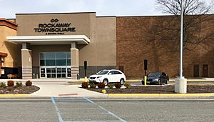
- Rockaway Townsquare is a very large shopping mall in Rockaway Township. It is one of the biggest malls in New Jersey.
Getting Around Morris County
Roads and Highways
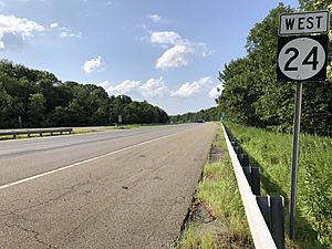
Morris County has over 2,500 miles (4,000 km) of roads. Local towns maintain most of them. The county and the state also maintain many roads.
Major highways that go through Morris County include:
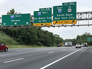
- Interstate 80
- Interstate 280
- Interstate 287
- U.S. Route 46
- U.S. Route 202
- U.S. Route 206
- Route 10
- Route 15
- Route 23
- Route 24
Public Transportation
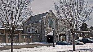
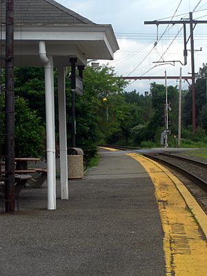
NJ Transit provides train service in Morris County. You can take trains to Hoboken Terminal and New York City. Train stations are in towns like Chatham, Madison, and Morristown.
Bus services are also available from companies like Lakeland Bus Lines and NJ Transit.
Air Travel
Morristown Municipal Airport is a local airport. It is located near Morristown in Hanover Township. It is used for general aviation, not large commercial flights.
Local News and Media
- WMTR is an AM radio station in Morristown. It plays oldies music.
- WDHA is an FM radio station from Dover. It plays rock music.
- WJSV is a non-profit radio and TV station. It is run by Morristown High School.
- The Morristown Daily Record and The Star-Ledger are local newspapers.
- Hometown Tales is a TV show and podcast. It shares stories and urban legends from around the world. It is based in Morristown.
See also
 In Spanish: Condado de Morris (Nueva Jersey) para niños
 | William Lucy |
 | Charles Hayes |
 | Cleveland Robinson |


