Morris Plains, New Jersey facts for kids
Quick facts for kids
Morris Plains, New Jersey
|
||
|---|---|---|
|
Borough
|
||
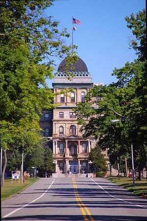
Greystone Park Psychiatric Hospital
|
||
|
||
| Motto(s):
"The Community of Caring"
|
||

Location of Morris Plains in Morris County highlighted in red (right). Inset map: Location of Morris County in New Jersey highlighted in orange (left).
|
||
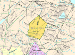
Census Bureau map of Morris Plains, New Jersey
|
||
| Country | ||
| State | ||
| County | ||
| Incorporated | April 15, 1926 | |
| Named for | Lewis Morris | |
| Government | ||
| • Type | Borough | |
| • Body | Borough Council | |
| Area | ||
| • Total | 2.59 sq mi (6.71 km2) | |
| • Land | 2.55 sq mi (6.61 km2) | |
| • Water | 0.04 sq mi (0.09 km2) 1.35% | |
| Area rank | 369th of 565 in state 30th of 39 in county |
|
| Elevation | 430 ft (130 m) | |
| Population
(2020)
|
||
| • Total | 6,153 | |
| • Estimate
(2023)
|
6,538 | |
| • Rank | 341st of 565 in state 28th of 39 in county |
|
| • Density | 2,409.6/sq mi (930.4/km2) | |
| • Density rank | 258th of 565 in state 12th of 39 in county |
|
| Time zone | UTC−05:00 (Eastern (EST)) | |
| • Summer (DST) | UTC−04:00 (Eastern (EDT)) | |
| ZIP Code |
07950
|
|
| Area code(s) | 973 | |
| FIPS code | 3402748210 | |
| GNIS feature ID | 0885308 | |
| Website | ||
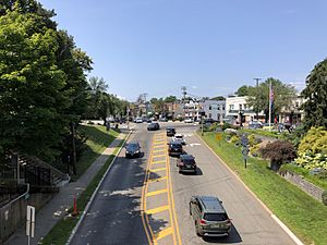
Morris Plains is a small town, called a borough, in Morris County, New Jersey. In 2020, about 6,153 people lived there. This was more than in 2010, showing the town is growing!
Morris Plains became a borough on March 15, 1926. It was formed from parts of Hanover Township. The town is named after Lewis Morris, who was a colonial governor of New Jersey.
Many people who live in Morris Plains travel to work in New York City. This is why it's sometimes called a "bedroom community." The Morristown Line of NJ Transit helps people get to places like New York Penn Station and Hoboken Terminal.
Contents
Geography and Climate
Morris Plains covers about 2.59 square miles (6.71 square kilometers). Most of this area is land, with a small part being water.
A small area called Littleton is also located within the borough. Morris Plains shares borders with other towns in Morris County, including Hanover Township, Morris Township, and Parsippany-Troy Hills.
Weather in Morris Plains
The weather in Morris Plains usually has hot, humid summers. Winters are generally mild to cool. The area has a climate known as a "humid subtropical climate."
| Climate data for Morris Plains, New Jersey | |||||||||||||
|---|---|---|---|---|---|---|---|---|---|---|---|---|---|
| Month | Jan | Feb | Mar | Apr | May | Jun | Jul | Aug | Sep | Oct | Nov | Dec | Year |
| Record high °F (°C) | 72 (22) |
77 (25) |
84 (29) |
93 (34) |
98 (37) |
99 (37) |
100 (38) |
101 (38) |
102 (39) |
88 (31) |
83 (28) |
74 (23) |
102 (39) |
| Mean daily maximum °F (°C) | 38 (3) |
40 (4) |
48 (9) |
61 (16) |
71 (22) |
80 (27) |
85 (29) |
83 (28) |
77 (25) |
64 (18) |
53 (12) |
42 (6) |
62 (17) |
| Mean daily minimum °F (°C) | 20 (−7) |
21 (−6) |
30 (−1) |
39 (4) |
49 (9) |
59 (15) |
63 (17) |
61 (16) |
53 (12) |
42 (6) |
33 (1) |
25 (−4) |
41 (5) |
| Record low °F (°C) | −16 (−27) |
−10 (−23) |
−4 (−20) |
12 (−11) |
26 (−3) |
32 (0) |
39 (4) |
36 (2) |
27 (−3) |
17 (−8) |
5 (−15) |
−8 (−22) |
−16 (−27) |
| Average precipitation inches (mm) | 3.55 (90) |
3.06 (78) |
4.18 (106) |
4.47 (114) |
4.98 (126) |
4.00 (102) |
4.87 (124) |
4.86 (123) |
4.32 (110) |
3.72 (94) |
4.57 (116) |
4.04 (103) |
50.62 (1,286) |
| Average snowfall inches (cm) | 9.4 (24) |
10.0 (25) |
5.7 (14) |
1.0 (2.5) |
0 (0) |
0 (0) |
0 (0) |
0 (0) |
0 (0) |
0 (0) |
1.0 (2.5) |
6.9 (18) |
34 (86) |
| Source: NOAA | |||||||||||||
Population and People
| Historical population | |||
|---|---|---|---|
| Census | Pop. | %± | |
| 1930 | 1,713 | — | |
| 1940 | 2,018 | 17.8% | |
| 1950 | 2,707 | 34.1% | |
| 1960 | 4,703 | 73.7% | |
| 1970 | 5,540 | 17.8% | |
| 1980 | 5,305 | −4.2% | |
| 1990 | 5,219 | −1.6% | |
| 2000 | 5,236 | 0.3% | |
| 2010 | 5,532 | 5.7% | |
| 2020 | 6,153 | 11.2% | |
| 2023 (est.) | 6,538 | 18.2% | |
| Population sources: 1930 1940–2000 2000 2010 2020 |
|||
In 2010, there were 5,532 people living in Morris Plains. Most residents were White (about 89%). There were also Black or African American, Asian, and other racial groups. About 5.7% of the population was Hispanic or Latino.
Many households were families, with about 61% being married couples. About 32% of households had children under 18. The average age of people in Morris Plains was about 42 years old.
Economy and Businesses
Morris Plains is home to some big companies. Pfizer, a large pharmaceutical company, has a major office here. They used to be the headquarters for Warner-Lambert. Pfizer has supported local education and events, like a 5k race.
A property owned by Pfizer is being redeveloped. It will include new homes and shops. In 2015, Honeywell, another big company, moved its headquarters to Morris Plains. They have a large campus in the borough.
Education in Morris Plains
The Morris Plains Schools teach students from pre-kindergarten up to eighth grade. The school district has two schools. Mountain Way School serves students in Pre-K to 2nd grade. Morris Plains Borough School is for students in grades 3 to 8.
After eighth grade, students go to Morristown High School. This high school also serves students from Morristown and Morris Township.
There used to be a Catholic school called St. Virgil Academy. It closed in 2016 because fewer students were enrolling and costs were rising.
Transportation and Travel
Morris Plains has several main roads, including U.S. Route 202, New Jersey Route 10, and New Jersey Route 53. Larger highways like Interstate 80 and Interstate 287 are close by in Parsippany-Troy Hills Township.
Public Transport Options
NJ Transit offers train service at the Morris Plains station. You can take trains on the Morristown Line to places like Newark Broad Street Station, Secaucus Junction, New York Penn Station, and Hoboken Terminal. The train station building itself is quite old, built in 1915, and is listed as a historic place.
NJ Transit also provides local bus services. These buses help people travel around the area.
Morris Plains in Pop Culture
- In the TV show The Sopranos, a scene in the episode "Made in America" takes place at a gas station in Morris Plains.
Famous People from Morris Plains
Many interesting people have lived in or are connected to Morris Plains:
- Darron Collins (born 1970), an expert in human ecology and plants, who became president of the College of the Atlantic.
- Michael Dogbe (born 1996), a professional football player for the Arizona Cardinals.
- William Perry Fogg (1826–1909), an author and adventurer.
- Robert Martin (born 1947), a State Senator for New Jersey.
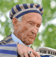
- Edward Mosberg (1926-2022), a Holocaust survivor, teacher, and generous giver.
- Suzanne Scott (born 1965/66), the CEO of Fox News.
- Gustav Stickley (1858–1942), a famous furniture maker and designer.
- Ben Weinman (born 1975), a musician from the band The Dillinger Escape Plan.
- Paul Zimmerman (born 1932), a sportswriter for Sports Illustrated.
See also
 In Spanish: Morris Plains para niños
 | Roy Wilkins |
 | John Lewis |
 | Linda Carol Brown |


