Whippany River facts for kids
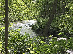
The Whippany River is a cool river in northern New Jersey, United States. It's about 20 miles (30 km) long. It's a tributary of the Rockaway River, which means it's a smaller river that flows into a bigger one.
Contents
What is the Whippany River?
The Whippany River is an important waterway in Morris County. It helps carry water from many smaller streams and areas into larger rivers. Think of it like a branch of a tree, bringing water to the main trunk.

Where Does the Whippany River Flow?
The river starts in Mendham Township, which is west of Morristown. From there, it flows generally east and northeast. It takes a winding path, called a meander, through Morristown. It also goes through the Whippany area in Hanover.
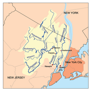
The Whippany River then flows through a special wetland area called the Troy Meadows. Finally, it joins the Rockaway River in the Hatfield Swamp. This meeting point is in eastern Morris County. The Rockaway River then flows into the Passaic River very close by.
How Big is the Whippany River?
The area that drains water into the Whippany River is about 69 square miles. This is called its drainage area. It means all the rain and water that falls in this 69-square-mile space eventually flows into the Whippany River.
Scientists use special tools called water gauges to measure the river's flow. There are three of these gauges on the Whippany River. One gauge in Parsippany shows that the river's average flow is about 178 cubic feet (5.0 cubic meters) of water per second. That's a lot of water moving every second!
Where Did the Name "Whippany" Come From?
The name "Whippany" comes from the Whippanong Native Americans. This tribe used to live in the area a long time ago. The word "Whippanong" meant "place of the willows." This name was given because of the many willow trees that grew along the banks of the river.
 | George Robert Carruthers |
 | Patricia Bath |
 | Jan Ernst Matzeliger |
 | Alexander Miles |


