
Chatham Borough, New Jersey facts for kids
Quick facts for kids
Chatham Borough, New Jersey
|
||
|---|---|---|
|
Borough
|
||

Main Street in Downtown Chatham
|
||
|
||

Location of Chatham (borough) in Morris County highlighted in red (right). Inset map: Location of Morris County in New Jersey highlighted in orange (left).
|
||

Census Bureau map of Chatham (borough), New Jersey
|
||

Chatham Borough, New Jersey
Location in Morris County, New Jersey

Chatham Borough, New Jersey
Location in New Jersey

Chatham Borough, New Jersey
Location in the United States
|
||
| Country | ||
| State | ||
| County | ||
| European settlement | 1710 (as a colonial village) | |
| Incorporated | August 19, 1892 (as village) | |
| Reincorporated | March 1, 1897 (as borough) | |
| Named for | William Pitt, 1st Earl of Chatham | |
| Government | ||
| • Type | Borough | |
| • Body | Borough Council | |
| Area | ||
| • Total | 2.38 sq mi (6.16 km2) | |
| • Land | 2.34 sq mi (6.07 km2) | |
| • Water | 0.04 sq mi (0.09 km2) 1.51% | |
| Area rank | 382nd of 565 in state 32nd of 39 in county |
|
| Elevation | 233 ft (71 m) | |
| Population
(2020)
|
||
| • Total | 9,212 | |
| • Estimate
(2023)
|
9,275 | |
| • Rank | 257th of 565 in state 21st of 39 in county |
|
| • Density | 3,925.0/sq mi (1,515.5/km2) | |
| • Density rank | 167th of 565 in state 7th of 39 in county |
|
| Time zone | UTC−05:00 (Eastern (EST)) | |
| • Summer (DST) | UTC−04:00 (Eastern (EDT)) | |
| ZIP Code |
07928
|
|
| Area code(s) | 973 | |
| FIPS code | 34-12100 | |
| GNIS feature ID | 0885182 | |
| Website | ||

Chatham Borough is a town in Morris County, New Jersey. It's a suburban area, meaning it's a residential community near a larger city. In 2020, about 9,212 people lived here. This was a small increase from 2010.
People have lived in the Chatham area for thousands of years. Native Americans lived here before Europeans arrived. They farmed, fished, and hunted. Europeans began trading with them when the area was part of New Netherlands. The first European settlement in Chatham was in 1710. It was called John Day's Bridge. This spot was chosen because it was on an old Native American trail. It also had an important crossing of the Passaic River and was near a gap in the Watchung Mountains. In 1773, the community changed its name to Chatham.
Chatham residents played a part in the American Revolutionary War. This war ended in 1783. Chatham Township was formed in 1806. It took its name from the village of Chatham. In 1892, Chatham became a village with its own government. Then, in 1897, it officially became a borough. This made it fully independent from Chatham Township.
An early railroad line, the Morris and Essex Lines, had a stop in Chatham. This attracted many people from nearby Manhattan, which is about 20 miles away. Chatham is still a commuter town today. Many residents work in New York City. Chatham is a friendly town for walking. It covers less than 2.5 square miles. Its main downtown area and train station are close to its edges. The borough is in southeastern Morris County. It borders Essex and Union counties along the Passaic River. The Mall at Short Hills is just northeast of Chatham.
Chatham has been recognized as a great place to live. In 2005, CNN/Money and Money magazine ranked it ninth in the U.S. New Jersey Monthly magazine called it the 25th best place to live in New Jersey in 2008. In 2018, Bloomberg ranked Chatham as the 64th highest-income place in the U.S. It was the 8th highest-income place in New Jersey. In 2021, the average household income in Chatham Borough was $209,283.
Contents
- Chatham's Early History
- Chatham During the American Revolution
- Chatham's Government and Growth
- Chatham's Architecture and Homes
- Chatham's Geography and Natural Features
- Chatham's Climate
- Population and Demographics
- Chatham's Economy
- Fishawack Festival: A Community Celebration
- Education in Chatham
- Transportation in Chatham
- Library of The Chathams
- Sister City
- Notable People from Chatham
- Images for kids
Chatham's Early History
Native American Roots and European Arrival
For thousands of years, Native Americans lived on this land. Clans of the Minsi and Lenni Lenape tribes were here. They farmed, fished, and hunted. Their villages were moved when the soil needed to rest. They also moved to different fishing and hunting grounds.
In 1498, John Cabot explored this part of the New World. The area was claimed by the Dutch as part of New Netherland. They traded furs here. But the Lenape stopped permanent settlements beyond what is now Jersey City. The Dutch and British fought over this land. In 1664, the British took control. The area became the Province of New Jersey. This is when permanent European settlements began.
The land that became Chatham was part of East Jersey. In 1680, the British bought the land from the Minsi and Lenni Lenape tribes. These tribes spoke an Algonquian language. They had well-used paths connecting their settlements. These paths went to important resources and other villages. The paths also went through valleys, marshes, and mountains. These safe routes connected Chatham with other areas. Most roads in Chatham today follow these old Native American trails. Main Street goes from a shallow crossing of the Passaic River. It then goes through Chatham and Bottle Hill (now Madison). The road continues west to the plateau where Morristown was founded.
Founding of John Day's Bridge
In 1680, the British bought the Lenape land. John Day made the first European settlement here in 1710. He settled on the west bank of the Fishawack Crossing of the Passaic River. This was on the traditional Lenape Minisink Trail. Chatham was part of Morris Township. This river crossing was the best place to cross the river. The Lenape always used it on their way to the Hudson River. This part of the Great Trail became today’s Route 124. It leads to Madison, Morristown, Mendham, and Chester. In Chatham, it became known as Main Street.

The village soon became known as John Day's Bridge. This was because John Day built a bridge across the river. By 1750, the village had a blacksmith shop. It also had a flour mill, a grist mill, and a lumber mill.
In 1773, the village was renamed "Chatham". This honored William Pitt, a British Parliament member. He strongly supported the rights of the American colonists.
Chatham During the American Revolution
New Jersey was one of the Thirteen Colonies that fought against British rule. This was during the American Revolutionary War. The New Jersey Constitution of 1776 was passed on July 2, 1776. This was two days before America declared independence.
Chatham citizens were very involved in the Revolutionary War. Nearby Morristown became a key military center. George Washington set up his winter headquarters in Morristown twice. Revolutionary troops were often in the area. The Lenape helped the colonists. They provided warriors and scouts. In return, they received food and a promise of a future Native American state. In 1781, General Rochambeau built a large bakery in Chatham. This was a trick to make the British think his troops would stay. But his troops were actually marching south to Yorktown.
The Watchung mountain range was important in the war. It was a natural barrier against British troops. It also gave Washington a good view of enemy movements. The Minisink Trail and the village bridge were vital. They provided a way to move supplies across the river and through the mountains. The Hobart Gap was the only pass through the Watchung Mountains.
Washington wrote 17 letters while staying at a home in Chatham. The community saw several small battles. Residents and the rebel army stopped British attacks. This kept Washington's supplies in Morristown safe.
In 1779, a printing press was set up in Chatham by Shepard Kollock. He published books, pamphlets, and the New Jersey Journal. This was the third newspaper in New Jersey. It discussed independence efforts. It also boosted the spirits of troops and their families. The news came directly from Washington's headquarters. Kollock's newspaper was published until 1992. It was one of the oldest continuously published newspapers in the U.S.
Chatham's Government and Growth
After the Revolutionary War ended in 1783, new governments were formed. On February 12, 1806, Chatham village became part of Chatham Township. This township shared the village's name. It included other communities and large areas of undeveloped land.
However, by 1892, Chatham Village felt it was not getting enough services from the township. Even though village residents paid 40% of the township taxes, they only received 7% of services. The village had to raise its own money for street lamps. Its roads were in bad shape. So, on August 9, 1892, the village voted to separate from the township.
Ten days later, on August 19, 1892, Chatham became a new type of village government. The state then offered a "borough" form of government. Chatham adopted this new form. The village became a borough on March 1, 1897. This gave it complete independence from Chatham Township.
Many colonial settlements that were part of Chatham Township also left. They formed their own governments. This left Chatham Township mostly with undeveloped lands. In 1910, Chatham Borough grew slightly. It gained a small piece of land from Florham Park. The borough's government and boundaries have stayed the same since then. It covers about 2.4 square miles.
Chatham's Architecture and Homes
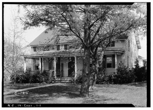
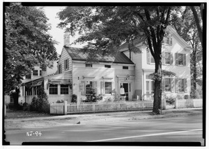
Chatham is about 2.4 square miles. Most of its buildings were constructed before World War II. Many homes still show dates from colonial and revolutionary times. Two houses from colonial times are still standing. They are the Paul Day House at 24 Kings Road and the Nathaniel Bonnell House at 34 Watchung Avenue. These are now privately owned.
Chatham's Geography and Natural Features
Location and Nearby Towns
Chatham Borough covers about 2.38 square miles. Most of this is land, with a small amount of water. It is located 20 miles west of New York City. It is on the eastern edge of Morris County.
Chatham's neighbors include Summit to the southeast in Union County. To the northeast is Millburn (including its Short Hills area) in Essex County. Within Morris County, Chatham borders Chatham Township to the west. It also borders Madison and Florham Park to the north.
Rivers, Mountains, and Swamps
The Passaic River flows north along Chatham's eastern border. This river starts in Millington Gorge. It also helps define the Great Swamp. A good river crossing spot, found by Native Americans, was important in Chatham's early history. Fairmount Avenue goes up Long Hill from Main Street. This is the highest point in town among the Watchung Mountains. From there, you can see the lights of New York. Water from artesian wells is stored at the top of the hill. This provides drinking water for the community.
Part of the Great Swamp reaches Chatham's southern border. Other marshes surround the town to the north and northwest. These marshes and brooks carry water from the plateau of Morristown and other areas. They are what's left of a huge lake. This lake covered the area after the last Ice age.
Saving the Great Swamp
In 1959, Chatham residents helped save the Great Swamp. The New York Port Authority wanted to build a huge airport there. Local groups, including the Jersey Jetport Site Association, fought against this. They were joined by the North American Wildlife Foundation. Together, they bought enough land to protect the Great Swamp as a federal park.
Two Chatham students, Kafi Benz and Esty Weiss, helped stop the airport plans. They attended meetings of the Port Authority. They handed out flyers against the project. Other groups also joined the fight. Finally, most of the swamp was given to the federal government. It became a National Wildlife Refuge. Stewart Udall, the Secretary of the Interior under President John F. Kennedy, supported saving the swamp. On November 3, 1960, the United States Congress passed a law creating the Great Swamp National Wildlife Refuge.
Chatham's Climate
Chatham has a humid continental climate. This means it has warm summers and cold winters. Its temperatures are a bit more extreme than New York City's.
| Climate data for Chatham (07928, includes Chatham (borough) and Chatham Township) | |||||||||||||
|---|---|---|---|---|---|---|---|---|---|---|---|---|---|
| Month | Jan | Feb | Mar | Apr | May | Jun | Jul | Aug | Sep | Oct | Nov | Dec | Year |
| Record high °F (°C) | 73 (23) |
82 (28) |
89 (32) |
96 (36) |
97 (36) |
103 (39) |
107 (42) |
104 (40) |
99 (37) |
93 (34) |
84 (29) |
76 (24) |
107 (42) |
| Mean daily maximum °F (°C) | 39 (4) |
42 (6) |
51 (11) |
62 (17) |
73 (23) |
82 (28) |
86 (30) |
85 (29) |
78 (26) |
66 (19) |
55 (13) |
44 (7) |
64 (18) |
| Mean daily minimum °F (°C) | 18 (−8) |
20 (−7) |
28 (−2) |
38 (3) |
47 (8) |
57 (14) |
63 (17) |
61 (16) |
53 (12) |
40 (4) |
32 (0) |
24 (−4) |
40 (4) |
| Record low °F (°C) | −25 (−32) |
−26 (−32) |
−6 (−21) |
12 (−11) |
25 (−4) |
31 (−1) |
41 (5) |
35 (2) |
26 (−3) |
13 (−11) |
−5 (−21) |
— | −26 (−32) |
| Average precipitation inches (mm) | 3.54 (90) |
2.91 (74) |
4.20 (107) |
4.29 (109) |
4.38 (111) |
4.70 (119) |
4.73 (120) |
4.42 (112) |
4.89 (124) |
4.65 (118) |
4.06 (103) |
4.13 (105) |
50.90 (1,293) |
Population and Demographics
| Historical population | |||
|---|---|---|---|
| Census | Pop. | %± | |
| 1880 | 738 | — | |
| 1890 | 780 | 5.7% | |
| 1900 | 1,361 | 74.5% | |
| 1910 | 1,874 | 37.7% | |
| 1920 | 2,421 | 29.2% | |
| 1930 | 3,869 | 59.8% | |
| 1940 | 4,888 | 26.3% | |
| 1950 | 7,391 | 51.2% | |
| 1960 | 9,517 | 28.8% | |
| 1970 | 9,566 | 0.5% | |
| 1980 | 8,537 | −10.8% | |
| 1990 | 8,007 | −6.2% | |
| 2000 | 8,460 | 5.7% | |
| 2010 | 8,962 | 5.9% | |
| 2020 | 9,212 | 2.8% | |
| 2023 (est.) | 9,275 | 3.5% | |
| Population sources: 1880–1890 1890–1920 1890–1910 1910–1930 1940–2000 2000 2010 2020 |
|||
In 2010, Chatham Borough had 8,962 people. There were 3,073 households and 2,397 families. The population density was about 3,776 people per square mile. Most residents (91.13%) were White. About 4.85% were Asian, and 0.99% were Black or African American. About 5.10% of the population was Hispanic or Latino.
Many households (48.1%) had children under 18. Most families (68.9%) were married couples. The average household had 2.91 people, and the average family had 3.37 people. About 33.5% of the population was under 18. The median age was 38.0 years.
Chatham is a wealthy community. In 2010, the average household income was $143,281. The average family income was $164,805. The income per person was $64,950. Only a small percentage of families (0.4%) and people (1.1%) lived below the poverty line.
Chatham's Economy
Weichert, Realtors was started in Chatham Borough in 1969. It is now a large real estate company. Chatham is also home to Chatham Asset Management. This is a company that manages money for investors. It owns parts of several big media companies.
Fishawack Festival: A Community Celebration
The Fishawack Festival started in 1971. It happens at the beginning of summer. Streets are closed so up to 20,000 people can walk around freely. Local sellers set up booths. They sell food, clothes, toys, and souvenirs. There are also games and rides for kids. The festival raises money for different community groups in Chatham and Chatham Township.
The name "Fishawack" comes from the Lenni Lenape name for the Passaic River. A book called Chatham at the Crossing of the Fishawack explains this. It says Chatham was at the narrowest part of the river. This made it the "Crossing of the Fishawack." In 1971, a sidewalk sale called Fishawack Day began. This event grew into the big town festival we know today.
Education in Chatham
Public Schools for Chatham Students
The School District of the Chathams serves students from Chatham and Chatham Township. It includes students from pre-kindergarten to twelfth grade. In 1986, voters in both towns decided to combine their school districts. So, since the 1988–1989 school year, they have shared a regional school district. Chatham High School was formed by merging the old high schools. The old Chatham Borough High School building is now the Chatham Borough Hall.
In the 2020–21 school year, the district had 3,930 students and six schools:
- Milton Avenue School (Pre-K–3)
- Southern Boulevard School (K–3)
- Washington Avenue School (K–3)
- Lafayette School (4–5)
- Chatham Middle School (6–8)
- Chatham High School (9–12)
The district's board of education has nine members. They make rules and manage the schools' money and education. Four seats on the board are for Chatham Borough.
Chatham High School received the National Blue Ribbon School Award of Excellence in 2004–2005. This is a very high award for American schools. Milton Avenue School also received this award in 2014. In 2014, New Jersey Monthly magazine ranked Chatham High School as the top public high school in New Jersey.
Private Schools in Chatham
Saint Patrick School was founded in 1872. It teaches students from pre-kindergarten to eighth grade. It is run by the Roman Catholic Diocese of Paterson.
Transportation in Chatham
Roads and Highways
As of 2010, Chatham had about 32.16 miles of roads. The town maintained most of them. New Jersey Route 24 is a multi-lane highway that crosses Chatham's borders. The closest exit is just outside the borough. New Jersey Route 124 is the main local road into Chatham. This route has been used since before colonial times. It followed the old Great Minisink Trail. It was called Route 24 until the new highway was built. The local towns chose to keep their historic feel. They did not want the new multi-lane highway to go through them.
In 1906, Chatham was in the news for something special. It might have been the first place in the world to use a speed bump. The New York Times reported that the "bumps" were a "decided success" in slowing down cars.
Public Transportation Options

NJ Transit trains stop at the Chatham station. These trains take people to Hoboken Terminal and Penn Station in Midtown Manhattan.
NJ Transit does not offer direct bus service from Chatham to Manhattan. You can take a bus with transfers. Local bus service is available on the 873 route. This route goes to the Livingston Mall and Parsippany-Troy Hills. Bus lines also connect Chatham to other towns along Route 24. These towns include Newark and Morristown. Buses mostly run parallel to the train lines. In the past, stagecoaches and trolleys were used for public transport along Main Street.
Library of The Chathams

The Chatham Library started in 1907. It moved to bigger buildings as its collection grew. The current building on Main Street was built in 1924. It is on the old site of the Fairview Hotel, which had burned down.
In 1974, voters approved combining the library with Chatham Township. The library was renamed the Library of The Chathams. It is now managed by six trustees. These trustees are appointed by the mayors of both towns. A representative from the shared School District of the Chathams also serves.
In 1985, the library joined the Morris Automated Information Network (MAIN). This is an electronic system that links all public libraries in Morris County. The library was expanded in 2004. The two towns helped pay for the nearly $4,000,000 project.
Sister City
Chatham has one sister city: Esternay, France.
Notable People from Chatham
Many interesting people have lived in or are connected to Chatham since 1710. Here are a few:
- Ben Bailey (born 1970), a comedian and host of the TV show Cash Cab.
- Kafi Benz (born 1941), a writer, artist, and conservationist who helped save the Great Swamp.
- Shepard Kollock (1750–1839), an editor and printer during the American Revolution. He started the New Jersey Journal, Chatham's first newspaper.
- Nick Mangold (born 1984), a professional football player for the New York Jets.
- Bob Papa (born 1964), the main radio announcer for the New York Giants football team.
- David K. Shipler (born 1942), an author and journalist who won a Pulitzer Prize.
- John Tolkin (born 2002), a professional soccer player.
- Aaron Montgomery Ward (1844−1913), who invented mail order shopping.
- Alice Waters (born 1944), a famous chef who helped start the local, organic food movement.
Images for kids
-
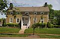
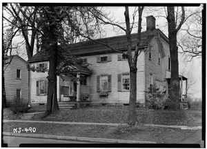
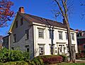
William Day House
-
Peter Dusenberry House


