Somerset County, New Jersey facts for kids
Quick facts for kids
Somerset County
|
|||
|---|---|---|---|
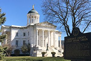
Somerset County courthouse in Somerville, the county seat
|
|||
|
|||
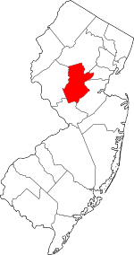
Location within the U.S. state of New Jersey
|
|||
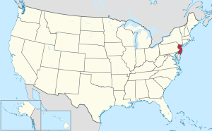 New Jersey's location within the U.S. |
|||
| Country | |||
| State | |||
| Founded | May 14, 1688 | ||
| Named for | English county of Somerset | ||
| Seat | Somerville | ||
| Largest municipality | Franklin Township (population) Hillsborough Township (area) |
||
| Area | |||
| • Total | 304.95 sq mi (789.8 km2) | ||
| • Land | 301.87 sq mi (781.8 km2) | ||
| • Water | 3.09 sq mi (8.0 km2) 1.00% | ||
| Population
(2020)
|
|||
| • Total | 345,361 | ||
| • Estimate
(2023)
|
348,842 |
||
| • Density | 1,132.517/sq mi (437.267/km2) | ||
| Time zone | UTC−5 (Eastern) | ||
| • Summer (DST) | UTC−4 (EDT) | ||
| Congressional districts | 7th, 12th | ||
Somerset County is a county located in the north-central part of New Jersey. It's part of the larger New York metropolitan area. The county seat, or main town, is Somerville.
In 2020, over 345,000 people lived here. This made Somerset County the 13th most populated county in New Jersey. Franklin Township had the most residents. Hillsborough Township was the largest in terms of land area.
Somerset County is known for being a wealthy area. In 2015, it had one of the highest average incomes per person in the United States. It also ranks high for median household income. Many residents are college graduates, making it a highly educated county. It's also considered one of the healthiest counties in New Jersey.
Contents
A Look at Somerset County's History
Somerset County is one of the oldest counties in America. It was named after the county of Somerset in England. The first settlers arrived in 1681 near Bound Brook. The county was officially created on May 22, 1688. Most early residents were from the Netherlands.
How Somerset County Played a Role in History
General George Washington and his troops marched through the county many times. They even slept in some local homes. Somerset County was also important during World War I and World War II. It had places to store weapons and factories that made wool blankets for the army.
For a long time, Somerset County was mostly farmland. In the late 1800s, wealthy business owners started building country homes here. Today, it's still home to many people who work in the pharmaceutical industry.
In 1917, Somerset County teamed up with Rutgers University. They hired an agricultural agent to help local farmers with expert advice. Today, the Rutgers Cooperative Extension still helps residents with farming, nature, and youth programs like 4-H.
From Farms to Suburbs
In the 1960s, many farm towns quickly became suburban communities. Examples include Bridgewater Township and the Watchung Hills towns. This growth happened because many pharmaceutical and technology companies moved to the area.
More recently, many people who work in New York City have moved to Somerset County. They use NJ Transit trains or Interstate 78 to get to work.
Exploring Somerset County's Geography
Somerset County covers about 305 square miles. Most of this area is land, with a small part being water.
The highest point in the county is on Mine Mountain in Bernardsville. It's about 860 feet above sea level. The lowest point is near sea level on the Raritan River.
Neighboring Counties
Somerset County shares its borders with these other counties:
- Morris County, New Jersey – to the north
- Union County, New Jersey – to the east
- Middlesex County, New Jersey – to the southeast
- Mercer County, New Jersey – to the south
- Hunterdon County, New Jersey – to the west
Weather and Climate in Somerset County
| Weather chart for Somerville, New Jersey | |||||||||||||||||||||||||||||||||||||||||||||||
|---|---|---|---|---|---|---|---|---|---|---|---|---|---|---|---|---|---|---|---|---|---|---|---|---|---|---|---|---|---|---|---|---|---|---|---|---|---|---|---|---|---|---|---|---|---|---|---|
| J | F | M | A | M | J | J | A | S | O | N | D | ||||||||||||||||||||||||||||||||||||
|
3.6
38
18
|
2.8
41
20
|
3.9
50
27
|
4.1
61
36
|
4.3
72
46
|
4.4
80
56
|
4.8
85
61
|
4
83
60
|
4.3
76
52
|
4.2
64
40
|
3.6
54
31
|
3.8
42
23
|
||||||||||||||||||||||||||||||||||||
| temperatures in °F precipitation totals in inches source: The Weather Channel |
|||||||||||||||||||||||||||||||||||||||||||||||
|
Metric conversion
|
|||||||||||||||||||||||||||||||||||||||||||||||
In Somerville, the county seat, temperatures usually range from 18°F in January to 85°F in July. However, it has been as cold as -16°F and as hot as 105°F. The county gets about 2.8 to 4.8 inches of rain each month.
Who Lives in Somerset County?
| Historical population | |||
|---|---|---|---|
| Census | Pop. | %± | |
| 1790 | 12,296 | — | |
| 1800 | 12,815 | 4.2% | |
| 1810 | 14,725 | 14.9% | |
| 1820 | 16,506 | 12.1% | |
| 1830 | 17,689 | 7.2% | |
| 1840 | 17,455 | * | −1.3% |
| 1850 | 19,692 | 12.8% | |
| 1860 | 22,057 | 12.0% | |
| 1870 | 23,510 | 6.6% | |
| 1880 | 27,162 | 15.5% | |
| 1890 | 28,311 | 4.2% | |
| 1900 | 32,948 | 16.4% | |
| 1910 | 38,820 | 17.8% | |
| 1920 | 47,991 | 23.6% | |
| 1930 | 65,132 | 35.7% | |
| 1940 | 74,390 | 14.2% | |
| 1950 | 99,052 | 33.2% | |
| 1960 | 143,913 | 45.3% | |
| 1970 | 198,372 | 37.8% | |
| 1980 | 203,129 | 2.4% | |
| 1990 | 240,279 | 18.3% | |
| 2000 | 297,490 | 23.8% | |
| 2010 | 323,444 | 8.7% | |
| 2020 | 345,361 | 6.8% | |
| 2023 (est.) | 348,842 | 7.9% | |
| Historical sources: 1790–1990 1970-2010 2010 2020 * = Lost territory in previous decade. |
|||
Population Details from 2020
In 2020, Somerset County had 345,361 people. There were 122,606 households, which are groups of people living together. The population density was about 1,144 people per square mile.
Most residents (61.0%) were White. About 10.0% were African American, and 18.5% were Asian. About 15.2% of the population identified as Hispanic or Latino.
About 21.5% of households had children under 18. Most households (59.3%) were married couples. The average household had 2.65 people. The average family had 3.16 people.
About 21.5% of the population was under 18 years old. The median age was 42.2 years. This means half the people were older than 42.2 and half were younger.
The median household income was $111,587. The median family income was $135,129. About 5.7% of the population lived below the poverty line.
Economy of Somerset County
In 2021, the total value of all goods and services produced in Somerset County was about $39.8 billion. This makes it one of the top counties in New Jersey for economic activity.
Parks and Fun Things to Do
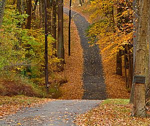
The Somerset Patriots are a professional baseball team. They play at the TD Bank Ballpark, which seats 6,100 fans. They used to be an independent team but became a Double-A team for the New York Yankees in 2021.
The Somerset County Parks Commission manages many parks. Some popular ones include Natirar, Duke Island Park, and Colonial Park. Lord Stirling Park is part of the Great Swamp National Wildlife Refuge. Leonard J. Buck Garden is a beautiful botanical garden.

The county also has natural parks like Washington Valley Park and the Sourland Mountain Preserve. These parks offer great trails for hiking and mountain biking.
The southeastern part of Somerset County includes Delaware and Raritan Canal State Park. Here, you can enjoy hiking, biking, and boating. The Parks Commission also runs five public golf courses. Trump National Golf Club in Bedminster is a private golf club.
Education in Somerset County
Somerset County has many great schools and colleges.
School Districts
Here are some of the school districts in the county:
- Schools for all grades (K-12)
- Bernards Township School District
- Bound Brook School District
- Bridgewater-Raritan Regional School District
- Franklin Township Public Schools
- Hillsborough Township School District
- Manville School District
- Montgomery Township School District
- North Plainfield School District
- Somerset Hills Regional School District
- Somerville Public Schools
- High Schools
- Somerset County Vocational and Technical School District
- Watchung Hills Regional High School
- Elementary Schools
- Bedminster Township School District
- Branchburg Township School District
- Green Brook School District
- South Bound Brook School District
- Warren Township Schools
- Watchung Borough Schools
Colleges and Universities
Somerset County is home to two colleges:
- Raritan Valley Community College (RVCC) in North Branch. Rutgers University partners with RVCC. This allows students to earn a bachelor's degree from Rutgers while taking classes at RVCC.
- Somerset Christian College, now called Pillar College, in Zarephath.
Private Schools
Some private schools in the county include:
- Gill St. Bernard's School (Gladstone)
- Immaculata High School (Somerville)
- Mount St. Mary Academy (Watchung)
- Pingry School (Martinsville)
- Purnell School (Pottersville)
- Rutgers Preparatory School (Somerset)
Somerset Hills Learning Institute helps children with autism. In 2024, a local grocery store started selling salads grown by students in the school's hydroponics program.
Towns and Communities
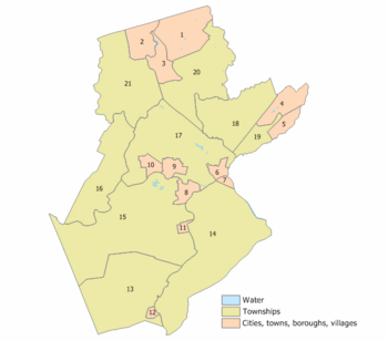
Somerset County has many towns, boroughs, and townships. Some of these larger areas also contain smaller, unincorporated communities. These smaller areas might be called "census-designated places" (CDPs) by the U.S. Census Bureau.
| Municipality (with map key) |
Municipal type |
Population | Housing Units |
Total Area |
Water Area |
Land Area |
Pop. Density |
Housing Density |
Communities |
|---|---|---|---|---|---|---|---|---|---|
| Bedminster Township (21) | township | 8,165 | 4,349 | 26.30 | 0.22 | 26.08 | 313.1 | 166.8 | Lamington Pluckemin Pottersville |
| Bernards Township (20) | township | 26,652 | 10,103 | 24.06 | 0.13 | 23.93 | 1,113.6 | 422.1 | Basking Ridge Liberty Corner Lyons |
| Bernardsville (1) | borough | 7,707 | 2,871 | 12.98 | 0.08 | 12.91 | 597.2 | 222.5 | |
| Bound Brook (6) | borough | 10,402 | 3,816 | 1.69 | 0.04 | 1.66 | 6,269.6 | 2,300.0 | |
| Branchburg Township (16) | township | 14,459 | 5,419 | 20.28 | 0.24 | 20.04 | 721.4 | 270.4 | Neshanic Station North Branch |
| Bridgewater Township (17) | township | 44,464 | 16,657 | 32.51 | 0.47 | 32.04 | 1,387.9 | 519.9 | Bradley Gardens CDP (14,206) Finderne CDP (5,600) Green Knoll CDP (6,200) Martinsville CDP (11,980) |
| Far Hills (3) | borough | 919 | 418 | 4.88 | 0.08 | 4.80 | 191.6 | 87.1 | |
| Franklin Township (14) | township | 62,300 | 24,426 | 46.85 | 0.70 | 46.15 | 1,350.0 | 529.3 | Blackwells Mills CDP (803) Clyde CDP (213) East Franklin CDP (8,669) East Millstone CDP (579) East Rocky Hill CDP (469) Franklin Center CDP (4,460) Franklin Park CDP (13,295) Griggstown CDP (819) Kingston CDP (part; 271) Middlebush CDP (2,326) Pleasant Plains CDP (922) Rockingham Six Mile Run CDP (3,184) Somerset CDP (22,083) Ten Mile Run CDP (1,959) Voorhees CDP (976) Weston CDP (1,235) Zarephath CDP (37) |
| Green Brook Township (19) | township | 7,203 | 2,448 | 4.48 | 0.01 | 4.47 | 1,610.5 | 547.3 | |
| Hillsborough Township (15) | township | 38,303 | 14,030 | 55.00 | 0.47 | 54.54 | 702.3 | 257.3 | Amwell Cloverhill Flagtown Neshanic South Branch Zion |
| Manville (8) | borough | 10,344 | 4,277 | 2.45 | 0.09 | 2.36 | 4,382.0 | 1,811.9 | |
| Millstone (11) | borough | 418 | 167 | 0.76 | 0.02 | 0.74 | 566.5 | 226.3 | |
| Montgomery Township (13) | township | 22,254 | 7,902 | 32.48 | 0.17 | 32.31 | 688.8 | 244.6 | Amwell Belle Mead CDP (216) Blawenburg CDP (280) Dutchtown Harlingen CDP (297) Skillman CDP (242) Stoutsburg Zion |
| North Plainfield (5) | borough | 21,936 | 7,848 | 2.81 | 0.01 | 2.79 | 7,850.0 | 2,808.5 | |
| Peapack-Gladstone (2) | borough | 2,582 | 949 | 5.85 | 0.04 | 5.81 | 444.5 | 163.4 | Gladstone |
| Raritan (10) | borough | 6,881 | 2,847 | 2.04 | 0.04 | 1.99 | 3,452.2 | 1,428.3 | |
| Rocky Hill (12) | borough | 682 | 292 | 0.62 | 0.00 | 0.62 | 1,101.4 | 471.6 | |
| Somerville (9) | borough | 12,098 | 4,951 | 2.36 | 0.03 | 2.33 | 5,189.5 | 2,123.8 | |
| South Bound Brook (7) | borough | 4,563 | 1,865 | 0.75 | 0.10 | 0.66 | 6,933.8 | 2,834.0 | |
| Warren Township (18) | township | 15,311 | 5,258 | 19.64 | 0.08 | 19.57 | 782.5 | 268.7 | |
| Watchung (4) | borough | 5,801 | 2,234 | 6.05 | 0.03 | 6.03 | 962.7 | 370.7 | |
| Somerset County | county | 323,444 | 123,127 | 304.86 | 3.04 | 301.81 | 1,071.7 | 408.0 |
Getting Around Somerset County
Somerset County has many roads and highways. As of 2010, there were over 1,700 miles of roadways. Local towns maintained most of these roads. The county and the state also maintained many miles of roads.
Major Roads and Highways
Several important county roads pass through Somerset County. These include County Routes 512, 514, 518, 523, 525, 527, 529, 531, and 533.
State Routes 27 and 28 also cross the county. U.S. Routes 22, 202, and 206 are major routes here. The two main interstates are Interstate 78 and Interstate 287.
Public Transportation Options
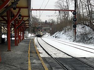
NJ Transit offers train service on the Gladstone Branch and the Raritan Valley Line. These trains connect to other parts of New Jersey.
NJ Transit also provides bus service. You can take buses to Port Authority Bus Terminal in Midtown Manhattan. There are also buses to other major cities in New Jersey and within Somerset County. Local shuttle services like SCOOT, DASH, and CAT buses help people get around the county.
See also
 In Spanish: Condado de Somerset (Nueva Jersey) para niños
 | Laphonza Butler |
 | Daisy Bates |
 | Elizabeth Piper Ensley |


