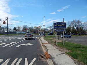
Manville, New Jersey facts for kids
Quick facts for kids
Manville, New Jersey
|
||
|---|---|---|
|
Borough
|
||
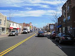
Central business district of Manville
|
||
|
||
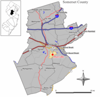
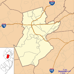
Location of Manville in Somerset County highlighted in yellow (right). Inset map: Location of Somerset County in New Jersey highlighted in black (left).
|
||
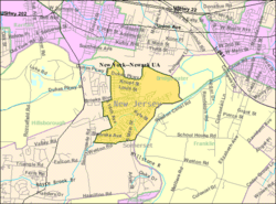
Census Bureau map of Manville, New Jersey
|
||
| Country | ||
| State | ||
| County | ||
| Incorporated | April 18, 1929 | |
| Government | ||
| • Type | Borough | |
| • Body | Borough Council | |
| Area | ||
| • Total | 2.45 sq mi (6.34 km2) | |
| • Land | 2.36 sq mi (6.11 km2) | |
| • Water | 0.09 sq mi (0.23 km2) 3.59% | |
| Area rank | 377th of 565 in state 15th of 21 in county |
|
| Elevation | 56 ft (17 m) | |
| Population
(2020)
|
||
| • Total | 10,953 | |
| • Estimate
(2023)
|
10,779 | |
| • Rank | 230th of 565 in state 11th of 21 in county |
|
| • Density | 4,639.1/sq mi (1,791.2/km2) | |
| • Density rank | 124th of 565 in state 5th of 21 in county |
|
| Time zone | UTC−05:00 (Eastern (EST)) | |
| • Summer (DST) | UTC−04:00 (Eastern (EDT)) | |
| ZIP Code |
08835
|
|
| Area code(s) | 908 | |
| FIPS code | 3403543620 | |
| GNIS feature ID | 0885291 | |
Manville is a small town, called a borough, located in Somerset County, in the central part of New Jersey. It's nestled in the Raritan Valley region and is considered part of the larger New York metropolitan area.
As of the 2020 United States census, about 10,953 people live in Manville. This was a small increase from the 10,344 people counted in 2010. The borough was named after the Johns-Manville Corporation, which used to have a big factory there for many years.
Many people in Manville have family roots from Slavic countries, especially Poland (about 23% in 2000) and Ukraine. You can find many businesses and restaurants that celebrate Polish American culture along Main Street. Manville officially became a borough on April 1, 1929.
Contents
Manville's Location and Natural Surroundings
Manville covers a total area of about 2.45 square miles (6.34 square kilometers). Most of this area is land (2.36 square miles or 6.11 square kilometers), with a small part being water (0.09 square miles or 0.23 square kilometers).
The borough shares its borders with three other towns: Bridgewater Township, Franklin Township, and Hillsborough Township.
Local Plant Life
If you were to look at the natural plants that would grow in Manville without human interference, you would mostly find Oak trees. The area is part of what's called an Eastern Hardwood Forest.
Manville's Population Over Time
| Historical population | |||
|---|---|---|---|
| Census | Pop. | %± | |
| 1930 | 5,441 | — | |
| 1940 | 6,065 | 11.5% | |
| 1950 | 8,597 | 41.7% | |
| 1960 | 10,995 | 27.9% | |
| 1970 | 13,029 | 18.5% | |
| 1980 | 11,278 | −13.4% | |
| 1990 | 10,567 | −6.3% | |
| 2000 | 10,343 | −2.1% | |
| 2010 | 10,344 | 0.0% | |
| 2020 | 10,953 | 5.9% | |
| 2023 (est.) | 10,779 | 4.2% | |
| Population sources: 1930 1940–2000 2000 2010 2020 |
|||
The population of Manville has changed over the years. In 1930, there were 5,441 people. The population grew quite a bit, reaching its highest in 1970 with 13,029 residents. Since then, it has seen some ups and downs, with the most recent count in 2020 showing 10,953 people.
What the 2010 Census Showed
In 2010, there were 10,344 people living in Manville. There were 4,016 households, which are groups of people living together in one home. About 26.8% of these households had children under 18. The average household had about 2.58 people. The median age of people in Manville was 39.6 years old.
Education in Manville
The Manville School District is in charge of public schools for students from pre-kindergarten all the way through twelfth grade. In the 2019–2020 school year, the district had about 1,601 students and 132 teachers. This means there were about 12 students for every teacher.
The schools in the district are:
- Weston Elementary School: For students in Pre-K through 2nd grade.
- Roosevelt Elementary School: For students in 3rd and 4th grades.
- Alexander Batcho Intermediate School: For students in 5th through 8th grades.
- Manville High School: For students in 9th through 12th grades.
There was also a private school called Christ the King School, which opened in 1968. It closed in 2015 because fewer students were attending, and it was costing the church too much money.
Getting Around Manville
Roads and Highways
As of 2010, Manville had about 42 miles of roads. Most of these roads (about 39 miles) are taken care of by the town itself. The county maintains about 2.88 miles of roads.
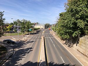
Manville doesn't have any major interstate highways or U.S. state routes directly passing through it. The most important road in the borough is County Route 533. You can also find County Route 608 here.
Public Transportation
Somerset County offers a bus service called SCOOT. This bus service runs through Manville on its R1, R2, and Peak routes, helping people get around.
Train Lines
Several important freight train lines meet in Manville at a place called Port Reading Junction. These include the Norfolk Southern Railway Lehigh Line, the Conrail Shared Assets Operations Lehigh Line, and the CSX Transportation Trenton Subdivision.
Cleaning Up the Environment
Manville was home to a large environmental cleanup project called The Federal Creosote Site. This project was part of the Federal Superfund program, which cleans up dangerous waste sites. The United States Environmental Protection Agency (EPA) spent $250 million to clean up this area.
The cleanup covered a residential area of 35 acres and a commercial area of 15 acres. The EPA officially announced that the cleanup was finished on March 7, 2008.
Understanding Flooding in Manville
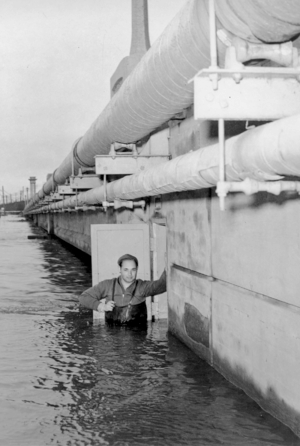
Manville sometimes experiences floods, especially after a lot of heavy rain. This happens because the Raritan River and the Millstone River, which flow near the town, can overflow their banks. The northern part of the borough (near the Raritan) and the Lost Valley section (near the Millstone) are often affected. Even parts of Main Street can flood because of Royce Brook, which connects to the Millstone River.
Experts are studying ways to control the flooding in the Millstone River basin and Manville. However, as of late 2006, these ideas were still in the early planning stages.
Hurricane Floyd's Impact in 1999
In September 1999, Hurricane Floyd caused severe flooding in Manville. The storm dropped between 10 to 12 inches of rain. The floods badly damaged the Lost Valley section and parts of the North and South sides of town. In some areas, the water reached 12 to 17 feet deep! People needed to be rescued by boat or helicopter. Many homes were damaged, and some even moved off their foundations because of the strong water and floating fuel oil.
The Lost Valley section was hit especially hard because it's located where the Raritan and Millstone rivers meet. This area was designed to be open land due to its high flood risk. The September 1999 flood was the worst Manville had ever seen, even worse than floods in 1971 and the 1950s.
More Flooding in Lost Valley
The Lost Valley section of Manville is a natural flood plain between the Raritan and Millstone Rivers. It's often cut off from the rest of the town by railroad tracks, with only a tunnel and a bridge connecting it.
After Hurricane Floyd, other severe floods have also hit Lost Valley. The April 2007 Nor'easter caused another devastating flood, leaving many homes and businesses underwater. More flooding happened in March 2010 due to snowmelt and heavy rain. In August 2011, Hurricane Irene also caused extensive flooding. While Hurricane Sandy in October 2012 didn't cause flooding in Manville, its strong winds left many homes without power.
Hurricane Ida Floods in 2021
On September 1, 2021, the remains of Hurricane Ida brought record-breaking floods to Manville. The Raritan River reached a record high of 27.66 feet, which was even higher than during Hurricane Floyd. The floodwaters were so deep that firefighters couldn't reach some areas. Sadly, some houses exploded due to the flood, and a local banquet hall also burned down.
Monitoring River Levels
Flooding in Manville begins when the Raritan River reaches a stage of 14 feet. Severe flooding happens when the water reaches 18 feet. You can check the current river levels in real time through the National Oceanic and Atmospheric Administration.
Famous People from Manville
Manville has been home to several notable people:
- Cheryl Chase (born 1958), a voice actress known for her work.
- Joe Lis (1946–2010), a professional baseball player.
- Joseph D. Patero (1932–2020), a politician who served as Manville's mayor and in the New Jersey government.
- Edward Rogalski (born 1942), who became the president of St. Ambrose University.
- Theo Riddick (born 1991), a professional football player.
- Robert Sikoryak (born 1964), a cartoonist.
- Al Tasnady (1930–1988), a stock car racing driver.
See also
 In Spanish: Manville (Nueva Jersey) para niños
 | Mary Eliza Mahoney |
 | Susie King Taylor |
 | Ida Gray |
 | Eliza Ann Grier |


