Weston, New Jersey facts for kids
Quick facts for kids
Weston, New Jersey
|
|
|---|---|
| Country | |
| State | |
| County | Somerset |
| Township | Franklin |
| Area | |
| • Total | 1.45 sq mi (3.74 km2) |
| • Land | 1.39 sq mi (3.61 km2) |
| • Water | 0.05 sq mi (0.13 km2) 3.58% |
| Elevation | 95 ft (29 m) |
| Population
(2020)
|
|
| • Total | 2,023 |
| • Density | 1,452.26/sq mi (560.65/km2) |
| Time zone | UTC−05:00 (Eastern (EST)) |
| • Summer (DST) | UTC−04:00 (Eastern (EDT)) |
| Area code(s) | 609/640 and 732/848 |
| FIPS code | 34-79715 |
| GNIS feature ID | 02584040 |
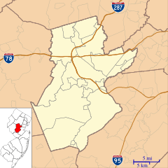
Weston is a small community in Franklin Township, Somerset County, New Jersey. It's known as an "unincorporated community" and a "census-designated place" (CDP). This means it's a specific area that the government counts for population, but it doesn't have its own separate local government.
In 2020, about 2,023 people lived in Weston. It's located on the east side of the Millstone River. You can find it north of East Millstone and south of Zarephath. Long ago, people called this area by different names like Schenck's Mill or Frogtown.
Contents
Weston Causeway Bridge
The Weston Causeway is a bridge that crosses the Millstone River and the Delaware and Raritan Canal. It's the only bridge connecting these areas between East Millstone and the Raritan River. The bridge is also known as County Route 623.
Even though official records call it the Weston Causeway on one side, local people sometimes call it the Manville Causeway. Parts of the Delaware and Raritan Canal State Park are right next to the causeway. You can find walking trails, the historic Bridge Tender's House, and small parking areas there.
History of Weston
Weston has a rich history, especially around its old mill.
Early Mills and Families
Around the 1740s, a man named Heinrich (Henry) Schenck built a grist mill on the east side of the Millstone River. A grist mill grinds grain into flour. His brother, Peter, also built a mill nearby.
Henry Schenck's sons were very smart. Three of them were in the second class to graduate from Queen's College. This college later became Rutgers University. Henry's daughter, Gertrude, married Frederick Frelinghuysen. He was a very important person in American history.
Frederick Frelinghuysen became a Major General and a U.S. Senator. His family started one of the most famous political families in American history. This family's political involvement ended in 2018 when U.S. Representative Rodney Frelinghuysen retired.
The Battle of Millstone
From 1771 to 1797, Abraham Van Neste owned the mill. During this time, a small but important battle happened here. On January 21, 1777, during the American Revolutionary War, a group of about 600 British soldiers came looking for flour. They thought a lot of flour was stored at the mill.
However, about 450 American militia, led by General Philemon Dickinson, surprised them. The Americans had to cross the icy river, which was waist-deep. They surprised the British so much that the British soldiers quickly left. They didn't even fire their cannons! The British left behind many wagons, horses, cattle, and sheep. They also left 12 soldiers who became prisoners. The Americans lost 5 men, but the British lost about 30. This event is known as the Battle of Millstone.
How Weston Got Its Name
When William Rodgers owned the mill from 1823 to 1843, he changed its name to Weston. He did this because people already used the name "Weston" for an area across the river from the mill.
The Delaware and Raritan Canal
The Delaware and Raritan Canal was finished in Weston in 1834. A special house for the bridge tender, who managed the bridge, is still there today. The Canal Company had one of its telegraph stations in Weston. They used the Morse telegraph to send messages quickly. This was one of the first times the Morse telegraph was used in the United States! Even with the canal, Weston didn't grow as much as other towns nearby.
Weston in the 1800s
By the 1880s, Weston had grown a bit. It had a post office, a schoolhouse, a blacksmith shop, a store, the gristmill, and a sawmill. About 15 homes were in the area.
The Mill's End
Wilbur Smith was the last owner of the original mill, from 1925 until 1982. He tried for many years to save the old mill. But it eventually fell into the river. It was too damaged to fix and was seen as a flood risk. There were plans to save parts of the historic building. However, before much could be done, vandals set the mill on fire. This destroyed what was left of it.
Today, the mill is gone. All that remains of the historic Weston area are a few homes and several roads that still carry the name.
Geography
Weston covers a total area of about 1.45 square miles (3.75 square kilometers). Most of this area is land, about 1.39 square miles (3.61 square kilometers). A small part, about 0.05 square miles (0.13 square kilometers), is water.
Population Information
| Historical population | |||
|---|---|---|---|
| Census | Pop. | %± | |
| 2010 | 1,235 | — | |
| 2020 | 2,023 | 63.8% | |
| Population sources: 2010 | |||
In 2010, Weston had 1,235 people living there. By 2020, the population had grown to 2,023 people.
2010 Census Details
According to the 2010 census, there were 1,235 people living in Weston. Most residents (about 87.85%) were White. About 7.13% were Asian, and 3.24% were Black or African American. A small number (2.83%) were of Hispanic or Latino background.
There were 666 households in Weston. About 64.6% of these were married couples. Many households (27.9%) had just one person living there. A large number of people (59.6%) were 65 years old or older. The average age in Weston was 67.5 years.
See also
 In Spanish: Weston (Nueva Jersey) para niños
 | Percy Lavon Julian |
 | Katherine Johnson |
 | George Washington Carver |
 | Annie Easley |


