Hudson County Park System facts for kids
The Hudson County Park System manages and runs many parks in Hudson County, New Jersey. This system started around the early 1900s, inspired by the City Beautiful movement. Today, it includes eight parks, one of which has a golf course, covering a total of about 716.52 acres. The county also protects land in the New Jersey Meadowlands.
Contents
How the Parks Began
Around the year 1900, a movement called the City Beautiful movement aimed to make industrial cities better places to live. It focused on adding public spaces for people to relax and have fun.
The idea for a county park system in Hudson County started in the 1880s. In 1892, the Hudson County Park Commission was formed. Their goal was to plan parks and a main road system, similar to what other cities like Boston and Newark had. The first big project was a road called Hudson Boulevard, which would connect the future parks. This road was later renamed John F. Kennedy Boulevard in the 1960s.
It was built between 1892 and 1897 and became the main north-south road in the county. It stretched about 14 miles from Bayonne north to the Bergen County line. Later, it looped east and south as Boulevard East, following the edge of the Bergen Hill cliff. In 1908, the State of New Jersey improved and beautified this road.
Two important architects, Daniel W. Langton and Charles N. Lowrie, were part of the City Beautiful movement. They also helped start the American Society of Landscape Architects. Lowrie took over from Langton as the Landscape Architect for the Hudson County Park Commission and held that job for 30 years.
James J. Braddock—North Hudson Park
This park is located in North Hudson, specifically in the Woodcliff Section of North Bergen. It's named after its location and to honor James J. Braddock, a famous World Heavyweight Boxing Champion from 1935 to 1937. He lived in North Bergen his whole life. People sometimes call it "80th Street Park."
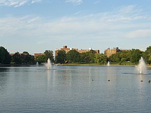
The park was created in 1910 and covers about 167 acres. It includes Woodcliff Lake, which is 16 acres and the largest lake in the county.
Columbus Park
Columbus Park is located near Hoboken High School in Hoboken. It covers about 2.6 acres. Charles N. Lowrie, who designed many parks for Hudson County, originally designed this one.
In the middle of the park, there is a statue of Christopher Columbus. There is also a memorial dedicated to John A. Sacci, a beloved high school history teacher. This monument was created by students.
Stephen R. Gregg Park—Bayonne Park
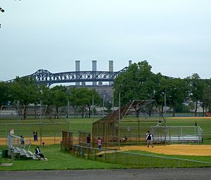
Stephen R. Gregg Park, also known as Bayonne Park, is in Bayonne. It's located west of Kennedy Boulevard along Newark Bay. The park is 97.5 acres and was also designed by Charles N. Lowrie.
The park is named after Stephen Raymond Gregg Sr., a Bayonne native and soldier. He received the Medal of Honor, the highest military award in the United States, for his brave actions in World War II. This park is also part of the Hackensack RiverWalk.
Laurel Hill (Snake Hill)
Laurel Hill, better known as Snake Hill, is the newest county park. It's located along the Hackensack River in Secaucus and is part of the New Jersey Meadowlands. You can see this unique rock formation from the New Jersey Turnpike. It rises about 150 feet from the flat Meadowlands area. The park covers 104.5 acres, with a possibility to add another 100 acres.
Lincoln Park
Lincoln Park started in 1905 and is in the Bergen Section of Jersey City, New Jersey. The eastern part of the park covers about 150.4 acres. Its main entrance features a statue called Lincoln the Mystic.
Lincoln Park West—Skyway Golf Course
Lincoln Park West covers 123 acres. The Skyway Golf Course is the only public golf course in Hudson County. This nine-hole course is located along the Hackensack River.
The 55-acre course was built on a larger site. About 1.2 million cubic yards of soil were used to raise the ground, creating hills as high as 45 feet. It opened in June 2015. Its name comes from the nearby Pulaski Skyway.
Mercer Park
Mercer Park was created from parts of Curries Woods near the border of Greenville, Jersey City and Bayonne. It was named after General Hugh Mercer, a hero from the American Revolution. The park was developed during the Works Progress Administration (WPA) era as part of the New Deal programs. Over time, much of its original land was used for other projects, leaving a smaller section of 6.4 acres in Bayonne.
Washington Park
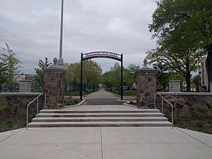
Washington Park is located between Jersey City Heights and Union City, along Paterson Plank Road. It covers about 21 acres west of Palisade Avenue. A large part of the park was designed and built during the Works Progress Administration in the 1930s.
West Hudson Park
West Hudson Park is located in the West Hudson communities of Harrison and Kearny. It was originally designed by Charles N. Lowrie. The park covers 43.4 acres.
 | Selma Burke |
 | Pauline Powell Burns |
 | Frederick J. Brown |
 | Robert Blackburn |


