Monmouth County, New Jersey facts for kids
Quick facts for kids
Monmouth County
|
|||
|---|---|---|---|
|
|||
|
|||
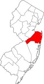
Location within the U.S. state of New Jersey
|
|||
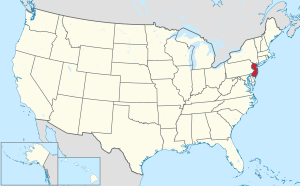 New Jersey's location within the U.S. |
|||
| Country | |||
| State | |||
| Founded | 1683 | ||
| Named for | Monmouthshire, Wales | ||
| Seat | Freehold Borough | ||
| Largest city | Middletown Township (population) Howell Township (area) |
||
| Area | |||
| • Total | 661.40 sq mi (1,713.0 km2) | ||
| • Land | 468.18 sq mi (1,212.6 km2) | ||
| • Water | 193.22 sq mi (500.4 km2) 29.2% | ||
| Population
(2020)
|
|||
| • Total | 643,615 | ||
| • Estimate
(2024)
|
647,520 |
||
| • Density | 1,372.9/sq mi (530.1/km2) | ||
| Time zone | UTC−5 (Eastern) | ||
| • Summer (DST) | UTC−4 (EDT) | ||
| Congressional districts | 3rd, 4th, 6th | ||
Monmouth County is a county in the central part of New Jersey. It is next to Mercer and Middlesex Counties to the west. To the south is Ocean County. The Atlantic Ocean is to its east, and Raritan Bay is to its north. Across the bay are parts of New York City like Staten Island and Brooklyn. Almost 30% of Monmouth County is water. It is also part of the famous Jersey Shore.
In 2020, Monmouth County was the fifth most populated county in New Jersey. It had 643,615 people living there. This was the highest number of people ever counted in the county. The main town, or county seat, is Freehold Borough. However, many county offices are also in nearby Freehold Township. The town with the most people is Middletown Township. The largest town by land area is Howell Township.
The county's name might come from settlers from Rhode Island. Another idea is that it was named after Monmouthshire in Wales, Great Britain. Monmouth County played a big role in the American Revolutionary War. The famous Battle of Monmouth happened here in June 1778. Today, you can visit Monmouth Battlefield State Park where the battle took place.
Monmouth County has a strong and varied economy. It is close to New York City and attracts many tourists. People visit the coastal cities like Red Bank, Long Branch, and Asbury Park. Many people who live here travel to work in New York City. The county also has farms, orchards, and wineries. Important scientific discoveries were made at the Bell Labs Holmdel Complex. Monmouth University is also located here.
Contents
Exploring Monmouth County's Past
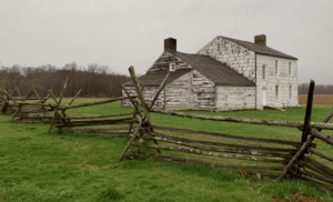
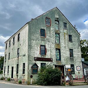
Monmouth County has a long and interesting history. It was a key location during important times in American history.
How Monmouth County Got Its Name
There are a few ideas about how Monmouth County got its name. One idea is that it was named after the Rhode Island Monmouth Society. Many early settlers came from Rhode Island. Another idea is that Colonel Lewis Morris suggested naming it after Monmouthshire in Wales. Some also think it was named after James Scott, 1st Duke of Monmouth.
Early Native American Life
Around the year 1000, the Lenape Native Americans lived in the Monmouth County area. They came from the Mississippi River region. They lived along the Jersey Shore and Raritan Bay. The Lenape were hunter-gatherers. They hunted small animals and birds. They were also good at fishing and gathered many clams. They also grew some crops for food. An important meeting point for two major Lenape trails was in the area of Freehold Township.
Colonial Times and the Revolution
In 1609, the explorer Henry Hudson saw land in what is now Monmouth County. This was likely near Sandy Hook. Early European settlers included Richard and Penelope Stout. Penelope survived a Native American attack and lived to be 110 years old. Quaker families from Long Island settled the Monmouth Tract in 1665. Scottish and Dutch settlers followed them. The Lenape people welcomed the new arrivals, and they mostly had a friendly relationship. Enslaved Africans were also present in the area from at least 1680.
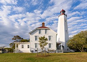
Monmouth County was officially created on March 7, 1683. It was part of East Jersey. In 1693, it was divided into three townships: Freehold, Middletown, and Shrewsbury. The Sandy Hook Lighthouse was built in 1764.
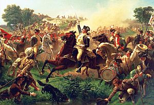
The Battle of Monmouth was fought on June 28, 1778. It was near Freehold Township. General George Washington's soldiers fought the British. This was the longest land battle of the American Revolutionary War. Other battles also happened in Monmouth County. After the war, the number of enslaved people in Monmouth County went down. The number of free African Americans grew.
1800s: Growth and Innovation
In 1822, James P. Allaire started the Howell Works Iron Foundry in what is now Wall Township. It was a "company town" where workers lived and had stores. Today, it is Allaire Village, a living history museum.
The Navesink Twin Lights were first lit in 1828. They were one of only seven lighthouses in the country. A new, bigger structure was built in 1862. It was the most powerful lighthouse in the United States. Today, it is a National Historic Landmark.
In 1848, a Life Saving Station was built in Sandy Hook. This was for the United States Coast Guard. Construction of Fort Hancock began between 1857 and 1867. It was a fort to defend New York City. The Sandy Hook Proving Ground was set up in 1874 to test weapons.
Keyport was a major shipbuilding center in the 1800s. Monmouth Park Racetrack opened in 1870 for thoroughbred racing.
In 1881, U.S. President James A. Garfield died in Long Branch. He had been shot a few months earlier. Many presidents, like Ulysses S. Grant and Theodore Roosevelt, vacationed in Long Branch.
The Seabright Lawn Tennis and Cricket Club opened in Rumson in 1886. It was the first lawn tennis club in the United States. Palace Amusements opened in Asbury Park in 1888. It had rides and games. It closed in 1988, but parts like the Tillie mural were saved. In 1899, Guglielmo Marconi showed his wireless telegraph at the Navesink Twin Lights.
1900s: Modern Times and Changes
In 1910, the Wright Brothers held an aviation show in Interlaken. They broke records for altitude and longest flight. They also made the first air mail delivery.
Fort Hancock played a small role in World War 1 and World War 2. It was meant to defend New York City. The fort closed in 1974 and is now a National Historic Place.
In 1916, two shark attacks happened in Monmouth County. One was in Spring Lake and another in Matawan.
Construction of Fort Monmouth began in 1917. It was a training ground. Many scientific breakthroughs happened here. These included Project Diana in 1946 and SCORE, the first communications satellite, in 1958.
The Count Basie Theater opened in Red Bank in 1926. It was first called the Carlton Theater. It was renamed in 1984 after Count Basie, a famous musician from Red Bank. Many well-known artists have performed there.
The Asbury Park Convention Hall was built in 1928. The Paramount Theater opened in 1930. These buildings are connected by a grand arcade.
In 1934, the SS Morro Castle caught fire and drifted ashore in Asbury Park. It was one of the deadliest sea disasters in U.S. history.
Naval Weapons Station Earle was built in 1943. It stores and moves military equipment. The Bell Labs Holmdel Complex was a major science center. Important discoveries like radio astronomy and the silicon solar cell were made there. In 1978, cosmic microwave background radiation was discovered at Bell Labs.
The Garden State Arts Center opened in Holmdel Township in 1968. It hosts music concerts and other events. It was renamed PNC Bank Arts Center in 1996.
In 1970, Asbury Park had a major riot. It was caused by high unemployment and poor living conditions. The The Stone Pony music venue opened in Asbury Park in 1974. It became famous for launching the careers of Bruce Springsteen and the E Street Band.
2000s: New Beginnings
Fort Monmouth closed in 2011. There are plans to build a Netflix film studio and housing on the land. The Bell Labs complex was sold in 2006. It has been redeveloped into a modern mixed-use facility.
Monmouth Mall in Eatontown is also being redeveloped. It will become a pedestrian-friendly area with housing and shops. In 2018, Monmouth Park Racetrack became the first place in New Jersey to offer sports betting.
Monmouth County's Landscape and Weather
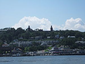
Monmouth County covers about 661 square miles. About 70% is land and 30% is water.
Hills and Waterways
Most of Monmouth County is flat. But there are some low hills in Holmdel Township. Crawford Hill is the highest point, about 380-391 feet above sea level. The northeastern part of the county, near Highlands, is also hilly. The lowest point is sea level at the ocean.
Monmouth County is great for boating and fishing. Many rivers and inlets flow into the Raritan Bay and Lower New York Bay. These waters then drain into the Atlantic Ocean. The Manasquan Inlet connects the ocean to the Manasquan River. This river is the start of the Intracoastal Waterway. Many boats use it every weekend.
Climate and Weather Patterns
Most of Monmouth County has a humid subtropical climate. This means it has hot, humid summers and mild winters. Some inland areas have a hot-summer humid continental climate. In Freehold Borough, average temperatures range from 22°F in January to 86°F in July. The record low was -13°F in 1984. The record high was 106°F in 2011.
In October 2012, Hurricane Sandy caused a lot of damage to coastal areas. Flood levels at Sandy Hook were over 13 feet above normal. This broke all previous records.
Neighboring Counties
Monmouth County shares borders with:
- Middlesex County (northwest)
- Ocean County (south)
- Mercer County (west)
- Burlington County (southwest)
- Richmond County, New York (north)
- Long Island (Kings County and Queens County, New York) (northeast)
Protected Natural Areas
Part of the Gateway National Recreation Area is in Monmouth County.
People and Population
Monmouth County has grown a lot over the years. In 1790, it had 16,918 people. By 2020, the population was 643,615.
Who Lives Here?
In 2020, there were 643,615 people in Monmouth County. Most residents were White (71.6%). About 6.08% were African American, and 5.6% were Asian. About 12.5% of the population was Hispanic or Latino.
The average age in the county was 43.5 years old. About 21.4% of the people were under 18. The median household income was $102,870. This means half of the households earned more than this, and half earned less.
How Monmouth County is Governed
Monmouth County is run by a group of five people called the Board of County Commissioners. They are elected by the public for three-year terms. Each year, they choose one person to be the Director. The Commissioners manage over 70 county departments. They are in charge of things like public works, human services, and finance. In 2016, Commissioners were paid $27,000 a year.
The County Administrator, Teri O'Connor, helps run the county every day. She makes sure the Commissioners' plans are carried out.
Monmouth County also has three other elected officials:
- The County Clerk (Christine Giordano Hanlon)
- The County Surrogate (Maureen T. Raisch)
- The County Sheriff (Shaun Golden)
These officials are elected for five-year or three-year terms. Raymond Santiago is the Monmouth County Prosecutor. He is in charge of legal cases for the county.
Fire Departments and Safety
Monmouth County has 53 different fire departments. They have 135 fire companies and over 7,000 volunteer firefighters. The Monmouth County Fire Marshal's Office trains firefighters. They also investigate suspicious fires.
Most fire departments in the county are made up of volunteers. The largest volunteer department is in Middletown Township. It has 11 stations. The oldest fire department is the Hope Fire Company in Allentown, started in 1856. When there's a big emergency, towns help each other through a system called mutual aid.
Economy and Jobs
Monmouth County's economy is strong and diverse. In 2021, the county's total economic output was $34.2 billion. This was the ninth highest in New Jersey.
Wealth and Housing
In 2015, the average income per person was $69,410. This was the fifth highest in New Jersey. Monmouth County is considered one of the wealthiest counties in the United States.
After Hurricane Sandy in 2012, many coastal areas were rebuilt. This has led to higher property values. Many homes are now used as vacation homes.
Technology and Business
The Bell Labs Holmdel Complex has been a place for many new ideas in technology. Today, companies like Verizon Wireless, AT&T Communications, and Vonage are in the area.
Shopping and Tourism
Monmouth County is a popular place for shopping and tourism. Its location on the Jersey Shore attracts many visitors. People come from New Jersey and nearby states like New York and Pennsylvania. Besides beaches, there are also hayrides, wine tasting, and apple picking in the fall.
The county has five major shopping malls:
- Freehold Raceway Mall
- Monmouth Mall
- Pier Village
- The Grove at Shrewsbury
- Jersey Shore Premium Outlets
Learning and Education
Monmouth County offers many educational opportunities.
Colleges and Universities
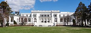
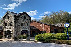
Monmouth University is a private university in West Long Branch. It started in 1933. Brookdale Community College is the two-year college for Monmouth County. It is in Lincroft and opened in 1967. Rutgers University also offers programs at Brookdale's Freehold campus.
Schools for Kids (K-12)
Monmouth County has many public school districts. Some districts cover grades K-12, while others are just for high school or elementary school. There are also private schools like St. Rose High School and Ranney School.
The Monmouth County Vocational School District has five special "magnet schools" for students interested in specific careers:
- Academy of Allied Health & Science (for health careers)
- Biotechnology High School (for science and biotech)
- Communications High School (for media and communication)
- High Technology High School (for advanced technology)
- Marine Academy of Science and Technology (for marine science)
Fun Things to Do and See
Monmouth County has many places to visit and explore.
Arts and Culture Spots
- Count Basie Theatre: A historic performing arts center in Red Bank. It hosts many concerts and shows.
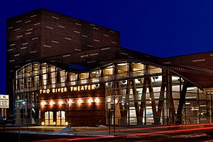
- Two River Theater: A professional theater company in Red Bank that puts on plays and educational programs.
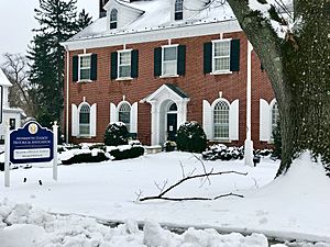
- Monmouth County Historical Association: This group works to find and save things related to Monmouth County's history. Their headquarters are in Freehold Borough.
- Monmouth County Jewish Heritage Museum: This museum focuses on Jewish life in the county, which started as early as 1720.
Historical Parks and Landmarks
- Monmouth Battlefield State Park: Located in Freehold Township, this park protects the land where the Battle of Monmouth was fought. You can hike, ride horses, and see old farmhouses.
- Gateway National Recreation Area at Sandy Hook: This area includes Fort Hancock, an old fort with historic buildings. It also has seven beaches, including Gunnison Beach. You can fish and use small boats here.
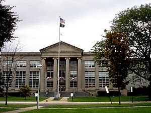
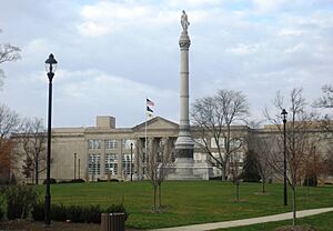
- Monmouth County Courthouse: In front of the courthouse in Freehold Borough, there's a park with a 90-foot monument to the Battle of Monmouth.
- St. Peter's Episcopal Church: A historic church built in 1771 in Freehold Borough.
- Ocean Grove Camp Meeting Association District: This is a historic Christian meeting site by the sea. It was founded in 1869.
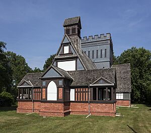
- Church of the Presidents: This former chapel in Long Branch was visited by seven U.S. presidents.
- Seabrook–Wilson House: Also called the "Spy House," this house in Port Monmouth was built in 1663. It is the oldest building in Monmouth County.
- Allaire State Park: This park has a restored 19th-century ironworks village called Allaire Village. It's a living history museum where you can see how people lived in the 1890s. The park also has the Pine Creek Railroad.
- Holmdel Park: A large park in Holmdel Township. It has hiking trails, picnic areas, and tennis courts. It also features the Holmdel Arboretum, a garden with many trees and shrubs. The park also has Longstreet Farm, a living history farm that shows life in the 1890s.
Sports and Recreation
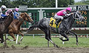
Monmouth Park Racetrack in Oceanport and Freehold Raceway in Freehold offer thoroughbred horse racing. Freehold Raceway will close on December 28, 2024.
In 1943, the New York Yankees held their spring training in Asbury Park. This was during World War II to save train travel.
Parks and Outdoor Fun
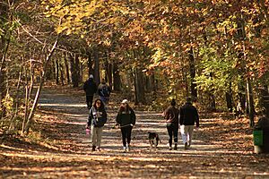
The Monmouth County Park System manages over 40 parks. Popular parks include Turkey Swamp Park, Manasquan Reservoir, and Seven Presidents Oceanfront Park. There are also three major bike trails: the Union Transportation Trail, the Edgar Felix Bikeway, and the Henry Hudson Trail.
The county also has two state parks: Monmouth Battlefield State Park and Allaire State Park. Part of the Gateway National Recreation Area is at Sandy Hook.
Wineries, Breweries, and Distilleries
Monmouth County is home to several places that make drinks:
- Basil T's Brewery
- Carton Brewing
- Cream Ridge Winery
- Four JG's Orchards & Vineyards
- Kane Brewing
- Laird & Company
- Peppadew Fresh Vineyards
Other Interesting Places
- Keansburg Amusement Park & Runaway Rapids
- PNC Bank Arts Center
- Pier Village
- Asbury Park Boardwalk
- Freehold Raceway Mall
- Monmouth Mall
- iPlay America (an indoor amusement park)
- Many beaches along the Jersey Shore
Towns and Communities
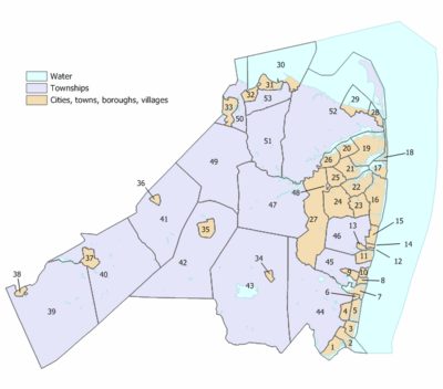
Monmouth County has 53 different towns, called municipalities. Some are boroughs, cities, or townships. Many larger townships also have smaller, unincorporated communities within them.
| Municipality |
Map index |
Mun. type |
Pop. | Housing units |
Total area |
Water area |
Land area |
Pop. density |
Housing density |
School district | Unincorporated communities |
|---|---|---|---|---|---|---|---|---|---|---|---|
| Aberdeen | 50 | township | 19,329 | 7,102 | 7.77 | 2.33 | 5.45 | 3,343.0 | 1,303.8 | Matawan-Aberdeen | Cliffwood Cliffwood Beach CDP (3,036) Henningers Mills Strathmore CDP (7,225) |
| Allenhurst | 14 | borough | 472 | 365 | 0.28 | 0.02 | 0.26 | 1,887.9 | 1,389.3 | Asbury Park (S/R) | |
| Allentown | 38 | borough | 1,734 | 735 | 0.63 | 0.03 | 0.60 | 3,023.9 | 1,215.8 | Upper Freehold Regional | |
| Asbury Park | 11 | city | 15,188 | 8,076 | 1.60 | 0.18 | 1.42 | 11,319.5 | 5,672.4 | Asbury Park | |
| Atlantic Highlands |
29 | borough | 4,414 | 2,002 | 4.56 | 3.27 | 1.29 | 3,401.2 | 1,552.9 | Henry Hudson Regional (7-12) Atlantic Highlands (K-6) |
Hilton Stone Church |
| Avon-by- the-Sea |
8 | borough | 1,933 | 1,321 | 0.54 | 0.12 | 0.43 | 4,459.1 | 3,098.6 | Manasquan (9-12) (S/R) Avon (K-8) |
|
| Belmar | 7 | borough | 5,907 | 3,931 | 1.65 | 0.60 | 1.05 | 5,544.0 | 3,761.4 | Manasquan (9-12) (S/R) Belmar (PK-8) |
|
| Bradley Beach | 10 | borough | 4,282 | 3,180 | 0.63 | 0.02 | 0.61 | 7,023.6 | 5,196.6 | Asbury Park (9-12) (S/R) (93%) Neptune Twp (9-12) (S/R) (7%) Bradley Beach (PK-8) |
|
| Brielle | 1 | borough | 4,982 | 2,034 | 2.37 | 0.62 | 1.76 | 2,717.5 | 1,157.8 | Manasquan (9-12) (S/R) Brielle (PK-8) |
Manasquan Park |
| Colts Neck | 47 | township | 9,957 | 3,735 | 31.79 | 1.06 | 30.73 | 330.0 | 121.5 | Freehold Regional (9-12) Colts Neck (PK-8) |
Bucks Mill Colonial Terrace Cooks Mills Montrose Phalanx Scobeyville Vanderburg |
| Deal | 15 | borough | 900 | 926 | 1.32 | 0.08 | 1.24 | 604.8 | 746.7 | Shore Regional (9-12) Deal (K-8) |
|
| Eatontown | 24 | borough | 13,597 | 5,723 | 5.88 | 0.05 | 5.83 | 2,181.5 | 982.3 | Monmouth Regional (9-12) Eatontown (PK-8) |
|
| Englishtown | 36 | borough | 2,346 | 647 | 0.59 | 0.02 | 0.57 | 3,245.7 | 1,137.0 | Freehold Regional (9-12) Manalapan-Englishtown (PK-8) |
|
| Fair Haven | 20 | borough | 6,269 | 2,065 | 2.11 | 0.51 | 1.60 | 3,832.5 | 1,292.9 | Rumson-Fair Haven (9-12) Fair Haven (PK-8) |
|
| Farmingdale | 34 | borough | 1,504 | 578 | 0.52 | 0.00 | 0.52 | 2,547.7 | 1,108.0 | Freehold Regional (9-12) Farmingdale (PK-8) |
|
| Freehold Borough | 35 | borough | 12,538 | 4,249 | 1.95 | 0.00 | 1.95 | 6,180.8 | 2,179.1 | Freehold Regional (9-12) Freehold (PK-8) |
|
| Freehold Township | 42 | township | 35,369 | 13,140 | 38.73 | 0.22 | 38.50 | 939.8 | 341.3 | Freehold Regional (9-12) Freehold Township (PK-8) |
Burlington Heights East Freehold CDP (4,987) Georgia Monmouth Heights Orchard Estates Siloam Smithburg Stonehurst East Stonehurst West West Freehold CDP (13,596) |
| Hazlet | 53 | township | 20,125 | 7,417 | 5.67 | 0.12 | 5.56 | 3,659.4 | 1,334.8 | Hazlet Township | Centerville Mechanicsville North Centerville Tiltons Corner Van Marters Corner West Keansburg |
| Highlands | 28 | borough | 4,621 | 3,146 | 1.37 | 0.60 | 0.77 | 6,522.8 | 4,100.1 | Henry Hudson Regional (7-12) Highlands (PK-6) |
Waterwitch |
| Holmdel | 51 | township | 17,400 | 5,792 | 18.11 | 0.22 | 17.90 | 937.3 | 323.7 | Holmdel Township | Centerville Crawford Corners Everett Morrells Corner Pleasant Valley Crossroads |
| Howell | 43 | township | 53,537 | 17,979 | 61.21 | 0.65 | 60.56 | 843.4 | 296.9 | Freehold Regional (9-12) Howell Township (PK-8) |
Adelphia Ardena Ardmore Estates Bergerville Candlewood Collingwood Park Fairfield Fort Plains Freewood Acres Jerseyville Lake Club Land of Pines Larrabees Lower Squankum Matthews Maxim Oak Glen Parkway Pines Ramtown CDP (6,329) Salem Hill Shacks Corner Southard Squankum West Farms Winston Park Wyckoff Mills |
| Interlaken | 13 | borough | 828 | 393 | 0.38 | 0.05 | 0.33 | 2,482.3 | 1,189.7 | Shore Regional (9-12) (S/R) West Long Branch (K-8) (S/R) |
|
| Keansburg | 30 | borough | 9,755 | 4,318 | 16.79 | 15.72 | 1.07 | 9,452.3 | 4,039.1 | Keansburg | Tiltons Corner |
| Keyport | 32 | borough | 7,204 | 3,272 | 1.47 | 0.07 | 1.40 | 5,188.4 | 2,344.8 | Keyport | |
| Lake Como | 6 | borough | 1,697 | 1,115 | 0.27 | 0.01 | 0.25 | 6,943.6 | 4,401.4 | Manasquan (9-12) (S/R) Belmar (PK-8) (S/R) |
|
| Little Silver | 21 | borough | 6,131 | 2,278 | 3.32 | 0.61 | 2.71 | 2,197.3 | 841.3 | Red Bank Regional (9-12) Little Silver (PK-8) |
Little Silver Point |
| Loch Arbour | 12 | village | 194 | 159 | 0.14 | 0.04 | 0.10 | 1,928.2 | 1,580.4 | Shore Regional (9-12) (S/R) West Long Branch (K-8) (S/R) |
|
| Long Branch | 16 | city | 31,667 | 14,170 | 6.28 | 1.01 | 5.27 | 5,824.4 | 2,686.7 | Long Branch | Branchport East Long Branch Elberon North Long Branch Pier Village West End |
| Manalapan | 41 | township | 40,905 | 13,735 | 30.84 | 0.23 | 30.61 | 1,270.0 | 448.8 | Freehold Regional (9-12) Manalapan-Englishtown (PK-8) |
Clarks Mills Elton Gordons Corner Lafayette Mills Millhurst Monmouth Heights Oakland Mills Smithburg Taylors Mills Tennent Whittier Oaks Yorketown CDP (6,617) |
| Manasquan | 2 | borough | 5,938 | 3,500 | 2.53 | 1.15 | 1.38 | 4,263.0 | 2,530.2 | Manasquan | |
| Marlboro | 49 | township | 41,502 | 13,436 | 30.47 | 0.11 | 30.36 | 1,323.7 | 442.5 | Freehold Regional (9-12) Marlboro Township (PK-8) |
Beacon Hill Bradevelt Claytons Corner Henningers Mills Herberts Corner Hillsdale Marlboro Monmouth Heights Montrose Morganville CDP (6,203) Mount Pleasant Pleasant Valley Robertsville CDP (11,399) Smocks Corner Spring Valley Wickatunk |
| Matawan | 33 | borough | 9,565 | 3,606 | 2.40 | 0.14 | 2.26 | 3,896.6 | 1,594.9 | Matawan-Aberdeen | Freneau |
| Middletown |
52 | township | 67,106 | 24,959 | 58.73 | 17.75 | 40.99 | 1,622.9 | 608.9 | Middletown Township | Belford CDP (1,648) Chapel Hill East Keansburg Everett Fairview CDP (3,731) Harmony Hendrickson Corners Holland Leonardo CDP (2,549) Leonardville Lincroft CDP (7,060) Locust Monmouth Hills Navesink CDP (2,004) New Monmouth (28,689) North Middletown CDP (3,295) Oak Hill Philips Mills Port Monmouth CDP (3,745) Red Hill River Plaza Stone Church Tiltons Corner Town Brook |
| Millstone Township |
40 | township | 10,376 | 3,434 | 37.27 | 0.68 | 36.59 | 288.8 | 93.9 | Upper Freehold Regional (9-12) (S/R) Millstone Township (PK-8) |
Bairdsville Bergen Mills Carrs Corner Carrs Tavern Charleston Springs Clarksburg Ely Elys Corner Fair Play Holmeson Perrineville Smithburg Stone Tavern Sweetman |
| Monmouth Beach |
17 | borough | 3,174 | 1,981 | 2.07 | 0.99 | 1.08 | 3,049.5 | 1,842.4 | Shore Regional (9-12) Monmouth Beach (PK-8) |
Galilee |
| Neptune City | 9 | borough | 4,626 | 2,312 | 0.95 | 0.00 | 0.95 | 5,105.0 | 2,424.0 | Neptune Township (9-12) (S/R) Neptune City (K-8) |
|
| Neptune Township | 45 | township | 28,061 | 12,991 | 8.67 | 0.49 | 8.18 | 3,414.3 | 1,587.8 | Neptune Township | Bradley Park Green Grove Hamilton Ocean Grove CDP (2,549) Shark River Hills CDP (3,583) West Grove |
| Ocean Township | 46 | township | 27,672 | 11,541 | 11.00 | 0.12 | 10.88 | 2,509.1 | 1,061.1 | Ocean Township | Cold Indian Springs Deal Park Elberon Park Green Grove Oakhurst CDP (4,069) Oakhurst Manor Wanamassa CDP (4,344) Wayside Wertheins Corner West Allenhurst (1,934) |
| Oceanport | 22 | borough | 6,150 | 2,390 | 3.80 | 0.62 | 3.18 | 1,833.7 | 751.5 | Shore Regional (9-12) Oceanport (PK-8) |
Port-au-peck Sands Point |
| Red Bank | 26 | borough | 12,936 | 5,381 | 2.16 | 0.42 | 1.74 | 7,019.1 | 3,094.4 | Red Bank Regional (9-12) Red Bank (PK-8) |
|
| Roosevelt | 37 | borough | 808 | 327 | 1.92 | 0.01 | 1.91 | 461.8 | 171.2 | East Windsor (7-12) (S/R) Roosevelt (PK-6) |
|
| Rumson | 19 | borough | 7,343 | 2,585 | 7.12 | 2.06 | 5.06 | 1,408.0 | 511.0 | Rumson-Fair Haven (9-12) Rumson (PK-8) |
Oceanic Waterloo |
| Sea Bright | 18 | borough | 1,449 | 1,211 | 1.29 | 0.56 | 0.73 | 1,935.5 | 1,659.9 | Shore Regional (9-12) Oceanport (PK-8) (S/R) |
Low Moor Navesink Beach Normandie |
| Sea Girt | 3 | borough | 1,866 | 1,291 | 1.45 | 0.39 | 1.06 | 1,729.6 | 1,221.5 | Manasquan (9-12) (S/R) Sea Girt (PK-8) |
|
| Shrewsbury Borough |
25 | borough | 3,809 | 1,310 | 2.20 | 0.03 | 2.17 | 1,757.2 | 604.4 | Red Bank Regional (9-12) Shrewsbury (PK-8) |
|
| Shrewsbury Township |
48 | township | 1,076 | 648 | 0.10 | 0.00 | 0.10 | 10,877.7 | 6,177.7 | Monmouth Regional (9-12) Tinton Falls (K-8) |
|
| Spring Lake | 5 | borough | 2,789 | 2,048 | 1.73 | 0.40 | 1.33 | 2,250.8 | 1,540.2 | Manasquan (9-12) (S/R) Spring Lake (PK-8) |
North Spring Lake |
| Spring Lake Heights |
4 | borough | 4,890 | 2,972 | 1.31 | 0.03 | 1.28 | 3,671.3 | 2,315.1 | Manasquan (9-12) (S/R) Spring Lake Heights (K-8) |
Villa Park |
| Tinton Falls | 27 | borough | 19,181 | 8,766 | 15.62 | 0.14 | 15.49 | 1,155.3 | 566.0 | Monmouth Regional (9-12) Tinton Falls (K-8) |
Green Grove Hockhockson Macedonia Pine Brook Reevytown Wayside West Shrewsbury Wileys Corner |
| Union Beach | 31 | borough | 5,723 | 2,269 | 1.89 | 0.09 | 1.80 | 3,461.5 | 1,257.7 | Keyport (9-12) (S/R) Union Beach (PK-8) |
Natco Van Marters Corner |
| Upper Freehold | 39 | township | 7,273 | 2,458 | 47.23 | 0.82 | 46.42 | 148.7 | 53.0 | Upper Freehold Regional | Arneytown Cooleys Corner Cream Ridge CDP (630) Ellisdale Emleys Hill Homes Mills Hornerstown Imlaystown Kirbys Mills Nelsonville New Canton New Sharon Polhemustown Pullentown Red Valley Robinsville Sharon Shrewsbury Spring Mill Walnford Wrightsville |
| Wall | 44 | township | 26,525 | 10,883 | 31.74 | 1.06 | 30.67 | 853.0 | 354.8 | Wall Township | Allaire Allenwood CDP (954) Collingwood Park Glendola New Bedford West Belmar CDP (2,459) |
| West Long Branch |
23 | borough | 8,587 | 2,528 | 2.89 | 0.04 | 2.86 | 2,832.9 | 884.5 | Shore Regional (9-12) West Long Branch (K-8) |
|
| Monmouth County | — | county | 643,615 | 258,410 | 665.32 | 196.53 | 468.79 | 1,344.7 | 551.2 |
Community Services
Monmouth County SPCA
The Monmouth County Society for the Prevention of Cruelty to Animals (SPCA) helps animals in need. It is in Eatontown. They care for homeless, neglected, and abused animals. The SPCA was started in 1945. They take in animals and offer them for adoption. They also investigate animal cruelty cases. The SPCA provides dog training, a spay/neutering clinic, and support for pet owners.
Getting Around Monmouth County
Monmouth County has many roads and public transportation options.
Major Roads and Highways
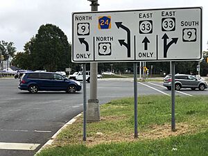
The county has over 3,300 miles of roads. Many are maintained by local towns or the county. Key roads include:
- US 9: This highway goes through most of Monmouth County.
- Route 18
- Route 33 and Business Route 33
- Route 34
- Route 35
- Route 36
- Route 66
- Route 70
- Route 71
- Route 79
- Interstate 195: This is the only interstate highway that goes through the county.
- Route 138
- The Garden State Parkway: This major highway runs for about 26.5 miles through the county.
Public Transportation Options
NJ Transit buses travel throughout the county. They take many passengers to northern New Jersey and New York City every day.
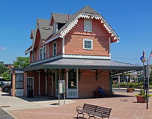
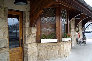
The NJ Transit Rail Operations' North Jersey Coast Line also serves the county. It connects to Penn Station in New York City. There are 14 train stations in Monmouth County.
See also
 In Spanish: Condado de Monmouth para niños
 | Roy Wilkins |
 | John Lewis |
 | Linda Carol Brown |


