Ocean County, New Jersey facts for kids
Quick facts for kids
Ocean County
|
|||
|---|---|---|---|
|
|||
|
|||
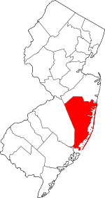
Location within the U.S. state of New Jersey
|
|||
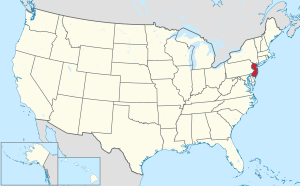 New Jersey's location within the U.S. |
|||
| Country | |||
| State | |||
| Founded | 1850 | ||
| Named for | Atlantic Ocean | ||
| Seat | Toms River | ||
| Largest municipality | Lakewood Township (population) Jackson Township (area) |
||
| Area | |||
| • Total | 914.84 sq mi (2,369.4 km2) | ||
| • Land | 628.29 sq mi (1,627.3 km2) | ||
| • Water | 286.55 sq mi (742.2 km2) 31.3% | ||
| Population
(2020)
|
|||
| • Total | 637,229 | ||
| • Estimate
(2023)
|
659,197 |
||
| • Density | 696.547/sq mi (268.9383/km2) | ||
| Time zone | UTC−5 (Eastern) | ||
| • Summer (DST) | UTC−4 (EDT) | ||
| Congressional districts | 2nd, 4th | ||
Ocean County is a county located in the state of New Jersey. It's the southernmost county in the New York metropolitan area. The county touches the Atlantic Ocean on its eastern side. It is the largest county in New Jersey when you count its total area. The main town, or county seat, is Toms River. Ocean County is part of the famous Jersey Shore and is also considered part of Central Jersey.
Since 2020, Ocean County has been the fastest-growing county in New Jersey. In 2020, its population was 637,229 people. This was the highest number of people ever counted in the county. It meant the population grew by over 60,000 people since 2010. The county's population has been growing faster than the rest of the United States. In 2023, it was estimated that 659,197 people lived here. The town of Lakewood Township is the most populated and fastest-growing place in Ocean County. Jackson Township is the largest town by land area.
Ocean County is a popular vacation spot, especially in the summer. It's about 50 miles east of Philadelphia and 70 miles south of New York City. About 31% of Ocean County's total area is water. It's known for its beautiful beaches and fun attractions. These include places like Seaside Heights, Long Beach Island, and Point Pleasant Beach. You can also find Six Flags Great Adventure amusement park in Jackson Township. Ocean County is also a gateway to New Jersey's Pine Barrens, a huge protected natural area.
Contents
History of Ocean County
Before Ocean County was created, most of its land was part of Monmouth County. Only a couple of towns, Tuckerton and Little Egg Harbor Township, were from Burlington County. Ocean County was officially formed on February 15, 1850. It was created from parts of Monmouth County. Later, in 1891, Little Egg Harbor Township joined from Burlington County. The county got its name from the Atlantic Ocean that it borders.
Today, the most populated town is Lakewood Township. Its population grew a lot, by over 45% between 2010 and 2020. Jackson Township is the biggest town in Ocean County by land area.
Geography and Climate
Ocean County is the largest county in New Jersey by total area. It covers about 915 square miles. About 68.7% of this is land, and 31.3% is water.
Most of the county is flat and close to the coast. It has a very long shoreline with many beaches along the Jersey Shore. Some famous beaches include Barnegat Light, Beach Haven, and Seaside Heights. The highest points in the county are three unnamed hills. They are about 230 feet high. The lowest point is at sea level along the Atlantic Ocean and Barnegat Bay.
Ocean County's Weather
| Climate data for Jackson Township, New Jersey | |||||||||||||
|---|---|---|---|---|---|---|---|---|---|---|---|---|---|
| Month | Jan | Feb | Mar | Apr | May | Jun | Jul | Aug | Sep | Oct | Nov | Dec | Year |
| Mean daily maximum °F (°C) | 41 (5) |
44 (7) |
51 (11) |
61 (16) |
71 (22) |
80 (27) |
85 (29) |
83 (28) |
77 (25) |
67 (19) |
57 (14) |
46 (8) |
64 (18) |
| Mean daily minimum °F (°C) | 22 (−6) |
24 (−4) |
30 (−1) |
39 (4) |
49 (9) |
59 (15) |
64 (18) |
62 (17) |
55 (13) |
43 (6) |
35 (2) |
27 (−3) |
42 (6) |
| Average precipitation inches (mm) | 3.92 (100) |
3.30 (84) |
4.79 (122) |
4.07 (103) |
3.73 (95) |
3.80 (97) |
4.60 (117) |
4.69 (119) |
3.79 (96) |
3.90 (99) |
4.11 (104) |
4.51 (115) |
49.21 (1,251) |
| Climate data for Beach Haven Beach, New Jersey (1981–2010 averages) | |||||||||||||
|---|---|---|---|---|---|---|---|---|---|---|---|---|---|
| Month | Jan | Feb | Mar | Apr | May | Jun | Jul | Aug | Sep | Oct | Nov | Dec | Year |
| Mean daily maximum °F (°C) | 40.6 (4.8) |
42.5 (5.8) |
49.2 (9.6) |
57.7 (14.3) |
67.9 (19.9) |
77.0 (25.0) |
82.7 (28.2) |
81.6 (27.6) |
75.6 (24.2) |
65.1 (18.4) |
55.1 (12.8) |
45.3 (7.4) |
61.8 (16.6) |
| Daily mean °F (°C) | 33.4 (0.8) |
35.4 (1.9) |
41.7 (5.4) |
50.5 (10.3) |
60.3 (15.7) |
69.7 (20.9) |
75.4 (24.1) |
74.5 (23.6) |
68.2 (20.1) |
57.1 (13.9) |
47.7 (8.7) |
38.2 (3.4) |
54.4 (12.4) |
| Mean daily minimum °F (°C) | 26.3 (−3.2) |
28.2 (−2.1) |
34.3 (1.3) |
43.2 (6.2) |
52.7 (11.5) |
62.4 (16.9) |
68.2 (20.1) |
67.5 (19.7) |
60.7 (15.9) |
49.0 (9.4) |
40.3 (4.6) |
31.1 (−0.5) |
47.1 (8.4) |
| Average precipitation inches (mm) | 3.21 (82) |
3.06 (78) |
3.97 (101) |
3.40 (86) |
2.80 (71) |
2.68 (68) |
3.80 (97) |
4.09 (104) |
2.83 (72) |
3.44 (87) |
2.90 (74) |
3.32 (84) |
39.50 (1,003) |
| Average relative humidity (%) | 68.1 | 65.8 | 64.5 | 65.3 | 69.0 | 72.6 | 71.9 | 73.3 | 72.4 | 70.2 | 69.5 | 68.4 | 69.3 |
| Average dew point °F (°C) | 24.0 (−4.4) |
25.1 (−3.8) |
30.6 (−0.8) |
39.3 (4.1) |
50.1 (10.1) |
60.5 (15.8) |
65.7 (18.7) |
65.4 (18.6) |
59.0 (15.0) |
47.5 (8.6) |
38.2 (3.4) |
28.7 (−1.8) |
44.6 (7.0) |
| Source: PRISM | |||||||||||||
| Weather chart for Toms River, New Jersey | |||||||||||||||||||||||||||||||||||||||||||||||
|---|---|---|---|---|---|---|---|---|---|---|---|---|---|---|---|---|---|---|---|---|---|---|---|---|---|---|---|---|---|---|---|---|---|---|---|---|---|---|---|---|---|---|---|---|---|---|---|
| J | F | M | A | M | J | J | A | S | O | N | D | ||||||||||||||||||||||||||||||||||||
|
3.9
41
24
|
3.3
44
25
|
4.8
51
32
|
4.1
61
41
|
3.7
71
51
|
3.8
80
61
|
4.6
85
66
|
4.7
83
64
|
3.8
77
58
|
3.9
67
46
|
4.1
57
38
|
4.5
46
29
|
||||||||||||||||||||||||||||||||||||
| temperatures in °F precipitation totals in inches source: The Weather Channel |
|||||||||||||||||||||||||||||||||||||||||||||||
|
Metric conversion
|
|||||||||||||||||||||||||||||||||||||||||||||||
Ocean County has a humid subtropical climate. This means it has hot, humid summers and mild winters. In Toms River, the average temperature in January is about 24°F. In July, it's about 85°F. However, temperatures can go much lower or higher. For example, it was -19°F in January 1982 and 105°F in July 1999.
Areas closer to the ocean usually have milder winters and cooler summers. This is because the large body of water helps to keep temperatures more steady. The county gets a good amount of rain throughout the year. The most rain in one month was over 15 inches in August 2011, when Hurricane Irene hit.
People of Ocean County
| Historical population | |||
|---|---|---|---|
| Census | Pop. | %± | |
| 1850 | 10,032 | — | |
| 1860 | 11,176 | 11.4% | |
| 1870 | 13,628 | 21.9% | |
| 1880 | 14,455 | 6.1% | |
| 1890 | 15,974 | 10.5% | |
| 1900 | 19,747 | 23.6% | |
| 1910 | 21,318 | 8.0% | |
| 1920 | 22,155 | 3.9% | |
| 1930 | 33,069 | 49.3% | |
| 1940 | 37,706 | 14.0% | |
| 1950 | 56,622 | 50.2% | |
| 1960 | 108,241 | 91.2% | |
| 1970 | 208,470 | 92.6% | |
| 1980 | 346,038 | 66.0% | |
| 1990 | 433,203 | 25.2% | |
| 2000 | 510,916 | 17.9% | |
| 2010 | 576,567 | 12.8% | |
| 2020 | 637,229 | 10.5% | |
| 2023 (est.) | 659,197 | 14.3% | |
| Historical sources: 1790–1990 1970–2010 2010 2000–2010 2020 |
|||
Population in 2020
In 2020, 637,229 people lived in Ocean County. Most people, about 92.2%, were White. About 3.9% were Black or African American, and 2.1% were Asian. About 10.2% of the population were Hispanic or Latino (of any race).
About 24.6% of the people were under 18 years old. About 22.8% were 65 years or older. More than half of the population (51.3%) were female.
Population in 2010
In 2010, Ocean County had 576,567 people. The majority, about 91%, were White. About 3.15% were Black or African American, and 1.75% were Asian. About 8.29% of the population were Hispanic or Latino.
About 23.4% of the people were under 18 years old. About 21% were 65 years or older. The average age was 42.6 years.
Economy and Jobs
In 2022, the total value of all goods and services produced in Ocean County was about $23.8 billion. This showed a 4.1% increase from the year before.
Ocean County is home to the Ocean County Mall in Toms River. It's a large shopping center.
Education in Ocean County
Ocean County has many schools for students of all ages.
Colleges and Universities
- Ocean County College is a two-year community college in Toms River. It opened in 1964.
- Georgian Court University is a private Roman Catholic college in Lakewood Township. It started in 1908.
- Beth Medrash Govoha in Lakewood is a very large yeshiva (a Jewish school for religious studies). It has 5,000 students, making it one of the biggest in the world outside of Israel.
- Stockton University has a campus in Manahawkin. It offers programs for both undergraduate and graduate students.
Local Schools
Ocean County has many public school districts. Some districts teach students from kindergarten through 12th grade (K-12). Others are just for high school students (secondary) or for younger students (elementary).
- K-12 School Districts
- Barnegat Township School District
- Brick Public Schools
- Jackson School District
- Lacey Township School District
- Lakewood School District
- Manchester Township School District
- Plumsted Township School District
- Point Pleasant Beach School District
- Point Pleasant School District
- Toms River Regional Schools
- High School Districts
- Central Regional School District
- Ocean County Vocational Technical School
- Pinelands Regional School District
- Southern Regional School District
- Elementary School Districts (mostly K-6)
- Bay Head School District (K-8)
- Beach Haven School District
- Berkeley Township School District
- Eagleswood Township School District
- Island Heights School District
- Lakehurst School District (K-8)
- Lavallette School District (K-8)
- Little Egg Harbor Township School District
- Long Beach Island Consolidated School District
- Ocean Gate School District
- Ocean Township School District
- Seaside Heights School District
- Seaside Park School District (non-operating)
- Stafford Township School District
- Tuckerton School District
Toms River Regional Schools is the largest suburban school district in New Jersey. Ocean County also has a great vocational high school program called the Ocean County Vocational Technical School district. It has campuses in several towns and three special magnet schools:
- Marine Academy of Technology and Environmental Science (MATES)
- OCVTS Performing Arts Academy (for theater, dance, and singing)
- OCVTS Academy of Law and Public Safety (ALPS)
Fun Attractions
Ocean County has a long shoreline along the Atlantic Ocean. It's home to many popular Jersey Shore towns and boardwalks like Seaside Heights and Point Pleasant Beach.
Six Flags Great Adventure is a huge theme park in Jackson Township. It used to have Kingda Ka, one of the world's tallest roller coasters. The park also has Six Flags Hurricane Harbor, which is New Jersey's largest water park. Plus, there's the Safari Off Road Adventure, a large drive-thru animal safari.
The county has about 40 miles of barrier beaches that form the Barnegat and Little Egg Harbor Bays. These are great for water sports. You can also visit the Tuckerton Seaport, a village that shows off maritime history in Tuckerton.
Ocean County is also the northern gateway to New Jersey's Pine Barrens. It has several state parks:
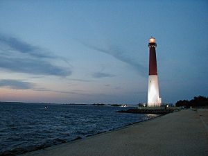
- Barnegat Lighthouse State Park has the famous Barnegat Lighthouse on Long Beach Island.
- Island Beach State Park has 3,000 acres of coastal sand dunes.
- Double Trouble State Park covers 8,000 acres in the Pine Barrens.
- Brendan T. Byrne State Forest is a large forest with 37,000 acres.
- Forked River State Marina
ShoreTown Ballpark in Lakewood is home to the Jersey Shore BlueClaws. They are a minor league baseball team linked to the Philadelphia Phillies.
National Protected Areas
- Edwin B. Forsythe National Wildlife Refuge protects 48,000 acres of wetlands and coastal areas.
Local Media
Ocean County is covered by daily newspapers like the Asbury Park Press and The Press of Atlantic City. There are also several weekly local newspapers published by Micromedia Publications.
For radio, 92.7 WOBM provides local news, traffic, and weather. It started broadcasting in 1968. 91.9 WBNJ also offers local news and events.
Getting Around Ocean County
Ocean County has many roads and highways. The county has over 2,900 miles of roadways. Most of these are maintained by the local towns.
Major Roads
- U.S. Route 9 (the only U.S. Highway here)
- Route 35
- Route 37
- Route 70
- Route 72
- Interstate 195 (runs only through Jackson Township)
- The Garden State Parkway goes through Ocean County for about 38.5 miles.
Public Transportation
Trains
NJ Transit's North Jersey Coast Line has stations at Bay Head and Point Pleasant Beach. These stations connect to New York Penn Station. There are also plans for a new train line called the Monmouth Ocean Middlesex Line.
Buses
- NJ Transit: Buses connect Ocean County to places like New York City, Newark, and Philadelphia. Some routes are express, meaning they go directly without many stops.
- Ocean Ride: This is a county-wide bus system with 12 regular routes. Many of these routes stop at the Ocean County Mall. Most routes run a few days a week, but some run more often. Ocean Ride also helps people with special transportation needs.
- Other Services: Academy Bus provides service from northern Ocean County to New York City. Many retirement communities also have their own shuttle buses for residents.
Towns and Communities
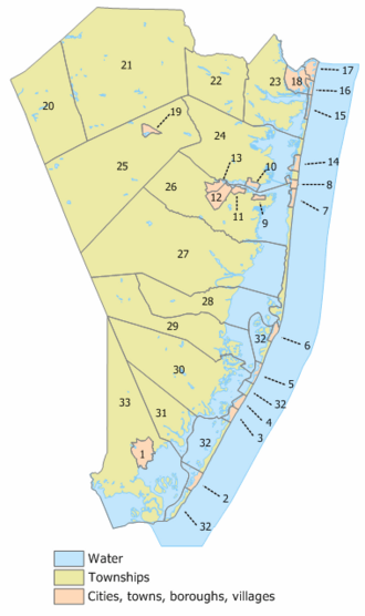
Ocean County has 33 different towns, called municipalities. Each one has its own population, housing, and area. Some towns also have smaller, unnamed communities within them. The table below lists these towns and some of their details.
| Municipality (map index) | Map key | Mun. type |
Pop. | Housing units |
Total area |
Water area |
Land area |
Pop. density |
Housing density |
School district |
Unincorporated communities/notes |
|---|---|---|---|---|---|---|---|---|---|---|---|
| Barnegat Light | 6 | borough | 640 | 1,282 | 0.85 | 0.12 | 0.73 | 785.1 | 1,753.6 | Southern Regional (7–12) Long Beach Island (PK-6) |
|
| Barnegat | 29 | township | 24,296 | 9,085 | 40.78 | 6.41 | 34.38 | 609.0 | 264.35 | Barnegat Township | Barnegat CDP (3,894), Howardsville, Ocean Acres (part; 925), Warren Grove |
| Bay Head | 16 | borough | 930 | 1,023 | 0.70 | 0.12 | 0.58 | 1,662.8 | 1,757.3 | Point Pleasant Beach (9–12) (S/R) Bay Head (K-8) |
|
| Beach Haven | 2 | borough | 1,027 | 2,667 | 2.32 | 1.34 | 0.98 | 1,196.0 | 2,726.2 | Southern Regional (7–12) Beach Haven (PK-6) |
|
| Beachwood | 12 | borough | 10,859 | 3,826 | 2.85 | 0.00 | 2.85 | 3,878.4 | 1,343.5 | Toms River | |
| Berkeley Township | 26 | township | 43,754 | 23,818 | 56.00 | 13.13 | 42.86 | 962.5 | 555.7 | Central Regional (7–12) Berkeley Township (PK-6) |
Bayville (20,512), Cedar Beach, Crossley, Glen Cove, Holiday City-Berkeley CDP (12,943), Holiday City South CDP (4,124), Holiday Heights CDP (2,143), Holly Park, Pelican Island, Silver Ridge CDP (1,167) |
| Brick | 23 | township | 73,620 | 33,677 | 32.32 | 6.60 | 25.72 | 2,919.4 | 1,309.6 | Brick | Adamston, Breton Woods, Burrsville, Cedarcroft, Herbertsville, Laurelton, Osbornsville, Parkway Pines |
| Eagleswood | 31 | township | 1,722 | 760 | 18.86 | 2.80 | 16.06 | 99.8 | 47.3 | Pinelands Regional (7–12) Eagleswood (PK-6) |
West Creek |
| Harvey Cedars | 5 | borough | 391 | 1,214 | 1.19 | 0.63 | 0.56 | 604.6 | 2,178.0 | Southern Regional (7–12) Long Beach Island (PK-6) |
|
| Island Heights | 10 | borough | 1,650 | 831 | 0.91 | 0.30 | 0.61 | 2,738.3 | 1,360.2 | Central Regional (7–12) Islands Heights (K-6) |
|
| Jackson | 21 | township | 58,544 | 20,342 | 100.62 | 1.38 | 99.24 | 552.7 | 205.0 | Jackson | Bennetts Mills, Cassville, Harmony, Holmeson (part; 5,231), Jackson Mills, Prospertown, Vista Center CDP (2,370), Whitesville |
| Lacey Township | 27 | township | 28,655 | 11,573 | 98.53 | 15.27 | 83.26 | 332.0 | 139.0 | Lacey Township | Aserdaten, Barnegat Pines, Forked River CDP (5,274), Lanoka Harbor |
| Lakehurst | 19 | borough | 2,636 | 943 | 1.01 | 0.09 | 0.91 | 2,900.8 | 1,030.7 | Manchester (9–12) (S/R) Lakehurst (PK-8) |
|
| Lakewood | 22 | township | 135,158 | 26,337 | 24.98 | 0.41 | 24.58 | 3,777.7 | 1,071.6 | Lakewood | Lakewood CDP (69,398), Leisure Village CDP (4,966), Leisure Village East CDP (4,189) |
| Lavallette | 14 | borough | 1,787 | 3,207 | 0.95 | 0.15 | 0.81 | 2,319.2 | 3,966.8 | Point Pleasant Beach (9–12) (S/R) Lavallette (K-8) |
|
| Little Egg Harbor | 33 | township | 20,784 | 10,324 | 73.05 | 25.69 | 47.37 | 423.6 | 218.0 | Pinelands Regional (7–12) Little Egg Harbor (PK-6) |
Mystic Island CDP (8,301), Nugentown, Parkertown Warren Grove, West Tuckerton |
| Long Beach | 32 | township | 3,153 | 9,216 | 22.04 | 16.59 | 5.44 | 560.5 | 1,693.0 | Southern Regional (7–12) Long Beach Island (PK-6) |
High Bar Harbor, Loveladies, North Beach Haven CDP (2,198) |
| Manchester Township | 25 | township | 45,115 | 25,886 | 82.69 | 1.07 | 81.62 | 527.7 | 317.2 | Manchester | Bullock, Cedar Glen Lakes CDP (1,517), Cedar Glen West CDP (1,379), Crestwood Village CDP (8,426), Leisure Knoll CDP (3,692), Leisure Village West (3,493), Pine Lake Park CDP (8,913), Pine Ridge at Crestwood CDP (2,537), Ridgeway, Roosevelt City, Wheatland, Whiting |
| Mantoloking | 15 | borough | 331 | 535 | 0.64 | 0.26 | 0.39 | 767.9 | 1,387.9 | Point Pleasant Beach (9–12) (S/R) | |
| Ocean Gate | 9 | borough | 1,932 | 1,203 | 0.45 | 0.01 | 0.45 | 4,490.3 | 2,686.1 | Central Regional (7–12) Ocean Gate (PK-6) |
|
| Ocean Township | 28 | township | 8,835 | 4,291 | 32.04 | 11.49 | 20.56 | 405.3 | 208.8 | Southern Regional (7–12) (S/R) (9–12) Ocean Township (PK-6) |
Brookville, Waretown CDP (1,483) |
| Pine Beach | 11 | borough | 2,139 | 903 | 0.62 | 0.00 | 0.61 | 3,465.4 | 1,471.2 | Toms River | |
| Plumsted | 20 | township | 8,072 | 3,067 | 40.15 | 0.44 | 39.71 | 212.1 | 77.2 | Plumsted Township | Archertown, Brindletown, New Egypt CDP (2,357) |
| Point Pleasant | 18 | borough | 18,941 | 8,331 | 4.17 | 0.68 | 3.49 | 5,272.1 | 2,388.1 | Point Pleasant | |
| Point Pleasant Beach | 17 | borough | 4,766 | 3,373 | 1.74 | 0.32 | 1.43 | 3,270.1 | 2,364.4 | Point Pleasant Beach | Clark's Landing |
| Seaside Heights | 8 | borough | 2,440 | 3,003 | 0.75 | 0.13 | 0.62 | 4,662.9 | 4,850.2 | Central Regional (7–12) Seaside Heights (PK-6) |
|
| Seaside Park | 7 | borough | 1,436 | 2,703 | 0.77 | 0.12 | 0.65 | 2,429.4 | 4,158.7 | Central Regional (7–12) Lavallette (K-6) (Opt. 1) Toms River (K-6) (Opt. 2) |
|
| Ship Bottom | 3 | borough | 1,098 | 2,066 | 1.00 | 0.29 | 0.71 | 1,620.6 | 2,896.3 | Southern Regional (7–12) Long Beach Island (PK-6) |
|
| South Toms River | 13 | borough | 3,643 | 1,160 | 1.23 | 0.06 | 1.17 | 3,146.7 | 990.8 | Toms River | |
| Stafford Township | 30 | township | 28,617 | 13,604 | 54.88 | 9.03 | 45.85 | 578.8 | 296.7 | Southern Regional (7–12) Stafford Township (PK-6) |
Beach Haven West CDP (4,143), Cedar Run, Manahawkin CDP (2,413), Mayetta, Ocean Acres (part; 15,217), Warren Grove |
| Surf City | 4 | borough | 1,243 | 2,566 | 0.92 | 0.17 | 0.75 | 1,616.5 | 3,442.4 | Southern Regional (7–12) Long Beach Island (PK-6) |
|
| Toms River | 24 | township | 95,438 | 43,334 | 52.88 | 12.40 | 40.49 | 2,253.5 | 1,070.3 | Toms River | Cattus Island, Chadwick Beach Island, Dover Beaches North CDP (1,277), Dover Beaches South CDP (1,331), Gilford Park, Pelican Island, Silverton, Toms River CDP (92,830) |
| Tuckerton | 1 | borough | 3,577 | 1,902 | 3.80 | 0.44 | 3.36 | 995.1 | 565.5 | Pinelands Regional (7–12) Tuckerton (PK-6) |
|
| Ocean County | county | 637,229 | 278,052 | 915.40 | 286.62 | 628.78 | 917.0 | 442.2 |
See also
 In Spanish: Condado de Ocean para niños
 | Laphonza Butler |
 | Daisy Bates |
 | Elizabeth Piper Ensley |


