List of New Jersey state parks facts for kids
New Jersey has an amazing system of public parks! The New Jersey Division of Parks and Forestry takes care of over 50 special places. These include state parks, state forests, and recreation areas. They also look after 38 historical sites and buildings. Plus, there are five public marinas and four public golf courses.
The State Park Service started in 1923. New Jersey's parks range from small to very large. For example, Barnegat Lighthouse State Park is 32 acres. But Wharton State Forest is huge, at 115,000 acres! Overall, the state park system covers 430,928 acres. That's about 7.7% of New Jersey's land! More than 17.8 million people visit these parks every year.
Contents
How New Jersey's State Parks Began
Early Efforts to Protect Forests
At the start of the 1900s, New Jersey didn't have a big lumber industry. Many forests had been cut down for factories. Wildfires also caused a lot of damage. In 1896, state geologists suggested buying land for parks. This would protect water and offer places for people to relax.
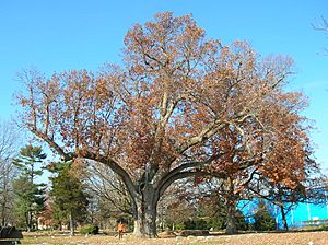
After many years of ideas from experts, Governor Edward C. Stokes created the Forest Park Reservation Commission in 1905. Their goal was to protect forests and create parks. They chose the Salem Oak tree as a symbol for New Jersey's parks. The first forest reserves were bought in southern New Jersey. One of these became the main part of Bass River State Forest.
In 1907, they also bought 5,000 acres on Kittatinny Mountain. This land became the start of Stokes State Forest. These areas were used to study trees and plant new ones. By 1912, the reserves covered 13,720 acres.
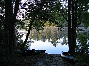
The commission also bought land that included Swartswood Lake. Here, they started creating parks for fun activities. These included boating, fishing, camping, and picnicking. In 1915, they said they wanted to make Swartswood a "public playground."
Creating the State Park Service
In 1923, the state decided to create the State Park Service. This new group would manage the state parks and forests. New Jersey started focusing more on parks for recreation.
The state also wanted to create a historic park along the Delaware River. This would be where George Washington crossed the river in 1776. This famous event happened before the Battle of Trenton and the Battle of Princeton. The park was officially opened on June 4, 1927.
After World War I, a state forester suggested a new park on Kittatinny Mountain. It would be a memorial to soldiers who died in the war. A few years later, Colonel Anthony R. Kuser gave his land at High Point to the state. High Point is the highest spot in New Jersey. He also gave $500,000 to build a tall monument to honor veterans. The monument was finished in 1930.
Today, the New Jersey Division of Parks and Forestry manages 430,928 acres. In one year (2005-2006), these parks had over 17.8 million visitors!
Planning for New Parks
In 2006, the Division of Parks and Forestry started planning two new state parks. These were Great Falls State Park in Paterson and Capital State Park in Trenton. New Jersey's only other city park is Liberty State Park in Jersey City.
Capital State Park would include areas around Trenton's state capitol building. It would also cover areas along the Delaware River. The goal was to help Trenton's downtown area and connect it to the river. Great Falls later became Paterson Great Falls National Historical Park.
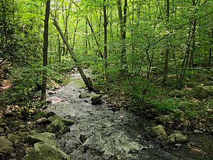
In 2009, the state also bought 1,174 acres in Jefferson Township. This land used to be a monastery. It's in the Highlands region and has mountain streams.
In 2021, Governor Phil Murphy approved buying an old railway path. This path will become a new state park called the Essex - Hudson Greenway. It will run from Montclair to Jersey City. This park will also be part of the East Coast Greenway. It will connect to other trails and might even include a new transportation route.
Fun Things to Do and Places to Visit
The State Park Service asks everyone to follow the "Carry In, Carry Out" rule. This means you should take all your trash with you. This helps keep the parks clean and beautiful!
You can go fishing and hunting in many state parks and forests.
Golf Courses in State Parks
New Jersey's State Park System also has four golf courses open to everyone. Each course has a restaurant and event spaces. Private companies manage them for the state.
- Centerton Golf Course: Located in Pittsgrove Township, inside Parvin State Park.
- Cream Ridge Golf Course: In Cream Ridge, Monmouth County. The state bought it in 2006.
- Spring Meadow Golf Course: In Farmingdale, Monmouth County. It was built in the 1920s and the state bought it later.
- White Oaks Golf Course: In Gloucester County.
Many of these properties were bought to protect open spaces. This was done through the New Jersey Department of Environmental Protection's Green Acres Program.
New Jersey's State Parks
| Park Name | Image | Location | Year Established | Size | What Makes it Special | Links |
|---|---|---|---|---|---|---|
| Allaire State Park |  |
Howell and Wall townships in Monmouth County | 1940 | 3,205 acres (12.97 km2) | See a restored 1800s ironworks at Allaire Village. The park has many wildflowers, trees, and birds. It also has the Pine Creek Railroad, a fun train ride. | |
| Allamuchy Mountain State Park |  |
Green and Byram townships in Sussex County; Allamuchy Township in Warren County Mount Olive Township in Morris County |
1966 | 9,092 acres (36.79 km2) | This park is along Allamuchy Mountain and the Musconetcong River. It has beautiful forests and fields. There are 14 miles of marked trails and 20 miles of unmarked trails for exploring. | |
| Barnegat Lighthouse State Park |  |
At the northern tip of Long Beach Island in Ocean County | 1951 | 32 acres (0.13 km2) | Home to the Barnegat Lighthouse (built in 1859). It's a great place for watching marine birds and fishing in the ocean. | |
| Cape May Point State Park |  |
Lower Township in Cape May County | 1972 | 244 acres (0.99 km2) | This park has the Cape May Lighthouse (1859). It's one of the best places in North America to watch birds migrate south in the fall. | |
| Capital State Park | Trenton in Mercer County | 2006 | - | This park is still being developed. It will include areas around Trenton's capitol and along the Delaware River. It will celebrate Trenton's rich history. | ||
| Cheesequake State Park |  |
Old Bridge Township in Middlesex County | 1940 | 1,610 acres (6.5 km2) | This park is unique because it has many different types of environments. You can find open fields, saltwater and freshwater marshes, and forests. | |
| Corson's Inlet State Park | 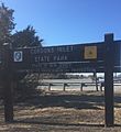 |
Corson's Inlet between Ocean City and Strathmere in Cape May County | 1963 | 341 acres (1.38 km2) | This is one of the last natural beach areas on the New Jersey Shore. It has sand dunes and is home to many wild animals. You can hike, fish, crab, boat, and sunbathe here. | |
| Delaware and Raritan Canal State Park | 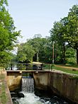 |
Over 60 miles (97 km) through Central New Jersey in Middlesex, Somerset, Mercer, and Hunterdon counties | 1974 | 6,595 acres (26.69 km2) | This park follows the historic Delaware and Raritan Canal. It's a long, narrow park with old buildings, locks, and a towpath. It's a "greenway" that goes through a very populated area. | |
| Double Trouble State Park | 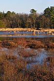 |
Lacey and Berkeley townships in Ocean County | 1964 | 8,495 acres (34.38 km2) | This park shows what the Pine Barrens looked like in the past. It has a preserved historic village. This village was important for growing cranberries and cutting down trees. | |
| Farny State Park |  |
Rockaway Township in Morris County | 1943 | 4,866 acres (19.69 km2) | Next to Splitrock Reservoir, this park has forests, swamps, and streams. It's a home for rare birds like the red-shouldered hawk and barred owl. | |
| Fort Mott State Park |  |
Pennsville Township in Salem County | 1951 | 124 acres (0.50 km2) | This park was once a coastal defense fort. It was built between 1872 and 1902 to protect the Delaware River and Philadelphia. Soldiers were here from 1897 to 1922. | |
| Hacklebarney State Park |  |
Located between Long Valley and Chester in Morris County | 1924 | 1,186 acres (4.80 km2) | This park features the rocky valley of the Black River. It has rocks left behind by glaciers. You can find three rare plant species here. | |
| High Point State Park | 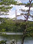 |
Montague Township, Sussex County | 1923 | 16,091 acres (65.12 km2) | This park was given to the state by Colonel Anthony R. Kuser. It has the highest point in New Jersey, High Point. There's a 220-foot granite monument to veterans there. | |
| Hopatcong State Park | 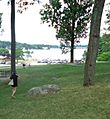 |
Landing, Roxbury Township in Morris County; Hopatcong Borough in Sussex County | 1922 | 163 acres (0.66 km2) | This park is on the shore of Lake Hopatcong, New Jersey's largest freshwater lake. It also has parts of the old Morris Canal and a historical museum. | |
| Island Beach State Park |  |
Former borough of Island Beach and Berkeley Township in Ocean County | 1953 | 3,003 acres (12.15 km2) | This park is a narrow barrier island between the Atlantic Ocean and Barnegat Bay. It has untouched sand dunes, wetlands, and forests. It's home to New Jersey's largest osprey colony and many other birds. | |
| Kittatinny Valley State Park |  |
Andover Township and Andover Borough in Sussex County | 1994 | 5,656 acres (22.89 km2) | This park has lakes formed by glaciers and limestone rocks. Part of the Sussex Branch Trail goes through the park. It's also home to an airbase for fighting wildfires. | |
| Liberty State Park |  |
Jersey City in Hudson County | 1976 | 1,212 acres (4.90 km2) | This park was created to celebrate America's 200th birthday. It has amazing views of the Hudson River and the Manhattan skyline. You can take a ferry to Ellis Island and the Statue of Liberty from here. | |
| Long Pond Ironworks State Park |  |
Hewitt, West Milford Township in Passaic County | 1974 | 6,911 acres (27.97 km2) | This park has Monksville Reservoir and the ruins of Long Pond Ironworks. This was a community that made iron from 1766 to 1882. | |
| Monmouth Battlefield State Park |  |
Manalapan and Freehold, in Monmouth County | 1961 | 1,818 acres (7.36 km2) | This is where the Battle of Monmouth happened on June 28, 1778. George Washington's army fought the British here during the American Revolution. You can visit a visitor center and see an annual reenactment of the battle. | |
| Parvin State Park |  |
Pittsgrove Township in Salem County | 1931 | 2,092 acres (8.47 km2) | This park has Pine Barrens swamps and forests. It's home to over 200 types of flowering plants. Historically, it was a camp for young workers and later a temporary home for Japanese-American children during World War II. | |
| Pigeon Swamp State Park |  |
South Brunswick Township in Middlesex County | from=Q24259875}} | 1,078 acres (4.36 km2) | This undeveloped park has ponds and forests. It was once a major nesting site for the now-extinct passenger pigeon. | - |
| Princeton Battlefield State Park |  |
Princeton Borough in Mercer County | from=Q7941714}} | 681 acres (2.76 km2) | This is the site of the Battle of Princeton on January 3, 1777. This American victory helped boost morale during the American Revolution. You can see the Clarke House, where General Hugh Mercer died. | |
| Rancocas State Park |  |
Westampton Township in Burlington County | from=Q7971803}} | 1,252 acres (5.07 km2) | This park is along the North Branch of the Rancocas Creek. It has a large freshwater marsh. | |
| Ringwood State Park |  |
Ringwood in Passaic County | from=Q14705916}} | 4,444 acres (17.98 km2) | Located on Ramapo Mountain, this park has the historic Ringwood Manor. It also features the New Jersey Botanical Garden and Shepherd Lake. | |
| Stephens State Park |  |
near Hackettstown in Warren County; Mount Olive Township in Morris County | from=Q3364105}} | 805 acres (3.26 km2) | This park is along the Musconetcong River. It has parts of the old Morris Canal, including locks and a towpath. The Highlands Trail also runs through the park. | |
| Swartswood State Park |  |
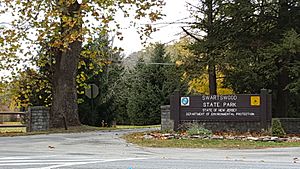
Stillwater Township, Sussex County | from=Q7653944}} | 3,460 acres (14.0 km2) | This was New Jersey's first state park! It's focused on recreation at Swartswood Lake, the state's third-largest freshwater lake. | |
| Tall Pines State Preserve |  |
Deptford Township and Mantua Township in Gloucester County | from=Q24259875}} | 110 acres (0.45 km2) | This used to be a golf course. Now it has over 4 miles of walking trails through natural areas. Mantua Creek flows through the middle of it. | |
| Voorhees State Park |  |
Glen Gardner Borough, Hunterdon County | from=Q7941714}} | 1,336 acres (5.41 km2) | Former New Jersey governor Foster M. Voorhees donated his farm to create this park. It has great views of Round Valley Reservoir and Spruce Run Reservoir. There's also an observatory with the largest public telescope in the state! | |
| Washington Crossing State Park |  |
Washington Crossing and Titusville sections of Hopewell Township in Mercer County | from=Q7971803}} | 3,575 acres (14.47 km2) | This park remembers where General George Washington and his army crossed the Delaware River on December 25-26, 1776. This happened before the Battle of Trenton during the American Revolution. | |
| Washington Rock State Park |  |
Green Brook Township, Somerset County | from=Q14705916}} | 52 acres (0.21 km2) | This park was a lookout point for George Washington in 1777. He used it to watch British troops moving around New York City and northern New Jersey. | |
| Wawayanda State Park |  |
Vernon Township in Sussex County; West Milford in Passaic County |
from=Q3364105}} | 35,524 acres (143.76 km2) | Wawayanda has 60 miles of trails, including a 20-mile part of the Appalachian Trail. It features the Bearfort Mountain Natural Area and the Wawayanda Swamp Natural Area. |
New Jersey's State Forests
| State park | Image | Location | Created | Size | What Makes it Special | Links |
|---|---|---|---|---|---|---|
| Abram S. Hewitt State Forest |  |
near Hewitt, West Milford Township in Passaic County | 1951 | 2,001 acres (8.10 km2) | You can only reach this park by walking. It's on Bearfort Mountain and includes a part of the Appalachian Trail. | |
| Bass River State Forest |  |
Burlington County | 1906 | 29,147 acres (117.95 km2) | This is New Jersey's very first state forest! It has a man-made lake called Lake Absegami. You can also see parts of the Pine Barrens' unique "pygmy forest" here. | |
| Belleplain State Forest |  |
near Woodbine in Cumberland and Cape May counties | 1928 | 21,324 acres (86.30 km2) | This forest has young pine, oak, and Atlantic white cedar trees. It also has the remains of old Civilian Conservation Corps camps and Lake Nummy. | |
| Brendan T. Byrne State Forest |  |
New Lisbon, Woodland Township in Ocean County | 1908 | 37,242 acres (150.71 km2) | This forest has the site of Lebanon Glass Works (1851–1867). It also includes Whitesbog Village, where high bush blueberries were first grown. | |
| Jenny Jump State Forest | 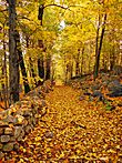 |
Hope in Warren County | 1931 | 4,466 acres (18.07 km2) | This park features the Jenny Jump Mountain ridge and large rocks left by glaciers. It has some of the darkest skies in New Jersey, making it great for stargazing at the Greenwood Observatory. | |
| Norvin Green State Forest |  |
West Milford Township and Bloomingdale Borough in Passaic County |
1946 | 5,416 acres (21.92 km2) | Located near Wanaque Reservoir, this forest offers views of the Manhattan skyline. You can only explore it on foot. | |
| Penn State Forest |  |
Jenkin's Neck in Burlington County 39°44′04.90″N 74°29′28.82″W / 39.7346944°N 74.4913389°W |
1910 | 3,366 acres (13.62 km2) | This forest features Oswego Lake and River. It also has a part of New Jersey's "pygmy forest," which has very small trees. | |
| Ramapo Mountain State Forest | 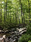 |
Passaic and Bergen counties | - | 4,269 acres (17.28 km2) | This forest was once the estate of Clifford MacEvoy. It includes the Ramapo Lake Natural Area. | - |
| Stokes State Forest |  |
Sandyston, Montague, and Frankford townships in Sussex County | 1917 | 16,025 acres (64.85 km2) | New Jersey Governor Edward C. Stokes donated land to create this forest. It's on Kittatinny Mountain and has the Tillman Ravine Natural Area. | - |
| Wharton State Forest |  |
Large tract through Burlington, Camden, and Atlantic counties | 1954 | 115,000 acres (470 km2) | This is New Jersey's largest state forest! It's part of the New Jersey Pinelands National Reserve. You can explore historic Batsto Village and many hiking trails. | - |
| Worthington State Forest |  |
Knowlton and Hardwick townships in Warren County | 1954 | 6,421 acres (25.98 km2) | This forest was once part of Charles Campbell Worthington's land. It includes Mount Tammany and the New Jersey side of the Delaware Water Gap. You can also find Sunfish Pond, a lake formed by a glacier. | - |
Recreation Areas in New Jersey
| State park | Image | Location | Created | Size | What Makes it Special | Notes |
|---|---|---|---|---|---|---|
| Atsion Recreation Area |  |
Shamong Township in Burlington County | - | - | This recreation area is located inside Wharton State Forest. | - |
| Bull's Island Recreation Area |  |
Delaware and Raritan Canal State Park Delaware Township in Hunterdon County |
- | 80 acres (0.32 km2) | - | |
| Round Valley Recreation Area |  |
Lebanon and Clinton townships in Hunterdon County | 1968 | 3,684 acres (14.91 km2) | This area has trails for hiking, horseback riding, and mountain biking. You can also go camping, fishing, picnicking, and swimming. | |
| Spruce Run Recreation Area |  |
Union and Clinton townships in Hunterdon County | 1974 | 1,290 acres (5.2 km2) | - | - |
| Warren Grove Recreation Area | - | Warren Grove in Ocean and Burlington counties 39°45′12.29″N 74°23′13.9″W / 39.7534139°N 74.387194°W |
1972 | 617 acres (2.50 km2) | This area is part of the "Pygmy Forest" in the New Jersey Pine Barrens. It has special small pine trees and rare plant species. |
State Marinas in New Jersey
| Marina | Image | Location | Berths | Maximum vessel length | Draft | What Makes it Special | Links |
|---|---|---|---|---|---|---|---|
| Senator Frank S. Farley State Marina | - | Atlantic City, Atlantic County 39°22′40.30″N 74°25′47.58″W / 39.3778611°N 74.4298833°W |
640 | 300 feet (91 m) | 12 feet (3.7 m) | This marina is in Atlantic City. You can reach the Atlantic Ocean through Absecon Inlet or the Intracoastal Waterway. | |
| Forked River State Marina | - | Forked River in Lacey Township, Ocean County 39°50′05.59″N 74°11′42.07″W / 39.8348861°N 74.1950194°W |
125 | 50 feet (15 m) | 6 feet (1.8 m) | This marina offers access to the Atlantic Ocean through Barnegat Inlet. It's also near Barnegat Bay and the Intracoastal Waterway. | |
| Fortescue State Marina | - | Fortescue, Downe Township, Cumberland County | 125 | 50 feet (15 m) | 9 feet (2.7 m) | This marina provides access to Delaware Bay and the Atlantic Ocean. | |
| Leonardo State Marina | - | Leonardo in Middletown Township, Monmouth County 40°25′20.74″N 74°03′40.26″W / 40.4224278°N 74.0611833°W |
176 | 50 feet (15 m) | 6 feet (1.8 m) | Located next to Sandy Hook, this marina offers access to the Atlantic Ocean and New York Bay. | |
| Liberty Landing Marina | - | Liberty State Park in Jersey City, Hudson County 40°42′35.46″N 74°03′05.40″W / 40.7098500°N 74.0515000°W |
200 | 50 feet (15 m) | 18 feet (5.5 m) | This marina is in Liberty State Park, right across from Manhattan. You can visit the Liberty Science Center or take a ferry to the Statue of Liberty and Ellis Island. |
Historic Sites in New Jersey
These historical sites are owned by the state of New Jersey. They are open to the public from Wednesday to Sunday.
| Historical site | Image | Location | Acquired | What Makes it Special | Links |
|---|---|---|---|---|---|
| Absecon Lighthouse | 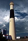 |
Atlantic City, Atlantic County | - | This historic lighthouse is a landmark in Atlantic City. | - |
| Allaire Village |  |
- | A restored village from the 1800s, showing what life was like in an ironworking community. | - | |
| Barnegat Lighthouse | - | This tall lighthouse has guided ships since 1859. You can climb to the top for amazing views. | - | ||
| Batsto Village |  |
- | A historic village that was once a busy center for making iron and glass in the Pine Barrens. | - | |
| Blackwells Mills Canal House |  |
- | This house is part of the Delaware and Raritan Canal State Park. It was home to the lock tender who managed the canal. | - | |
| Boxwood Hall |  |
- | This historic home was once owned by Elias Boudinot, a president of the Continental Congress. | - | |
| Cape May Light | 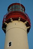 |
- | Another important lighthouse, built in 1859, offering views of the Atlantic Ocean. | - | |
| Central Railroad of New Jersey Terminal |  |
- | This historic train station was a major gateway for immigrants arriving in America. It's located in Liberty State Park. | - | |
| Clarke House |  |
- | - | This house is where General Hugh Mercer died after the Battle of Princeton. | - |
| Craig House |  |
- | - | An old farmhouse from 1746, located within Monmouth Battlefield State Park. | - |
| Double Trouble Village | - | - | - | A preserved historic village that shows the history of cranberry farming and logging in New Jersey. | - |
| Grover Cleveland Birthplace |  |
- | - | The house where President Grover Cleveland was born. | - |
| Hancock House |  |
- | - | This house was the site of a massacre during the American Revolution. | - |
| The Hermitage |  |
- | - | A historic house that played a role in the American Revolution. | - |
| High Point Monument | 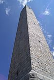 |
- | - | A tall granite monument built to honor veterans, located at New Jersey's highest point. | - |
| Indian King Tavern |  |
- | - | This historic tavern was where New Jersey declared its independence from Great Britain in 1776. | - |
| Johnson Ferry House |  |
Washington Crossing, Mercer County | - | This house is part of Washington Crossing State Park. It was important during George Washington's crossing of the Delaware River. | - |
| Long Pond Ironworks Historic District |  |
- | - | The ruins of an 18th and 19th-century ironworking community. | - |
| Monmouth Battlefield |  |
- | - | The site of a major battle during the American Revolution. | - |
| Mule Tenders Barracks | - | - | - | This building was home to the workers who cared for the mules that pulled boats along the Delaware and Raritan Canal State Park. | - |
| Navesink Twin Lights |  |
Highlands, Monmouth County 40°23′46.4″N 73°59′8.8″W / 40.396222°N 73.985778°W |
1962 | These twin lighthouses were built in 1862. They were the first in America to test a special lens. Marconi also demonstrated the wireless telegraph here in 1899. | - |
| Old Dutch Parsonage |  |
Somerville, Somerset County | 1947 | Built in 1751, this house was home to important religious leaders. They helped start Queen's College, which is now Rutgers University. | - |
| Port Mercer Canal House |  |
- | - | Another historic house along the Delaware and Raritan Canal State Park. | - |
| Prallsville Mills |  |
- | - | A collection of historic mills along the Delaware and Raritan Canal State Park. | - |
| Princeton Battlefield |  |
- | - | The site of a key American victory during the Revolutionary War. | - |
| Ringwood Manor |  |
- | - | A historic mansion with beautiful gardens, part of Ringwood State Park. | - |
| Rockingham |  |
- | - | This house was George Washington's headquarters for a time during the American Revolution. | - |
| Skylands Manor & State Botanical Garden |  |
- | - | A beautiful manor house with stunning botanical gardens. | - |
| Somers Mansion |  |
- | - | The oldest house in Atlantic County, built in 1725. | - |
| Steuben House |  |
- | - | A historic stone house that served as a headquarters during the Revolutionary War. | - |
| Trenton Battle Monument | 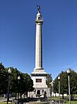 |
- | - | A monument celebrating the Battle of Trenton, a key victory for George Washington. | - |
| Wallace House |  |
Somerville, Somerset County 40°34′8″N 74°37′19″W / 40.56889°N 74.62194°W |
1947 | George Washington used this house as his headquarters in 1779. He hosted important guests and planned military strategies here. | |
| Walt Whitman House |  |
Camden, Camden County 39°56′33″N 75°07′26″W / 39.94250°N 75.12389°W |
1947 | This small house was where the famous American poet Walt Whitman lived his final years. It's now a museum with his belongings. | |
| Washington Crossing | 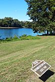 |
Hopewell Township, Mercer County | - | This park marks the historic spot where George Washington crossed the Delaware River during the American Revolution. | - |
| Waterloo Village |  |
Byram Township Sussex County 40°54′56″N 74°45′22″W / 40.91556°N 74.75611°W |
- | A restored village from the 18th and 19th centuries, connected to the iron industry and the Morris Canal. | - |
| Whitesbog Village |  |
- | - | A historic community known for its cranberry and blueberry farming. | - |
More About New Jersey's Natural Areas
- List of New Jersey wildlife management areas
- List of Registered Historic Places in New Jersey
- Palisades Interstate Park - a protected area along the Hudson River that New York and New Jersey share.
 | DeHart Hubbard |
 | Wilma Rudolph |
 | Jesse Owens |
 | Jackie Joyner-Kersee |
 | Major Taylor |


