Brendan T. Byrne State Forest facts for kids
Quick facts for kids Brendan T. Byrne State Forest |
|
|---|---|

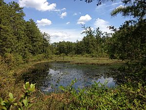
Cranberry bog in Brendan T. Byrne State Forest
|
|
| Lua error in Module:Location_map at line 420: attempt to index field 'wikibase' (a nil value). | |
| Location | Burlington and Ocean Counties |
| Area | 37,242-acre (150.71 km2) |
| Operated by | New Jersey Division of Parks and Forestry |
The Brendan T. Byrne State Forest is a huge natural area in the New Jersey Pine Barrens. It covers about 37,242 acres (151 square kilometers) of protected land. This forest is located across parts of Burlington and Ocean Counties. It's a great place to explore nature and learn about the unique plants and animals of the Pinelands.
Contents
About the Forest
Brendan T. Byrne State Forest is the second largest state forest in New Jersey. It has many miles of hiking trails and a special area for camping. The New Jersey Division of Parks and Forestry takes care of the park.
The forest was first called Lebanon State Forest. This name came from a glass factory that used to operate there in the 1850s and 1860s. In 2004, the forest was renamed after Brendan Byrne. He was the governor of New Jersey from 1974 to 1982. Governor Byrne was very important in protecting the Pinelands. In 1979, he signed a law called the Pinelands Protection Act. This law helped save thousands of acres of land in southern New Jersey. The park was renamed in his honor 25 years after this important law was passed.
Nature and Wildlife
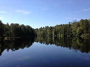
This forest is part of the Atlantic coastal pine barrens region. It includes a special area called the Cedar Swamp Natural Area, which is about 735 acres (3 square kilometers). Here, you can find different types of forests. These include pine-oak forests, oak-pine forests, and areas with pitch pine trees. There are also Atlantic white cedar swamp forests. This natural area is very important because it protects the home of the threatened Swamp pink flower and other rare plant species.
Explore the Trails
The Brendan T. Byrne State Forest has many trails for different activities.
- The Mount Misery Trail is a multi-use trail. This means you can go hiking or mountain biking on it.
- The Cranberry Trail is special because it is wheelchair-accessible. Everyone can enjoy this trail!
- The Batona Trail is a very long trail, almost 50 miles (80 kilometers) long. It's perfect for hiking, cross country skiing, and snowshoeing. This trail connects Brendan T. Byrne State Forest with Wharton State Forest and Bass River State Forest.
- There are also shorter loop trails. One loop is about 2 miles (3.2 kilometers) long and starts at the forest office. Another loop is about 1 mile (1.6 kilometers) long and is located at Pakim Pond.
- If you want a longer adventure, you can combine different trails with the Batona Trail. This allows for day hikes of about 6 miles (9.7 kilometers) or even 14 miles (22.5 kilometers).
Blueberry History at Whitesbog Village
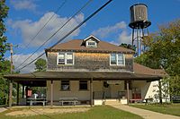
Inside the forest, you'll find Whitesbog Village. This is a historic village that was founded in the 1870s by Joseph J. White. It used to be one of the biggest cranberry and blueberry farms in New Jersey. It was very active through the mid-20th century.
Whitesbog Village is famous for its role in developing the cultivated blueberry. A woman named Elizabeth Coleman White worked with a scientist named Frank Coville to create a new type of blueberry. They used a native blueberry called Vaccinium caesariense to create the cultivated blueberry we know today. This made blueberries easier to grow and sell. Whitesbog Village shows how farming has changed in New Jersey over time. Today, a group called the Whitesbog Preservation Trust is working to restore and protect this important historical site.
 | Janet Taylor Pickett |
 | Synthia Saint James |
 | Howardena Pindell |
 | Faith Ringgold |


