Rancocas Creek facts for kids

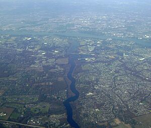
The Rancocas Creek is a waterway in southwestern New Jersey, United States. It flows into the Delaware River. The main part of the creek is about 8.3 miles (13.4 km) long. However, it has two longer branches: the North Branch, which is 28.3 miles (45.5 km) long, and the South Branch, which is 21.7 miles (34.9 km) long. This creek system helps drain a large area of farms and forests. This area is located on the western edge of the Pinelands, north and northeast of Camden and the nearby suburbs of Philadelphia.
Contents
The Creek's Journey
The Rancocas Creek begins with two main parts, or branches, inside the Pinelands National Reserve.
North Branch Rancocas Creek
The North Branch starts in the northern part of Burlington County. It begins near Mirror Lake, just south of Fort Dix. From there, it flows towards the west and northwest. It passes by the town of Mount Holly.
South Branch Rancocas Creek
The South Branch starts in the middle of Burlington County, close to Chatsworth. It generally flows towards the northwest. Along its way, it is joined by the Southwest Branch. This branch is about 13.8 miles (22.2 km) long and flows in from the south. It joins the South Branch about 5 miles (8 km) south of Mount Holly.
Where the Branches Meet
The North and South branches of the Rancocas Creek come together near Rancocas State Park. This meeting point is about 3 miles (5 km) west of Mount Holly. It's also close to where the New Jersey Turnpike and Interstate 295 cross the creek.
The Swiveling Bridge
Just a short distance downstream from the Interstate 295 and New Jersey Turnpike bridges, there's another bridge. This is Burlington County Route 635. This bridge is quite low, less than 4 feet (1.2 m) above the average water level. What's special about it is that its middle section can swivel! It can turn from being across the river to being parallel with it. This allows small boats to pass through.
In the 1980s, the bridge was repaired. During this time, the power system that made it swivel was removed. This was because there were hardly any large boats or barges using the creek anymore. Also, maintaining the system was expensive. The bridge can still be opened in an emergency, but it needs people to open it by hand.
Boating on the Creek
You can travel by boat on the Rancocas Creek for about 10 miles (16 km) upstream from where it meets the Delaware River. However, the CR 635 bridge acts like a barrier for boats. It stops them from going further upstream, about 7.6 miles (12.2 km) from the Delaware River.
Smaller Streams (Tributaries)
Here are the main smaller streams that flow into Rancocas Creek:
- North Branch Rancocas Creek
- South Branch Rancocas Creek
- Southwest Branch Rancocas Creek
 | William Lucy |
 | Charles Hayes |
 | Cleveland Robinson |

