Frankford Township, New Jersey facts for kids
Quick facts for kids
Frankford Township, New Jersey
|
||
|---|---|---|
|
Township
|
||
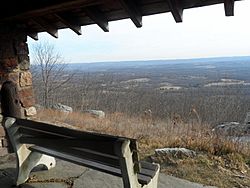
View from Stokes State Forest
|
||
|
||
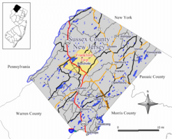
Map of Frankford Township in Sussex County. Inset: Location of Sussex County highlighted in the State of New Jersey.
|
||
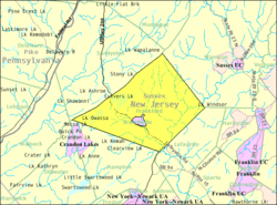
Census Bureau map of Frankford Township, New Jersey
|
||
| Country | ||
| State | ||
| County | ||
| Formed | April 10, 1797 | |
| Incorporated | February 21, 1798 | |
| Named for | Frankford, Philadelphia | |
| Government | ||
| • Type | Township | |
| • Body | Township Committee | |
| Area | ||
| • Total | 35.30 sq mi (91.42 km2) | |
| • Land | 33.88 sq mi (87.74 km2) | |
| • Water | 1.42 sq mi (3.68 km2) 4.02% | |
| Area rank | 68th of 565 in state 6th of 24 in county |
|
| Elevation | 659 ft (201 m) | |
| Population
(2020)
|
||
| • Total | 5,302 | |
| • Estimate
(2023)
|
5,304 | |
| • Rank | 370th of 565 in state 9th of 24 in county |
|
| • Density | 156.5/sq mi (60.4/km2) | |
| • Density rank | 517th of 565 in state 19th of 24 in county |
|
| Time zone | UTC−05:00 (Eastern (EST)) | |
| • Summer (DST) | UTC−04:00 (Eastern (EDT)) | |
| ZIP Code |
07826 – Branchville
|
|
| Area code(s) | 973 | |
| FIPS code | 3403724810 | |
| GNIS feature ID | 0882267 | |
| Website | ||
Frankford Township is a community in Sussex County, in the U.S. state of New Jersey. In 2020, about 5,302 people lived here. This was a small decrease from 2010, when 5,565 people lived in the township.
Frankford Township was created on April 10, 1797. It became an official township on February 21, 1798. It was one of the first 104 townships in New Jersey. Over time, parts of Frankford Township were used to create other nearby towns. These include Lafayette Township and Sparta Township (in 1845). Also, the town of Branchville (in 1898) was formed. Branchville is now completely surrounded by Frankford Township. The township is thought to be named after Frankford, a neighborhood in Philadelphia. This was after a visitor from that area helped at a local school.
Since 1976, Frankford Township has hosted the Farm and Horse Show. This event grew after moving from Branchville. The New Jersey State Fair / Sussex County Farm & Horse Show now has many activities all year. The township is also home to Skylands Park. This 4,300-seat baseball park was once home to the New Jersey Cardinals (1993-2005). It also hosted the Sussex Skyhawks (2006-2010). Since 2005, the stadium has been the home of the Sussex County Miners. They play in the Frontier League.
Contents
About Frankford Township's Geography
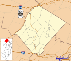
Frankford Township covers about 35.30 square miles (91.42 km2). Most of this is land (33.88 sq mi or 87.74 km2). About 1.42 square miles (3.68 km2) is water. Culver's Lake and Lake Owassa are two natural lakes. They are located below the Kittatinny Mountain and form the northern border. The township is in the Kittatinny Valley. This valley is part of the much larger Great Appalachian Valley.
The town of Branchville is entirely inside Frankford Township. This makes it one of 21 "doughnut towns" in New Jersey. A "doughnut town" is a place completely surrounded by another town. Frankford Township shares borders with other towns in Sussex County. These include Hampton Township, Lafayette Township, Sandyston Township, and Wantage Township.
Several small communities are located within Frankford Township. These include Ross Corner and Augusta. Other places are Armstrong, Culvers Gap, Culvers Inlet, Culvers Lake, Lake Owassa, Mount Pisgah, Northrup, Pallettown, Pellettown, Plains, and Wykertown.
The land in Frankford Township varies in height. It ranges from about 450 feet (137 m) to nearly 1000 feet (305 m) above sea level. Near the Paulinskill River, the elevation is about 500 feet (152 m). There are several hills over 800 feet (244 m) tall, with one reaching 908 feet (277 m).
Frankford Township's Past: A Look at History
How the Land Was Formed: Geology
Most of Frankford Township sits on a rock layer called the Ordovician Martinsburg Formation. This layer is made of shale, slate, and limestone. It formed about 450 million years ago. This happened when a chain of volcanic islands crashed into what would become North America. This shale is usually dark, almost black. However, in many areas, the Jacksonburg formation covers it. This shale is silver inside.
The collision of the islands created the Highlands of Sussex County. The Kittatinny Valley was lifted up. Sediment from the bottom of ancient seas formed the shale. Millions of years of erosion followed. Then, about 400 million years ago, another event happened. A long, thin continent collided with North America. This caused the land to fold and fault. The Silurian Shawnangunk conglomerate, which was under a shallow sea, was lifted by this pressure. The pressure created heat, melting silica and bonding quartz. This formed the Kittatinny Mountain.
The Wisconsin Glacier covered all of Frankford Township. This was from about 21,000 BCE to 13,000 BCE. The glacier even covered the top of Kittatinny Mountain. You can still see signs of the glacier today. There are "end moraines" in Stokes State Forest. These are piles of rock and dirt left by the glacier. Another end moraine is south of Ross's Corner. As the climate warmed, the glacier melted and retreated. This created many ponds and lakes, including Culver Lake.
The township is drained by two river systems: the Paulinskill and the Wallkill. The Paulinskill River flows northwest through the township before turning southwest. Papakatkin Creek starts near Branchville Reservoir and flows into the Wallkill River. Another creek starts near Sunrise Mountain and joins Papakatkin Creek. Dry Creek begins at Branchville Reservoir and flows south into Culver's Creek. It eventually empties into the Paulinskill. A chain of hills separates the Paulinskill and Wallkill river systems. Water south of Route 206 flows into the Paulinskill. Water north of Route 206 flows into the Wallkill River.
Culvers Gap is a pass through the mountains. It was created by an ancient stream that changed its path. The bottom of the gap is 400 feet (122 m) below the top of Kittatinny Mountain. This mountain can be seen from far away.
First People: Paleo Indians
After the glacier melted, the area was cold and wet. It was like a Tundra, where grasses grew slowly. Around 11,000 BCE, Paleo Indians came to this area. After thousands of years, the climate became warmer. As the plants changed, large plant-eating animals slowly died out. Or, they were hunted too much by the Paleo-Indians. Coniferous forests of spruce and pine began to grow. The area became a Taiga.
Paleo Indians used spears with special "fluted points." These points were made of black chert or jasper. They used Culver's Gap to travel between valleys. This path was later used by other Native Americans. Paleo Indians were hunter-gatherers, so they moved often. They made temporary camps. It's hard to find their camps today because they are buried deep underground.
Large animals like Mastodons, Musk Ox, and Caribou lived here. Mastodon bones have been found in nearby areas. As the climate warmed, these large animals either moved north, were overhunted, or died out.
Between 8000 BCE and 6000 BCE, the climate warmed even more. More deciduous trees like oak, maple, birch, and willow began to grow. Other big game animals then moved into the area. These included deer, elk, bear, and moose.
By 3000 BCE, even more types of deciduous trees grew. These included hickory, cherry, walnut, beech, butternut, chestnut, ash, and elm. The number of hunter-gatherers slowly grew because there was more food. The Paulinskill River was shallow, making it easy to fish. The valley had small hills, which made travel and setting up camps easy. With so many different plants and animals, food was everywhere. Gathering plants became more important.
Around 1000 BCE, clay pottery was invented. This allowed people to store seeds, nuts, and other food. The bow and arrow was also invented around this time. With pottery and the bow and arrow, hunter-gatherer populations grew even more. Camps were still temporary, and people moved often to find food. As populations grew, camps became more seasonal. These camps were often along rivers. Around this time, the Lenape Native Americans arrived from the west.
Lenape Native Americans: Life and Culture
The Lenape people settled in this area around 1000 BCE or a bit later. They set up seasonal camps for their extended families along river valleys. This was because food and water were plentiful there. They had a trade route that passed through the township. This path went from Minisink Island on the Delaware River to Raritan Bay. It passed through Culver's Gap and Frankford Township, crossing the Paulinskill River.
Around 800 CE to 1000 CE, triangular arrowheads were developed. This marked the start of the bow and arrow in North America. Also around 1000 CE, farming began to develop, along with clay pottery. With pottery, the bow and arrow, and farming, Native American populations grew even more. The Lenape were still hunter-gatherers, but they also grew corn, beans, and squash. They had gardens in fertile river valleys.
The Paulinskill River and its valley were excellent for Native American family camps. The Paulinskill River is shallow and narrow. This made it easy to fish, bathe, and gather plants. Animals like deer, bear, waterfowl, and other small game were attracted to the river valley. Since the land was flat, it was easy to travel, hunt, and gather food like nuts.
Culvers Lake was a site for Native American villages. Papakating Creek was also used as a campsite. Many trees were huge, providing large nut crops each autumn. Native American populations continued to grow. This growth continued until the Little Ice Age and the arrival of Europeans.
The Little Ice Age and European Arrival
The Little Ice Age began in the early 1600s and ended in the mid-1800s. In the late 1600s, Europeans first met the Lenape Native Americans in this area. The Little Ice Age had a big impact on Native American populations. The area experienced late frosts in June and early frosts in August. This affected corn crops and made hunting difficult. Corn took longer to grow than it does today. Trees that produced nuts, like oak and hickory, had fewer nuts because of the cold. Game animals often went into a semi-hibernation during cold spells, making them harder to find. Very cold weather and deep snow also made finding game difficult. Shallow rivers like the Paulinskill and Wallkill froze quickly, reducing fishing. Many Native Americans in this area starved because of these factors.
Native Americans also had no protection against European diseases. They had been separated from Europe and Asia for thousands of years. This made them very vulnerable to diseases like smallpox. Because Native Americans traveled and traded, diseases spread easily. Many Native Americans died from these diseases. Their populations decreased greatly in the late 1600s and early 1700s in Frankford Township and all of New Jersey.
By 1750, almost all Native Americans had left this area. This was due to land sales, European diseases, and starvation from the Little Ice Age.
First European Settlers
The first permanent European settlers likely arrived in Frankford Township around 1699. At that time, this area was part of Burlington County. In 1713, it became part of Hunterdon County. Later, it was included in Morris County.
The land was flat and had fresh water from the Paulinskill, Dry Creek, or Papakatkin Creek. A Quaker meeting house was built in 1700 near Papakating Creek. Settlers may have been here even earlier. The soil was good for farming. Huge trees filled the untouched forests. Game, fish, and waterfowl were plentiful. The land was cleared for farming. Forests were slowly cut down with axes. Fire was also used to clear land. The area was still cold due to the Little Ice Age, so farming was slow. Colonists raised pigs, chickens, sheep, and cattle brought from Europe. Apple trees were also planted. At this time, the area was controlled by England and was part of Morris County.
Settlers came from New York State. They traveled along the Wallkill River or through Culver's Gap. The Highlands to the east were difficult to cross.
French and Indian War Impact
The French and Indian War began on May 28, 1754. George Washington started it at the Battle of Jumonville Glen in Pennsylvania. At that time, Frankford Township was near the edge of the frontier. Settlers just west of the township were being attacked by Native Americans. Farms and houses were burned, and settlers were killed. Many colonists moved east to be safe. Eight fortified houses were built along the Delaware River. Native Americans sided with the French. This was because they felt unfairly treated by the English, for example, with the Walking Purchase of 1737. Native Americans did not understand how the English viewed land ownership.
Population Information: Demographics
| Historical population | |||
|---|---|---|---|
| Census | Pop. | %± | |
| 1810 | 1,637 | — | |
| 1820 | 2,008 | 22.7% | |
| 1830 | 1,996 | −0.6% | |
| 1840 | 2,410 | 20.7% | |
| 1850 | 1,941 | * | −19.5% |
| 1860 | 1,828 | −5.8% | |
| 1870 | 1,776 | −2.8% | |
| 1880 | 1,682 | −5.3% | |
| 1890 | 1,459 | −13.3% | |
| 1900 | 932 | * | −36.1% |
| 1910 | 1,004 | 7.7% | |
| 1920 | 936 | −6.8% | |
| 1930 | 1,074 | 14.7% | |
| 1940 | 1,244 | 15.8% | |
| 1950 | 1,530 | 23.0% | |
| 1960 | 2,170 | 41.8% | |
| 1970 | 2,777 | 28.0% | |
| 1980 | 4,654 | 67.6% | |
| 1990 | 5,114 | 9.9% | |
| 2000 | 5,420 | 6.0% | |
| 2010 | 5,565 | 2.7% | |
| 2020 | 5,302 | −4.7% | |
| 2023 (est.) | 5,304 | −4.7% | |
| Population sources: 1810–1920 1840 1850–1870 1850 1870 1880–1890 1890–1910 1910–1930 1940–2000 2000 2010 2020 * = Lost territory in previous decade. |
|||
2020 Census Data
The 2020 United States census counted 5,302 people in Frankford Township. There were 1,969 households. About 45.8% of the people were women. About 20.4% were 65 years or older. About 19.5% were under 18 years old. And 5.6% were under 5 years old.
Most of the population, 86.1%, was white. About 8.2% were Hispanic or Latino. 6% were two or more races. 2.3% were Asian. 1.1% were Black or African American. 0.1% were American Indian/Alaskan Native. And 0.0% were Native Hawaiian/Asian Pacific Islander.
The average household income was $111,392.00. There were 156.5 people per square mile. The land area was 33.88 square miles.
For more details, you can visit the U.S. Census Bureau website.
Education in Frankford Township
Students in Frankford Township attend public schools from pre-kindergarten through eighth grade. They go to the Frankford Township School District, at Frankford School. This school is located in Branchville. Students from Branchville also attend this school. As of the 2021–22 school year, the district had one school. It had 505 students and 54.5 teachers. This means there were about 9.3 students for every teacher.
For high school, students attend High Point Regional High School. This school serves students from ninth through twelfth grades. Students from Branchville, Frankford Township, Lafayette Township, Montague Township, Sussex Borough, and Wantage Township go here. In the 2021–22 school year, the high school had 812 students. There were 72.8 teachers, meaning about 11.2 students per teacher. The school district is managed by a nine-member board of education. Frankford Township has two seats on this board.
Getting Around: Transportation
As of 2010, Frankford Township had about 96.23 miles (154.87 km) of roads. The township maintained 60.37 miles (97.16 km) of these roads. Sussex County maintained 30.21 miles (48.62 km). The New Jersey Department of Transportation maintained 5.65 miles (9.09 km).
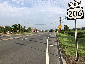
U.S. Route 206 is the main highway in Frankford Township. Other important roads that pass through the township include Route 15, County Route 519, County Route 521, and County Route 565.
Famous People from Frankford Township
People who have lived in or are connected to Frankford Township include:
- Gary R. Chiusano (born 1951), a former mayor and member of the New Jersey General Assembly.
- Russ Van Atta (1906–1986), a former MLB pitcher for the New York Yankees. He later became the Sheriff of Sussex County.
See also
 In Spanish: Municipio de Frankford (Nueva Jersey) para niños
 | Aaron Henry |
 | T. R. M. Howard |
 | Jesse Jackson |


