Sussex County, New Jersey facts for kids
Quick facts for kids
Sussex County
|
|||
|---|---|---|---|
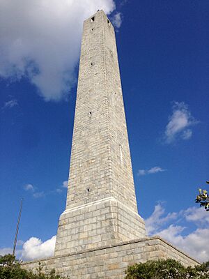
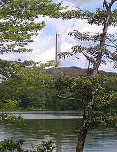
High Point Monument, located at the highest point in New Jersey
|
|||
|
|||
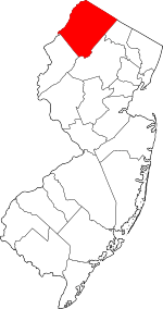
Location within the U.S. state of New Jersey
|
|||
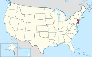 New Jersey's location within the U.S. |
|||
| Country | |||
| State | |||
| Founded | June 8, 1753 | ||
| Named for | Sussex, England | ||
| Seat | Newton | ||
| Largest municipality | Vernon Township (population and area) | ||
| Area | |||
| • Total | 535.54 sq mi (1,387.0 km2) | ||
| • Land | 518.66 sq mi (1,343.3 km2) | ||
| • Water | 16.88 sq mi (43.7 km2) 3.2% | ||
| Population
(2020)
|
|||
| • Total | 144,221 | ||
| • Estimate
(2023)
|
146,132 |
||
| • Density | 269.300/sq mi (103.9774/km2) | ||
| Time zone | UTC−5 (Eastern) | ||
| • Summer (DST) | UTC−4 (EDT) | ||
| Congressional districts | 5th, 7th | ||
Sussex County is the northernmost county in New Jersey, a state in the United States. Its main town and government center is Newton. The county is part of the larger New York metropolitan area and is known for its beautiful "Skylands Region."
In 2020, Sussex County had a population of 144,221 people. This made it the 17th most populated county in New Jersey. Vernon Township is the largest town in the county, both in terms of people and land size. Sussex County is located in the northern part of New Jersey.
Contents
- Why is it called Sussex County?
- A Look Back: History of Sussex County
- Land and Climate of Sussex County
- Geography and Weather
- People and Money
- Economy and Jobs
- Towns and Communities
- Keeping the Peace: Law Enforcement
- News and Media
- Getting Around: Transportation
- Learning and Schools
- Fun Things to Do: Recreation
- Sports and Activities
- See also
Why is it called Sussex County?
Sussex County was created in 1753. It was formed from parts of Morris County. The county was named after Sussex, a county in England.
A Look Back: History of Sussex County
The land that is now Sussex County has a long history. For thousands of years, different groups of Native Americans lived here. The Munsee Indians were living in the area when Europeans first arrived. The Munsee were part of the larger Lenape (or Delaware Indians) group. They spoke a unique language and lived in a wide area, including parts of New Jersey. Today, most Lenape groups live in Canada and other U.S. states.
Around 1690, Dutch and French settlers from New York began to move into the Upper Delaware Valley. This area was known as the "Minisink." They followed an old Native American trail, which later became the Old Mine Road. In the 1700s, German and Swiss immigrants also settled here, coming from Philadelphia. Scottish and English settlers from other parts of New Jersey and nearby states also moved into the eastern parts of what is now Sussex County.
By the 1750s, people living in this area wanted their own county. It was too far to travel to the government and courts. So, on June 8, 1753, Sussex County was officially created. It included what are now Sussex and Warren Counties. Later, in 1824, Warren County was separated from Sussex County.
For many years, Sussex County's economy relied on farming and mining. Early farms mainly grew food for themselves. Because of the land, dairy farming became very important. Farmers also grew fruits like apples and peaches. In the mid-1800s, with the arrival of railroads, farmers could send their products to other areas. Railroads also helped factories, like the H.W. Merriam Shoe Company, move to the county.
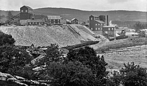
The Highlands Region of New Jersey had rich deposits of iron ore. In the mid-1700s, people started mining iron in areas like Andover and Franklin. During the American Revolutionary War, iron from these mines was used to make weapons for George Washington's army. Later, in the mid-1800s, the Andover mine produced a lot of iron. This iron was used to build railroads and even parts of the bridge at Niagara Falls.
By the mid-1800s, iron mining started to slow down as deposits ran out. In the 1880s, famous inventor Thomas Edison tried to find new ways to get iron from low-quality ore. He bought mines in Sussex County and built a huge factory near Ogdensburg. This factory used large electromagnets to separate iron. However, richer iron deposits were found elsewhere, and Edison closed his operation in 1900. He then used his ideas for the cement industry.
In the early 1800s, Samuel Fowler became interested in mineralogy in Franklin. He found ways to use zinc and discovered many rare minerals. Many of these zinc minerals glow in bright colors under ultraviolet light. Because of these unique minerals, Franklin is known as the "Fluorescent Mineral Capital of the World." After Fowler's death, companies formed to mine zinc and iron. These companies later became the New Jersey Zinc Company. Many immigrants from different countries came to Franklin to work in the mines, and the town grew quickly. Today, the Franklin and Sterling Hill mines are museums.
Starting in the 1950s and 1960s, new highways like Interstate 80 and Route 23 brought a lot of growth to Sussex County. The population nearly quadrupled, and the county began to change from a quiet rural area to a more suburban one.
Land and Climate of Sussex County
How the Land Was Formed
About 450 million years ago, volcanic islands crashed into North America. This created the Highlands and Kittatinny Valley. The western part of Sussex County was once under a shallow sea, and you can still find fossils there. Later, another continent collided, folding the rocks and creating the Kittatinny Ridge.
Around 23,000 to 13,000 years ago, a huge glacier covered all of Sussex County. This glacier created many lakes and streams. As the climate warmed, the land first became a tundra, then grew coniferous forests, and later deciduous forests with nut trees. This allowed early Native American populations to grow.
Sussex County has several important rivers. The Paulinskill River and Flatbrook flow into the Delaware River. The Wallkill River flows north to the Hudson River. Many smaller creeks also drain into these rivers.
Different Land Regions
Sussex County has two main land regions:
- The Ridge and Valley Appalachians: This area covers about two-thirds of the county. It has long, even ridges and valleys that run from southwest to northeast. Kittatinny Mountain is a big part of this region.
- The New York-New Jersey Highlands: This older region is in the eastern part of the county. It has mountains made of very old rocks. The Highlands provide fresh water for millions of people in New Jersey and New York City. Because of this, the state passed a law in 2004 to protect these water resources from too much development.
Mountains and Valleys to Explore
The Delaware River forms the western edge of Sussex County. This area is called the Upper Delaware Valley.
Kittatinny Mountain is the most important mountain range in the western part of the county. It is part of the larger Appalachian Mountains. High Point, the highest spot in New Jersey, is on Kittatinny Mountain. It is 1,803 feet above sea level. Between Kittatinny Mountain and the Delaware River is the Wallpack Ridge, a smaller ridge.
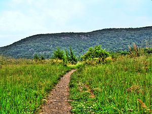
East of Kittatinny Mountain is the Kittatinny Valley. This valley has rolling hills and flat areas. It is part of the Great Appalachian Valley. This valley is home to three major river systems: the Wallkill River, the Paulins Kill, and the Pequest River. There is also a unique spot called Rutan Hill, which is a 440-million-year-old igneous rock formation from an ancient volcano.
The Highlands region has mountains that rise from the land, like Hamburg Mountain and Wawayanda Mountain. These mountains are generally between 1,000 and 1,500 feet high.
Rivers and Waterways
Sussex County's rivers flow in three main directions:
- North to the Hudson River: The Wallkill River starts at Lake Mohawk and flows north.
- West and South to the Delaware River: The Flat Brook and Paulins Kill flow into the Delaware River. The Pequest River also flows towards the Delaware.
- East toward Newark Bay: Some eastern parts of the county drain into rivers that lead to Newark Bay.
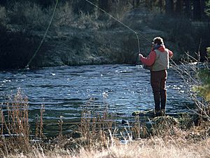
In the past, these rivers powered mills and helped transport goods. Today, they are popular for outdoor activities like canoeing and fishing. The state stocks these rivers with different types of trout, making them great for fishing.
Soils of Sussex County
The soils in Sussex County were mostly formed by glaciers and rivers. The last ice age left behind a lot of rock and soil material. Melting glaciers also deposited materials. Rivers and streams deposited soil during floods. Over time, decaying plants also added organic matter to the soil.
Geography and Weather
Sussex County covers about 535 square miles. Most of this is land, with a small part being water. It is the fourth-largest county in New Jersey.
The county is in the Kittatinny Mountains, which are part of the Appalachian Mountains. High Point is the highest natural spot in New Jersey, at 1,803 feet above sea level. The lowest point in the county is about 300 feet above sea level along the Delaware River.
Because of its mountains and forests, Sussex County is still very rural. Many state and federal parks protect large areas of land. The eastern part of the county has more suburban areas because it is closer to bigger towns.
Sussex County is unique because it borders both New York and Pennsylvania. Its shape is like a diamond, with its corners pointing to the main compass directions.
Sussex County's Climate
Sussex County has a cooler humid continental climate. This means it gets a good amount of rain and snow throughout the year. It's different from the rest of New Jersey, which is generally warmer.
In winter and early spring, the county can experience "nor'easters." These are big storms that can bring heavy snow or flooding. Hurricanes and tornadoes are rare here. The Kittatinny Valley, especially north of Newton, gets a lot of snow. This area is sometimes called the "Sussex County Snow Belt." This happens because the Kittatinny Mountains push moist air upwards, causing more snow to fall. This is great for the ski resorts in Vernon Valley!
In Newton, the average temperatures range from about 17°F in January to 84°F in July. The county gets about 40 to 50 inches of snow each year. The lowest temperature ever recorded was -26°F in January 1994. The highest was 104°F in September 1953.
People and Money
Population Changes
| Historical population | |||
|---|---|---|---|
| Census | Pop. | %± | |
| 1790 | 19,500 | — | |
| 1800 | 22,534 | 15.6% | |
| 1810 | 25,549 | 13.4% | |
| 1820 | 32,752 | 28.2% | |
| 1830 | 20,346 | * | −37.9% |
| 1840 | 21,770 | 7.0% | |
| 1850 | 22,989 | 5.6% | |
| 1860 | 23,846 | 3.7% | |
| 1870 | 23,168 | −2.8% | |
| 1880 | 23,539 | 1.6% | |
| 1890 | 22,259 | −5.4% | |
| 1900 | 24,134 | 8.4% | |
| 1910 | 26,781 | 11.0% | |
| 1920 | 24,905 | −7.0% | |
| 1930 | 27,830 | 11.7% | |
| 1940 | 29,632 | 6.5% | |
| 1950 | 34,423 | 16.2% | |
| 1960 | 49,255 | 43.1% | |
| 1970 | 77,528 | 57.4% | |
| 1980 | 116,119 | 49.8% | |
| 1990 | 130,943 | 12.8% | |
| 2000 | 144,166 | 10.1% | |
| 2010 | 149,265 | 3.5% | |
| 2020 | 144,221 | −3.4% | |
| 2023 (est.) | 146,132 | −2.1% | |
| Historical sources: 1790–1990 1970–2010 2000 2010 2000–2010 2020 * = Lost territory in previous decade. |
|||
In 2010, there were 149,265 people living in Sussex County. Most residents (about 93.5%) were White. About 6.4% of the population was Hispanic or Latino.
The county has a mix of ages. About 24% of people were under 18, and 12% were 65 or older. The average age was 41.8 years.
Wealth and Income
Sussex County is considered a well-off area. Many residents have college degrees and work in professional jobs. Their incomes are often higher than the state average. In 2010, the average income per person was $49,207, which was much higher than the national average.
In 2010, the average household income was $84,115. Only a small percentage of families (2.8%) and people (4.0%) lived below the poverty line. However, in some towns like Sussex Borough, Newton, and Andover Borough, the poverty levels are higher.
Economy and Jobs
In 2021, the total value of goods and services produced in Sussex County was $4.6 billion. This shows the county's economic activity.
Jobs and Industries
In 2010, about 69.6% of people over 16 in Sussex County had jobs.
| Category | Persons employed | Percentage of labor force |
|---|---|---|
| Management, business, science, and arts jobs | 29,443 | 40.1% |
| Service jobs | 11,689 | 15.9% |
| Sales and office jobs | 18,712 | 25.5% |
| Natural resources, construction, and maintenance jobs | 6,715 | 9.2% |
| Production, transportation, and material moving jobs | 6,784 | 9.2% |
| TOTAL | 73,343 |
In the past, Sussex County's economy was based on farming, milling, and mining. As mining declined, the county's economy changed. Today, Sussex County has a mix of farms, forests, and suburban areas. Many residents travel to nearby counties or New York City for work. This is why it's sometimes called a "bedroom community."
Farming Today
Even though dairy farming has decreased a lot, it is still the biggest part of farming in Sussex County. Farmers have had to change what they grow or sell their land for development. Many farms now grow ornamental trees, plants, and flowers for landscaping. Christmas trees are also a big crop.
Hay production is also important, with a lot of farmland dedicated to it. Much of this hay is used to feed livestock on farms.
The number of farms in Sussex County has stayed high, but the total land used for farming has gone down. This is partly because of "suburban sprawl," where farmland is sold for homes and businesses.
New Jersey's wine industry has grown, and Sussex County is home to three wineries: Cava Winery & Vineyard, Ventimiglia Vineyard, and Westfall Winery.
Modern Industry
Sussex County's industries are no longer focused on heavy mining. Today, companies like Thorlabs are located here.
Towns and Communities
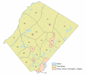
Sussex County has 24 different towns and communities. Here is a list of them with their populations from the 2010 Census:
| Municipality | Map key | Municipal type |
Population | Housing units |
Total area |
Water area |
Land area |
Pop. density |
Housing density |
School district | Communities |
|---|---|---|---|---|---|---|---|---|---|---|---|
| Andover Borough | 3 | borough | 595 | 263 | 1.47 | 0.02 | 1.45 | 417.3 | 181.1 | Newton (9-12) (S/R) Andover (PK-8) |
|
| Andover Township | 21 | township | 5,996 | 2,181 | 20.69 | 0.73 | 19.96 | 316.6 | 109.3 | Newton (9-12) (S/R) Andover (PK-8) |
Brighton Pinkneyville Springdale Whitehall |
| Branchville | 9 | borough | 791 | 386 | 0.60 | 0.01 | 0.59 | 1,419.2 | 651.4 | High Point (9-12) Frankford Township (PK-8) (S/R) |
|
| Byram Township | 23 | township | 8,028 | 3,207 | 22.26 | 1.19 | 21.07 | 396.2 | 152.2 | Lenape Valley (9-12) Byram Township (PK-8) |
Byram Center CDP (2,232) Lake Mohawk CDP (part; 1,824) |
| Frankford | 15 | township | 5,302 | 2,520 | 35.44 | 1.42 | 34.02 | 163.6 | 74.1 | High Point (9-12) Frankford Township (PK-8) |
Ross Corner CDP (120) |
| Franklin | 6 | borough | 4,912 | 2,136 | 4.57 | 0.07 | 4.50 | 1,121.6 | 474.9 | Wallkill Valley (9-12) Franklin Borough (K-8) |
|
| Fredon Township | 20 | township | 3,235 | 1,289 | 18.00 | 0.28 | 17.72 | 194.0 | 72.7 | Kittatinny (7-12) Fredon Township (PK-6) |
|
| Green Township | 24 | township | 3,627 | 1,251 | 16.26 | 0.27 | 15.98 | 225.3 | 78.3 | Newton (9-12) (S/R) Green Township (K-8) |
|
| Hamburg | 7 | borough | 3,266 | 1,476 | 1.16 | 0.02 | 1.14 | 2,870.4 | 1,292.9 | Wallkill Valley (9-12) Hamburg (K-8) |
|
| Hampton Township | 19 | township | 4,893 | 2,200 | 25.30 | 0.92 | 24.38 | 213.2 | 90.3 | Kittatinny (7-12) Hampton Township (PK-6) |
Crandon Lakes CDP (part; 682) |
| Hardyston | 13 | township | 8,125 | 3,783 | 32.64 | 0.67 | 31.97 | 256.9 | 118.3 | Wallkill Valley (9-12) Hardyston Township (PK-8) |
|
| Hopatcong | 2 | borough | 14,362 | 6,296 | 12.25 | 1.39 | 10.85 | 1,395.5 | 580.0 | Hopatcong | |
| Lafayette Township | 14 | township | 2,358 | 919 | 18.05 | 0.09 | 17.96 | 141.3 | 51.2 | High Point (9-12) Lafayette Township (PK-8) |
|
| Montague | 10 | township | 3,792 | 1,802 | 45.38 | 1.38 | 44.00 | 87.4 | 41.0 | High Point (9-12) Montague Township (PK-8) |
|
| Newton | 4 | town | 8,374 | 3,479 | 3.17 | 0.02 | 3.15 | 2,542.2 | 1,106.0 | Newton | |
| Ogdensburg | 5 | borough | 2,258 | 905 | 2.33 | 0.05 | 2.28 | 1,055.4 | 396.3 | Wallkill Valley (9-12) Ogdensburg Borough (PK-8) |
|
| Sandyston | 16 | township | 1,977 | 988 | 43.26 | 0.74 | 42.52 | 47.0 | 23.2 | Kittatiny (7-12) Sandyston-Walpack (K-6) |
Layton CDP (692) |
| Sparta | 22 | township | 19,600 | 7,423 | 38.97 | 2.02 | 36.94 | 533.9 | 200.9 | Sparta Township | Lake Mohawk CDP (part; 8,092) |
| Stanhope | 1 | borough | 3,526 | 1,472 | 2.19 | 0.35 | 1.84 | 1,966.3 | 801.8 | Lenape Valley (9-12) Stanhope (K-8) |
|
| Stillwater Township | 18 | township | 4,004 | 1,930 | 28.38 | 1.32 | 27.06 | 151.5 | 71.3 | Kittatiny (7-12) Stillwater Township (PK-6) |
Crandon Lakes CDP (part; 496) |
| Sussex | 8 | borough | 2,024 | 1,005 | 0.62 | 0.03 | 0.59 | 3,615.9 | 1,706.1 | High Point (9-12) Sussex-Wantage (K-8) |
|
| Vernon Township | 12 | township | 22,358 | 10,958 | 70.59 | 2.35 | 68.23 | 350.9 | 160.6 | Vernon Township | Glenwood (2,751) Highland Lakes CDP (4,816) McAfee (127) Upper Greenwood Lake CDP (part; 3,786) Vernon Center CDP (1,713) Vernon Valley CDP (1,491) |
| Walpack Township | 17 | township | 7 | 15 | 24.70 | 0.65 | 24.05 | 0.7 | 0.6 | Kittatiny (7-12) Sandyston-Walpack (K-6) |
|
| Wantage | 11 | township | 10,811 | 4,173 | 67.48 | 0.73 | 66.75 | 170.1 | 62.5 | High Point (9-12) Sussex-Wantage (K-8) |
Quarryville |
| Sussex County | county | 144,221 | 62,057 | 535.74 | 16.73 | 519.01 | 287.6 | 119.6 |
Keeping the Peace: Law Enforcement
Some towns in Sussex County have their own police departments. If a town does not have its own police, the New Jersey State Police provides services. The State Police has a station in Augusta. Less than half of the county's towns have their own police. The other towns rely on the State Police. For example, Stillwater Township stopped its police department in 2009 to save money.
The New Jersey State Park Police also patrols state parks like Stokes State Forest.
| Sussex County Sheriff's Office | |
|---|---|
| Abbreviation | SCSO |
| Agency overview | |
| Formed | 1753 |
| Jurisdictional structure | |
| Operations jurisdiction | United States |
| Legal jurisdiction | Sussex County, New Jersey |
| Operational structure | |
| Headquarters | 39 High Street Newton, New Jersey |
| County Sheriff responsible |
|
The Sussex County Sheriff's Office helps keep the county safe. They are in charge of security at the county courthouse and run the county jail. They also handle civil processes. The current sheriff is Michael F. Strada.
News and Media
Local Newspapers
Sussex County has one daily newspaper, the New Jersey Herald. It is published six days a week. The Herald started in 1829 and is one of the oldest newspapers in New Jersey. It covers news and sports from Sussex County and nearby areas. Its main office is in Newton.
Television and Radio
Sussex County gets television service from Optimum. They offer local channels and community bulletin boards. WMBC-TV is an independent TV station based in Newton. It shows Korean language programs and English programs.
You can also listen to many radio stations in Sussex County. Many come from the New York City area. There are also local stations like 102.3 FM WSUS (Adult Contemporary), 103.7 FM WNNJ (Classic Rock), and 106.3 FM WHCY (Country).
Getting Around: Transportation
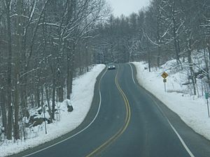
Sussex County has many roads that connect it to the rest of New Jersey, Pennsylvania, and New York. Most residents drive their own cars to work outside the county. Interstate 80 goes through the very southern part of Sussex County. Other important roads include Route 15, Route 23, Route 94, and U.S. Route 206.
Bridges Across the Delaware River
Sussex County has two toll bridges over the Delaware River:
- The Milford-Montague Toll Bridge: This bridge carries U.S. Route 206 and connects Montague Township to Milford, Pennsylvania. It opened in 1954.
- The Dingman's Ferry Bridge: This is one of the last privately owned toll bridges in the United States. It connects Sandyston Township to Dingmans Ferry, Pennsylvania.
Train Service

Currently, Sussex County only has train service for cargo. Passenger train service stopped in the 1960s. However, NJ Transit is planning to reopen commuter service through the Lackawanna Cut-Off Restoration Project. This will allow trains to travel through Andover and Green Townships to New York City and Hoboken. This service is expected to start in 2019.
Bus Service
NJ Transit offers bus service in Sussex County, including the "Skylands Connect" route. The county also has a ParaTransit bus service for seniors, veterans, and people with disabilities. This service helps people get to appointments and run errands. NJ Transit also has weekday bus service to New York City.
Airports for Small Planes
Sussex County has four public airports for small planes:
- Aeroflex-Andover Airport
- Newton Airport (closed in 2013)
- Sussex Airport
- Trinca Airport
These airports are mainly used by recreational pilots.
Learning and Schools
Before 1942, Sussex County had over 100 small school districts, many with one-room schoolhouses. Over time, these small districts combined into larger ones.
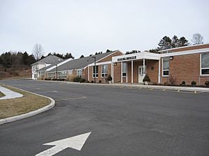
Sussex County's public schools provide education for children from kindergarten to 12th grade. There are nine high school districts and twenty elementary school districts. Montague Township, the northernmost town, sends its middle and high school students to Port Jervis, New York. However, they are looking into sending them to High Point Regional High School in Wantage Township instead. Many schools in the county have won awards for their academic excellence. The county also has the Sussex County Technical School in Sparta Township, which offers technical high school education.
There are also private schools, including Pope John XXIII Regional High School in Sparta, which is a Catholic school.
Sussex County's high schools compete in sports and other activities through the New Jersey State Interscholastic Athletic Association (NJSIAA).
- K-12 School Districts
- Hopatcong Public Schools (K-12)
- Newton Public School District (K-12)
- Sparta Township Public School District (K-12)
- Vernon Township School District (K-12)
- Elementary School Districts (K-8, some K-6)
- Andover Regional School District
- Byram Township School District
- Frankford Township School District
- Franklin Borough School District
- Fredon Township School (K-6)
- Green Township School District
- Hamburg School District
- Hampton Township School District (K-6)
- Hardyston Township School District
- Lafayette Township School District
- Montague Township School District
- Ogdensburg Borough School District
- Sandyston-Walpack Consolidated School District (K-6)
- Stanhope Public Schools
- Stillwater Township School District (K-6)
- Sussex-Wantage Regional School District
- Secondary School Districts (9-12, some 7-12)
- High Point Regional High School
- Kittatinny Regional High School (7-12)
- Lenape Valley Regional High School
- Sussex County Vocational School District
- Wallkill Valley Regional High School
Colleges and Higher Learning
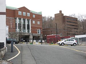
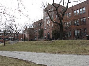
Sussex County Community College (SCCC) opened in 1982. It is a two-year public college in Newton. The campus used to be a Catholic seminary. SCCC offers many different associate degree programs and professional certificates. Many students go on to finish their four-year degrees at other colleges. The college also has programs for high school students and community education courses. In 2015, SCCC had over 2,700 students.
Fun Things to Do: Recreation
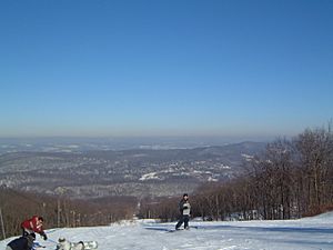
Sussex County is part of the "Skylands Region," which is promoted for tourism. New Jersey is one of the top states for tourism income.
Farm Fun: Agritourism
Many local farmers have found new ways to make money by combining farming with tourism. This is called "Agritourism." Many farms offer corn mazes and "pick your own" fruits and vegetables, like apples, strawberries, and pumpkins. You can also pick your own Christmas trees.
Sussex County is home to three wineries: Cava Winery & Vineyard, Ventimiglia Vineyard, and Westfall Winery.
Parks and Protected Areas
A large part of Sussex County is undeveloped. This land is protected as federal or state parks and wildlife areas.
- National Park Service Areas
- Appalachian National Scenic Trail
- Delaware Water Gap National Recreation Area
- Middle Delaware National Scenic River
- U.S. Fish and Wildlife Service Area
- New Jersey State Parks and Forests
- Allamuchy Mountain State Park
- High Point State Park
- Hopatcong State Park
- Kittatinny Valley State Park
- Stokes State Forest
- Swartswood State Park
- Wawayanda State Park
- New Jersey Wildlife Management Areas
|
|
Libraries for Learning and Fun
The first official Sussex County Library opened in 1942. Today, the Sussex County Library System (SLCS) has six branches. The Main Library is in Newton. The other five branches are the Dennis Memorial Branch, Dorothy Henry Branch, Franklin Branch, Louise Childs Branch, and Sussex-Wantage Branch.
The libraries offer many resources, including books, e-books, audiobooks, magazines, newspapers, DVDs, video games, and CDs. All locations have computers with internet access and Wi-Fi. They also have meeting rooms and host many programs like story time. You can visit their website at http://www.sussexcountylibrary.org.
Sports and Activities
Skiing and Winter Sports
In the 1960s, Vernon Township became a popular spot for skiing and other winter sports.
- Mountain Creek is a well-known resort.
- Hidden Valley is now the National Winter Activity Center. It teaches groups about winter sports.
Professional Sports Teams
Sussex County has a large stadium called Skylands Stadium in Augusta. It can seat 4,200 people. The Sussex County Miners baseball team plays here. They are part of the Frontier League. The Miners won their league championship in 2018.
In the past, the New Jersey Cardinals (1994-2005) and the Sussex Skyhawks (2006-2010) also played at Skylands Stadium.
Sussex County Fairgrounds
The Sussex County Farm and Horse Show has been held in Augusta since 1940. Since 1999, it has been known as the New Jersey State Fair. The fairgrounds also host other shows, like poultry shows.
Outdoor Adventures
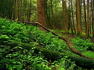
Sussex County has 12 wildlife management areas. These areas cover over 15,000 acres and are great for hunting, fishing, hiking, snowshoeing, and cross country skiing. There are also several state forests and state parks to explore.
See also
 In Spanish: Condado de Sussex (Nueva Jersey) para niños
 | Aaron Henry |
 | T. R. M. Howard |
 | Jesse Jackson |


